![]() May 18, 2021:
May 18, 2021:
April 11, 2021: This book, written by Professor Donald G. Creighton, in 1937, is the best book of Canadian History and Canadian Economics and Politics. It was originally published as The Commercial Empire of the St. Lawrence, 1760-1850. Published in Toronto by the Macmillan Company of Canada, reprinted in 1980, no ISBN, 440 pages.
Cities, Towns and Villages along the Rideau Canal
Added an 1827 picture of Barrack Hill on Parliament Hill. Lieutenant Colonel John By - Added a portrait from before he came to Bytown / Ottawa Merrickville Smiths Falls Kingston Chaudiere Falls and Mill Site - Added a picture by John Burrows from c. 1830 Added a text block explaining the background story to the Vaudreuil and Ste. Annes Locks. Parliament Buildings Under Construction, 1862 (photograph from the headlocks) A long quotation regarding malaria on the Rideau Canal in 1829 by John McTaggartApril 12, 2021:
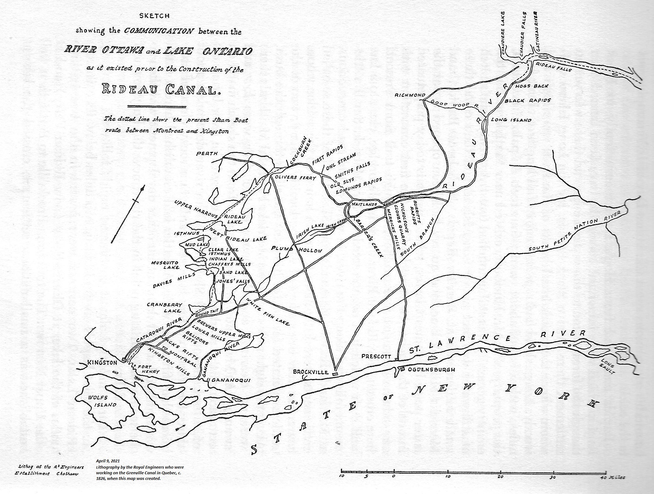
The following map was prepared by the men of the Royal Engineers in about 1827 when they were stationed at the construction of the Grenville Canal on the Ottawa River, in Quebec, across the River from Hawkesbury, Upper Canada. It was presented to Colonel John By.
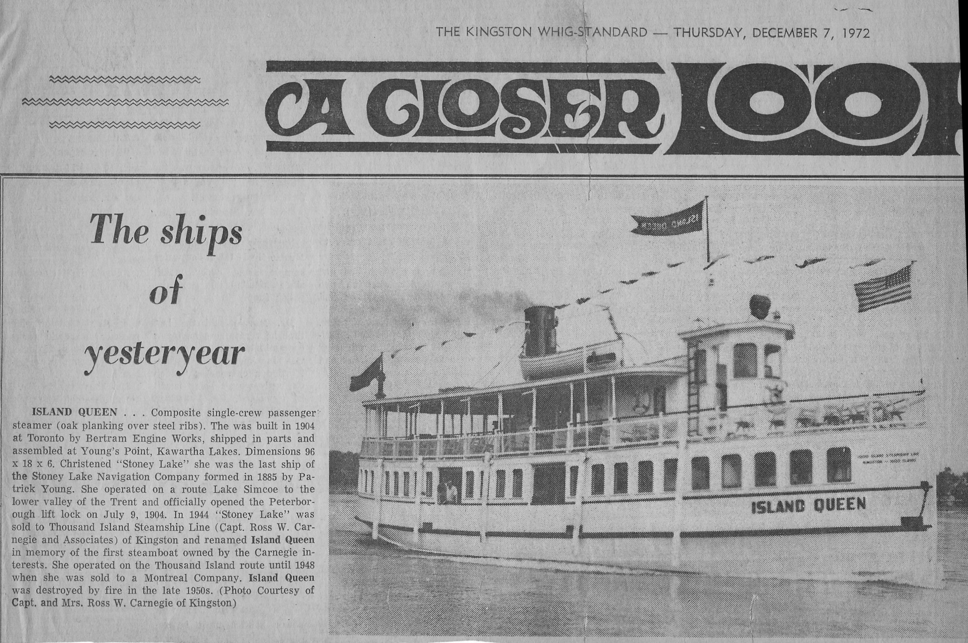 Names for the search engine: Bertram Engine Works, Young's Point, Kawartha Lakes, the Stoney Lake, the Stoney Lake Navigation Company, Patrick Young,
Lake Simcoe, Trent River, Peterborough Lift Lock, Thousand Island Steamship Line, Captain Ross W. Carnegie and Assosciates, Kingston, Island Queen,
Thousand Island Route until 1948, Photo Courtesy of Captain and Mrs. Ross W. Carnegie of Kingston.
Names for the search engine: Bertram Engine Works, Young's Point, Kawartha Lakes, the Stoney Lake, the Stoney Lake Navigation Company, Patrick Young,
Lake Simcoe, Trent River, Peterborough Lift Lock, Thousand Island Steamship Line, Captain Ross W. Carnegie and Assosciates, Kingston, Island Queen,
Thousand Island Route until 1948, Photo Courtesy of Captain and Mrs. Ross W. Carnegie of Kingston.
Here are a couple of web pages with steamships in the Ottawa area, beginning about 1820 (mainly pictures) and a page giving some steamer background material from Frank Mackey's book.
April 5, 2021:
Here is one of the best maps of the Upper Ottawa Valley. From the inside back cover of the book by Clyde C. Kennedy called The Upper Ottawa Valley, A Glimpse of History, published by the Renfrew County Council, 1970, ISBN none. This is one of the few books which documents a lot of the steamships on the Ottawa River west of the city.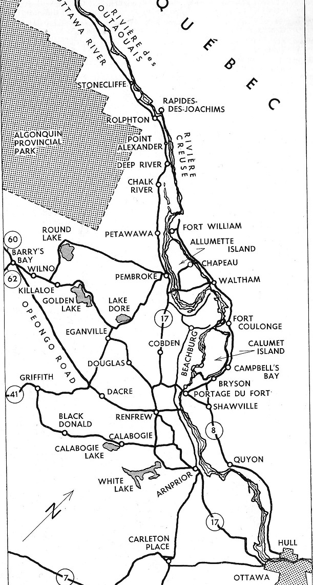
April 6, 2021:
Text from Clyde C. Kennedy's book, page 130, The Upper Ottawa Valley - a glimpse of history