Via Ferrata Degli Alpini to Col dei Bois
[Home]
[Main]
[Prev]
[Next]
September 23, 2019
We were not expecting good weather today so we slept in, but awoke to a not so bad looking day after all. We hastily had breakfast,
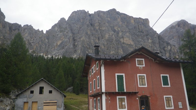
checked the weather... rain at noon, and packed our stuff hoping to get a climb in before the rain arrived. We drove to the top of a pass at
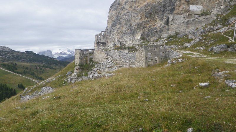
2200 meters and started up an unmarked trail behind a big red building. This brought us to the ruins of a World War One field hospital and the base
of the route. As we geared up another couple of guys arrived and took a break so we could get started ahead of them.
Looking up at the mountain from the trailhead at the big red building.
Remains of the WWI field hospital.
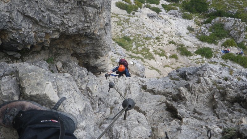
The start was rather spicy
on polished rock and steep climbing. The ferrata was very well equipped however, with protection set every couple of meters or so. After the first
fifty meters of steep climbing, the grade slackenned off, and from there it was rather enjoyable scrambling and exposed traverses, with the occasional
hard move to grunt up on. Even the easier walking parts were wire protected, and at one of these areas the other two guys caught up to us and we let
them pass. Another bit of steep climbing, but on really big jugs was a lot of fun, and then unfortunately the fog rolled in, obscurring all
visibility. No problem though, just keep following the wire!
Steep, but super well protected climbing.
At the last pitch it started raining. Kat was on flat ground and managed to get her
waterproofs on, but I was already climbing a steeper section so elected to just keep moving. The polished rocks started getting slippery, so more
and more
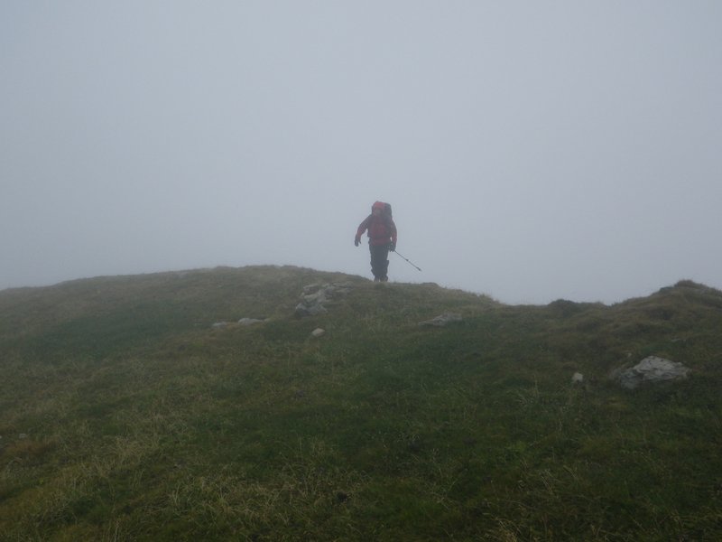
I pulled on the wire for aid to keep moving quickly. Finally it topped out on a wide grassy plateau and I could shrug into my rain coat. The route
description said to walk for ten minutes to the summit, so blinded by fog, we followed a grassy slope upwards until we came
to a headwall which appeared out
of the gloom. I searched and found a weakness which I scrambled, bringing me up to a field of sketchy loose blocks which led up to the summit. Kat
found a better scramble way around, though upon reaching the summit we discovered an easy walking trail that we should have taken.
Topping out in the rain.
Summit cross.
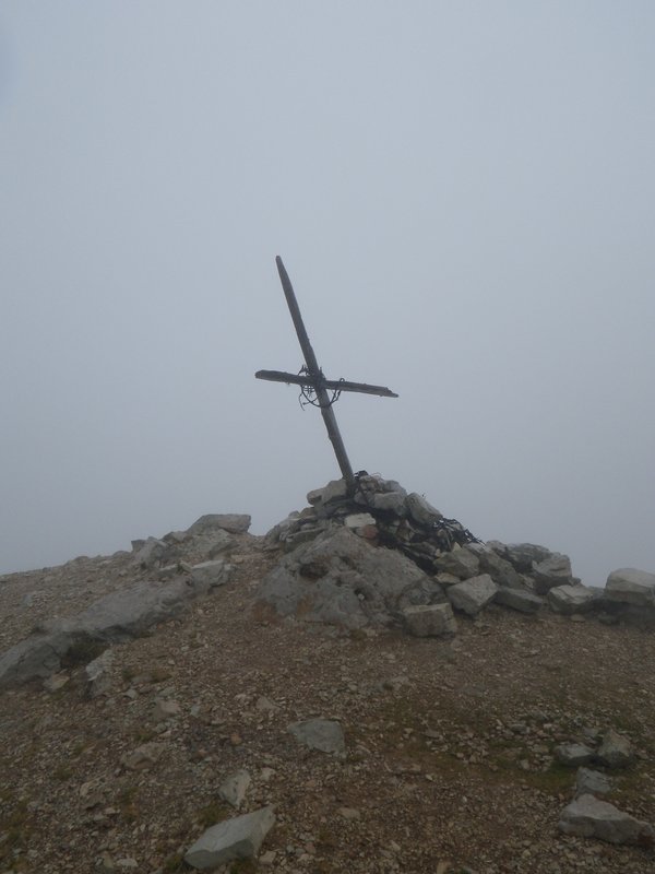
Unfortunately there was
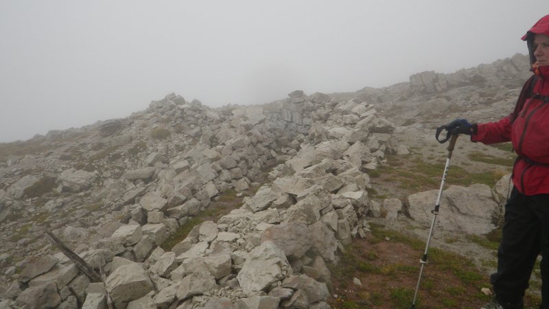
no view, and we had to pull out the compass to navigate down. This was interesting as we passed many bunkers and trenches from the war. We tried
to climb into one to get out of the downpour at one point, but it was too cramped and full of debris inside to make a comfortable lunch spot. We
ate a quick sandwich while standing in the rain instead. Some more compass work found us a herd path, which shortly intersected a main hiking trail.
Here we found a man made cave which we took shelter in while donning some extra layers for warmth.
Exploring the trenches.
A little further along, we came to an old road
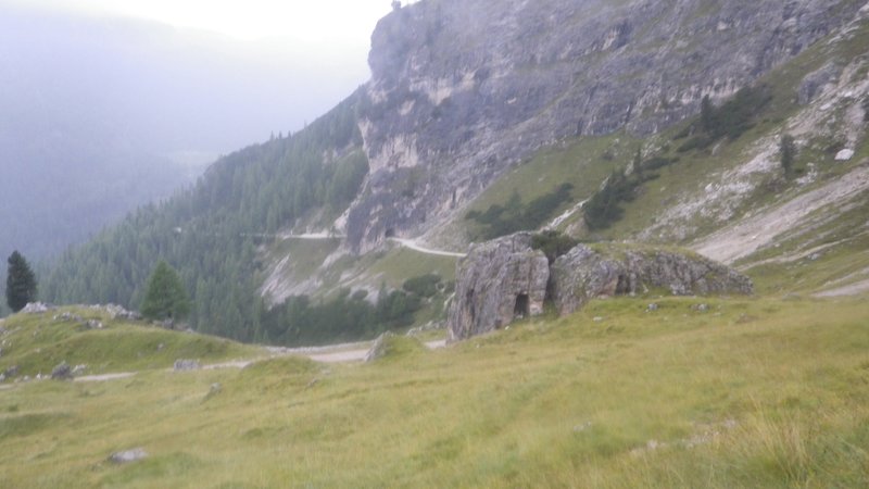
which switchbacked down the mountain with hiking paths cutting off most of these. At one point we saw a nice looking tunnel over the road, and a
direct trail downwards. We took the trail and after hitting the road again continued on for quite a while before realizing that we were much too
low. A check of the map showed our error so we reversed up the road, bushwhacked past another switchback, and then after another kilometer or so of
road walk, reached a junction which we would have found much more quickly had we gone through the tunnel in the first place. From here another
kilometer of hiking brought us back to the car.
The tunnel we should have taken.
Ascent time: 3 hours
Total time: 5.5 hours
[Home]
[Main]
[Prev]
[Next]