Agawa Bay to Barrett Island
[Home]
[Main]
[Prev]
[Next]
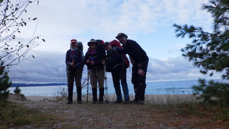
Sep 6, 2021
I woke up at 05:00 and wandered down to the beach where I witnessed a clear starry sky, punctuated by meteor flashes
every few minutes. I returned to the campsite and read until the others awoke at a more reasonable hour. We packed everything in Judy's Jeep and drove over to the visitor center to get signed in for the hike. We were first
in the door for the 09:00 opening hour and managed to hit the trail about fifteen minutes later.
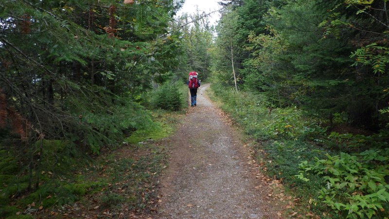
The trail started with interlock brick pavement which then continued as manicured gravel. This made walking easy and
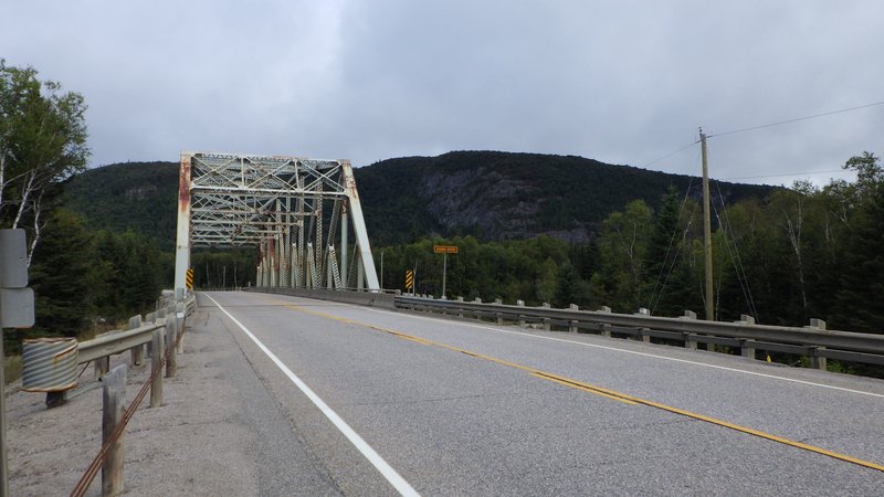
we ticked off the first few kilometers in short order. At the Agawa river, the trail uses the highway to cross this
wide water body. Walking this was not so much fun as large speeding trucks passed us while we clung to the narrow
shoulder. It was a relief to plunge back into the woods on the far side, however the trail became much more rugged at
this point.
Start of the trail
Smooth sailing for the first while
Crossing the Agawa River
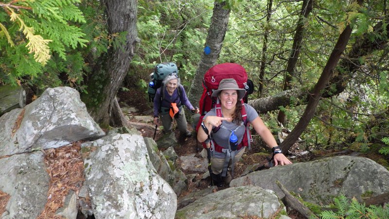
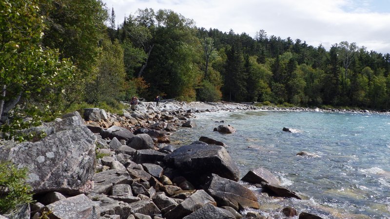
The next while had lots of full body scrambling both up and down the numerous ridges. Nothing too
technically difficult, but with heavy packs this sometimes could be quite awkward. The scenery was fantastic which
provided for many photos from the various vistas. We had luch at a campsite overlooking the lake and then continued
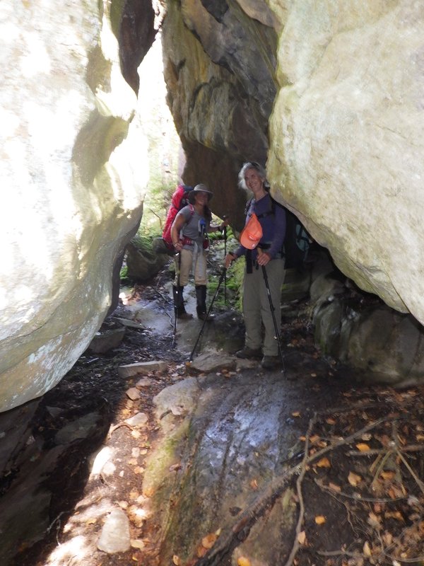
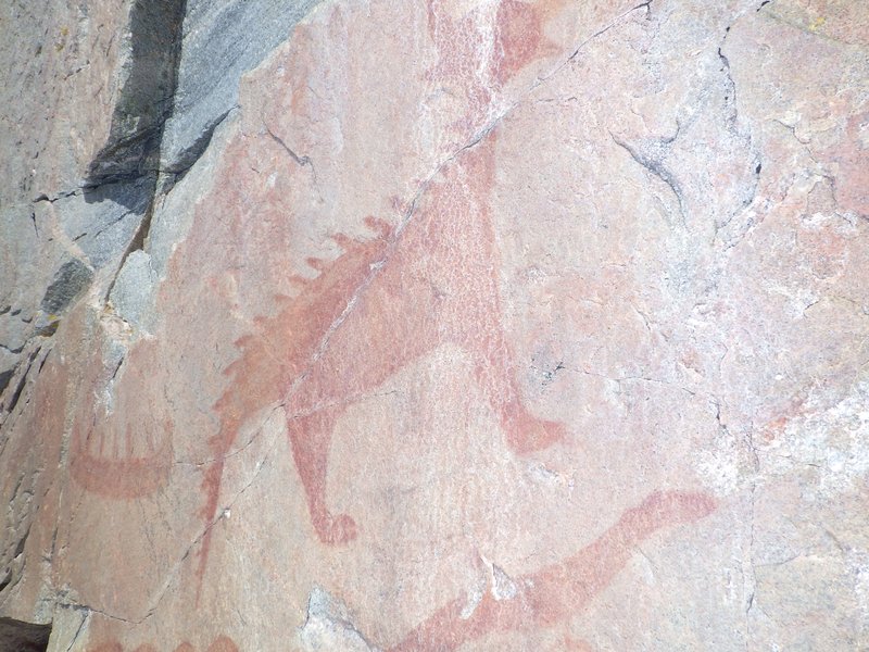
hiking slowly, passing through a brilliant boulder cave system after which we hit the Agawa Rock pictograph trail.
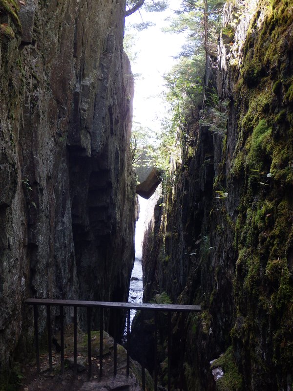
Here we dropped our packs and scampered through a dike and
then down to the water to see the pictographs. They were somewhat difficult to get to due to slippery rock and the
broken remnants of some sort of fence or viewing platform poking out of the rock slab which threatened to trip you up.
We had hoped to refill our water here, as the day had gotten quite warm and our fluid reserves were dwindling, but the
shoreline here was unfortunately far too slippery and dangerous.
Scrambling over the ridges
Boulder hopping along the shore
Spelunking thorugh the boulder caves
Chockstone in a dike on the way to the pictographs
Slippery rock walk, trying not to fall into the water while concurrently trying not to touch the pictographs on
the wall beside you. Honestly, the park could definitely make this tourist attraction a little more accessible and
protect these acient artifacts at the same time.
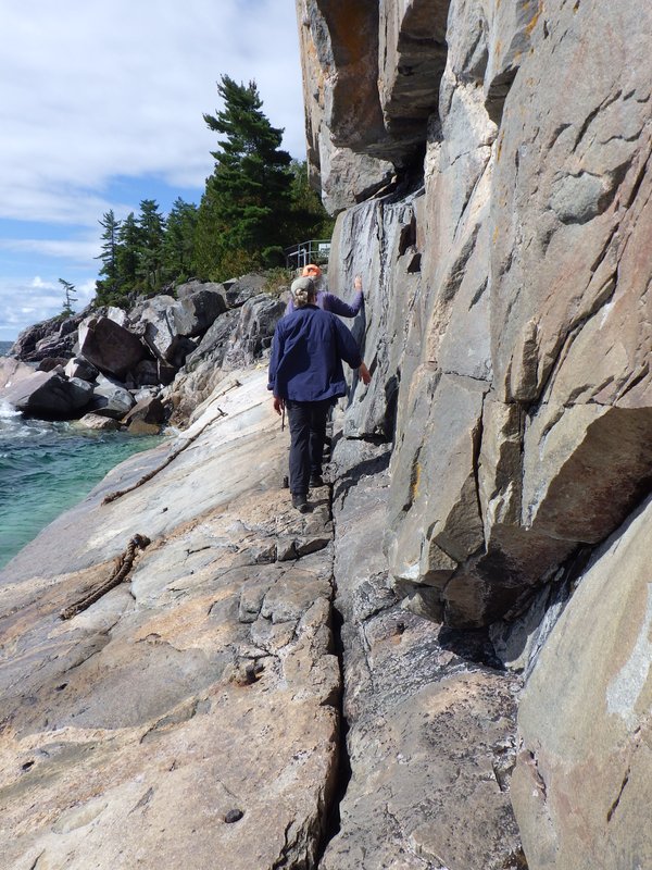
Pictographs
After rejoining our packs, a little bit further brought us out to a
beach with quite a few people hanging out with screaming children. The boat launch proved to be a
convenient water filling area at least.
The last three kilometers to Barrett Island took a long time. The terrain remained complex and everyone was beginning
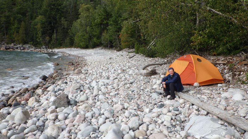
to get tired and footsore by this point. Finally we arrived at the bay, and the first campsite was unoccupied so we
settled in. This trail is more difficult than I was expecting. Katharina dubs this as "horizontal mountaineering".
Loads of fun though! Whoever would of thought that Ontario of all places had such great hiking?
Campsite at Barrett Island Cove
Hiking time: 8 hours
[Home]
[Main]
[Prev]
[Next]