[Home]
[Main]
[Prev]
[Next]
September 4, 2020 - Ishpatina Ridge, North Peak
Deb and I were the only fools keen on spending another day romping around the thick brush of Temagami, so we paddled out
by ourselves after an early breakfast. A quick carry over to McCulloch Lake and then a liftover into a tiny pond
brought us to our "trailhead". We whacked over to an adjacent pond, skirted around this on what looked like an old and
destroyed log run bridge, and then cross country to Twin Lakes at 414m. From here it was a straight berring up the
ridgeline to the summit. Most of the whack was fairly thick and slow going, but were treated to an open maple grove
for about a kilometer where we could scamper along quickly. One small cliff band proved to be an obstacle, but a
weakness was quickly was quickly located where we could scramble up with a couple of third class tree hauling manouvers.
The terrain levelled out onto the summit plateau and we set about trying to find the highest point in the dense
view-less forest. We found a tiny meadow which I think might be it, but a very globular tree trunk nearby made for a
more interesting summit photo backdrop.
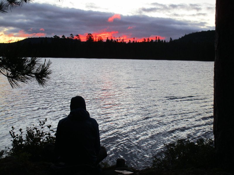
Firey sunrise.
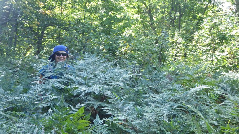
Debbie lost in the ferns.
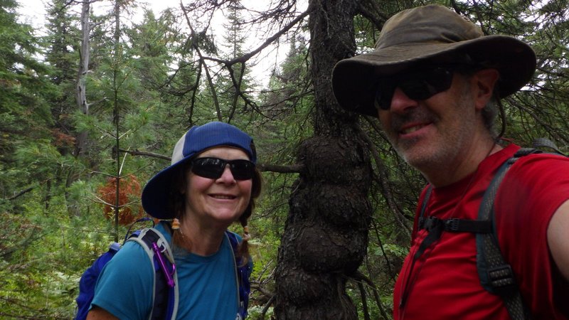
What we declared to be the summit of North Peak.
Hungry now, we turned south to hit the tops of the
south cliffs where we found a nice place to sit for lunch with a view of Ishpatina Tower. It started to rain, so we
packed up quickly, so quickly that I forgot my knife up here. Damn, that is a real bummer as it was a good knife. Deb
was keen ot complete the traverse of North Peak and loop back via Ishpatina Gorge, so we continued west as we tried to
find a way down the 150m cliffs we stood atop of. Several times we found a route downwards, but got cliffed out and
had to whack back upawards into the incredibly thick bush. This took a long time, to the point where I stated that if
we had not found a way down into the gorge in the next hour we were going to turn back and simply retrace our route
back to the canoes over the summit.
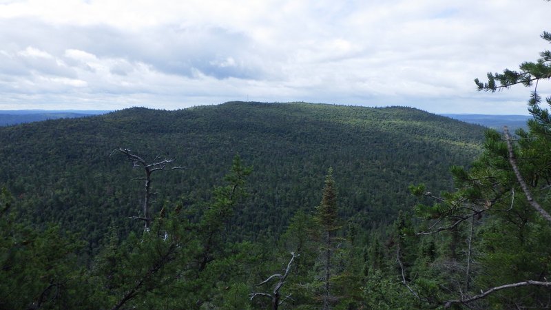
View over to Ishpatina Tower.
Finally we found a way into the descent gully, much further north than planned, but
from here we could safely descend even with the occasional cliff band to work around. Eventually we reached the bottom,
just as our turn-around time was exceeded and it was declared that we were now at the point of no return for the walk
through the gorge.
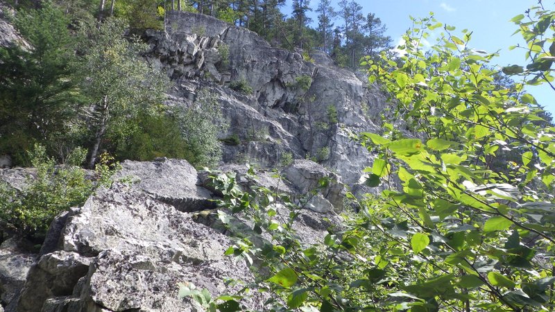
Working around the extensive cliffs.
A dense whack took us along the base of the cliffs and then along the shore of a long narrow lake.
Another berring through thick forest towards twin lakes has us spy them from about 60m above on top of yet another set
of cliffs. We spent a while traversing these pretty much all the way back to our ascent route from the morning before
we could find a way downwards.
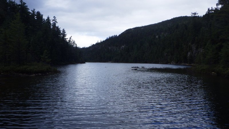
Gorge lake.
One more compass shot was supposed to bring us back to the canoe, but something went
wrong. We whacked along through the thick and finally came to a lake, but it was much larger than the one we were
aiming for. We checked Deb's GPS, and sure enough we were looking at the norhtern tip of McCullock Lake. A glance at
our track showed us what had happened. We started out following a perfect line, but at the midpoint we made a thirty
degree beed in our track. I surmise that the compass dial had gotten inadvertantly turned at one point as I had been
squirming through one of the thick sections, putting us off course slightly, but not signifcantly enough to notice.
Oh well, easily corrected now that we knew what went wrong, so we turned south and after another 300m of forest
swimming we arroved back at the canoe. A short paddle through what a burst of deluging rain had us soaked, but back in
time for supper after this 8.5 hour day.
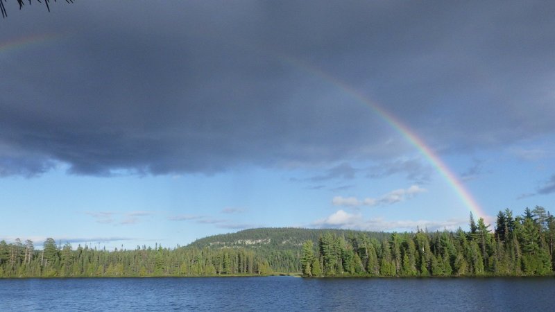
End of the day rainbow.
[Home]
[Main]
[Prev]
[Next]