During my GIS internship at the Cobscook Bay Resource Center in Eastport, Maine, I had the opportunity to take many trips to view the many natural and manmade sites in the area. On August 21, 1999 I left Eastport at 5:30 am to make the 3 hour drive to the south gate of Baxter State Park.
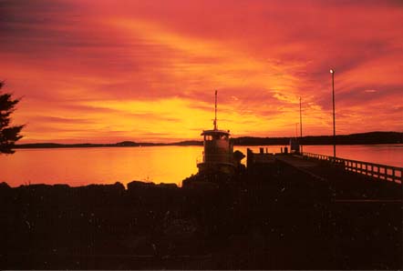
As I passed by the town breakwater, I took this wonderful picture of the sunrise over Campobello Island, New Brunswick.
I drove north on Route 1, then west on Route 6 to Lincoln, where I then went north on Interstate 95, where I got off at the exit for Medway and then west on Routes 157 & 11 towards Millinocket. At this point, you can hear the latest news and information about Baxter State Park on the AM radio frequency of 1610. From Millinocket, you just follow the signs indicating Baxter State Park.
I arrived at the south gate of Baxter State Park at 8:30 am and was told that the parking lots for the hiking trails leading to Mt. Katahdin were already full by 7:00 am that morning! Apparently, in most of July, all of August, and on September and October, weekends, the parking lots fill up VERY early on Saturday mornings.
I was told that I could choose to do an alternate hike and a very friendly and nice female ranger suggested that I should consider hiking up on North Brother (Elev. 4143 ft) as it is the park's second highest peak and the parking lots to its hiking trails were still open.
It should be noted that Baxter State Park is essentially a hiking park. The road in the park is just a basic winding and rough northern style tote road. Motorcycles and large vehicles are not allowed in the park and the speed limit on the tote road is about 20 mile per hour. However, the tote road is so rough I doubt you could drive faster than 20 m.p.h.
I paid my $8.00 to enter the park and drove slowly along the rough road along the base of Mt. Katahdin. I passed by the Abol campground and then I came upon the Katahdin Streams campgrounds. Across from the Katahdin Springs campground ,I noticed that there were some parking spaces available at the Grassy Pond hiking trail. I decided to park my car there and take the hike to Grassy Pond. From Grassy Pond, I hiked to Daicy Pond where I connected to the Appalachian trail.
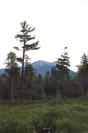
This picture shows the view of Katahdin from Elbow Pond, which is west of Grassy Pond.
Since the Appalachian goes to Mt. Katahdin, I followed it to the Katahdin
Springs campground and then I started up the hiking trail to the summit.
This trail is known as the HUNT TRAIL. The trail starts off quite
easily and then like many mountain trails, it gets steeper as you go higher.
The trail is uneven in spots , but there are also some flat sections as
well. The trail is quite well maintained and in some places the rocks
are placed like steps. The big and dramatic change comes when you
leave the tree line and then you can see what the mountain has waiting
for you! The hiking trail suddenly becomes just a route up a mountain.
Above the tree line, it becomes a technical climb in many places. There
are many rocks and ledges, and in some places it is so steep that metal
climbing bars and pins have been placed into the rock face.
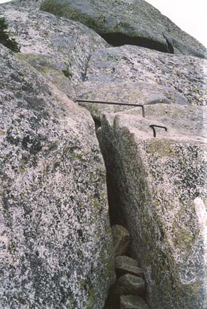
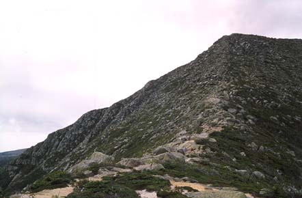
From here it gets rough! If you are going to try this climb you will need sturdy hiking boots and some knowledge of how to do basic mountain climbing. There are no vertical walls, but the route is very steep and it meanders up the side of the mountain along a section known as the Gateway.
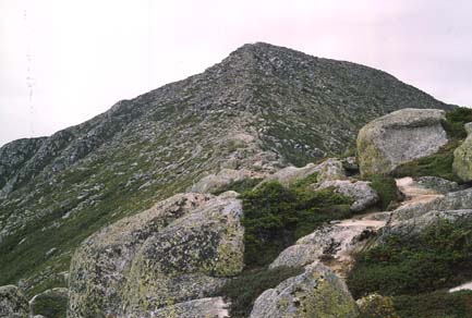
The "peak" in this photo is not Baxter peak, but it is the edge of the table land on the top of Katahdin.
Halfway up the Gateway at this point.
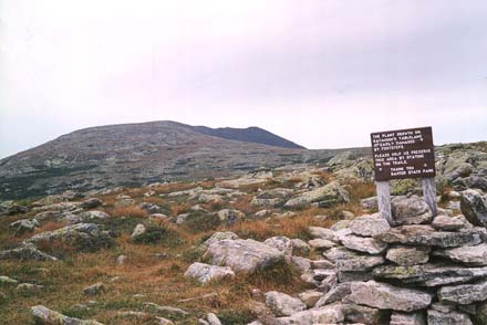
I finally arrived at the table land where the trail appears again and you can take a leisurely walk across a well marked trail towards Baxter Peak. The table land resembles Arctic tundra and the trail passes by a spring known as Thoreau Spring which is named after Henry David Thoreau who climbed the mountain in the 1846.
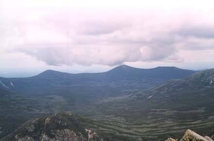
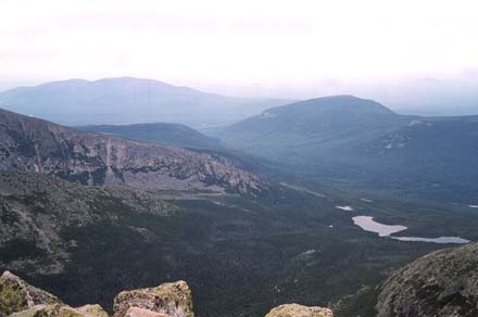
And if you look off of the mountain, there are some great views such
as "the Brothers" in this picture.
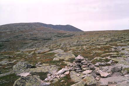
Then I continued along the table land where it began to rise up towards
Baxter Peak. The increase in elevation is not that extreme at this section,
but at this point in the hike, my energy reserves were getting quite
low.
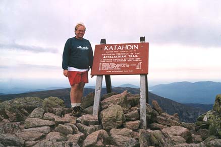
I made it! It took approximately fours hours to make the hike/climb/hike from the Katahdin Springs campground to the summit. The fatigue that I experienced should be quite noticeable in this photograph!
This photograph is looking north towards North Turner Mt.
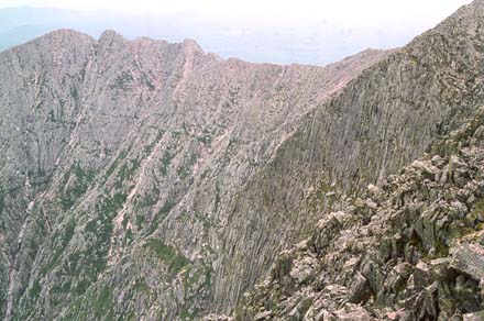
This view shows part of the VERY steep and dangerous Knife Edge Pass.
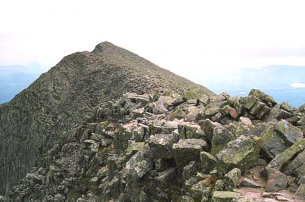
View of the south Peak and the start of the Knife Edge.
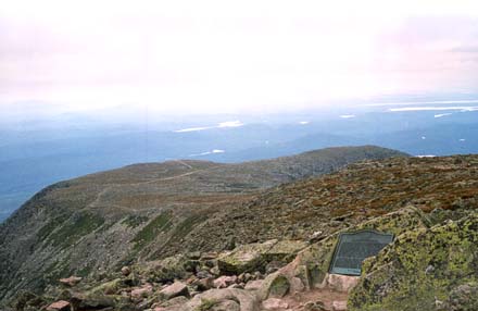
A view from Baxter Peak looking southwest showing the plaque commemorating former Maine Governor Percival Baxter who donated the lands that became Baxter State Park.
Comments? Send E-mail to Michael Kostiuk
Page first created on August 25, 1999.
Last update: November 4, 2007.