Leaving Elephant Rock, not very early, we were fortunate not to be travelling North via Cunningham's Gap, for the road had been closed due to a rockfall and traffic proceeding in this direction was faced by a long diversion either East or West. We, however, were on our way North of Brisbane, intending to stay at a place called Aswelikeit, but we wondered what Paul and Nicole would have done - they had intended to cross the Gap. Well, in a few minutes we found out....calling in at the first fuelling stop, in Aratula, we found them, surrounded by maps, trying to find the best route past the road stoppage ! Refuelled and reprovisioned, we left them to their cogitations and continued toward Highway 3, Highway 2 and, Oh Horrors, Brisbane and its snarled bypass roads, cul-de-sacs and false turns. We made only made one mistake this time, quickly repaired with the invaluable aid of the Garmin GPS. The GPS and the Australian maps which we can load from the (expensive) CD have proved to be invaluable - thanks a million, Tim. There was nothing remarkable in this journey, like so many highways, the route is designed for high-speed, safe movement, but we are always impressed by the regular appearance of "rest stops", almost always provided with picnic and washroom facilities, a feature rapidly disappearing from North American highways. We carry a Canadian flag prominent on the rear window and, while this is to warn the following traffic that the driver is liable to do odd things at moments of stress, it also serves as an introduction to the people we meet at these stops, usually drinking a cuppa for revival - that's a cuppa tea, not coffee, for coffee is a rarity on this continent.
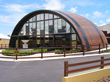
North of Brisbane, we switched to Highway 1, the major North-South route along the Eastern coast and went another 200 km North before heading West over the hills into quiet, hilly country there. These are the foothills of the Dividing Range again, cooler than the lower coastal area. Aswelikeit is on Skyring Creek Road, close to a tiny hamlet called Carters Ridge. We had 'phoned an enquiry in advance but Brian and Annette, the owners were out for the day, so Gretchen showed us the way in and we parked with great relief. As it turned out, we stayed for the next four days, for the clouds gathered and brought increasing rain storms so we stayed put, retreating to shelter beside the swimming pool, sometimes into the hot tub during the deluges - the whole Eastern coast was wracked by storms for a couple of weeks at this time. Gretchen and Russell, together with Rolfe and Nelly from Sweden were making an extended stay there also, and Saturday we were hosted to a BBQ by Brian and Annette.
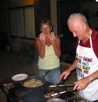
Vegetarian Gretchen showing her surgeon's hands - Carnivorous Brian intent upon his steak.
Like most country properties in Australia, Aswelikeit is dependent upon a dam, that is, a reservoir, and this dam slowly rose over the next few days until it was finally overflowing. We wondered how Lake Moogerah was faring - but it had a long way to go when we last viewed it....... The largest number of people staying here had been 170 during the Australia Day celebration in 2003 but we felt we had unlimited space here to walk its trails. There were always lots of birds, including the shy King Parrot with its riotous plumage.
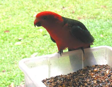
"Hey Guys - here's the food supply to beat all......."
One day, between the rain showers, we walked a couple of km to the little hamlet of Carters Ridge to buy a few groceries and thought we might as well stop off there and have some lunch. In a sense, this was a bit of a mistake because the rain poured down during our return, but the lunch stopover, prompted by the name of the special-of-the-day : "Works Ridgeburger" was a great affair. This proved to be an enormous bun with a large hamburger patty, cheese, a fried egg, beet (usual in Ozzie hamburgers), fried onion, bacon, lettuce, tomato, grated carrot, ketchup and/or bbq sauce with, piece de resistance, a big slice of pineapple !
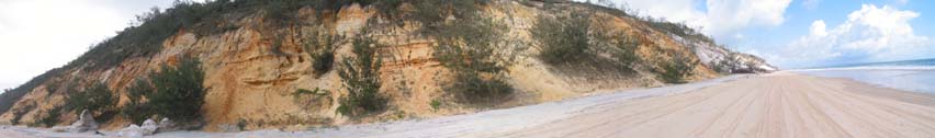
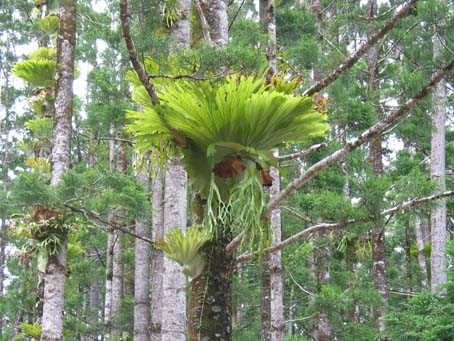
We were at the Caravan Park at Rainbow Beach, a matter of 300 m from the beach itself, so were able to swim in the sea. This was actually the first time we had managed to do this, the weather having been so generally poor. Most beaches have a well-defined and lifeguarded section, often with anti-shark nets, particularly important in this area because of the dangers of rip tides and strong undertows. But our main reason for coming here was in order to visit Fraser Island, just North of the little town of Rainbow Beach and South of Hervey Bay. Fraser Island is about 140 km long and is one gigantic sand dune, formed to the lee of a basalt volcano pipe at its North end. There are frequent ferries (barges) onto Fraser Island, but travel thereon demands a 4WD vehicle - certainly Gertie II would be a hazard. So we signed up for a one-day, air-conditioned, guided tour, which included a buffet lunch. Fraser Island, as is commonly the case, is a designated highway with speed limits, very variable conditions because of the tides and is frequently patrolled by the resident policemen of the island because of the not-uncommon accidents and roll-overs. Because of the noise of the surf, you can't hear the approach of these 4X4 cowboys so walking is often hazardous. We were driven 30 km or so along the East beach and then turned into the island centre. Fraser Island has a very peculiar geography - although composed completely of sand, yet it has a high rainfall and is classed as a rainforest area. It's also a World Heritage Site, meaning that access and usage are strictly controlled to preserve the fragile ecology so that the large-scale sand mining operations and logging have now ceased. An unexpected hazard is the pure strain of dingos, wild dogs not interbred with the mainland dingos and recognizable by their four white feet. Tourists are more frequently now being attacked by these creatures owing to the dingos losing their fear of humans due to increasing familiarity. We went for a short walk through the rainforest, among the giant pines (not, of course, at all like our Canadian pines) which often had large cabbage-like plants growing high up in their branches. These plants are not parasites - the tree and the plant simply live together amicably, the plant perhaps supplying condensed water to the tree. An interesting point is that the large trees which have not been logged often have twisted grooves in the trunk, corresponding to a twisted grain in the underlying timber - these trees survive because the hard wood then twists and destroys the milling saws, so the loggers passed them by !
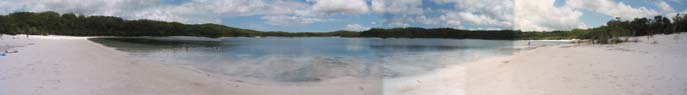
Another unique feature of Fraser Island is that, despite being composed of the purest silica sand (hence the now defunct sand-mining, for glass-making) it has many lakes. This is because there is, beneath the island, a huge water-table pushed up by saline hydrostatic pressure and yet kept salt-free by the high rainfall. The lakes have pure white sand beaches and the water is as mineral-free as can be, slightly acidic. The best-known of these is Lake MacKenzie, where we swam au naturel after walking a fair distance away from the textiled crowds.....
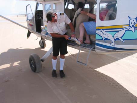
Had we wanted, we could have had an airplane joy-ride over the island in order to view these lakes from the air, but the price seemed a bit excessive for a 10-minute view of some treetops and blue-water lakes, so we passed this opportunity up and watched the airplane taking off and landing on the beach. The pilot, a careful house-keeper, was anxious not to get sand into his aircraft. Too much extra weight ? or would it clog up the controls ?
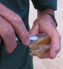
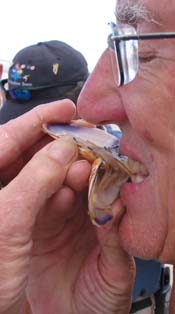
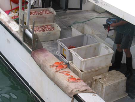
But we didn't pass over the opportunity to sample some aboriginal tucker on the return. The driver slooshed to a stop partway down the beach on return and dug up a dozen or so seashell creatures, detected by their air-holes in the wet sand. He assured us that these were not pernicious and were not only both nutritious and delicious but were extremely aphrodicious. They tasted like salt herring to me and I can't answer for any side-benefits....
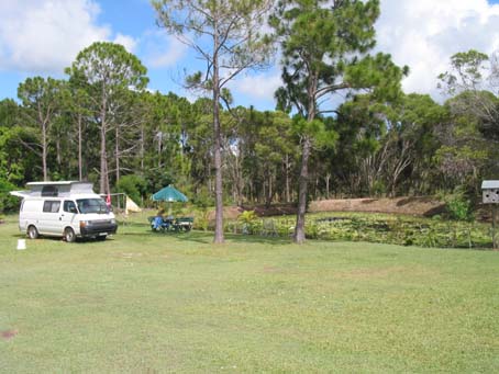
From Hervey Bay it was a short distance to Tony and Nicola's place, Garden of Edun, where we stayed for a couple of days. This was another comfortable spot, very convenient to Hervey Bay which is basically just a seaside resort town, full of motels and hotels and not much in the nature of unbuilt-up beaches. A bit like Brighton, perhaps. Garden of Edun is a gradener's delight and it would have been pleasant to stay even longer except that we had to get to Bundaberg before it was time to turn around and head South again. Usually, when we make our stay at nudist/naturist places, then we are alone in peace and quiet, particularly at weekends. But we mustn't forget that this is the beginning of the summer here in Queensland and people tend to keep away from the north during the hot months of the summer here. Here's a picture of our peacefull campsite, Gertie II very contented, beside the dam and the palm trees.
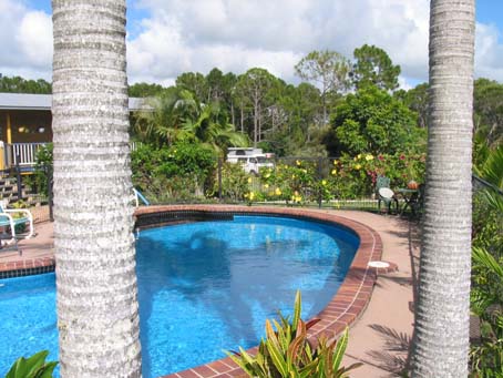
A lot of the time we splashed around in the swimming pool, too.
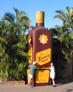
We drove the short distance to Bundaberg, intending to visit the distillery, home of the famous Budaberg rum. Visited the distillery, in fact. Had a couple of - er - interesting drinks but I'm afraid we weren't impressed by the factory tour other than that. Here's the oblgatory payment of homage to the rum god of Bundie. We preferred the Ginger Beer Factory, built in the shape of a gigantic beer cask and with a much more informative tour spiel. Pity we can't get Bundaberg Ginger Beer in Canada - it's very refreshing on a hot Queensland day........
Our reason for going to Bundaberg was not really to visit either of the two beverage factories, but rather to try and see the phenomenon of turtle egg laying/hatching. At Mon Repos beach/conservation area, close to the little town of Bargara, there is such a turtle rookery where one may, under very strictly-controlled conditions, watch the turtles, particularly loggerhead turtles, lay their eggs. Turtles breed only after full maturity at age 30 plus, in up to 4 batches of about 130 eggs each and then only every 4 to 5 years. The eggs are laid above the high water mark and the hatchlings hatch simultaneously but it is thought that only 1 in 1000 of these survive to maturity. Suitable beaches are increasingly under threat, the turtles themselves are under increasing hazard from other fishing and marine operations, so that these creatures may well become extinct unless extreme protection measures are imposed. Well, anyway, you can, very carefully, watch the process, either or both of laying or hatching eight weeks later by reserving a night-time visit to the rookery beach here. One cannot predict either the time or even the possibility of a nesting turtle but the opportunity was not one we wanted to miss. Unfortunately, the skies broke forth in a gigantic thunderstorm as we staggered along the beach in black darkness, increasingly soaked and even cold ! The turtles are measured, tagged, treated for parasites/barnacles etc during the nesting process and if the eggs are in a poor location, then these must be relocated within a critical 2 hr time frame. Most interesting of all, the hatchlings' sex is determined solely by the temperature of the nesting sand. Within a temperature range of 23-25 C males are exclusively formed, above 27 C only females. Well, I could go on for a long time about the turtles' reproductive peculiarities and particularly the females' mating behaviour but instead I'll refer you to the Mon Repos Web Page. Altogether, it was a fascinating visit and then we staggered back through the storm, threw our soaked clothing into a sopping heap and ourselves into bed ! Next moring we did our best to dry off and made our way toward The Drovers Hut.
Drovers Hut is where I'm writing, surrounded by the mango trees, the orange trees and the passionfruit vines. Tell you about it next time......