Mount Mansfield
[Home]
[Main]
October 15, 2011
Friday evening after work Patrick, Lynne, Debbie, Ivan, and myself drove down in Patrick's car to Underhill State
Park in Vermont. It poured rain the entire way down, so when we arrived at 22:30, rather than setting up tents we opted
for a lean-to, which was an awesome idea. It poured rain all night, but stopped in the morning as we cooked breakfast
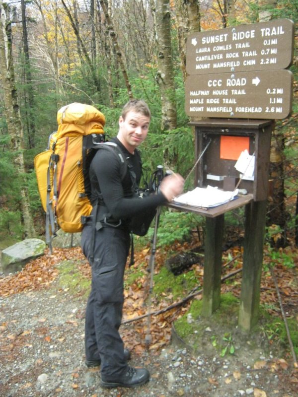
before light. We hit the trail at 07:30. The first couple km was on very easy grade trail following a road. After
hitting the registration box, we hiked on the road until we reached the Rock Garden trail. Now things became
interesting. The sky also cleared and we had a nice sunny day. We also began to hear gunfire. At first we assumed it
was hunters, but after hearing the distinct sounds of heavy guns and machine gun fire we realized that Vermont must be
at war. The war continued all day... to the point of being annoying. Fortunately the fighting was deep in the valley
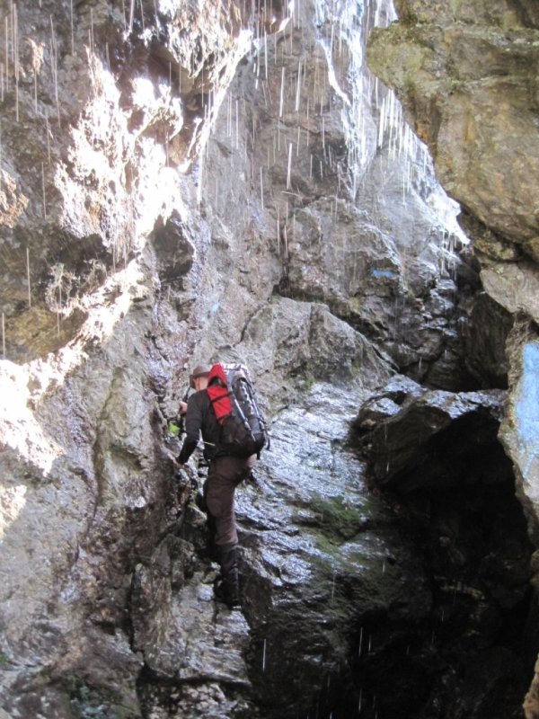
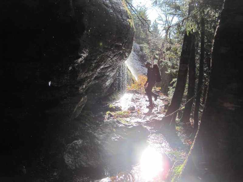
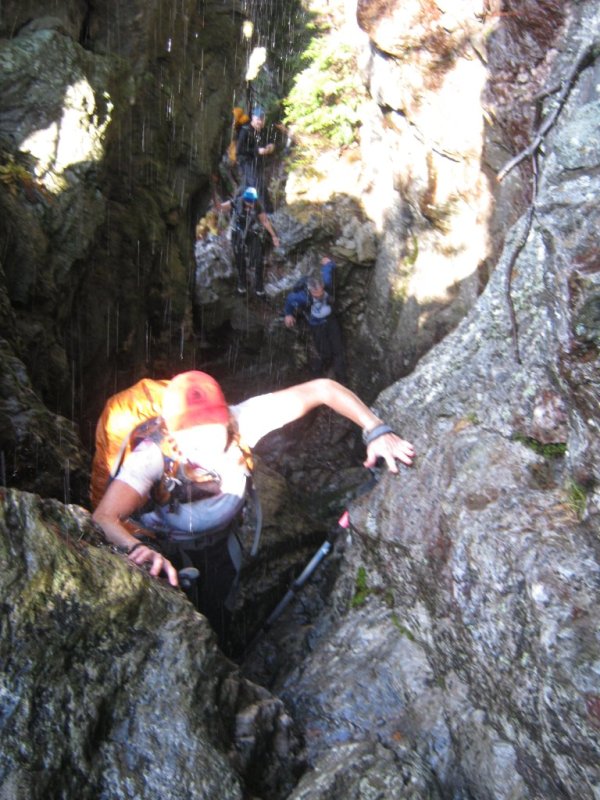
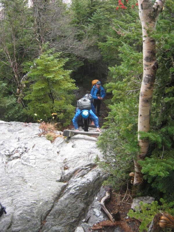
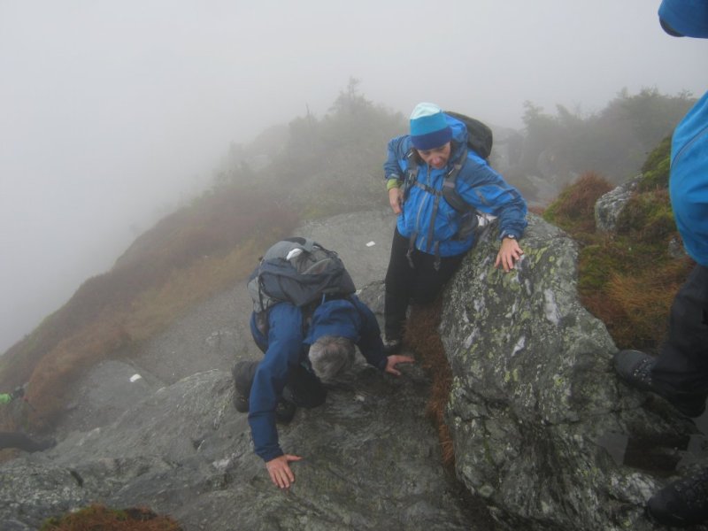
and did not seem to affect us so we just ignored it and treked on. The Rock Garden trail was really neat with some
scrambles through caves and boulders with water dripping down the cliff faces. In the morning sunlight it made for some
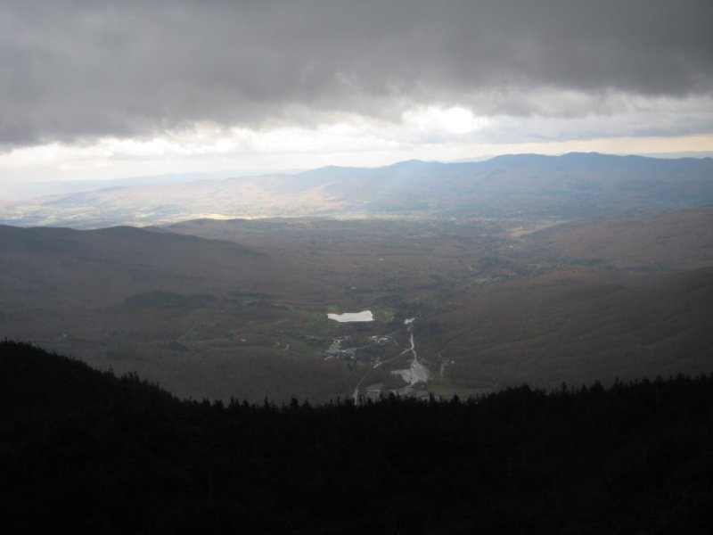
spectacular photos. We eventually broke out into alpine territory in which we were rewarded with spectacular views, and
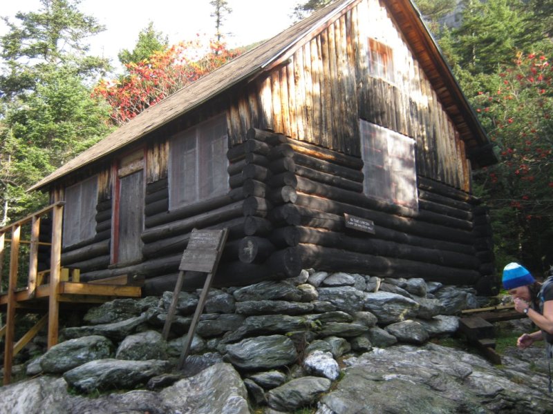
strong winds. We stopped for a snack in a Green Mountain Club hut which was empty. Then we began the final climb to
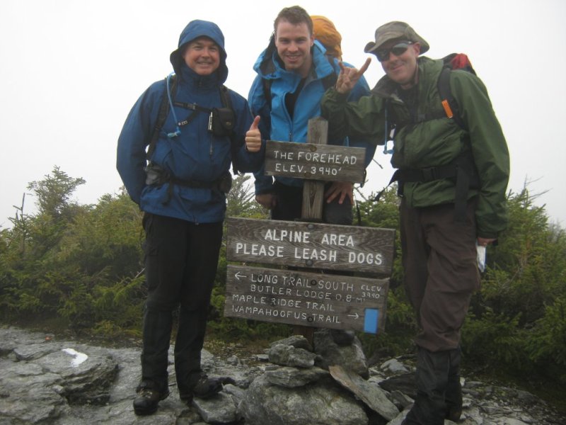
the top of Mr. Mansfield's forehead where a sign indicated this false summit. At this point it had fogged in and
started to rain, so we did not get any views from up here. It was also incredibly windy when we were in the exposed
areas. We continued on towards the nose. The map showed the trail skirting around the nose and indeed it did. We
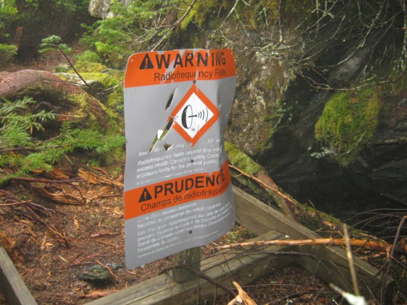
started looking for a trail up to this summit but instead found a sign that warned us that radiation limits on the
summit exceed Canadian safety standards. As we were Canadian, hiking in US territory, and given that we were unsure of
who exactly was at war with Vermont at this point, we decided to leave that one to the Americans. A little bit further
we came across a parking lot and a visitor center. We had not seen anybody at this point. Now there were crowds. Most
of them were Canadians... I guess we were winning the war (assuming it is Canada that was at war with Vermont). The
guns continued, and we continued hiking. A very windy walk along the ridge for another km or two brought us to the
summit where we took our turn for a photo by the survey marker. A young woman from the green mountain club was acting
as a summit steward, well bundled up from the weather. We did not stay long, and decided to descend down the west side
of the mountain about 200 m towards another hut for a lunch out of the weather. The descent was incredibly crowded,
although the majority of the people encountered were coming upwards against us. There was one section of very exposed
down climbing which created a big traffic jam of people. We reached the hut and found it full of French Canadians and
a few girl guides. We sat down for lunch with the Canadians and warily watched the girl guides, but they seemed to be
unarmed except for trail maintenance tools. During our lunch a group of boy scout reinforcements arrived, bringing lots
of ammunition of the wooden step variety. They nervously peered in the hut as the Canadians outnumbered them greatly,
but we assured them that we were surrenduring this territory once our bagels were finished. After lunch we headed back
up the mountain, intending to go back over the summit and descend the Sunset Ridge trail. Just before we reached the
final scramble to the summit plateau, a crack of lightning turned us around. We quickly descended back towards the hut
with a few bolts striking frightenningly close. The rain also changed to ice pellets making footing tricky. We reached
the summit bypass trail, appropriately named Profanity trail, which after some cussing we decided to take. The storm
had seemed to subside at this point so we now climbed back up to the exposed ridgeline. This went fairly slowly as
Lynne was beginning to reach her limit. We unloaded her pack and things went easier for her. Finally we reached the
ridgeline and began a long, exposed descent down Sunset Ridge. The wind made things very interesting, but after about
another hour we reached the shelter of the tree line, at which point it was an easy walk all the way back down to camp.
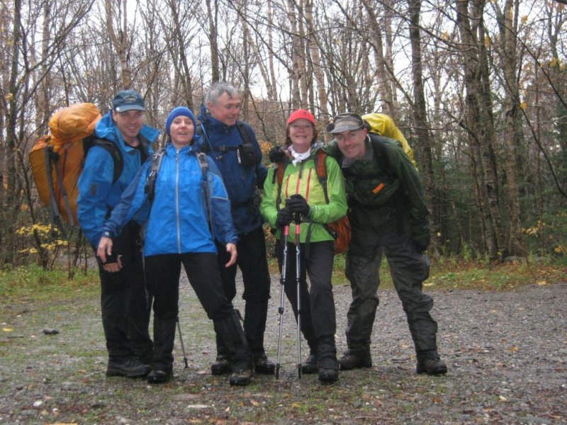
After a 9.5 hour day, and 20 km of walking, we celebrated our success (and Lynne's first 4000er) at the Hungry Lion
restaurant which was very good. Many beers followed at the lean-to back at camp later. A ceasefire must have occured
as the gunfire stopped, which caused us to seek truce with the local forest ranger. We had a peace exchange of a
free bundle of firewood for a beer and all was good.
Ivan, our fearless leader, signing in.
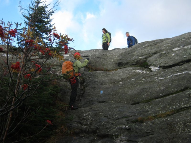
Debbie downclimbing a ledge.
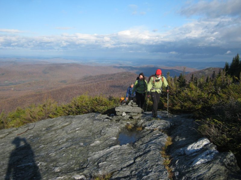
Hiking along the ridgeline.
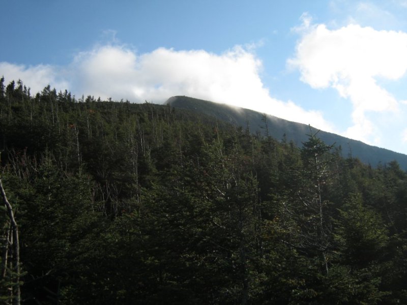
Mr. Mansfield's forehead.
Rock Garden trail.
Butler Logde.
Some ladders aid the ascent towards the forehead.
Three boys on top of Mr. Mansfield's forehead.
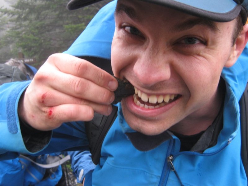
After unsuccesfully punching the rocks, Ivan decideds to eat them.
We decide not to summit the nose.
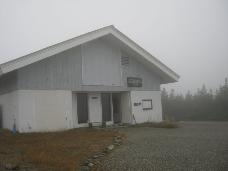
Visitor center on top of the ridge to the chin.
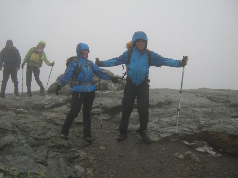
Windy along the ridge.
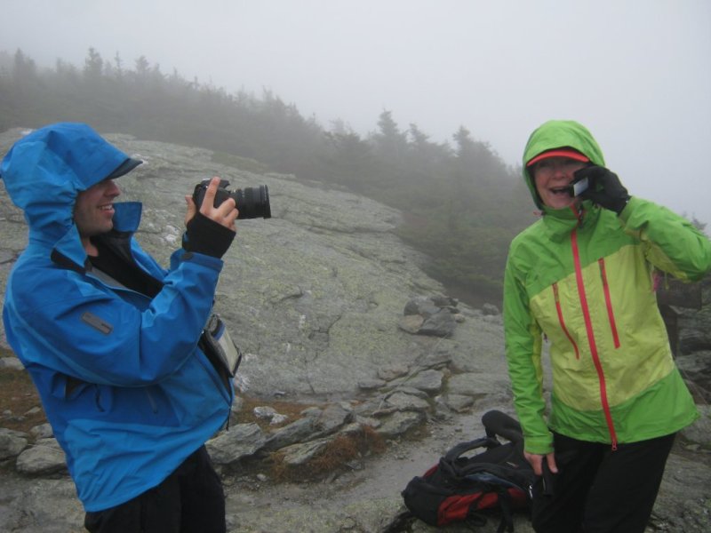
Debbie calling her sister to wish her a happy birthday from the top of Vermont.
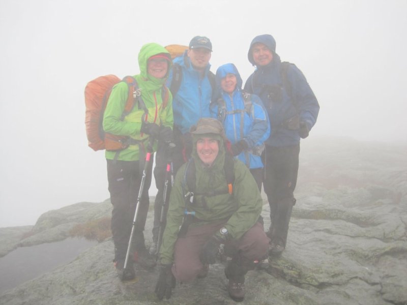
The team on the summit at Mr. Mansfield's chin.
Tricky bit of exposed down scrambling towards Taft Logdge.
As we decend Sunset Ridge trail, the sun makes an appearance.
End of the day group photo. Left to right: Ivan, Lynne, Patrick, Mike
October 16, 2011
The next morning was a lazy start. The gun fighting also resumed, but with less vigour than the day before. We set our
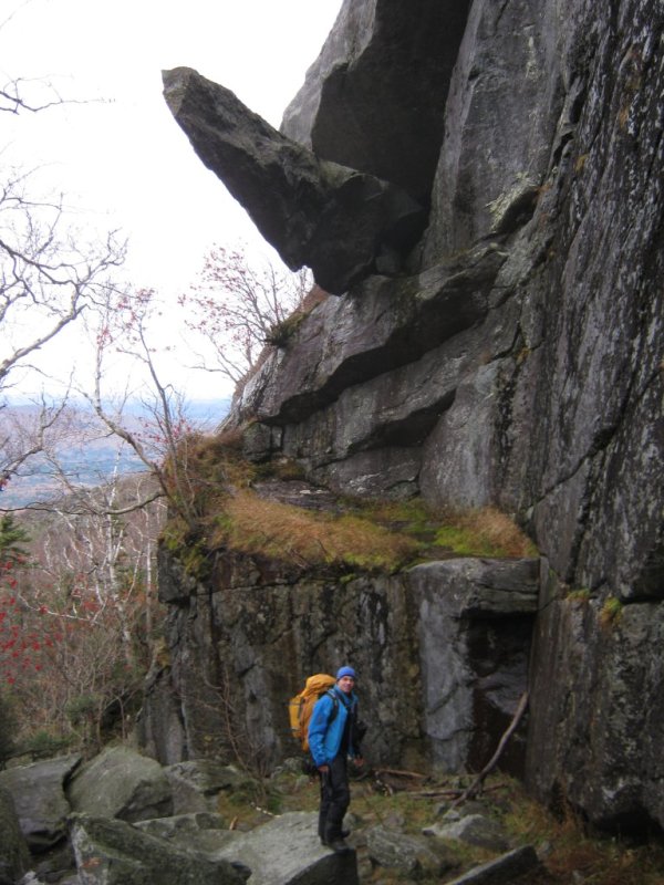
sights at cantilever rock, which was at the base of the Sunset Ridge trail. A fairly easy one hour hike up to this
yielded an impressive, if not somewhat phallic, geological formation. A great view towards Lake Champlain rewarded us
as we took a break hear on a big rock slab. We met a few other French Canadians here prior to our descent, after which
we drove home.
Cantilever Rock.
[Home]
[Main]