Yamnuska Traverse
[Home]
[Main]
[Next]
July 19, 2022
Yesterday we drove to Canmore from my brother's place in Gull Lake Sask., arriving in time to meet Tana and some other members of the ACC Rocky
Mountain section for supper at a pub downtown. We probed people for a good acclimatization hike for this day and it was universally decided that
we should do the Yam traverse, which turned out to be an excellent suggestion.
Kat and I drove the 25 km or so out in the late morning, arriving at the parking area for 09:30. We had to pay for parking, which I have no issue
with, but you had to pay by cell phone with no other option except driving all the way back to town. That is not cool. With a lot of swearing we
managed to get Kat's old phone to transfer $10 to the park and an additional $5 to some third party for the convenience of paying.
Yamnuska from the parking area
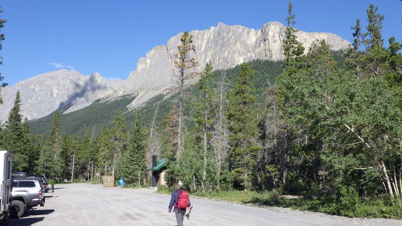
Anyway, parking sorted out, we started up the very well constructed trail towards the mountain. We leap frogged with several other groups as we
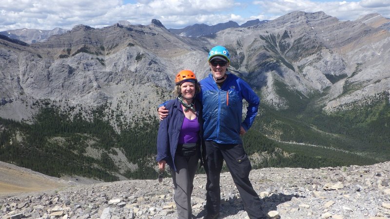
traversed the numerous switchbacks, and met a friendly couple of local women at one of the great lookouts where we got them to take our photo. After
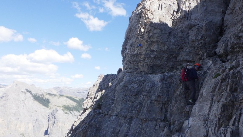
about an hour and a half of hiking we arrived at the tree line and were presented with the first fun scramble up a chimney. The trail continued
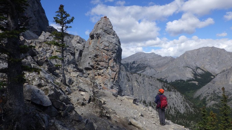
on, always well marked and for the most part fairly easy walking. A fun little exposed traverse with a chain to hold onto was followed by an
easy down climb (also chain protected), where the chain really got in the way as it seemed to always be right where you wanted to put your feet.
Lovely hike up
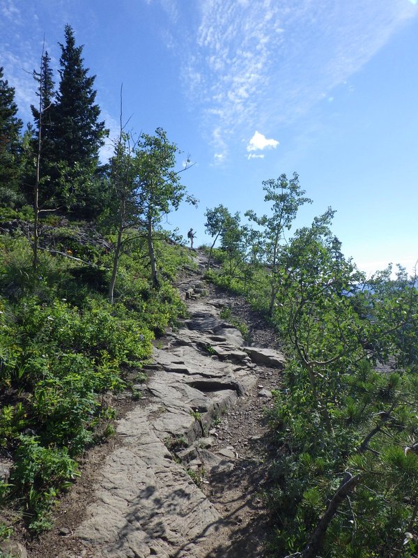
Stopping on at a lookout on the approach trail

Start of the scramble
Hiking along in the alpine

Chain protected traverse
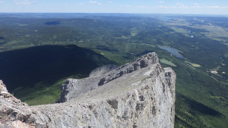
The last bit up to the summit was a lovely ridge walk with excellent views in all directions, leading up to a sloping summit area where quite a few
people were lounging around enjoying the sunshine. We sat down for a good 45 minutes here to breath the thinner air at 2240 meters and enjoy the
views and cool breeze.
Summit
Looking back at the route from the top
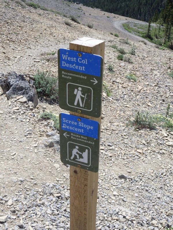
Finally we decided to go, where a steep scree lined trail took us down the other side of the mountain. At one point we came to a well marked
junction which had signs indicating left for the "not recommended route" or right for the "recommended route". Given my knee is bugging me, we
turned right which had us switchbacking fairly gently through the forest all the way back down to the parking area. The full loop took us just
over five hours, including the long lunch break.
Choose wisely
[Home]
[Main]
[Next]