USGS
Imagery of Tour Across Southern USA by Bicycle
USGS
Imagery of Tour Across Southern USA by Bicycle
Wow, how did I get here? I'm now on the porch of the Samesun Hostel in San Diego, California, where I'm staying for at least one night. It's a great hostel. Somehow, I've just ridden my bicycle across the southern USA. On the one hand, this is real; on the other, it's all like a fairy tale, so some of the following is a fantasy.
One rider calculated the distance of this trip as a bit more than 3,100 miles. Google has a route for bicycles across the USA of almost 2,700 miles. Organic Maps puts it at less than 2,400 miles. That's from Mango Mango restaurant in St Augustine Beach, Florida, where we were the night before to Samesun hostel in the Ocean Beach area of San Diego, where we stayed the night after. Were we dreaming too much?
I sometimes surprise myself. I'm thinking about my recent bicycle rides over the last few days that I continued to do daily for weeks and months by asking myself each morning: "Can I take another day of this?" The answer was never "No," but not always "Yes." These rides started when I arrived in St Augustine Beach on the Atlantic Ocean. There, I joined an organized bicycle tour that was headed to the Pacific Ocean. I took it all in a day at a time. I had trained for this ride but had second thoughts of continuing to go the distance for many days. Do I really want to stay in this group? Do I belong here? Should I stay? Do I want to go home and ski?
|
|
|
I had left my home in the cold north with great expectations of warm temperatures in Florida, which is two thousand kilometers further south. This was a bad assumption. There were many cold, freezing mornings on this trip and only a few truly warm or hot afternoons. But paradoxically, three of the last five days of the trip had sunstroke-inducing, hot temperatures of 95 F and higher.
My plan was to take this trip day to day and see how it goes, and I did. My attitude is that every day is just another day, every hill is just another hill, and every crank of the pedals is just another spin, eh? Just remember, "Small is beautiful," and every completed day is just another win, a reason to smile.
At times, other people kept asking me how I planned on doing all the climbing or all the distance required someday, many days ahead. Conversations would start with "How are you going to ..." I have and had absolutely no answer. I do not know. Every day is just another day. We'll see how it goes. Every hill climb only starts when you're at the bottom of a hill. Don't worry about it! Just think about it then!
The first terrible day was the third day when there was pouring rain and cold temperatures all day. I had all my clothes on and was still cold. I mistakenly left my winter jacket at home. The forecast was for a nice day the next day, so I persevered. At least the rain stopped. It was still cool.
Somewhere in here, I joined a couple of other riders who were on the same tour, and we rode along together. Somehow, this continued for many weeks. It all gets mindless after a while and one stays with "the group," eh?
I kept thinking, maybe I can even get through this with the help of a few others? We endured many cold and freezing mornings and had only a few warmer afternoons, at least at first. Many mornings were below freezing or, at most, 34 F. Somehow, I always got up and faced the day. I was having second thoughts. Luckily, I only really start thinking clearly after being awake for an hour or two.
Some other people grumbled about the tour. I was having second thoughts but kept my mouth shut. Instead, I wrote my negative thoughts about the trip into my diary, and they stayed there. They did inspire the section below on "What I Put Up With To Do This Tour?"
With "the group" I persevered and chatted about how to get there, where we were planning to stop and take breaks, what we were going to eat, and when the next in-door overnight stay would happen. See, this was a camping trip, but, at times, one wondered, as we stayed in many churches, a few motels, and the cabins in more than one campground. One indoor stay was due to strong winds; another one was due to a crappy campground with only one public toilet.
We continued bicycling every day even when there were strong winds in our faces of 25 mph with gusts of 45 mph or more. Luckily, there were other days with tailwinds and even a few days with no significant winds in any direction. The strong tailwinds blew us into camp early. At the end of this trip, another participating bicycle rider did some calculations and determined that there were more days with bad winds than good ones.
My only plan was not to try too hard, to not get overly strained, and only to put out effort when it was absolutely necessary. I took direction in fulfilling this tactic, from how I felt and a power meter and sensor on my bicycle. I tried to ride using a power level of a bit less than 2 watts per kilogram, most of the time, as this is a rate of exertion that I know I can persist at forever. I may be able to deliver more continuous power. I'm testing that out now, after the trip, when I can rest for a few days if I over-do my efforts. My first attempt was unsuccessful. I need some more rest.
My old power meter stopped working after a few days. My solution: buy new power sensors and a power meter ASAP. A few days later, I did so at a good bicycle store, Ride More Bicycles in Pensacola, Florida. Thanks again for supplying my new power pedal sensor. It enabled me to continue each day on this ride and eventually complete it all with almost no muscle pain!
Here is a brief story about this tour. After a few days, the rain stopped, and the weather became a bit warmer, even in the mornings. Each day was OK but not outstanding, and I felt OK but not great, so I continued.
I find this all easier to take and less overwhelming when I think separately of each of the tour's major parts: Florida, the Gulf Coast, Texas, a Warm Desert, a Hot desert, and the Pacific Coast. First, I recount tales about each section.
|
|
|
|
|
|
|
|
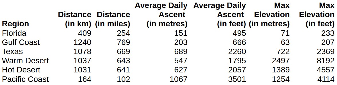
Florida's Atlantic coast has a lovely beach, as seen in the first picture in St Augustine. There are almost white, sandy beaches and miles of ocean-side piers topped with nearly perfect landscaping. These all get left behind when one travels inland. One then finds many small lakes, ponds, and swamps amidst a green landscape. There are a few giant trees. One also sees vast fields and orchards devoted to agriculture as much of the world's food is produced here, particularly fruit. There are also nature sanctuaries like the Aucilla Natural Wildlife Area.
Much of our travel through Florida was on bicycle trails and roads with minimal traffic and a few other busy roads with paved shoulders, making them also easy to ride bicycles along. It is also relatively flat, so bicycle riding is easy. This tranquility was broken on the third day when we awoke to developing storms with heavy and heavier rain, colder temperatures, and strong winds going the wrong way - i.e., in our faces ' the worst we had experienced. Luckily, we stayed in a Motel-6 that night. It was great to get warm and dry again.
|
|
|
|
|
|
|
|
|
|
Our bicycles are still in Florida when we greet the Gulf of Mexico/America. We're still in Florida - in the Florida Panhandle. Our bicycles follow the Gulf Coast for some time. This part goes through the Florida Panhandle, Alabama, and Louisiana.
We had great bicycling on these roads. Most of the time, the wind was at our backs, the Sun was out, and there were no clouds. Most mornings are icy, almost freezing, but the temperature warms enough by 10 a.m. to bicycle in t-shirts and shorts.
Along the Gulf Coast, the road is often close to the mostly sandy seashore. There are also several bridges. Between the bridges are many tourist resorts and second homes. Along most of this route, there is much access to the beach. The general atmosphere is one of wealth and happy living, enjoying life. A few other people were out enjoying the weather, the beach, and the ocean. The facilities could accommodate many more and there are times in the year when they are here. We're just here during the shoulder season of the tourism calendar so that we can enjoy the trip by ourselves or with just a few other people. I only remember seeing one great scenic beach after another, interspersed by a few homes, condominiums, and entertainment facilities. A review of the maps shows the almost continuous bicycle trails and sidewalks along most of these beaches. We often rode on these. There were also current military facilities and many historic ones.
On a break day, a day of rest with no bicycle riding, I go to a sports store to get a carabiner for hanging my dishes in the trailer and a fire starter log. The carabiner is useful as riders are allowed to hang their dishes in the van's trailer accompanying this trip across America. I hang my dishes in the trailer from this day onwards. Hanging my dishes with the carabiner makes it more convenient to get them at dinner time and any other time when I need, say, a cup for some coffee. I got the fire starter block, hoping we'd have some campfires on this trip. I like campfires. No one else on this trip seemed to be interested in campfires, and then, after we left the Gulf Coast, we were in high fire-prone areas most of the time, and campfires were not allowed. Drats! I still have my fire starter block as I write the story of this trip and I'm at home. Ah, there will be other trips and many campfires to come.
I also brought my hatchet along on this trip to help out with camp fires. My hatchet was useful for pounding tent pegs into the often hard grounds in the campgrounds and removing the steaks that got stuck, particularly in Texas. On most trips, the hatchet is also helpful when starting fires. Then, the hatchet helps break up logs into much smaller pieces.
There were many complaints on this trip about sore seats from sitting on the bikes all day. Mine was also painful until I went to the Trek bike store in Pensacola on the Gulf Coast. Riding the Gulf Coast was particularly wonderful for myself as I'm partial to the seashore. It was even better on my new bicycle seat. I'm pleased with this Cloud-9 Air Flow seat. It made a big difference in my trip. My old saddle was great at one time, but now, it was just OLD! A great time to replace it and throw it out into the bin! That's where it went. The new saddle has memory foam, so it feels even better as the days go by.
An in-depth examination of our route shows a ferry to Dauphin Island when one is traveling from the east. Our escape route the next day is on a causeway. The route includes this ferry so more of the Gulf shore can be experienced. Inquiries were made the day before. These indicated that the ferry runs a few times daily, including 1:30 p.m. and 5:30 p.m. Our riders mostly plan for the 1:30 p.m. sailing, and that's what we do, but barely! By that time, the ferry only had one engine running, and even though that seemed weak, it was enough to propel a few bikers across a flat bay, eh? Such is not the case, though, for our truck. It, along with all the cars, gets rerouted around the bay. It comes into camp 5 hours late. We still have a merry time on Dauphin Island. We have more time to appreciate its natural beauty. I ride the length of the island and take too many pictures. As we learn later, apparently, the ferry has had problems all year, and the second, larger ferry is in the shop getting worked on for its problems, so this boat could not be run today.
We camped north of Baton Rouge, Louisiana, one evening in Slidell. Some riders took a lift in the van to the city the next day as we had a rest day in this campground. Others were recovering from the night before. The tents were put up as usual, we thought. We noted that they were close to a wide stream but made nothing of it. In fact, someone commented that the tents looked beautiful beside this stream. It all seemed quite scenic and beautiful. At that point, the weather was calm. All of a sudden, there were strong gusts of winds that moved anything that was loose. Some tents had heavy items in them, and others were staked, but I was just in the process of putting up my tent and getting something to put into it. The wind gust suddenly blew my tent into this wide stream. Hmm, I made the error of going in after it. I did rescue the tent. It and I did dry out quickly and only reeked a bit from the smelly stream. However, the results could have been much worse. I was told that in the south, it's dangerous to jump into streams, as is done where I live in the north. In the south, alligators may lurk, so one must be wary. I'm from the north, so this fact did not come to mind. There are no alligator encounters today. We learned a few days later that the alligators are lethargic right now. They have periods of being very active during the year and other periods of not doing too much. Luckily, that's the way they were. Perhaps there were none in the area, too. But it was exciting for our crew and something to talk about and ponder. In this fairy tale of a trip, everything always works out OK and better in the end, eh?
The tent didn't reek too much. It has since been completely rinsed out and dried in the Sun. This tent was purchased at a bankruptcy sale. I have my second thoughts about using it on further trips. It's a bit too skinny, and the sides sway in too much in the wind, so it might not work on days with heavy rain storms. As we'll discover, there are very few rainy days on this trip to test the tent as almost half of this trip is in the desert, and the rest had little heavy rain.
There continues to be an agriculture industry along our trip's route. Besides fruits and field crops, cattle were on our trip even before we got to Texas, as shown in the photo near Ville Platte, Louisiana.
Many small towns were also interspersed along our route. One was Merryville, Louisiana, where we stayed in the park near the Legion Hall. All this was a couple of hundred yards, if that, from downtown. I show a picture of the big downtown above. At one point, some campers went to the library to use the Wi-Fi and internet. It's on the far side of the brown building where the pick-up truck is parked. This building also contains the city hall.
Merryville is a tiny town, but the townsfolk are lively and helpful. The folk at Merryville Museum are wonderful, kind, and generous. They also feed us in the evening and in the morning. The supper food includes much local seafood and alligators.
One local resident tells us a bit about Merryville's history before dinner: it was a boisterous town of 15,000 during the early 1900s when the tall native trees were harvested. It now has only a few thousand and is the site of the regional school and Parish government.
I usually just eat peanut butter and jam sandwiches for lunch and some cookies and granola bars as snacks. I varied on the day we stopped at the Museum Park in Oberlin. I have fried shrimp Pojo at the Crazy Canuck Cafe in Maumu. A Pojo is a tasty bun containing fried shrimp, lettuce and tomato.
My notes also indicate that some people had problems with dogs along this part of the route. I did speed up a few times to escape the dogs, and riding with three others tends to scare dogs more. The worst part is the arguments: Do the dogs want to kill us, or are they just being friendly by barking at us (like talking) and chasing us (like playing tag?)?
|
|
|
|
|
|
No one yelled it out, but I must announce that the easy part of this trip is now over. So far, we have mostly experienced flat roads with winds at our backs, and most of the road surfaces are nice, flat, well-kept pavement. Never again on this trip? Well, as we'll see, there is a part with flat roads in the desert, anyway, and, better still, the highways in California all have nice pavement. Here we begin the REAL trip of steep hills, wind in the face, high temperatures, and crappy pavement. Much of the latter is called chip seal, at least in Texas. It is better than sand, but it is awfully rough. It feels like super coarse sandpaper, and then there are little rolls in the road at times. You have to experience it to believe it. In Ontario, where I live, some secondary and lesser-used roads are gravel with tar on top. Gee, we think that's rough at home. Chip seal goes one step further in the coarseness of the surface. The tar roads gradually flatten out as they are used and driven on; chip seal does this a bit, but not as much. As it flattens, it also tends to crack. It's always rough.
Chip seal appears on more roads as we ride westward at this point, and then in Texas, almost all roads that we use are chip seal. Get used to it, eh?
In the early part of this region, there are giant forestry trucks that carry long logs of tree length. These trucks are just two or three an hour, so bicycling is no problem if one keeps an eye out for them. Then, sometimes, I need to stop to let big awkward trucks like this pass me. I have notes indicating that Texas drivers are almost all polite to bicycles. This seems to include even drivers of huge trucks.
I note the spiky, burred, small seed pods in the Cagle recreation area where we stay one night. At first, I put my tent up in an area with some leaves. The ground feels nice and spongy, soft for lying on? Then, I noticed a problem that others had warned me about a few days ago: keep your eyes open for tiny balls with burrs on them - these may be burrweed, but who cares what they are called, they do put holes in tents and air mattresses. I move my tent to a prepared tent pad that just has hard-packed gravel on it. Then I can easily see if there are any of these burred comfort killers around. So far, and all trip, my air mattress has had no holes!
This part of our trip includes a rest day in Austin, Texas. The group stays in a new Air B&B. I perceive that fitness is an IN thing in Austen. As we left town on a Saturday morning, groups of runners and bicyclists were out for the big time! The trails that we ride along the Colorado River are crowded with runners, and later, when we're riding on the road, a huge group of bicycle riders goes by with a police patrol. It looks more like a big training ride than a race.
We had a small celebration at Lost Maples Cafe in Utopia when camping at Lost Maples State Park since we have now reached half-way in this trek in terms of mileage. There's much more to do in the second half as there are more hills. The Lost Maples Cafe has good homemade food.
|
|
|
|
|
|
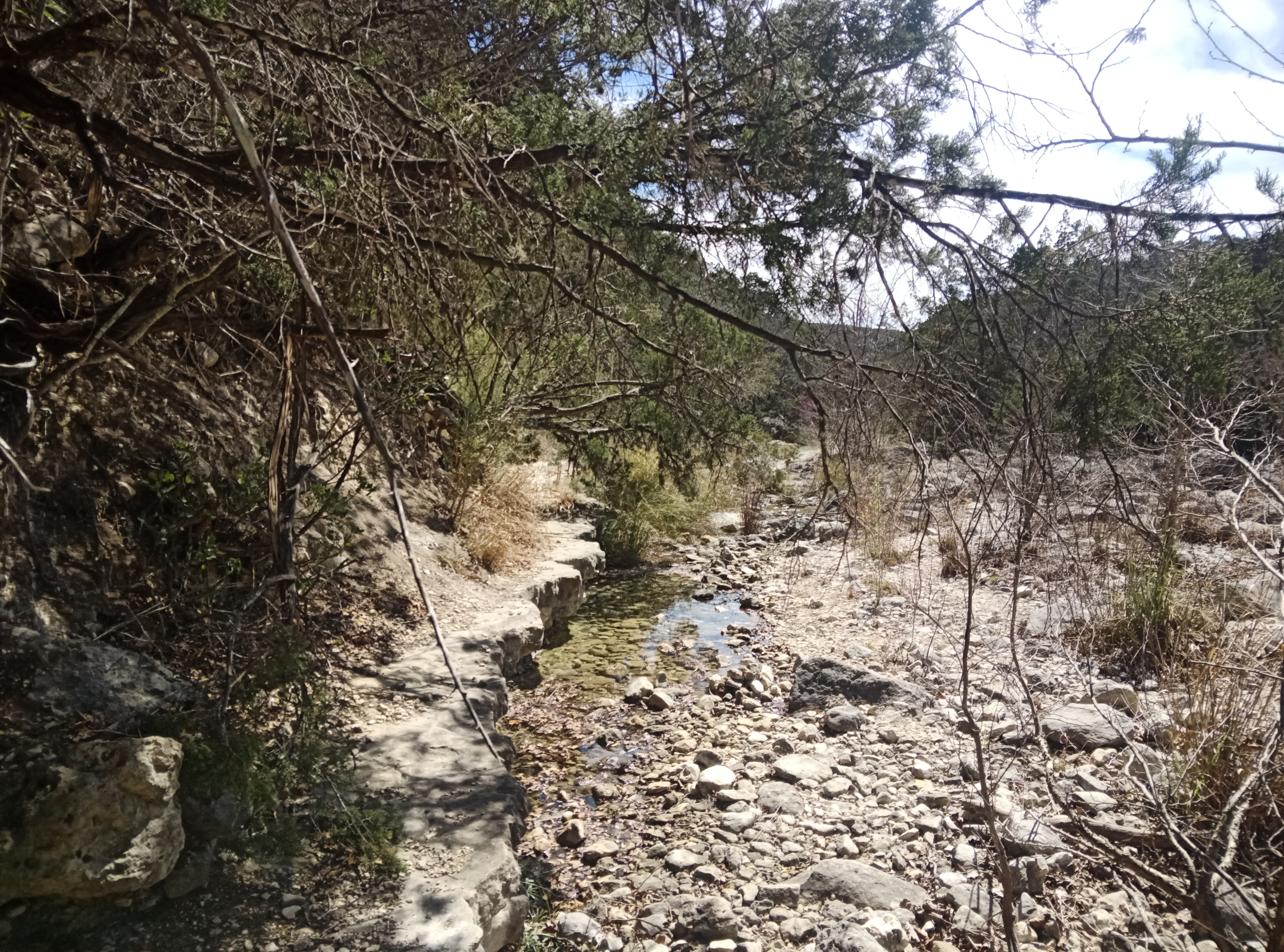
I'm now in the desert. There's not much vegetation. Instead, I see lots of dry river and creek beds, my towel dries quickly when I leave it out at night, and I see many signs of "road may flood," but the big problem is really lack of rain of any sort. There are other signs of "Please pray for rain." When the rain does come, there may be floods as the ground is hard, as we learn when putting up our tents. One defense against flooding is huge drainage systems in areas that are dry most of time. The road contains huge culverts so that big floods will go under them. At first, this does seem strange in an area where there is no surface water most of the time. But when is the big one coming? Are we ready?
The crappy road cover of the chip seal continues. At times, there is relief. One place was on the last 13 miles after descending a large hill to the flats before Marfa, Texas - the home of El Cosmico. Most of the road surface is still crappy, but there is a lovely, flat area on about 1 foot of the outside edge in the paved (?) road shoulder. I lead a group on this smoother surface into the wind at my usual pace. I feel a long-distance rhythm as I'm doing this part: look a few meters ahead and feel a rhythmic rock from side to side; glance occasionally at the landscape; focus on the task at hand like in meditation, eh?
All the travel before Marfa is not all this good. Before the last 13 miles, there were two huge hills. These were on an interstate highway that had nice, flat pavement on very wide shoulders. These took a while to climb, but that's not the problem. A big problem occurred when I was descending. I let the bike go as fast as it wanted. This sounds thrilling, eh. Well, it was at first. Then, the bicycle started to shake violently. Something had triggered it to shake at its frequency. Such shaking is referred to on the internet as shimmy, speed wobbles, tank-slapper, or death wobble. Well, I didn't crash this time. I'd experienced this before, way back. It took lots of strength to keep the wobble under control. It looks like I was going at the bicycle's resonance speed - a few internet notes on bicycle wobbles indicate these only occur when bikes are going more than 51 km/h (31.8 mph), and some other factors are present, including lack of bike stiffness. Bike stiffness is higher today, so newer bikes hardly ever get the wobbles. I'm riding an older frame so ... I can!
Another problem that I have is that my clear reading glasses fall apart. I usually wear these in the evening and early morning when we're in camp, eating and tenting. I do need these to see, but they become somewhat useless when one of the lenses falls out. I try fixing them with super glue, but the lense still falls out. A store in Marfa has a solution that does work. This is super glue gell that is for keeping items together that have a gap between them. So, Marfa has more charm than just El Cosmico. It's the place where I magically fixed my glasses.
My new power meter and sensor lasted through Texas but not much more. It looks like the battery has worn out already. It has a CR-1/3N battery. Much searching on the internet indicates that there is an outlet of BatteriesPlus.com in El Paso, and they do have the right battery in stock. They also agreed to get my order sent to Motel-6 West in El Paso at no extra cost! That's where we are staying in El Paso TX. It's one of the few metropolitan areas that our route goes through. And this all happens as planned! I now have my power sensor working again after 5 days without it. Drats! I actually buy a pack of 6 batteries as it's almost the same price as buying 2 batteries. In the end, I make it to the end of trip on one new battery. When will the battery fail again? Packaging indicates that these batteries last for 10 years when not used.
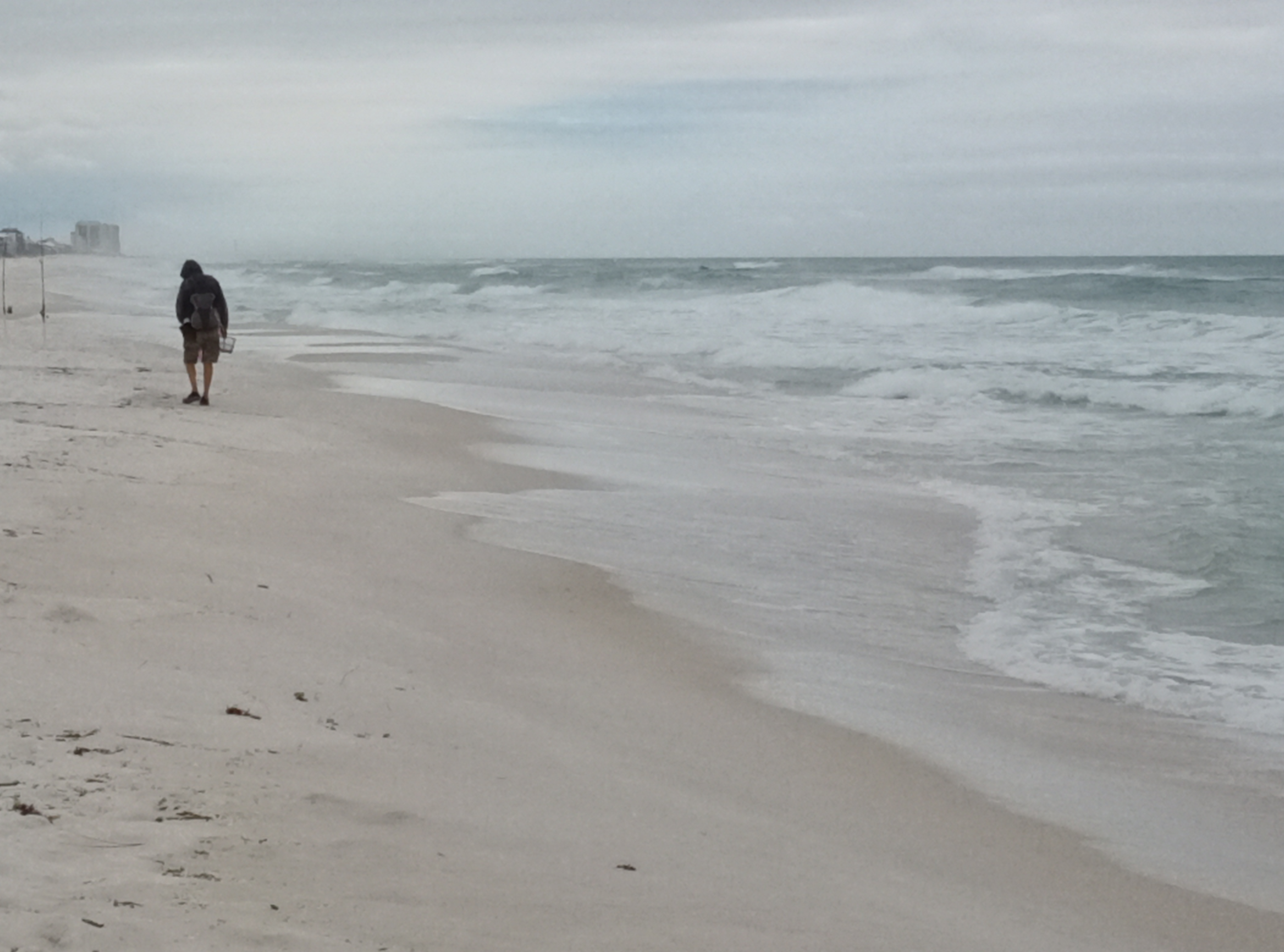
The roads get a bit smoother when the tour is near El Paso TX and we're riding along the Rio Grande River. One other difference from before is that near the Rio Grande, there is lots of farming with irrigation. The irrigation ditches are a very obvious feature of the landscape. There are many irrigated fields and orchards. There's one picture of this irrigation near Las Cruces.
In the middle of the desert, the tour gets to its highest point in Emory Pass. There was a heavy headwind that day and gusts of 35 mph predicted for the summit. These may have happened, but the route to the peak is a winding road amongst trees. So, somehow, there was not a constant wind when going up to this highest point. I passed the peak without realizing I was at the top as there's a viewing area that's further up than the road over to the right at this point and I thought I had to go there. Another peak distance done, then, is this Emory Pass. The traffic was rather light on this part of the trip.
|
|
|
|
|
|
The route goes by Roosevelt Lake in Gila County in central Arizona. There are more tourists in this part of the desert. There are several RV campgrounds along Roosevelt Lake. This Lake exists since the Roosevelt Dam backs up water. The Lake is used for recreational fishing and boating.
There's a rest day in Phoenix/Mesa. Greater Phoenix looks like great place to live. Visitors encounter nice landscaping in paved median at beginning of town, there are bike paths beside a water canal and an LRT on Main Street. The night when we arrived, I ate at Boulders On Southern Bar and Grill in Mesa with all our riders.
On the first day in Phoenix, I talk to an one older female tourist at breakfast in the La Quinta Inn where we're staying. She tells me that the real people are what I see in the country with many abandoned and dilapidated houses and buildings. In her opinion the super clean and beautified look of Phoenix/Mesa is somewhat fictitious.
La Quinta Inn is our most luxurious accommodation on this trip I have a room with JC who snores to wake me up a few times both nights, but Garmin watch says I'm sleeping a lot.
I use the outdoor hot tub and small pool in evening about 7:30 pm for almost an hour. I do kick offs and glides across the pool though only get part way, and alternate hot tub and pool a few times to get the full impact.
It's a great rides for the first 30 miles leaving Phoenix as we're mostly on bicycle trails that are beside canals and floodways. After this, we're first on some roads with lots of fast drivers and then on main highway 60 with 2+ lanes each way and grass median, like an expressway, but it's almost OK as there are paved shoulders of 1 car width all the way that we travel on this. The quality of pavement of shoulders varies. The big drawback is that this is a big route for transports so we listen to them all the way along this part of today's route.
When we get to the town with the next campsite, the RideWithGPS map takes us to the incorrect RV Park. Luckily, the one that we're staying at is just down the street a mile or 2 and we have the address. It's across street from Denny's restaurant ... tempting to go there for breakfast? Whoops further inspection indicates this restaurant is permanently closed.
At the border of California, the Colorado River has lots of water in it, unlike the last BIG river that we saw, The Rio Grande.
One church that we stay at in California is quite modern. It has a huge air conditioned hall and a short pool in which we can swim and dive, which I do. It feels wonderful to swim a few strokes again.
|
|
|
|
|
|
On second to last day there was a Long, tough climb to begin the day. Garmin gave me an award for longest total climb today. A total climb of 1,817 metres = 5961 feet that includes first big climb of 2760 feet and first 3 climbs at 4100 feet.. The total climb of 20 miles took over 3 hours! The first climb was on interstate road I-8 that has lots of truck traffic. The wind was mostly in my face and strong at times. I had to walk at least 3 times because the wind was so strong. The second and third climb were easier as grade was mostly easier, and there were no winds or canyons to focus the wind. Instead we were in much more open country.
At the end of this climb I leave behind the desert on the east side of the mountains and experience the green land on the west side of the mountains . Everything is greener! It's no longer super dry! The sweat accumulates on my skin again, like at home in the summer!
At the end of the second last day, we had a final dinner of all our group at Alpine Tavern & Grill at 2502 Alpine Blvd, Alpine, CA 91901. Bill W. gave out funny awards.
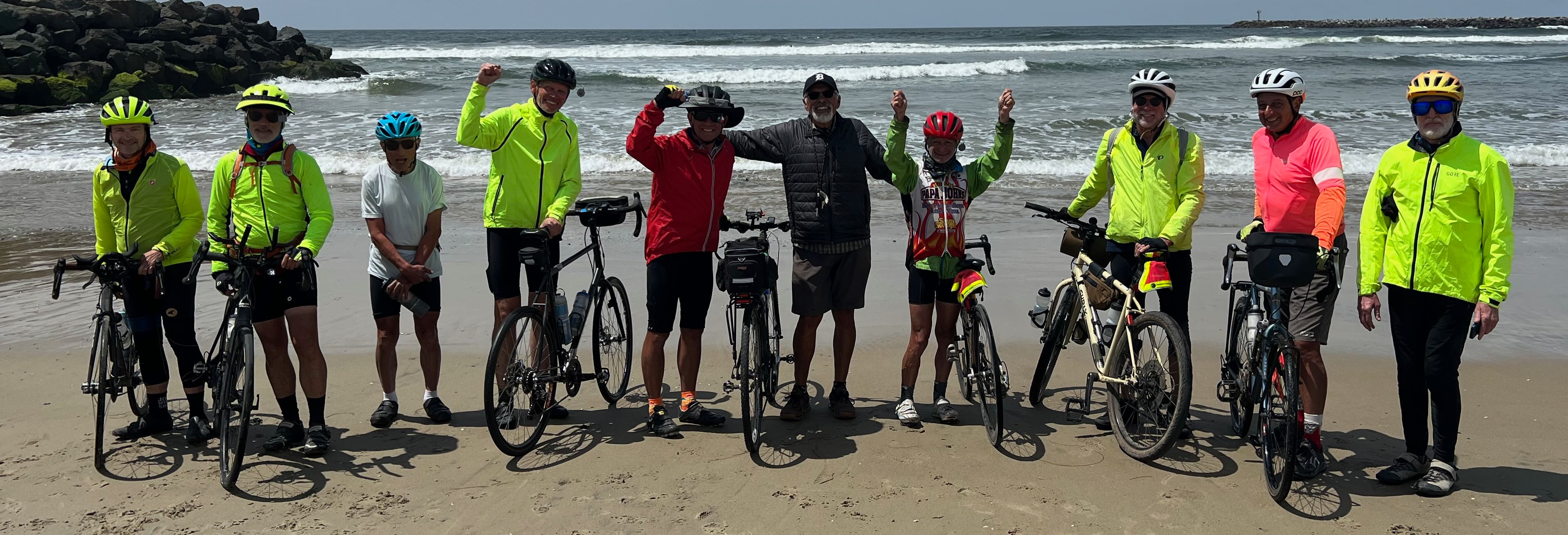
The ride on the last day to San Diego was mostly downhill and soon became a long ride on bicycle paths, ending with paths along the San Diego River.
Many of the group stay at the Samesun hostel in Ocean Beach area of San Diego as I do. I share a room with 2 bunk beds with 2 other riders who are staying 2 days. Samesun Hostel is very well kept and clean. There is a large common area and lounge that is outdoors, after all we are in the south in San Diego, eh? That's where I'm sitting as I write my notes, in a large comfortable chesterfield.
Ocean Beach has a long "strip" of stores on Newport Ave that Samesun hostel is part of. There is access to Pacific Oocean and it's beach access at end of Newport Avenue. Many people are on the beach during the day and in the evening. The sand goes on and on forever, eh?
All goes well for me at Samesun hostel in the afternoon. I do get my bike put in the box that the truck brought all the way from Florida. I lay the box out in a common area of Hostel and fill it there. All is quite safe. I sometimes need to leave bike and go get something or some water or ... and noone touches my bike and other stuff when I leave it in the common area. After filling the bike box, I have a shower and do get all my trip junk in the 2 large duffle bags that I brought on this trip. Eric weighs these all with his new weigh scale and all are less than 50 pounds each so are OK weight The bags are just over-sized. Yuk, paying more and more to get these shipped home!
I eat supper almost on the beach at Mike's Tacos with those trip participants who are staying in San Diego for a few days - Mike's Taco Club, 5060 Newport Ave . I have a steak and shrimp burrito and Mexican beer. After eating I have some magical new flavors of ice cream at Scoops across the street from Samesun Hostel. It over priced.
I close my first and only evening in San Diego by going for a short walk around a few blocks in Ocean Beach. It feels and looks like a continuous beach party. Many stores close at 8 pm.
So goes the fairy tale from coast to coast, from the Atlantic to the Pacific. Quite the ride, eh? Is it all true?
There were a few interesting spots along the way. Here, the tale continues with talk about them.
|
|
|
|
|
|
|
|
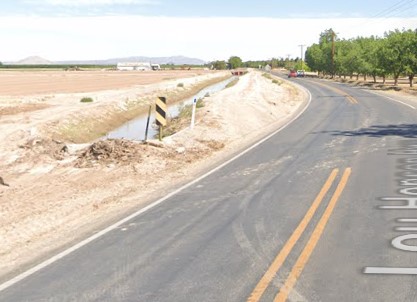
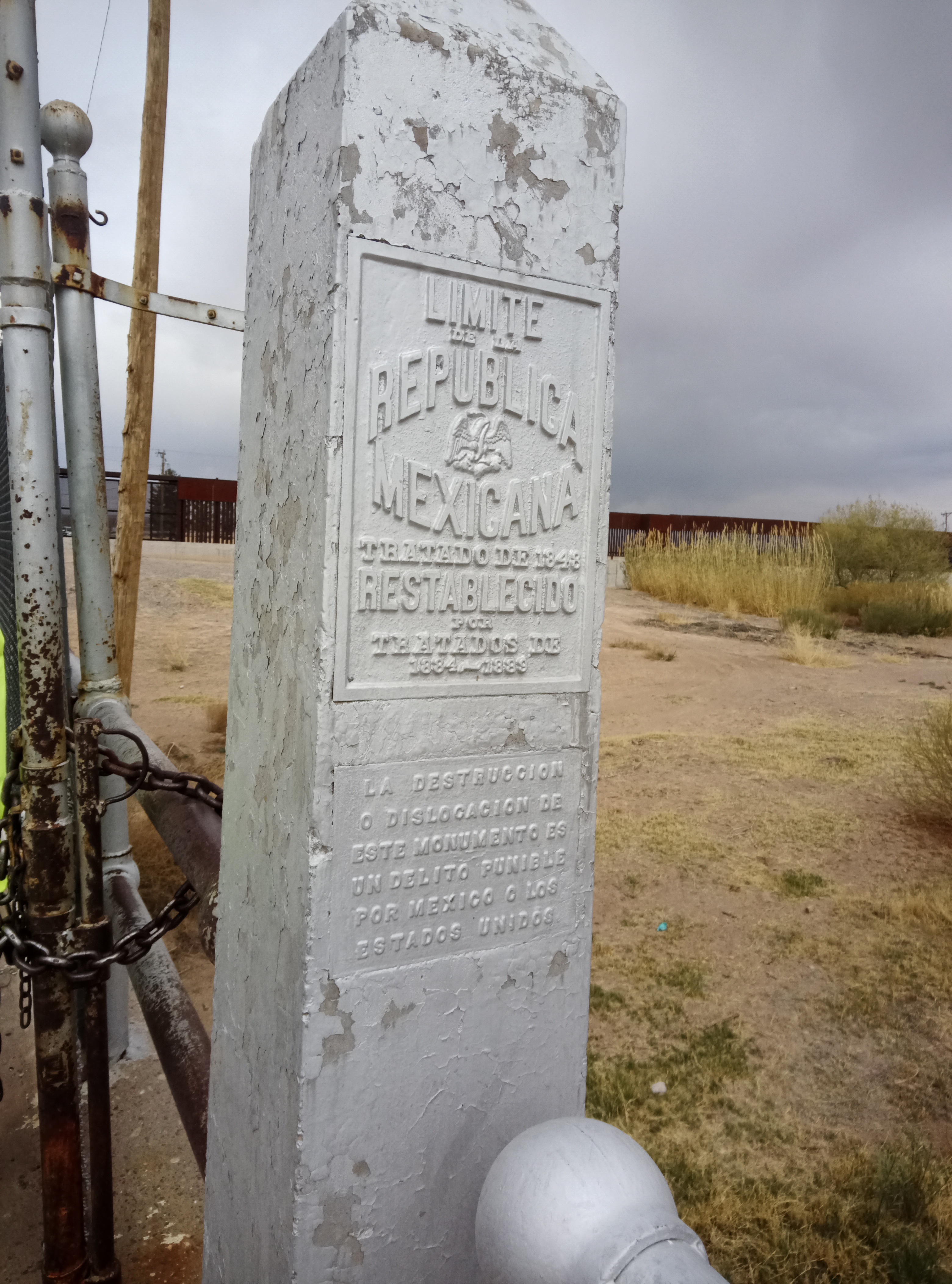
THE WALL runs along the border between Mexico and USA. We visited the wall in Fort Hancock, Texas. The Border Patrol allowed us to inspect the wall, walk through it, see the lack of water in the Rio Grande River, and gaze over at Mexico. This was very interesting given the increasing political importance of this structure. As one younger woman said in the Dollar Store parking lot in Fort Hancock: "You're going to see the wall? We live with it ... It was nicer before."
We saw THE WALL at other times, too - any time we road our bicycles close to the Mexican border. One time was near Canyon City, California.
|
|
|
Ichetucknee Springs near Gainesville, Florida is a "Registered Natural Landmark: Under the provisions of the historic sites act of August 21, 1933 in illustrating the natural history of the United States ... 1972 [plaque]." The natural springs that boil up from the aquifer, feed into the Ichetucknee River that, in turn, flows through shaded hammocks and wetlands into the Santa Fe River. The area was mined for phospate. The State Park was set up for protection of the spring-run ecosystem. Many visitors like tubing down the Ichetucknee River.
|
|
|
Shepherd's Sanctuary is a place to retreat to be peaceful. It promotes meditation, yoga, and alternative lifestyles and ways of looking at the world. It's a good thing we stayed in their cabins as the night was very cold. It was great to have dinner and breakfast inside as it was very cold and there was some rain in the evening.
The road to Shepherd's Sanctuary was a ways off our route down a few lanes, but worth it as this place promoted peace and relaxation and was very quiet, divorced of all sounds of transports on the roads.
|
|
|
I highlight Cagle Recreation Area since it's a pleasant, well-kept campground in a forest of trees. This is much better than many places we stayed at on this trip. I walked around a bit and took a trail that led me a bit deeper into the bush. As you can see in the picture, the vegetation on the trail is abundant.
Cagle Recreation Area is near the north end of Lake Conroe that adds to its beauty. People enjoy the fishing in Lake Conroe. Many repeat users are from Houston, TX that is an hour's drive south. It's a contrast to the busy, quick city life, eh? A way to calm the soul.
|
|
|
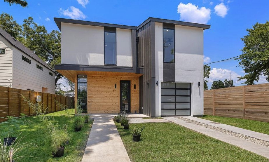
These are pictures of the Air B&B that we stayed in for our break day in Austin TX. This building is very new. The picture on Google maps just shows it under construction. Here's a picture of the finished home from a realtor's web page. It looked like this when we arrived.
|
|
|
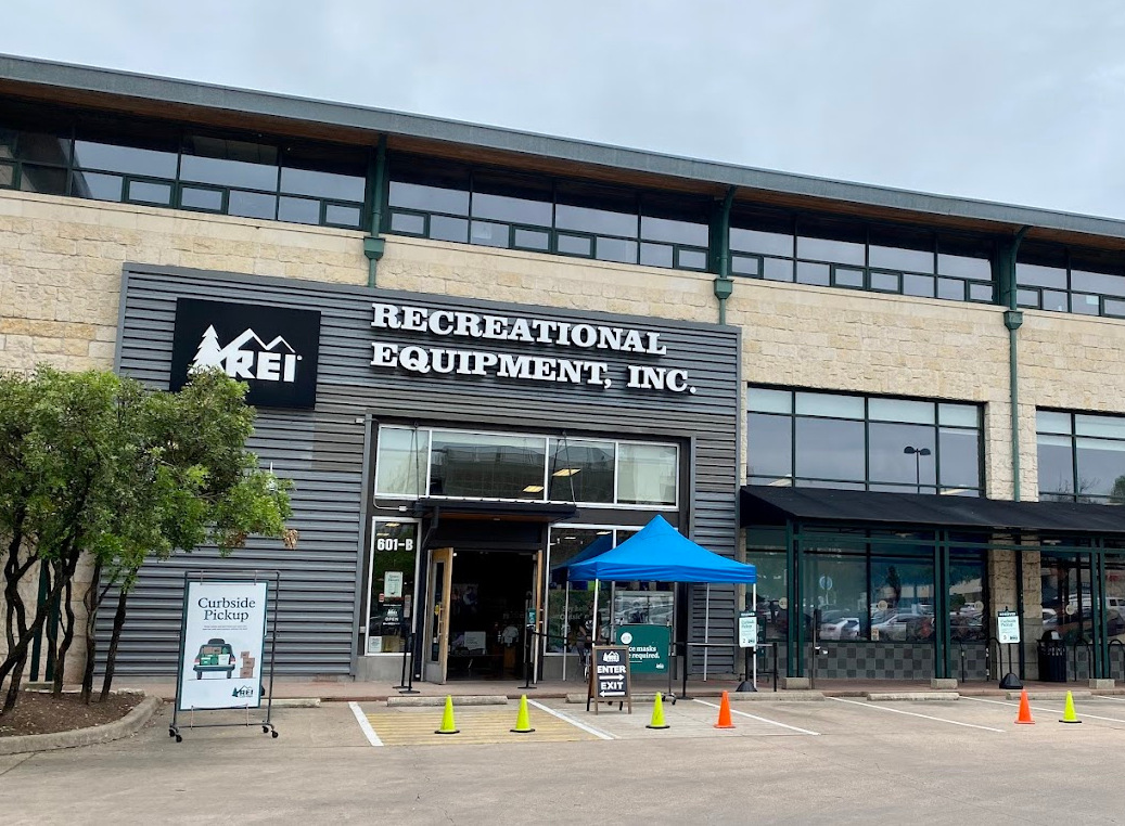
Most of the day in Austin was spent resting and cleaning gear, like bicycles. Some riders ate at a food truck lot that was just a block away from the Air B&B. Our van drove most of the bikers to downtown Austin in the early evening where it parked in the REI parking lot.
There are bicycle stores around Austin that have real mechanics in them. I go to Dogspeed Cycles that's part of a coffee shop like many other bicycle stores in Austin. Most bicycle stores here are very small, consisting of one mechanic and a few helpers. Often the mechanic is a real star. Luckily, the mechanic at Dogspeed Cycles is such a star. He is wonderful.
A few days ago, I noticed that my bottom bracket needs adjustment. The problem: sometimes, under stress, gears shifted incorrectly. Further examination at Dogspeed Cycles indicates that a new spacer is needed in the bottom bracket. One is inserted and the mechanic adjusts my front derailleur and checks my rear derailleur. He does a great job. The front derailleur still comes off at top adjustment. I adjusted this in a day or 2. I have yet to adjust any more any of the details of the adjustments of the 2 derailleurs on this bicycle. That mechanic at Dogspeed Cycles did a better job than I can to. Thanks!
|
|
|
|
Lost Maples State Park is a patch of green on the trip amidst a semi-arid landscape. There is a canyon that is cooler than the surrounding area so maple trees survive here much longer than in the surrounding area. There are still a few maple trees but gradually many less as Global Warming descends on us. There is one part that contains Uvalde bigtooth maples that are unique to the Sabinal canyon. Efforts are made by naturalists and park staff to keep them living.
The park has a number of hiking trails - over 10 miles of hiking trails in total! I take one along the Sabinal River canyon that has contained a native encampment for 10,000 years. Archaelogical evidence indicates that this was more a place natives stopped for a bit rather than continuous year round home.
|
|
|
|
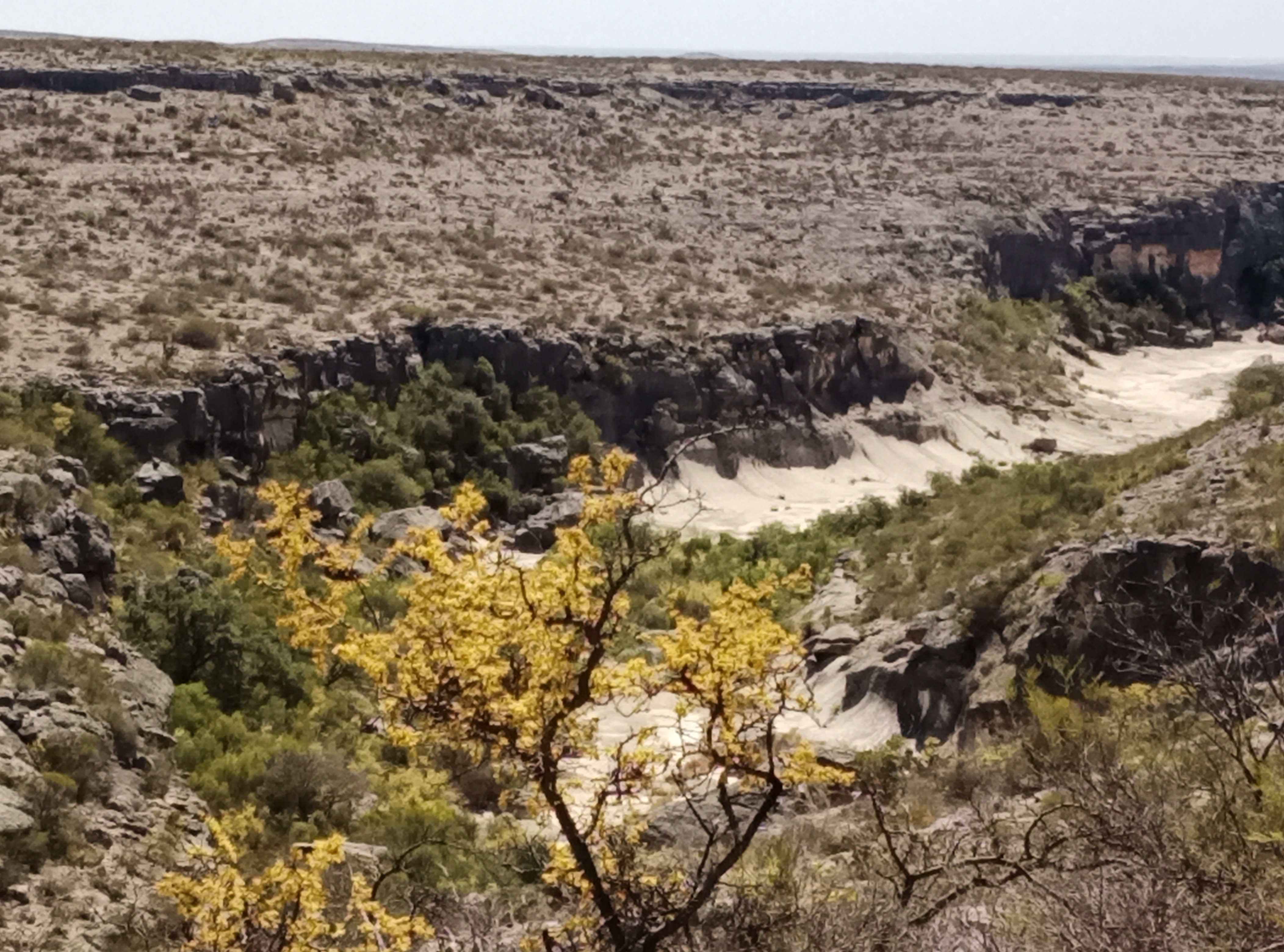
We camped at Seminole Canyon State Park. It is arid and has desert like vegetation and much bare desert sand and rocks. The day we were there it was very windy and hot. The campground is an open area on the top of a hill so is as windy as it gets.
One feature of the park are the Petroglyphs that were painted on cave walls by residents of ancient times to tell their stories and record their histories. Such natives have camped regularly in the Seminole Canyon for at least 10,000 years. The Petroglyphs are being preserved. To prevent any damage to them, tourists are only permitted to see them on guided tours. I went on such a guided tour of Seminole Canyon to see the Petroglyphs after examining pictures in the Visitor Center and wanting to see the real thing. I wanted to see the Petroglyphs to compare them to others that I have seen in other places. Many of the Petroglyphs in Seminole have very weak, faint paint, compared to others I have seen. The ones shown here are the boldest.
Non-natives are relatively recent settlers of Seminole. The USA government settled this area in the 1880s when military and civilian forces were set up to counter the natives, after the Mexican wars. There was ranching on Park land from shortly after this time until 1973 when Seminole State Park became official. There is still much livestock ranching close by.
|
|
|
|
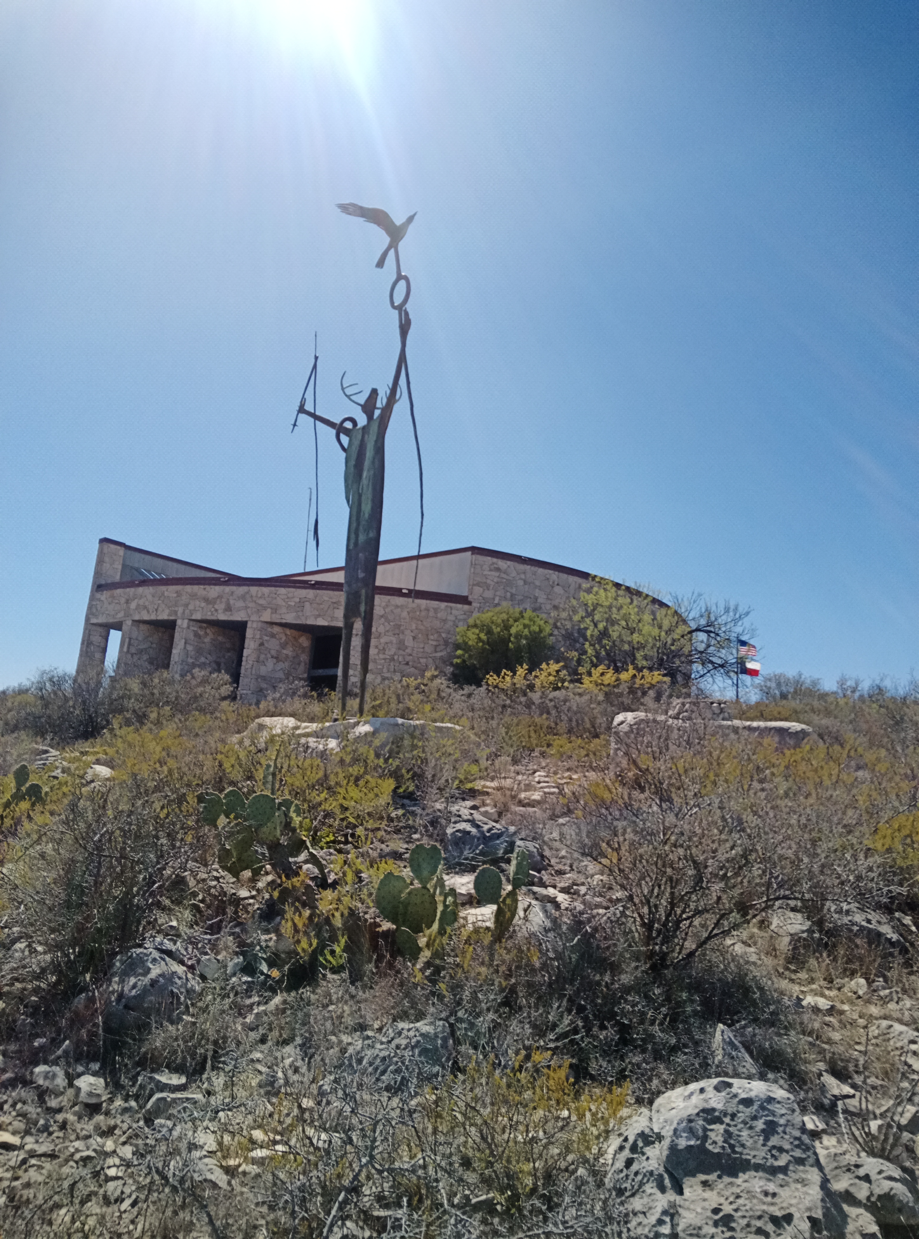
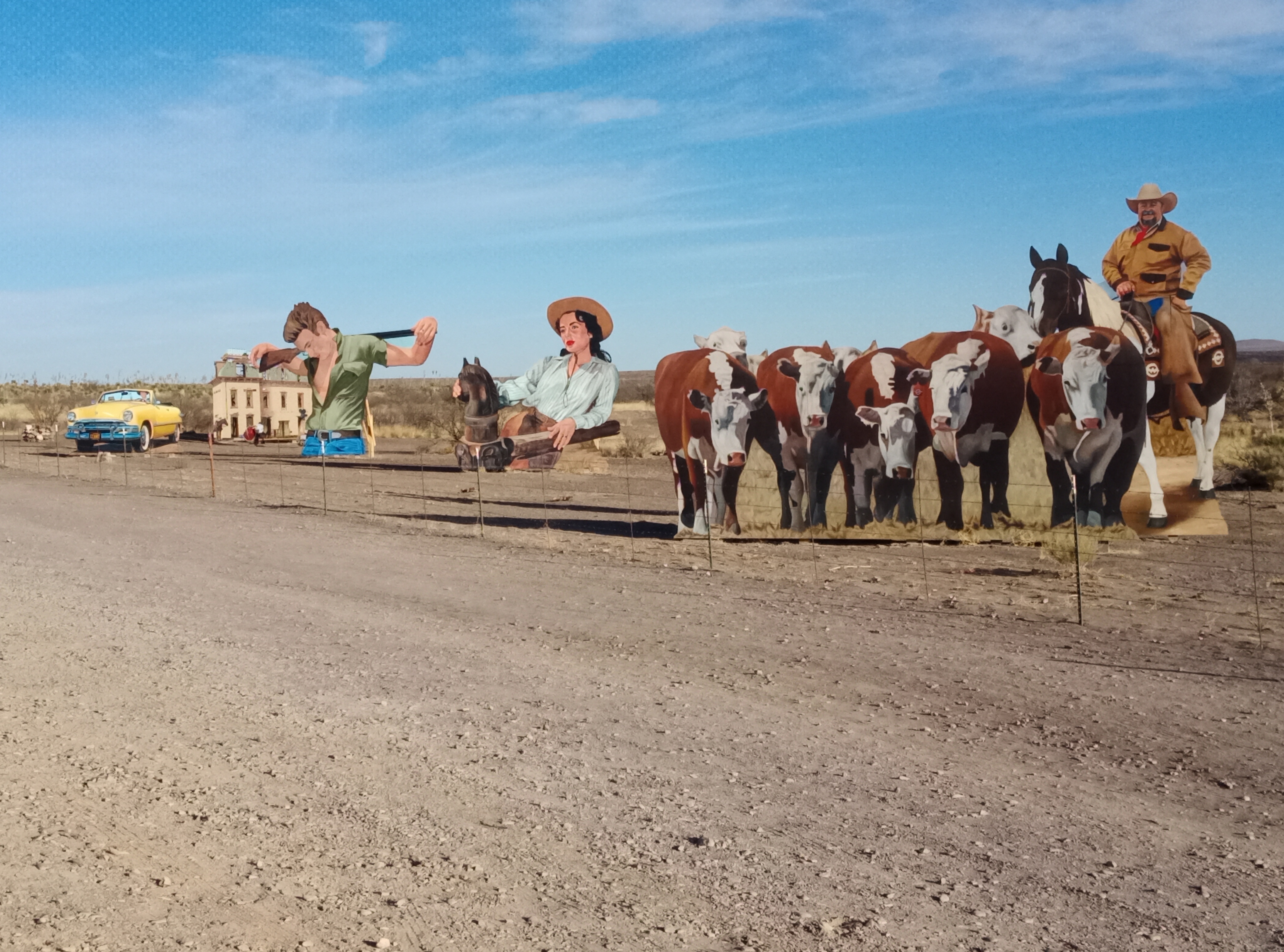
El Cosmico is a traditional location of camping and regional celebrations in Marfa, Texas in Chihuahuan desert in far West Texas. As I read I see more and more that Marfa is the site of the arts scene in west Texas. It has these music festivals that host important musicians, and a large gallery of large objects of art and undoubtedly other happenings. And, though maybe unrelated, the movie set from "Giant" is just down the road 10 miles west.
The music festivals: In the fall season, El Cosmico and town of Marfa host the Trans-Pecos Festival of Music + Love. https://www.facebook.com/TransPecosFestival and Flying Island Music Festival - "Flying island is a weekend of music, food, and art, set against the other-worldly backdrop of the Chihuahuan desert in far West Texas."
Our tour stopped at El Cosmico for a rest day. I went for a walk after dark and noted all the lit paths and facilities to accommodate large events. Unfortunately, the hot tubs were shut down as was much else except for the very comfortable chairs in the lounge. We had almost exclusive use of the lounge as we were there in the slow season and there were very few other guests. One unique feature are these large carts for transporting stuff from the parking lot to the campgrounds. All vehicles stay in the parking lot that is at least 100 years from one's camping spot. This leads to better safety and quiet times when camping.
Many of our group tested out eating at one of the start up companies in Marfa that's a mile or 2 north of El Cosmico. It had a unique style of hamburgers that were tasty.
Though our group camped, El Cosmico has a variety of other ways to spend one's time there, including teepees, trailers, and yurts. It's great for glamping. More pictures at this link, courtesy of Daphne .
The art gallery:: I'm reading now that there are large works of art close by at The Chinati Foundation that's also in the south end of Marfa at the site of the historic military fort Fort D. A. Russell. This is a must see next time one is in Marfa. I bet many people that visit and attend events also stay in El Cosmico. There's much more about The Chinati Foundation in Wikipedia. It contains the works of 12 artists and hosts travelling exhibits and celebrations.
|
|
|
In the desert, many lakes are man-made. Such is the case with Roper Lake in Roper Lake State Park, where we stayed one night. The lake was one man's dream. Mr Roper had dreamed since childhood of having his own lake. He sold some mining claims and decided that the time had come. He bought this property and built his lake. Later, when he moved to California to stake some more claims, he gave the lake and property to the State of Colorado. The county built a fishing hole near the Park, too, The Graham County Fairground Pond. There were people trying their luck when I rode past the Pond.
Roper Lake State Park also has several small trails. One goes up Maria Mesa. At the top, hikers get a good view of the surrounding area, which is relatively flat. The Mesa is taller, so the view is good.
|
|
|
Tonto National Monument is near Roosevelt Lake in Gila County in central Arizona. It is named in honour of some ancient cliff dwellings of the Salado people, which are much higher than the road. Efforts are being made to preserve these by requiring all visitors to visit them only with a guide.
TBD
When I set out on this trip, the rule was that Canadians could stay in USA for a year with no restrictions. This made my trip of 2 months be OK, with no problems with US border security. This situation all changed during this trip. On March 11, almost a month into the trip, I read an article in CBC News titled: Canadians Exempted from Fingerprinting for U.S. Travel under New Homeland Security Rules. My reaction: this is a strange title for an article. What are Canadians exempted from?
I read the article and noted a new 30-day rule for traveling in USA. Canadians now need to be registered for trips longer than 30 days. The article is somewhat vague as to exactly what Canadians need to do. The article indicates that the new rule will be implemented on April 11, 2025. That's before the end of my trip since it is longer than 30 days. Yuk! I need to take action or leave USA before April 11. One solution is to fly home from Phoenix and abandon my ordeal of bicycling from the Atlantic Ocean to the Pacific Ocean. Considerable searching of the internet and reading indicates that each Canadian in the USA needs to do the following:
Considerable reading leads to this paragraph:
Alien Registration Form & Evidence Of Registration
"Consistent with the Executive Order and the alien registration requirements of the INA [Immigration and Nationality Act], this rule designates a general registration option available to all unregistered aliens regardless of their status. To use this option, aliens must create their own unique account, or an account for their child, in myUSCIS [U.S. Citizenship and Immigration Services] at https://my.uscis.gov/?? and then complete G-325R Biographic Information (Registration), which is currently free of charge.
The actions required are more complicated than just completing Form G-325R, which has no charges attached for Canadian citizens like myself. It is supposed to be free. I find there are hidden complications and charges:
|
|