Moosilauke
[Home]
[Main]
May 4, 2019
Deb and I drove down to Lincoln, NH after a night dans la "Cheap and Cheery" in Orford, QC. We arrived at the River
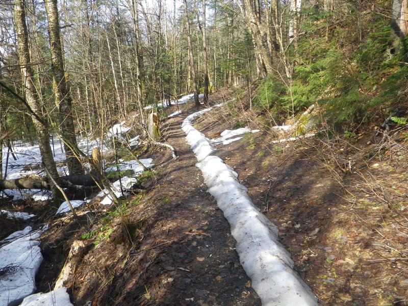
Lodge trailhead and started hiking at a fairly respectable hour of 08:30. The snowspine started almost immediately and
within the first kilometer we had spiked up. As we walked along we encountered copious amounts of steaming Moose dung,
and shortly thereafter we heard a very large crash in the woods. Though we did not see it we assume that it was the
moose of Moosilauke which must have given this mountain its name. Despite the somewhat surprising amount of
snow at low elevation, we had a beautiful blue sky with warm temperatures and by the time we reached the Carriage
trail, I was stripped down to a t-shirt.
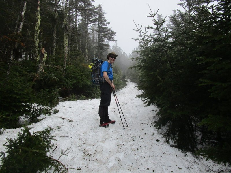
Monorail.
We started hiking up this gentle trail, and within a hundred meters, Deb noticed that she was missing her
gloves. She scampered back down to the Snapper trail junction, but unfortunately did not find them. Since they were
brand new gloves, she really wanted them back, and after a brief discussion it was decided that we would climb the
mountain and then come straight back down to look for them instead of hiking the complete loop as planned. We continued
on upwards and at about 3500 feet, I put on my snowshoes to make walking a little easier on the bizarre spined and snowy
trail. Even though there was up to two meters of snow depth, there was still occasional stretches of bare ground which
I scraped carefully across and back onto the snow to the delight of my shoes. We hit the ridge and did a quick scamper
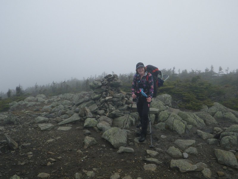
out to South Peak, which though an open summit, the weather had unfortunately fogged us in, so no views from here.
Full snow coverage up higher.
Summit of South Peak.
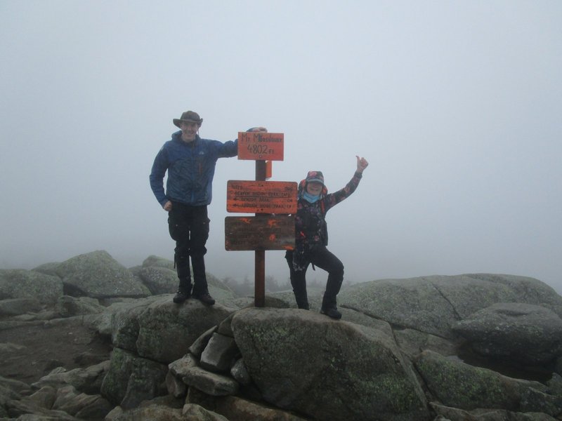
Back down, and then we were climbing Moosilauke. At tree line the snow disappeared so we switched back to boots, and
in a short little walk we arrived on top where we met three young women from Dartmouth College and exchanged photography
services and some friendly banter. It turned out that they were descending our up-track, so Deb put them on a mission
to find her gloves. That being taken care of, we were now free to complete our original mission after taking a short
lunch while gazing out into the fog.
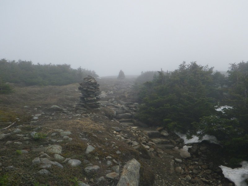
Entering the alpine fog.
Summit of Moosey.
Our bellies satiated, we set out down the Beaver Brook trail, where we found
somewhat awful conditions of a tall snowspine and lots of postholes. Even Debbie switched to her snowshoes to try to
stay on top of this mess. Several stretches of bare rock had us either changing footwear or scraping across gingerly,
but for the most part we were in the snow.
Rock walking in snow shoes.
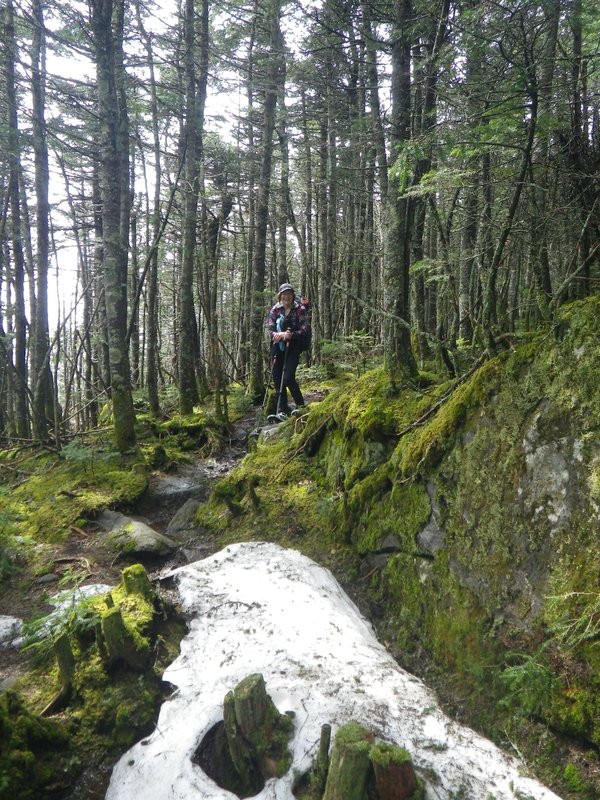
At the Asquam Ridge trail conditions improved considerably, since this path
appears not to be taken very often. Mt. Jim was not very impressive with its head in the woods, and shortly after
descending from the summit, we lost the trail. The woods were open and we decided to simply whack on downwards,
finally picking up the trail at about 3200 feet. We had a quick break at the junction with the Al Merril Loop after
which I did something stupid. I suggested we take a shortcut straight down instead of following the long switchback of
the ski trail. Debbie looked at me like I was on crack, but agreed to go with this plan which started out ok, but as we
approached the river, we got entangled in some very thick brush which eliminated any time we expected to save by cutting
off the extra distance.
Finally arriving at the river, we expected to pick up the trail, but it was not here! What was
not shown on our map, was that the trail actually crosses the river at the apex of the switchback (which we had just
brilliantly cut) and travels along the opposite side. No worries though, we consulted Deb's GPS which had a more
detailed map and we saw that the trail crossed back to our side about a kilometer downstream, so we just kept on
whacking.
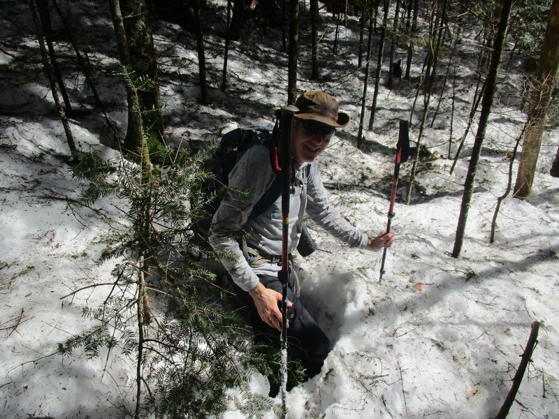
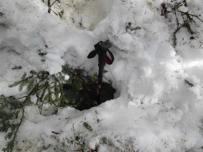
This took us nearly an hour as the rotting snow was very unsupportive and the terrain fairly rugged. We both fell into
numerous holes and spruce traps, and even contemplated fording the river at one point to get out of this mess and back
onto a cleared trail. The amount of water coming down the river made us choose the lesser of the two evils, continue
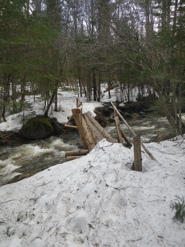
whacking downstream until mercifully I spied a bridge that brought us back onto the trail.
Stuck in one hole of many.
Another hole, deeper than my pole.
The bridge we should have used.
About another kilometer of
rotting snowspine brought us back to the parking area and we were happy to find Deb's gloves stuck in the door handle
of the car. Thanks you so much to our fellow hikers! Deb owes you three a round of beers. The seven hour hike was
concluded by a drive over to Conway where we relaxed with supper and brews in the White Mountain Hostel.
[Home]
[Main]