Hale and Zealand
[Home]
[Main]
May 21, 2023
There was a lot of rain last night, but we arrived at the Mount Hale trailhead for a relaxed 08:00 start on a warm
and sunny morning. Kat and Debbie were my hiking pals today as we climbed the moderately steep and steady incline
towards this healthy peak. As we climbed we kept leap frogging with a group of four women who we had met in the
parking lot. We finally reaching the top in just under two hours of hiking and our new aquaintences were only about
a minute behind. We found the footings of what looked to be a fire tower on top, along with a very large cairn, but
otherwise there were no views on this summit which was just as well, since we had climbed into a fog.
On top of the big, but healthy rockpile

Fealing healthy now but with nothing to see here,
we did not linger and headed directly down the "Lend a Hand" trail towards Zealand hut. At
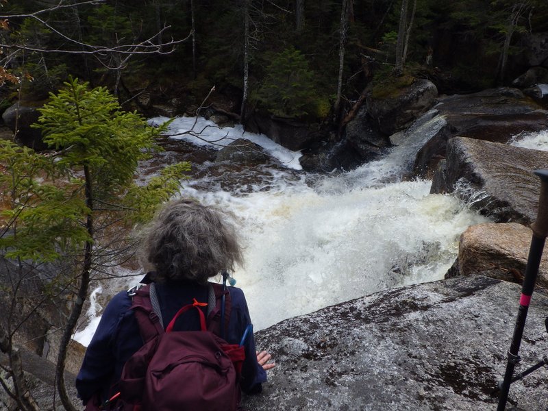
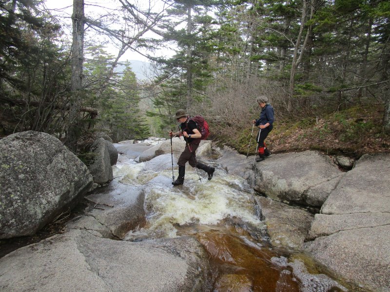
the trail junction we checked out a raging waterfall
and then ran into a couple folks coming against us. We asked them if
they had come from Zealand and they stated that they had aborted, and in about 30 seconds we would find out why. A
little more prodding had them admit that they had spent some time trying unsuccessfully to find a way across Whitewall
Brook, but with Debbie exuding confidence that we would find a way come hell or high water,
they decided to follow us and see what we thought of the situation.
Checking out the Waterfall of Whitewall Brook
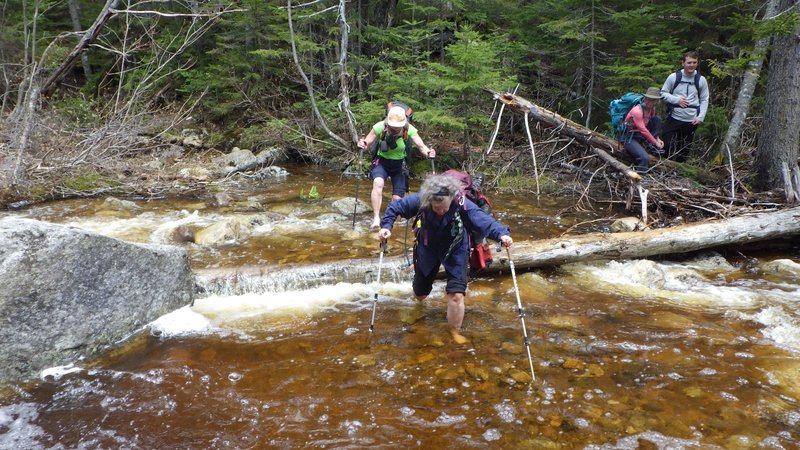
Crossing at via the trail was a no-go due to raging torents of water. We bushwhacked upstream, checking out
several other options with potential, but all looking rather dangerous if a mistep were to occur. Finally after
continuing about 200m off course we came to a wider section of the river, giving a knee deep ford with fairly
gentle current. We
decided to give it a go in bare feet. Actually while Deb and Kat removed their boots, I managed to find a rock hop
that worked for me, saving the effort of tying my shoes.
The other couple also made it across, but were a little dismayed when I
showed them on the map that we had almost 5 km to go to get to the summit of Zealand from here. After checking that
they were ok finding their way back to the trail, we set off on a compass bearing to pick up the trail a little higher
up. We did not see these two again.
Fording the river
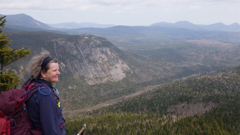
The trail ascended fairly steeply up to the top of Zealand cliff, where I checked out a side trail to a breathtaking
view point while waiting for Katharina to catch up. I made a mental note to ensure that everyone came out here on our
return journey. The last couple of kilometers along the mostly flat terrain towards Zealand summit was the most
difficult, as we encountered lots of rotting snow spine as the spirits were crushed by several
tiny false summits. Finally we reached the spur trail to Zealand where Kat
claimed that she was done. I convinced her to go the last 160 meters from here
to the top so we could have lunch.
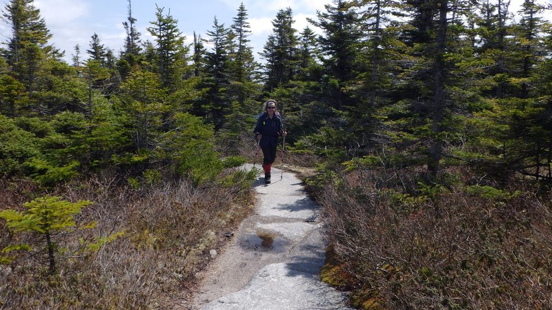
Sidewalk in the sky
Snowspine balancing

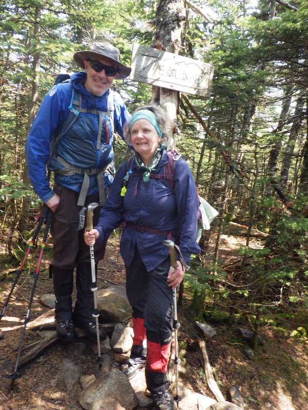
Zealand was another treed in summit, but at least it had a cool sign. We sat down in a patch of sunshine and took our
first real break of the day, about half way through being joined by another group of four young folks who had hiked up
after spending the night at Guyot campground.
Summit of Zealand... Katharina in awe of the view
The return along the snowspine seemed to go much more quickly, and in short order we were back at the lookout to spend
some time gawking at the sight. We met a young fellow here who had come up from Zealand hut and planned to descent back
via the Zeacliff trail. This was actually our planned route down,
but due to the high water situation, we did not want to
try a crossing of Whitewall brook at a lower point in the flow. When I voiced my concern to the young lad he looked at
me with confusion and a comment of "what river crossing?". After a brief discussion he vagually remembered
jumping across a brook near the hut, but stated that he had no trouble.
Us now confused about this, we wished him well and descended the way we came.
Arriving at the river, I walked easily across two slightly submerged rocks to get to the other side. Then back
again to show Katharina
the way to go. Quite amazing that the water had dropped so much in just a few hours. This explained the strange
conversation we had with the guy up on top of Zeacliff!
Enjoying the view from Zeacliff
Crossing Whitewall Brook was trivial at the end of the day
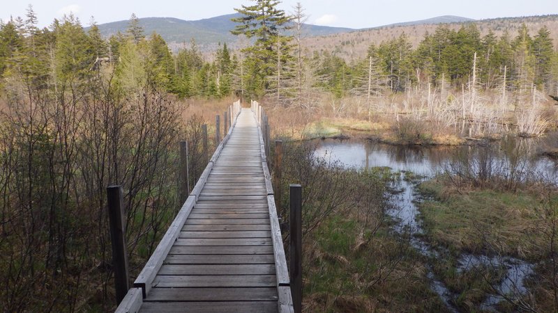
Swamp bridging on the way back to civilization
We stopped for a break at Zealand hut having a great chat with a gentleman on the porch who was out for a hike of Hale
but mostly there for bird watching. From
here we hiked the relatively flat trail out to the upper parking lot on Zealand road. I offered to scoot ahead to fetch
the car so walked the last couple of kilometers on my own, followed by a 15 minute road walk back to the Hale lot,
finishing the hike at just under 10 hours. I drove up to get the gals who were seated comfortably on a bench waiting
for me on arrival. We drove back to Conway to spend the night and then spent a half day climbing in Rumney before
making the long journey home.
[Home]
[Main]