Marshall
[Home]
[Main]
June 6, 2026
Not sure why every weekend I plan to hike a mountain starts off with a foreboding weather forecast. I almost cancelled,
but by Thursday evening the forecasted soggy misery was downgraded to less than 2.5mm of rain and chance of
thundershowers. Since staying home looked no better, I declared the trip a go.
After shooing away a curious bear from my camp spot, spent a rainy night in the tent at Keene Farm,
but awoke during a fortunate dry
spell. Ate a quick breakfast and drove over to
the Loj. New parking fees... twenty five US dollars! That is like a week's salary in worthless Canadian bills these
days. Did a u-turn and measured out the distance to South Meadows road where I could park for free. 1.4 km. Stopped
and contemplated my life and whether an added 2.8 km would kill me. Given my summer has been spent mostly focussed on
rock climbing and not walking, I figured the extra 30 minutes might very well do me in on top of a 26 km hike.
Drove back and reluctantly stuffed way too many green bills in the overflowing cash slot and parked beside the
trailhead register.
As I suited up I had a pleasant chat with the trailhead steward, who checked on my navigation tools, water capacity,
possesion of a headlamp, and willingness to turn around. Satisfied with my answers, she wished me a good hike.
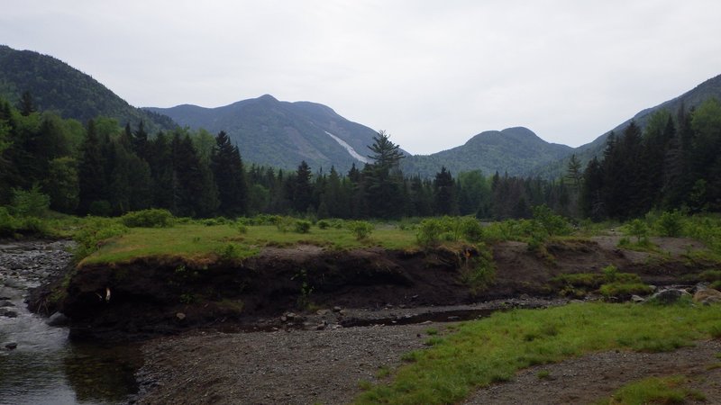
Made good time to Marcy Dam, and then turned upwards towards Avalanche Pass where I wanted to check out the new slide.
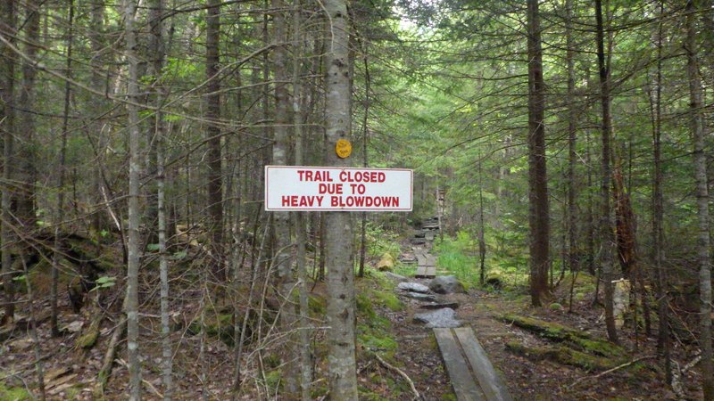
Passed a sign warning
me that the trail was closed due to "heavy blowdown". Continued anyway as I had it on good authority that the route was
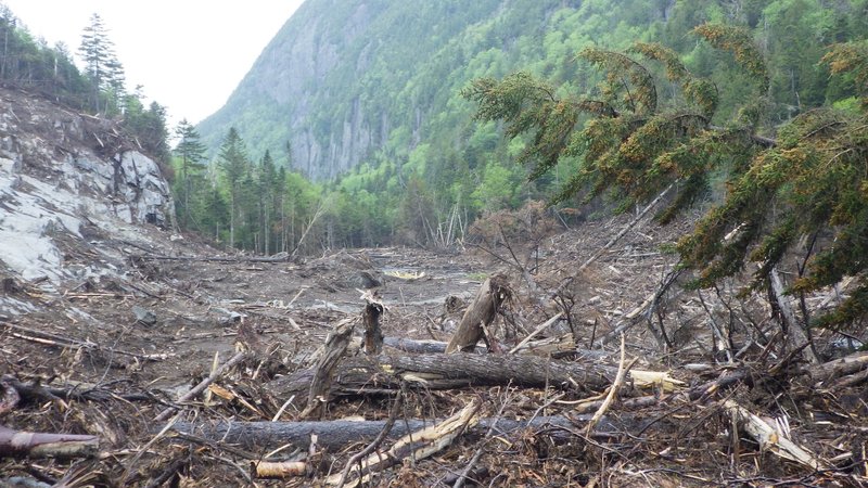
passable. Did not encounter any blowdown, but did encounter a big swath of landslide which was impressive.
Flagging and
a fairly well constructed trail made a route through the mess. A pile of lumber awaits further construction into a more
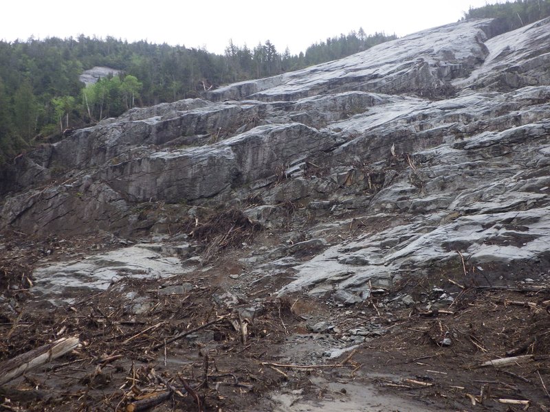
permanent solution. The new slide actually looks like it would be a very nice route to climb... a mission for another
day.
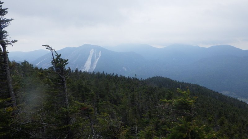
New Colden slide clearly visible from Marcy Dam
Discouraging sign
Must have been a big blow!
Looks like a fun new climb though
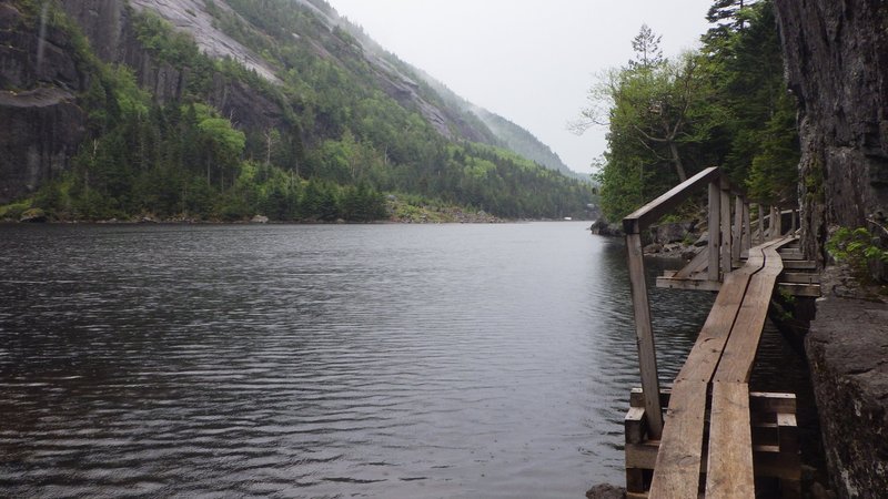
Just as I arrived at Avalanche Lake it started to rain. Since it was quite warm out, I did not bother with the jacket
figuring I was due for a good wash anyway. Picked my way around the lake and ran into quite a few backpackers coming
the other way. The rain politely stopped as I arrived at Lake Colden, and since I had never been up this section of the
of Cold Brook Pass trail from here, I decided to explore this long-time closed route. The
trail was easy to follow, but very
grown in. I was damp upon starting, but downright sopping wet after pushing through the bushes for about 3 km to the
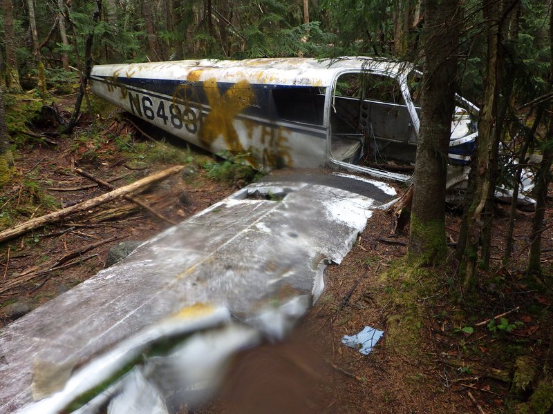
old airplane wreck. Took a quick snack here and then continued along through the pass until I reached the herd
path to Marshall.
Traversing Avalanche Lake in the rain
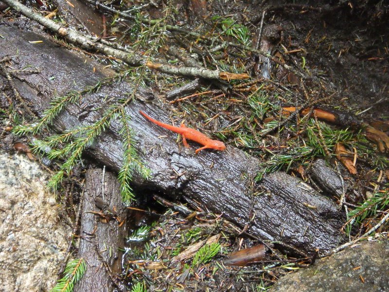
Met a few of these folk along the way
A visit to the old crash site
The herd path was much nicer than the overgrown former official trail. The wind picked up and I began to dry off. More
importantly the trees dried off too, which meant I might have a chance of staying dry during the on-trail
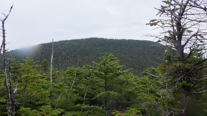
bushwack for my descent later. From the false summit Marshall looks a long way away, but I knew this was just
an illusion due to the minature tree size at this elevation. Sure enough, in about another fifteen minutes I was at the
summit sign. Explored a few spider trails to different lookouts, and settled on an east facing one with a lovely
view of Colden, where I sat down for lunch.
Marshall from sub-Marshall
View from my lunch spot
Passed one fellow on my way down towards Cold Brook Pass, and upon reaching the pass turned north-west towards Indian
Pass. The descent here seemed to go on forever, but fortunately the bushes were a little more tame on this side than
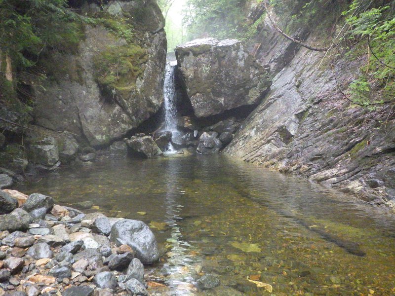
they were coming up. The fact that they were now dry also helped lift my spirits. Found a lovely deep pool with a
waterfall and I contemplated a swim, however on testing the water temperature, I found it to be quite close to that
of liquid nitrogen. Remembering from science class what happens to bananas and rubber balls submerged in
super-chilled liquids, I decided to play it safe and just took a photo and continued on my way.
Nice place for a swim on a warmer day
Reaching Indian Pass trail it started to drizzle a bit. I was hungry again, so decided that I would make for the leanto
a couple km to the north for my next break. About half way there, the drizzle turned into a deluge. Struggled into
my rain coat and then scampered the last bit and took shelter under the roof. Waited here for a good twenty minutes,
snacking and hoping the rain would let up. It did not. Finally decided that it was time to go, so struck out into the pour. The rain stopped about 3 km from the end of the hike. By the time I reached Heart Lake the sun was shining and
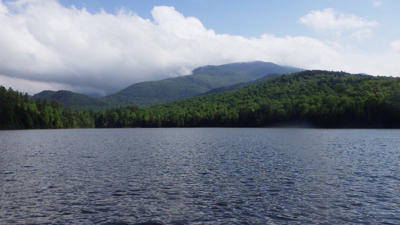
I was dry again. I was also foot sore and exhausted. Took a final rest on a sunny bench by the lake before crawling
the last few hundred meters back to the parking area. Thought about the 1.4 km road walk I could have had ahead of me.
Twenty five bucks be damned... money well spent!
Lovely place for a rest along the shore of Heart Lake
Hike time: 9.5 hours
[Home]
[Main]