Giant via Eagle Slide
[Home]
[Main]
May 5, 2012
Rob and I stayed at Lysek's Hostel in Lake Placid with about 10 other people from the ACC Ottawa crew. After a great
and hearty breakfast served by Mrs. Lysek herself, we drove out to the Roaring Brook trailhead and started hiking on a
foggy morning at about 08:00. We progressed quickly up the trail, even though our packs were heavy with a rope and a
small rack of rock gear.
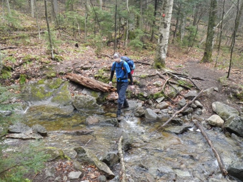
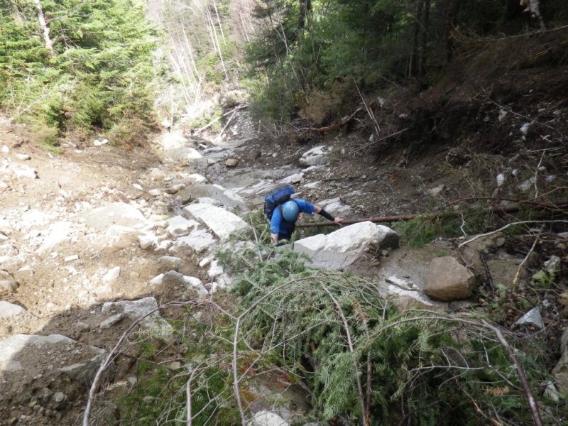
After crossing the brook, we travelled another kilometer and started looking for, according to the wisdom of the
internet, "an island in the trail with a cairn".
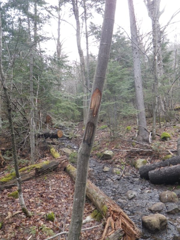
We found an island in the trail, with a couple blazes in a tree, and another faintly blazed tree about 10 meters into
the bush. We decided that this must be the place, and a faint, almost indistiguishable trail took us down to the
Roaring Brook bed and we started climbing up this as the sun started peaking out, burning the fog away. The day also
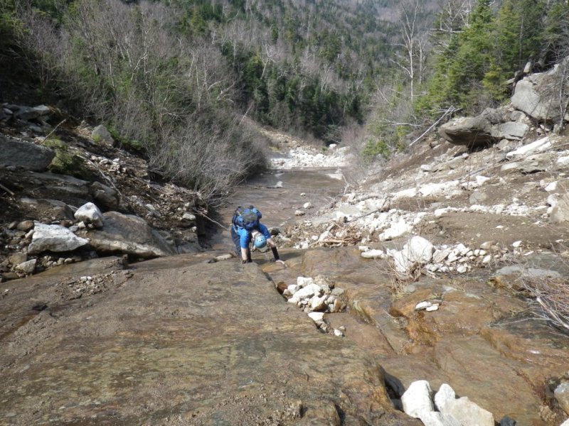
warmed up, allowing us to shed the layers and hike along in t-shirts. The creek bed was very hard going. Hurricane
Irene had played havoc here, as there were lots of land slides, creating huge walls of broken jumbled trees, which had
to be crawled through, under, and arround. Swaths of steep mud and sand felt like glacial morraine under the foot,
only even more unstable,
as mini landslides often formed under your feet as they were traversed. We joked that maybe we should have packed
avalanche beacons. Precarious looking rocks, (some of them not just looking), kept us travelling gently along here. At
one point the creek was jammed with trees, but a very precariously perched rock, the size of a mini van, created a sort
of cave that could be crawled through easily. Rob asked which of the pebbles underneath were the keystone. I did not
tempt fate and left them all alone, travelling as gingerly through here as if I was going through a narrow aisled china
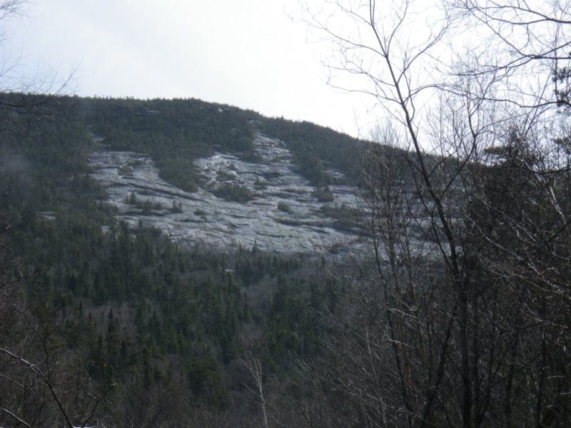
store while carrying a big backpack. We caught glimpses of the eagle. It looked steep and intimidating. We continued
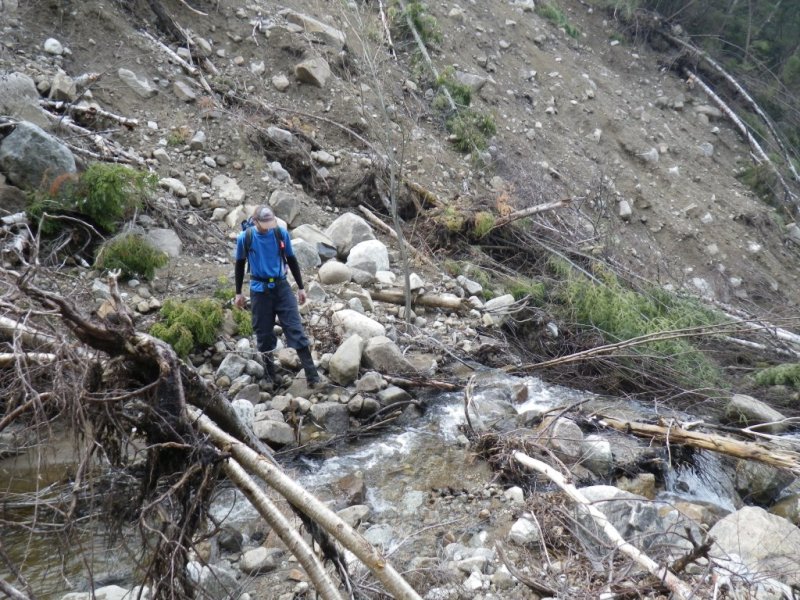
on anyway. Eventually we got to the elevation to leave the creek. A narrow slide apeared to our right. The direction
was right, our elevation was right, but the lay of the land looked wrong. It seemed to go up the ridge, rather than in
the gully we were looking
for. Well maybe it turns into a gully around the corner, lets climb it and see! As we climbed this dirty scrabbly
slope, it was realized that this was likely a new Irene slide, and sure enough around the corner we came to a headwall
of mud dirt, and broken trees. We had been Irened! Ok, bushwack off the side, perform a densly
forested traverse on very steep ground, and into the gully
we should have taken in the first place. Shortly after we found ourselves at the start of the eagle. A slick narrow
slab greeted us and we climbed this with our hiking boots. Came to the first ledge, ditched the boots and switched to
rock shoes. After a quick lunch (we had been going on four hours at this point), we roped up and started simul-climbing
the first pitch. It was decided then that maybe this was too steep for simul-climbing, so I led the next two pitches
in normal belayed style. The steepness did not let up, so we continued climbing this pitch after pitch, belaying each
one. This took a long time, but put the climb into our comfort zone. Maybe we are just wimps, but I cannot believe
that some climb this unroped. The climbing was easy, but the exposure was very high. A slip (and the wet rock was
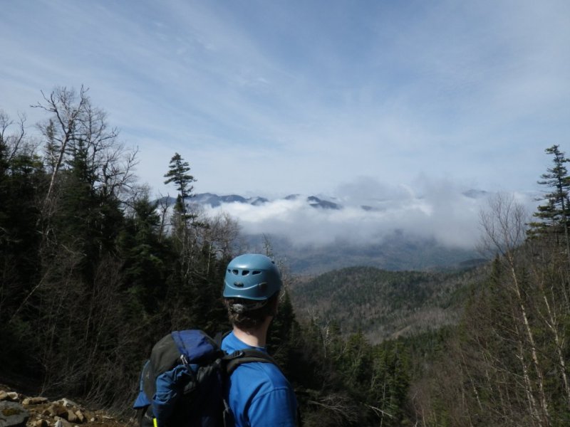
often slippery) could mean a long, long slide down. The views were awesome, as the day was fully clear now and we could
see most of the Great Range, Dial and Nippletop, Colvin and Blake, among many others. We waved at the specks dancing on
top of Noonmark, wondering if they were our ACC friends from the Hostel. We climbed on. The last pitch, the steepness
subsided somewhat, and I took a final turn at the sharp end. I reached the top of the Eagle just as the rope ran out.
Despite the terrain being fairly low angle, the belay stance turned out to be a hanging one, as this was the only thing
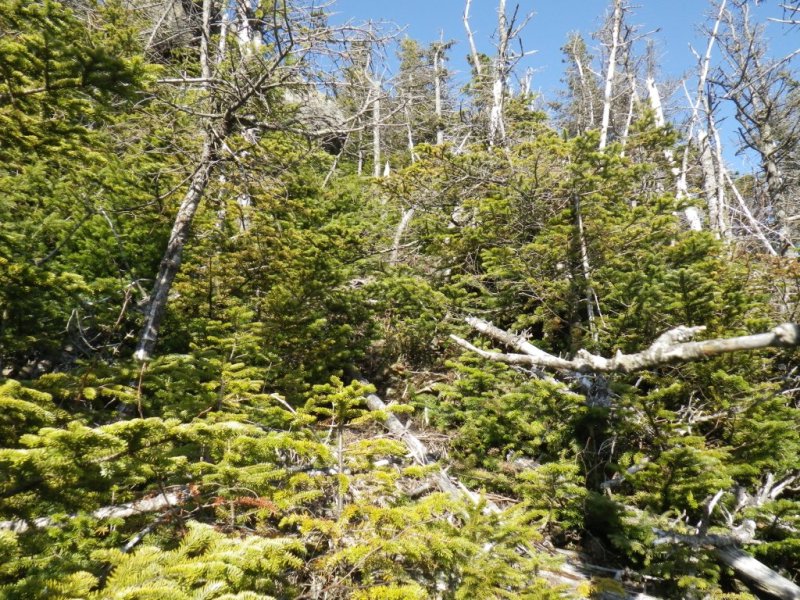
I could come up with in a sub-alpine zone of dead twigs vying for incorporation into an anchor. A short bushwack
through dense cripplebrush brought us to the trail, at which we happily got of of our cramped rock shoes and back into
comfy hiking boots. A quick snack, a long couple of pees, and we scampered up to the
summit a couple hundred meters down
the trail. It was now 18:00 and we were late for dinner with a thousand meters of elevation to lose. We scampered down
the trail, eating as we went, scrambling down the slabs with a bagels hanging out of our mouths. We came across
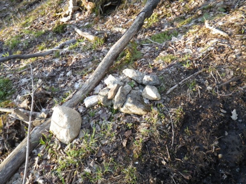
"an island in the trail with a cairn" and a distinct herd path off towards Roaring Brook. I guess this is where we
should have turned off on our way up, and not fifty meters later, we came across the place where we turned off.
Either way works I suppose. At 20:00 we arrived back at the trail-head,
after an intense 12 hour day. This probably breaks the
record for the longest day ever on Giant Mountain, but as the fun level was phenomenal we have no regrets. Arrived back
at the hostel to a couple fantastic plates of food that the crew had set aside for us, along with some cold beer, good
friendship, and musical interludes.
Crossing a stream along Roaring Brook trail.
An island in the trail with a couple blazes.
Irene debris.

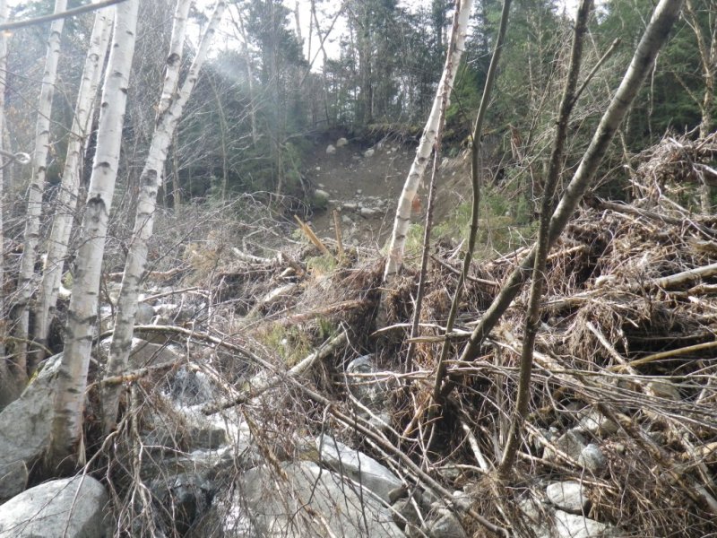
Are we in the Adirondacks or the Rockies?
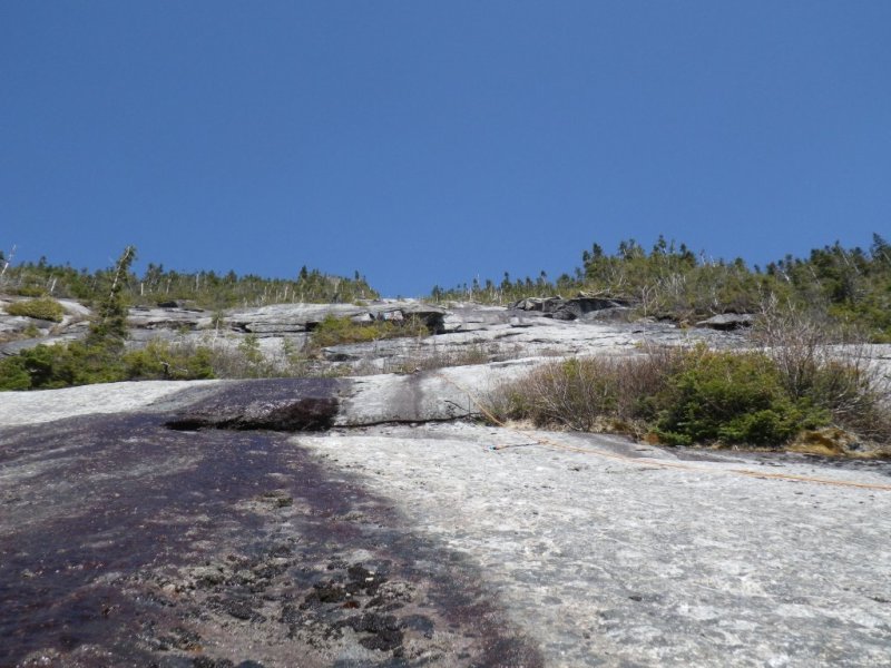
Eagle Slide. Our route took us right up the center.
Playing with Irene on a side trip.
Back on course, our climb awaits.
Looking over at the Great Range.
I think we go that way!

First pitch. Unroped on slippery rock.
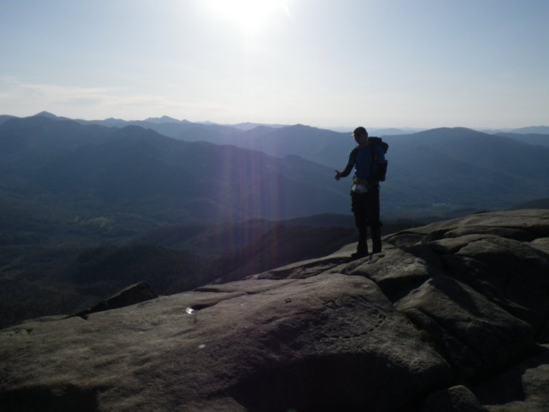
Pretty much every mountain of the Eastern High peaks is in view.

Climbing along. This is probably pitch 6 or 7.
Rob managed to find a rock tunnel to incorporate into the anchor!.

Rob at the top of the second last pitch.

Final bit of dense bushwacking onto the ridge.
Summit!. This time there is a view!
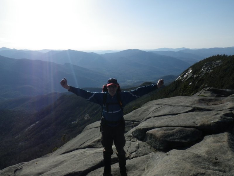
Rob on summit.
The pathetic cairn at the proper turn off. We added the big rock on the left to it.
[Home]
[Main]