


2003 Eastern Canada Motorcycle Tour


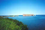 August 12, 2003 Percé, Quebec.
Percé lies on the eastern tip of the Gaspé peninsula. When the tide is low, one can take a walk over to that island in the photo. The coastal drive along route 132 from Rivière-du-Loup to Pointe-à-la-Croix, across from Campellton, New Brunswick, offers a great view of the St. Lawrence river, the Gulf of Saint Lawrence and the Baie des Chaleurs. Not to be missed, especially when the weather is as good as I was blessed with.
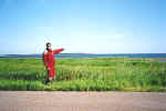 August 14, 2003 near Cape Tormentine, New Brunswick.
The 12.9 kilometer long Confederation Bridge (toll) connects Prince Edward Island to New Brunswick. It was completed in the spring of 1997 after three and a half years of construction. Bridge toll is collected upon leaving Prince Edward Island via the Confederation Bridge. As an alternate, a ferry (toll) operating between Wood Islands, PEI and Caribou, Nova Scotia can be taken. This would be a preferred route if traveling to the Cabot Trail in Cape Breton.
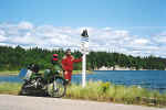 August 15, 2003 Cabot Trail at S. Gut St. Anns, Cape Breton, Nova Scotia.
The Cabot Trail is a must do for motorcyclists. Make sure you do the route in both directions, while taking some time to take in the sights.
 August 15, 2003 Cabot Trail at "The Point" in Ingonish, Cape Breton, Nova Scotia.
The view across North and South Bay Ingonish towards Cape Smoky shrouded in the clouds. The Cabot Trail just south of Cape Smoky climbs steeply with a good dose of twisty roads before reaching the top. The moist air from the ocean being pushed upwards by the land features causes the clouds to form as can be seen in the photo. The clouds were actually blow the top of Cape Smoky as I drove across.
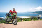 August 15, 2003 Cabot Trail at the lookout overlooking Pleasant Bay, Cape Breton, Nova Scotia.
There are numerous places along the Cabot Trail to pull off for a pic-nic or a photo opportunity.
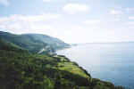 August 15, 2003 Cabot Trail at Cap Rouge, Cape Breton, Nova Scotia.
The view from Cap Rouge towards Presqu'ile along the Cabot Trail.
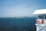 August 16, 2003 Arriving in Port-aux-Basques, Newfoundland abord the Lief Ericson.
Port-aux-Basques, Newfoundland was reached six hours after departing North Sydney, Nova Scotia. The weather couldn't have been better with blue skies from horizon to horizon during the crossing. Another alternative is to take the ferry from North Sydney, Nova Scotia to Argentia, Newfoundland, on the south eastern shores.
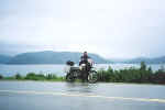 August 17, 2003 Gros Morne National Park, Newfoundland.
After six days of perfect weather, it was bound to rain. Newfoundland, being surrounded by water, makes rapidly changing weather a given.
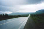 August 17, 2003 24 kilometers north of Hawke's Bay, Newfoundland.
The weather remained unchanged for the duration of the ride from Stephenville in the south to Flower's Cove in the north. The wind was howling out of the east making driving difficult, while the temperatures dropped from a comfortable 22 degrees Celsius in the morning to just below 10 degrees Celsius upon arrival at Flower's Cove late afternoon. This is a time that I would have welcomed some good company. It was one lonely and demoralizing ride.
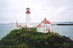 August 18, 2003 Ship Cove, Newfoundland.
I came across this picturesque lighthouse and lighthouse keeper's home while driving every back and secondary road in the Northern Peninsula. For a second, I was fooled by the distance, but when I related the size to nearby buildings and landscape, it was obvious that someone had a bit of spare time and lots of patience to build this highly detailed model. It even had a concrete slab for a base.
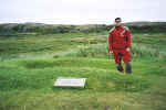 August 18, 2003 L'Anse aux Meadows, Newfoundland.
The Norse discovered the New World some 500 years before Christopher Columbus even set sail. I am standing in an area where the original excavations took place in the early 1960s. There are several mounds where the original buildings once stood.
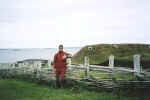 August 18, 2003 L'Anse aux Meadows, Newfoundland.
Parks Canada built these wood-framed peat-turf dwellings next to where the excavations took place in the early 1960s.
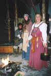 August 18, 2003 L'Anse aux Meadows, Newfoundland.
What the Viking settlers may have dressed like some 1000 years ago.
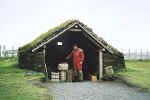 August 18, 2003 L'Anse aux Meadows, Newfoundland.
The iron worker's hut. I wonder if I can make a spare master link for my drive chain?
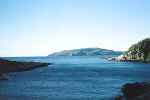 August 19, 2003 Englee, Newfoundland.
This priceless view of Canada Bay was taken from the window of my Bed & Breakfast.
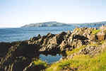 August 19, 2003 Englee, Newfoundland.
A short walk to the tip of rock on the left side in the photo above offers a good view for whale watching. The rock formations are quite different upon closer inspection.
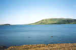 August 20, 2003 Red Bay, Labrador.
The view from my Bed & Breakfast. Red Bay is the end of the paved road that starts in the south at Old Fort Bay in Quebec. From Red Bay to Cartwright there are 330 kilometers of gravel road.
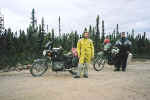 August 20, 2003 97 kilometers north of Port Hope Simpson, Labrador.
While on my way up to Cartwright, Labrador, I came across a BMW rider from Colorado riding a 1973 R75/5 coming from the opposite direction while I had stopped to lube my chain. It must have been slow going as his motorcycle was equipped with street tires.
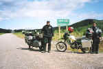 August 20, 2003 43 kilometers south of Cartwright, Labrador.
Just ahead of me and going my way, I came across another BMW rider on a 2003 R1150 GS Adventure. John was from Michigan and had been on the road for a while. We later met up on the Sir Robert Bond, a twelve hour overnight ferry that runs from Cartwright to Happy Valley - Goose Bay, Labrador. Since we had a lot of time, we talked about our adventures over a few beers.
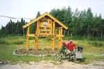 August 21, 2003 Happy Valley - Goose Bay, Labrador.
After getting off the ferry in Happy Valley - Goose Bay, John and I stopped for the usual photos before parting on our own ways. This was the start of my longest day of gravel road riding with 525 kilometers ahead of me. A motorcycle with a fuel range of at least 350 kilometers on gravel roads is a must.
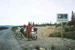 August 21, 2003 Churchill Falls, Labrador.
The drive along the Trans Labrador highway from Happy Valley - Goose Bay, Labrador to Churchill Falls was a tiring one after just having driven on 285 kilometers of gravel. Up ahead and to the right, the Churchill Falls hydro generating station that offers guided tours. The road is paved for about a kilometer on either side of Churchill Falls. Past that point, another 240 kilometers of gravel road till Labrador City is reached.
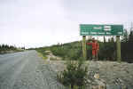 August 21, 2003 Churchill Falls, Labrador.
On the opposite side of the Trans Labrador highway from the photo above, a reminder of what was behind me; 285 kilometers of dust and gravel.
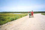 August 21, 2003 63 kilometers west of Churchill Falls, Labrador.
The Trans Labrador highway is pretty well straight as you've determined from the last few photos. There is the occasional elevation change, but as far as curves go, they are gentle at best. The best place to drive is the hard packed tracks made by cars and trucks, although it can be a bit rough at times due to potholes. If graders have smoothed the road out, it can be like driving on marbles. Driving itself isn't difficult but the constant concentration required to avoid larger rocks like the one ahead of me in the photo, can be very tiring. Speeds varied from as low as 50 km/hr to as high as 110 km/hr depending on the road surface. The majority of the time, 80 km/hr was an easy pace. Ego has no place here unless you don't mind being inconvenienced by a long wait for help.
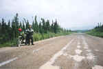 August 22, 2003 16 kilometers north of Manic Cinq, Quebec.
The 380 kilometer section of road between Labrador City, Labrador and Manic Cinq alternates between pavement and gravel, of which 237 kilometers are gravel. There are short sections of gravel road that are fairly twisty; the first section immediately south of Fermont and the other, 30 to 40 kilometers north of Manic Cinq. Other than those section, the road is quite straight with some elevation changes.
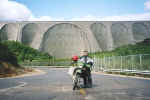 August 22, 2003 Manic Cinq, Quebec.
The paved road between Manic Cinq and Baie Comeau is a delight to drive. All 214 kilometers of it are composed of a combination of non-stop elevation changes and curves with great scenery thrown in. There are numerous roads branching off to logging roads, but not a single truck was to be seen.