


2001 European Motorcycle Tour


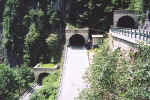 June 13, 2001 Passo di San Boldo, Italy.
Passo di San Boldo (706 m asl) consists of 18 hairpins, of which some of them lie in tunnels. From the north, this pass comes up on you unexpectedly, much like the Maloja Pass in Switzerland when approaching from the east. The road is fairly tame until you reach the other side of the pass, and then, nothing but hairpins. Note the white "STOP" line on the road prior to entering the center tunnel pictured. Traffic lights are spaced a few tunnels apart to avoid traffic jams in the tunnel hairpins. Don't let this discourage you from driving this pass, as it was clear sailing all the way down to the town of Tovena. The road leading to this pass from the north lies between the towns of Belluno and Feltre. While in the area, don't miss out on Passo Brocon which lies on the road from the town of Lamon, Italy.
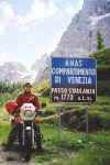 June 14, 2001 Passo Staulanza, Italy.
Passo Staulanza (1773 m asl), one of the many passes in the Dolomites region near Cortina d'Ampezzo. This is one area I have driven year after year. I never miss using it to get me from one area to another.
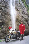 June 14, 2001 Sottoguda gorge, Sottoguda, Italy.
The Sottoguda gorge is located between the towns of Caprille and Canazei on the road leading up to Passo di Fedaia. The one-way Sottoguda gorge road starts in the town of Sottoguda, and runs east to west. At one point, you'll notice a road high above the gorge making a crossing. This is the main road up Passo di Fedaia, if you hadn't taken the turn into the town of Sottoguda to take the gorge road. Once back on the main road, take a short drive back to the east through a tunnel where you'll find a parking area to stop at. From there, you can walk along the bridge and view the Sottoguda gorge from above.
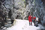 June 14, 2001 Sottoguda gorge, Sottoguda, Italy.
Of the many sights along the Sottoguda gorge road, a stream and picnic tables along this three kilometer section of road make this an ideal location for some rest and relaxation. There is even a small chapel backing onto the gorge.
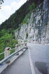 June 14, 2001 Mendelpass, Italy.
Also known as the Passo della Mendola, this pass is located just west of Bozen (a.k.a. Bolzano). This section of road follows the edge of the mountain some four kilometers northeast of the pass itself. There are a few widened areas where you can stop and overlook the valley that Bozen lies in. Just to the northwest, lies the Gampenpass (a.k.a. Passo Palade), between the towns of Fondo and Meran (a.k.a. Merano).
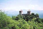 June 15, 2001 Leonburg, Meran, Italy.
Leonburg, one of the countless castles in the area, is best viewed from the road that heads down from the Gampenpass (a.k.a. Passo Palade) towards the town of Meran (a.k.a. Merano).
The town of Missian is a few kilometers west of Bozen (a.k.a. Bolzano). Hotel Schloss Korb lies in the foreground behind me, while Schloss Boymont, accessible by foot only, is situated on the hilltop in the background. The Bozen area is lined with fruit trees as can be seen by the trees behind me.
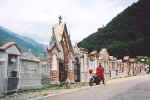 June 16, 2001 Bagolino, Italy.
This cemetery, located in the town of Bagolino, lies on the main road that heads up to Passo di Croce Domini from the town of Anfo on Lago d'Idro. I took this same road while on tour in 2000. For a detailed account of Passo di Croce Domini, refer to the 2000 Tour page.
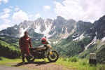 June 17, 2001 Passo del Vivione, Italy.
Passo del Vivione and Passo Presolana lie between the towns of Forno Allione and Lovere. This photo was taken 700 meters south of the pass itself.
You meet some of the nicest people on motorcycles. I met Gaby and Rudi at the hotel I was staying at in the town of Corteno Golgi while having breakfast. We were all leaving that day for another area so we rode together till we parted on our separate ways; I went towards Lago di Como, they went towards Passo Stelvio. Before doing so, they invited me to stay over at their place while on my way back to Germany. This was a much welcomed invitation since I usually ride 800 to 1000 kilometers on the last day of my tour to get back to my home base. Their invitation cut my ride in half. We had an excellent dinner with their relatives and friends the evening of my arrival and an equally good breakfast the following morning. Rudi and Gaby then took me on a sightseeing tour of Speyer with its nearly 1000 year old Speyer Dom (Cathedral).
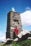 June 18, 2001 Passo di San Marco, Italy.
The road up Passo di San Marco heads south from the town of Morbegno, Italy.
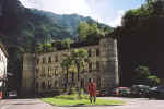 June 19, 2001 Piazza Castello (Castle Square), Chiavenna, Italy.
In the early times, it was called Granda Square. The Castello was the residence of Conti Balbiani, feudatory of the Valchiavenna in the 1400s. The Grigioni destroyed most of the castle in 1525. The façade and the towers are the only original parts of the present building, which was restored in the 1930s.
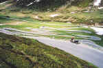 June 19, 2001 Splügen Pass, Italy / Switzerland.
The Splügen Pass lies between the towns of Chiavenna, Italy and Splügen, Switzerland. About 1 km to the north of this pass, you’ll encounter these series of hairpins. Although they appear to be on level ground, the meadow that I took the picture from was quite the upward hike.
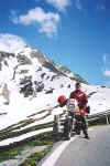 June 19, 2001 Splügen Pass, Italy / Switzerland.
This view, taken from the same location as the previous photo shows the nice blue skies that I had during most of my tour. Earlier in the day when I had crossed this pass to ride the nearby Passo del San Bernardino and the Lukmanier, the pass was shrouded in cloud at a temperature of 8 degrees Celcius. Changing weather is something that one accepts when riding the Alps.
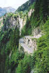 June 19, 2001 Splügen Pass, Italy / Switzerland.
The south approach to the Splügen Pass is equally exciting with countless hairpins along the vertical edge of the mountain.
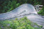 June 19, 2001 Splügen Pass, Italy / Switzerland.
Another view of one of the many hairpins on the south approach to the Splügen Pass. The northbound run provides a tight turn if a southbound vehicle happens to be in the hairpin at the same time. Normally on the upward run, you would take it wide while looking up over your shoulder for downward traffic. If all is clear, you can continue to run wide, then cut in at the apex. If not, it is a tight one.
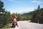 June 20, 2001 Ofenpass, Switzerland.
The Ofenpass lies between the towns of Zernez and Santa Maria im Münstertal. This photo was taken about halfway between the pass and Santa Maria im Münstertal. From this town, a short run south takes you over the Umbrail Pass which then tees into Passo dello Stelvio. It is a good idea to check with other riders when at rest stops on the passes to verify if nearby passes are open or not. During 2000 and 2001, Passo di Stelvio had sections that were closed due to earth slides.
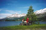 June 20, 2001 Lago da Segl, Switzerland.
Lago da Segl lies on the Malojapass. Towards the northeast, the Silvaplaner See and then the town of St. Moritz, Switzerland.
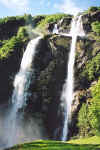 June 20, 2001 Cascata Acqua Fraggia, Piuro, Italy.
One kilometer prior to reaching my hotel in the Chiavenna area, I noticed a sign, “Cascata Acqua Fraggia” in the town of Piuro. I decided to investigate and came upon these falls just off the main road. Other falls worth viewing are the Cascata del Toce in Val Formazza, north of the town of Domodóssola, Italy.
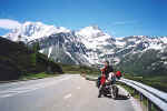 June 23, 2001 Simplonpass, Switzerland.
The Simplonpass lies between the town of Domodóssola, Italy and Brig, Switzerland. This view was taken 200 meters south of the pass itself. The road behind me leads up to the pass ahead from the town of Domodóssola. More great scenery covered in crystal clear blue skies. This is becoming hard to take.
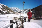 June 23, 2001 Col du Grand St. Bernard, Italy / Switzerland.
The Col du Grand St. Bernard (2469 m asl) lies on the Italian – Swiss border between the towns of Aosta, Italy and Martigny, Switzerland. I’m standing on the Italian side. In the background, Switzerland. Although it was relatively warm and there was a constant flow of water running across the pass road due to rapidly melting snow, the lake to my right was still frozen. The Italian and Swiss border guards standing next to their huts are still in place, but just wave you through.
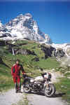 June 23, 2001 Monte Cervino a.k.a. the Matterhorn, Breuil-Cervinia, Italy.
This view of Monte Cervino, better known as the Matterhorn, was taken from the town of Breuil-Cervinia in Italy. The more recognizable shape of the Matterhorn as we commonly see it, is taken from the town of Zermatt in Switzerland. Zermatt is a pedestrian town and if you ride a motorcycle, you’ll have to leave it parked in a lot along with all your gear. Past the town of Breuil-Cervinia, a dirt road leads up towards the Matterhorn, although it is closed to traffic. I had trouble reading traffic signs that particular moment.
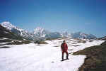 June 24, 2001 Col du Petit St. Bernard, France / Italy.
The Col du Petit St. Bernard (2188 m asl) lies on the French – Italian border between the towns of Bourg St. Maurice, France and Pré St. Didier, Italy. A short run down this road into France leads one to Val d’Isere and then the Col de l’Iseran.
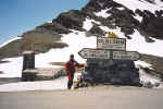 June 24, 2001 Col de l'Iseran, France.
The Col de l’Iseran (2770 m asl) is the beginning of countless passes that lie south towards Monaco. France has an excellent selection of less traveled passes simply because a good portion of them are gravel. These passes are more commonly visited by dual purpose motorcycles and only a very few cruisers and sport bikes.
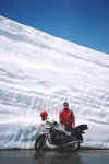 June 24, 2001 Col de l'Iseran, France.
As late as it was in June, there was plenty of snow on the passes that exceed the 2000 meter mark. The vertically cut snow bank behind me was just over 12 feet high.
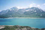 June 24, 2001 Lac du Mont Cenis, France.
Lac du Mont Cenis is located just southeast of the pass itself. Off the main road, there are numerous other dirt roads that lead to the far side of the lake as well as up the Col du Petit Mont Cenis, which strangely enough at 2182 m asl is higher than the Col du Mont Cenis at 2081 m asl. Go figure!