


1996 European Motorcycle Tour


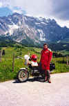 June 01, 1996 Dienten a. Hochkönig, Austria.
Federal Road 164 from Bischofshofen to Saalfelden a. Stein.Meer is packed with endless turns and elevation changes. The Dientner Sattel (1357 m asl) and the Filzensattel (1291 m asl) are crossed along this route. In the background, Hochkönig stands at 2941 m asl.
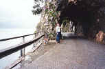 June 03, 1996 Kienbergwand-Strasse on the South side of Mondsee, Austria.
The road around Mondsee follows the lake's edge and offers some very nice scenery. On the South side, a short section of cobblestone road takes one through a series of tunnels carved out of the edge of the adjacent mountain. This section of road was constructed in 1898.
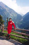 June 05, 1996 Gerlosstrasse, Austria.
The view from the Gerlosstrasse towards the Krimmler Fälle in the background. This toll road (ATS 50) on Federal Road 165 lies between the towns of Mittersill and Zell a. Ziller. A parallel road a few kilometers to the North takes one over the Gerlos Pass (1531 m asl).
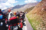 June 06, 1996 Timmelsjochstrasse, near Sölden, Austria.
This is the view leading to the Timmelsjochstrasse toll both (ATS 50). This is a Thursday, so you would think that everybody is at work. Rule number one: find out when the Germans have their national holidays. They seem to have a lot of them. My relatives in Germany can't believe that companies start us off with 2, maybe 3 weeks of vacation in North America and that it takes about 20 years to get 5. They start off with 5 weeks. The wait by the way was very short and the lineup behind us long. I think that I saw more bikes at this one location than I see back home all summer.
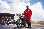 June 06, 1996 Rasthaus Timmelsjoch, Austria / Italy.
The Timmelsjochstrasse (2483 m asl) crosses over into Italy from Austria. The section of road in Italy takes one through numerous tunnels. A left turn at St. Leonhard i. Passeier, Italy leads up to the Jaufenpass (2099 m asl); a short run from the Timmelsjoch.
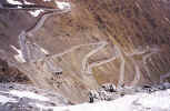 June 07, 1996 Passo dello Stelvio a.k.a. the Stilfser Joch, Italy.
This is a view of the road leading up from the town of Trafoi that lies to the East. A few more hairpins and you're at the top.
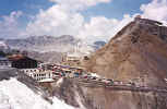 June 07, 1996 Passo dello Stelvio a.k.a. the Stilfser Joch, Italy.
I would rate the Passo dello Stelvio (2758 m asl) as one of the best passes in Europe. The air is quite thin up at this altitude. If you're in shape and don't notice this, your bike certainly will. This road lies between the towns of Gomagoi in the East and Bormio in the West.
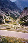 June 07, 1996 Passo dello Stelvio a.k.a. the Stilfser Joch, Italy.
This is the view heading west from the pass. In the foreground, numerous roads with hairpins at each end. In the background, more hairpins before the road straightens to follow the edge of the mountain through a series of tunnels. This road ends in the town of Bormio, Italy.
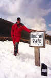 June 07, 1996 Umbrail Pass, Italy / Switzerland.
The Umbrail Pass heads from the Passo dello Stelvio northward to the town of Sta. Maria i. Münstertal, Switzerland. A section of this road is gravel.
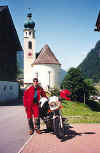 June 08, 1996 Landhaus Granig bed & breakfast, See, Austria.
This is the kind of shot that I can't resist taking. I am parked on the front patio of the Landhaus Granig in the town of See. See is on Federal Road 188 about 12 km to the West of Landeck, Austria. The 188 leads you to the Silvretta-Hochalpenstrasse and then ends further west in the town of Bludenz.
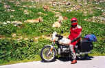 June 08, 1996 Silvretta-Hochalpenstrasse, Austria.
The Silvretta-Hochalpenstrasse toll road (ATS170) starts in the town of Galtür in the East and ends in the town of Partenen in the West. Just West of Galtür, a road heads up to the Zeinisjoch (1842 m asl) before coming to a dead end at the Speicher Kops; a reservoir and dam. Further West, at the Bielerhöhe (2036 m asl) and Silvretta Stausee, the highest point along this road, the parking area was filled with tour buses, cars and motorcyclists. A Honda Helix (scooter) with enough mountain pass stickers covering the body work that you couldn't tell what color it was, made a very rare appearance. Suckers for punishment do exist.
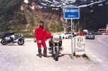 June 09, 1996 Oberalppass, Switzerland.
The West ramp of the Oberalppass (2046 m asl) ends in the town of Andermatt. The town of Andermatt makes a very good home base for alpine touring because of its central location in Switzerland.
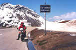 June 10, 1996 Furkapass, Switzerland.
The Furkapass (2436 m asl) lies between the towns of Realp to the East and Gletsch to the West.
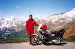 June 10, 1996 Furkapass, Switzerland.
The view taken from the Furkapass looking westward. The road to my right in the background leads up to the Grimselpass. The town of Gletsch lies at the bottom of this road in the valley below.
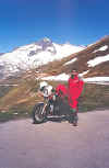 June 10, 1996 Furkapass, Switzerland.
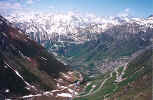 June 10, 1996 Furkapass, Switzerland.
A view of the West ramp of the Furkapass on the right that leads to the town of Gletsch in the valley below where the road zig-zags up towards the Grimselpass in the background.
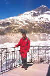 June 10, 1996 Rhonegletscher, Switzerland.
This view of the Rhonegletscher was taken from the Gletschergrotte, about 2 km west of the Furkapass. The Hotel Belvedere is located on the inside of a hairpin directly across from this scenic viewpoint. Note the blue-green colors within the ice.
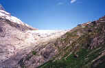 June 10, 1996 On the west ramp of the Furkapass, Switzerland.
The Rhonegletscher can be seen in the center. The Gletschergrotte and Hotel Belvedere are situated on the mountain side in the upper right.
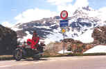 June 10, 1996 Grimselpass, Switzerland.
The Grimselpass (2165 m asl) lies between the towns of Gletsch in the South and Innertkirchen in the North.
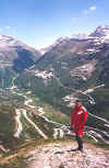 June 10, 1996 Grimselpass, Switzerland.
Directly behind me is the town of Gletsch in the valley below with the road leading up to the Grimselpass. In the background, the road leading up to the Furkapass.
 June 10, 1996 Räterichsbodensee, Grimselpass, Switzerland.
Immediately North of the Grimselpass.
 June 10, 1996 Sustenpass, Switzerland.
The Sustenpass (2224 m asl) lies between the towns of Innertkirchen in the West and Wassen in the East. There are numerous very short tunnels to the West of the Sustenpass. One of the tunnels becomes a waterfall as water flows over it and into the valley below. While passing through this tunnel, a hole carved into the side enables you to look through the waterfall towards the scenery in the background.
 June 11, 1996 Passo dello San Gottardo a.k.a. St. Gotthardpass, Switzerland.
The St. Gotthardpass (2091 m asl) lies between the towns of Hospental, just West of Andermatt and Airolo. There are two roads leading over this pass, the original and the newer, less interesting paved section. Unfortunately, the older road was closed for some reason. From the town of Airolo, head West to the Passo della Novena a.k.a. the Nufenenpass.
 June 11, 1996 Passo della Novena a.k.a. Nufenenpass, Switzerland.
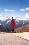
The Nufenenpass (2478 m asl) lies between the towns of Airolo and Ulrichen. I found this pass to be more barren than the others and the power lines took away from the landscape. Other than that, the views were great as is usual. A right turn in the town of Ulrichen leads back to the town of Gletsch. From there you have a choice of either the Furkapass or the Grimselpass. The five passes are arranged in a vertical figure eight. You can easily do them in a day if you don't stop often, but two days gives you more time to enjoy them.
 June 11, 1996 Passo della Novena a.k.a. Nufenenpass, Switzerland.
More great weather and scenery.
 June 12, 1996 Andermatt, Switzerland.
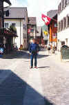
This is main street Andermatt, a narrow cobblestone road good enough for one car in some areas; two if you squeeze by in others. Stop by and relax at the "Hotel 3 Könige & Post" for dinner after a long day on the road. You'll meet many motorcyclists that stop by after just coming off the Oberalppass that heads directly into town.
 June 12, 1996 Andermatt, Switzerland.
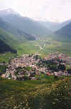
This is the view of the valley between Andermatt in the foreground and the road leading up to the Furkapass (not visible in the haze) in the background. Just to the West of Andermatt lies the town of Hospental. A turn Southbound from Hospental leads to the St. Gotthardpass. Further down the valley lies the town of Realp (not visible) that starts at the base of the Furkapass.