The
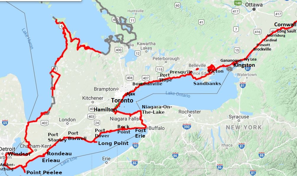
Waterfront Trail In Ontario From Windsor To Cornwall
Ontario’s Waterfront Trail www.waterfronttrail.org
was developed over the last few decades with further improvements in
the last few years. I first read about The Waterfront Trail a few
years ago and decide to ride it this year. I stay in campgrounds in
Ontario Provincial Parks and the HI Hostel in Niagara Falls.
The weather is mostly sunny and warm with a few clouds though
there are periods of heavy rain and strong winds. Overall, it is
pleasant bicycling weather, neither too hot, not too cold. On the
negative side, I do remember the aversive conditions of the first
night and the third day. There was heavy rain the first night and
strong side winds the third day that slowed my progress. I do
remember pleasant weather the rest of the trip: sunny with cloudy
periods and the wind at my back. Now, I see that my pictures also
indicate a stormy day with light rain when I visited Niagara Falls. I
think it was stormier that night, too, but I was dry inside the HI
Hostel, a well timed stay, eh?
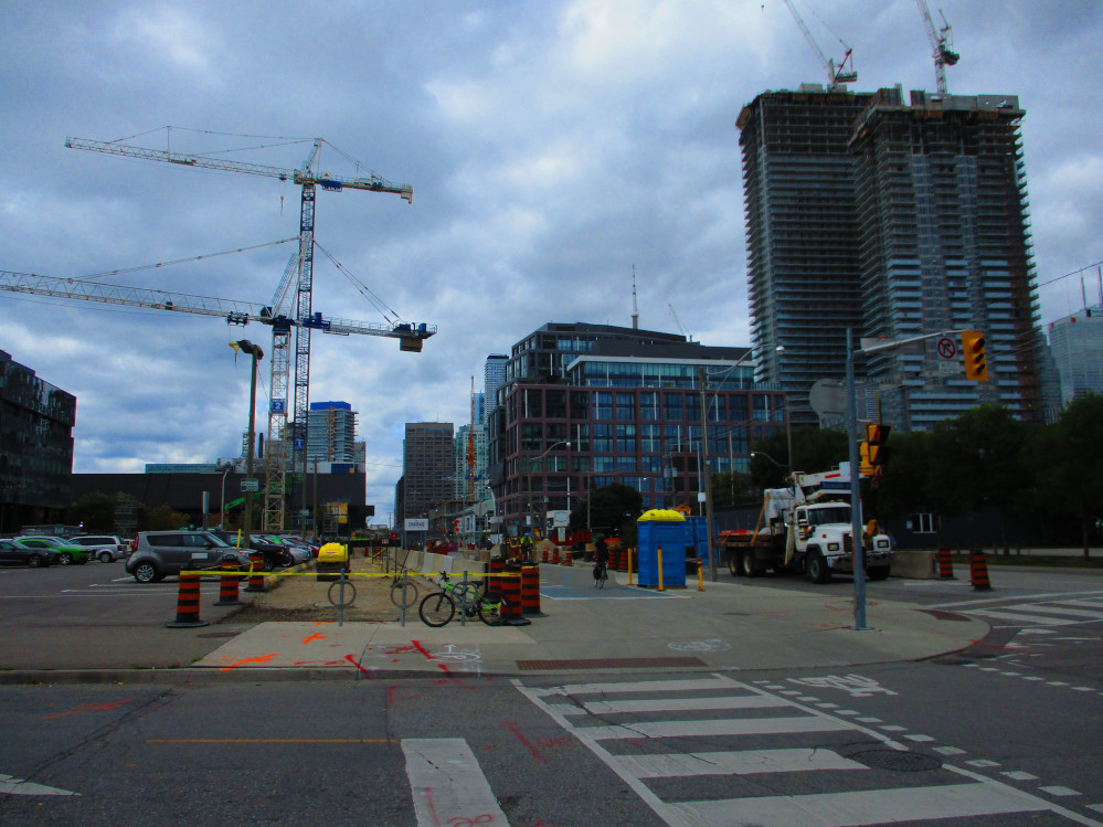
The trip starts with an overnight bus trip from my home in Ottawa
to Windsor with a transfer in Toronto. What a green way to travel.
And, there are no worries of one’s luggage or bicycle being
lost as I like other passengers, carries it all at any point of
transfer, including the bicycle, from one bus to another. For me this
consists of 2 short walks of 100 meters each: from 1 bus to the
secure waiting area inside the bus depot in Toronto and back out
again to catch the bus to Windsor an hour later. I have a bike box
and a huge 140 litre duffle bag for all my gear including sleeping
bag and tent. That’s all, as one is allowed 2 pieces of luggage
on a Greyhound Bus.
At one point, I considered taking the train to the start of this
trip as there is excellent train service for passengers with bicycles
who live along the direct route from Windsor to Montreal in places
like Toronto, London, and Kingston. Unfortunately, this
transportation alternative is difficult to access for bicycle riders
like myself who live 80 km north of these trains. So close, but yet
so far, eh?
I
sleep a bit on the bus, like most bus passengers, and have my own
seat for most of the way so have lots of room, but do share the seat,
luckily with another small person, from Toronto to London, as the bus
is crowded. Many passengers depart in London. The bus stops once at a
Time Horton’s and at the Peterborough bus terminal on the way
to Toronto. I only remember the stop in London on the trip from
Toronto to Windsor. Maybe I sleep through some other pit stops? It is
a 3 hour trip. Hmm, on the other hand, maybe the bus does stop at a
rest area so the bus driver can get a coffee, eh?
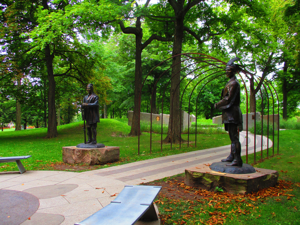
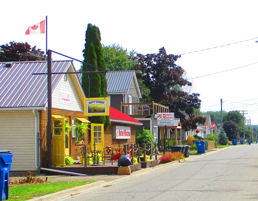
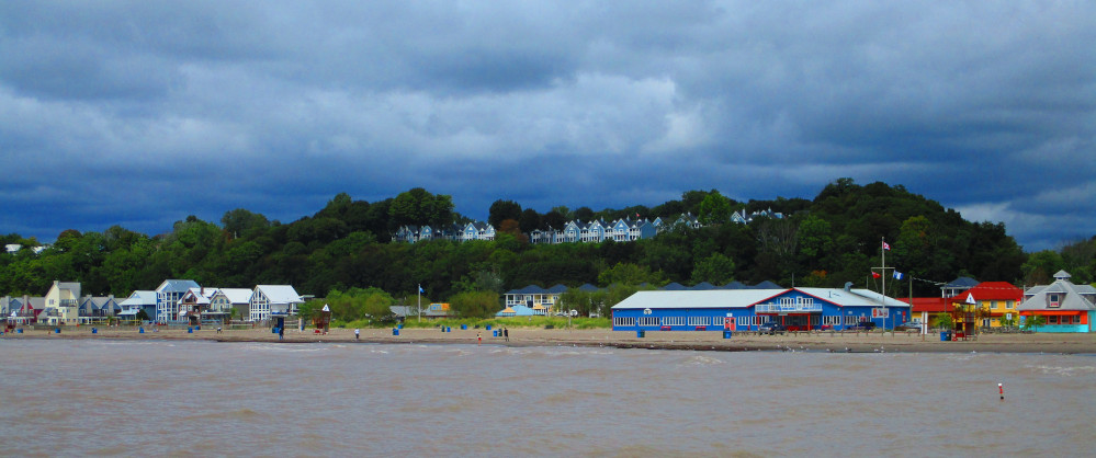
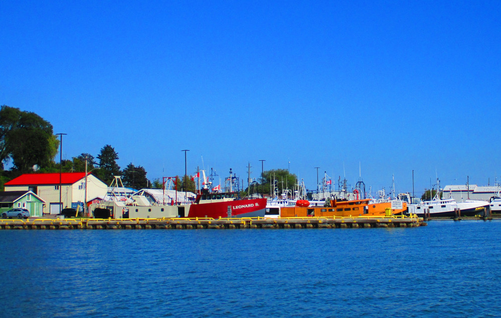
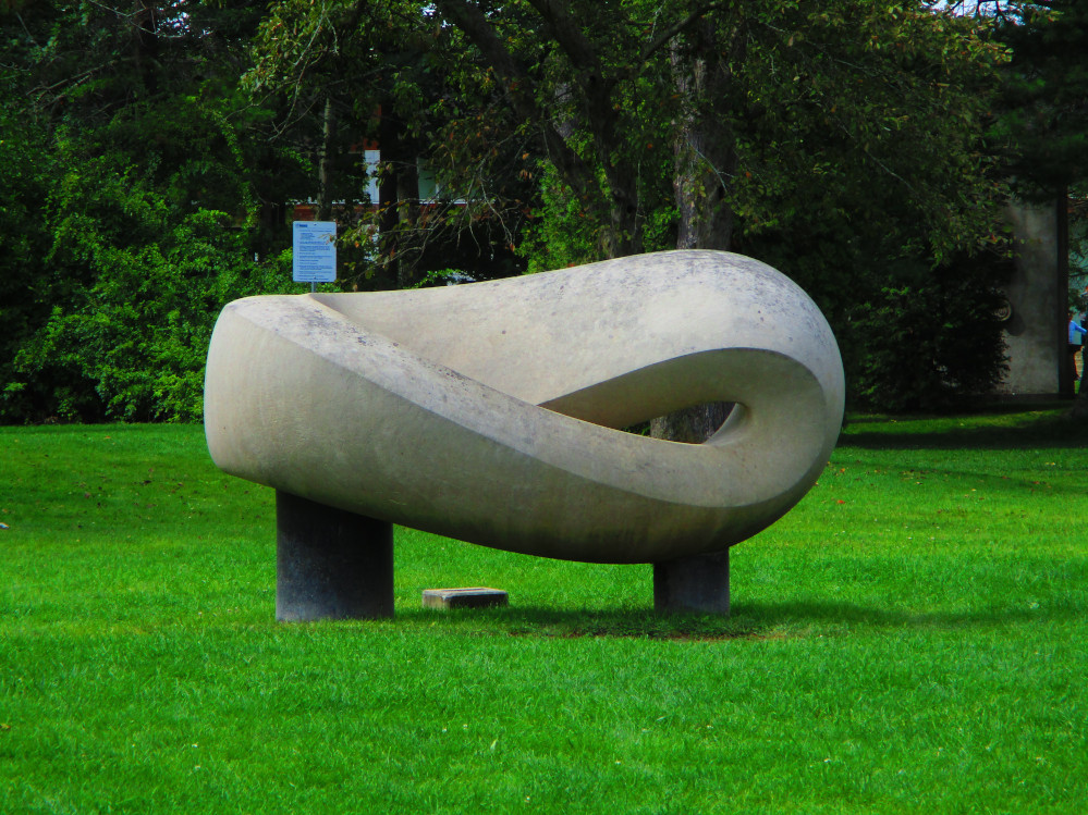
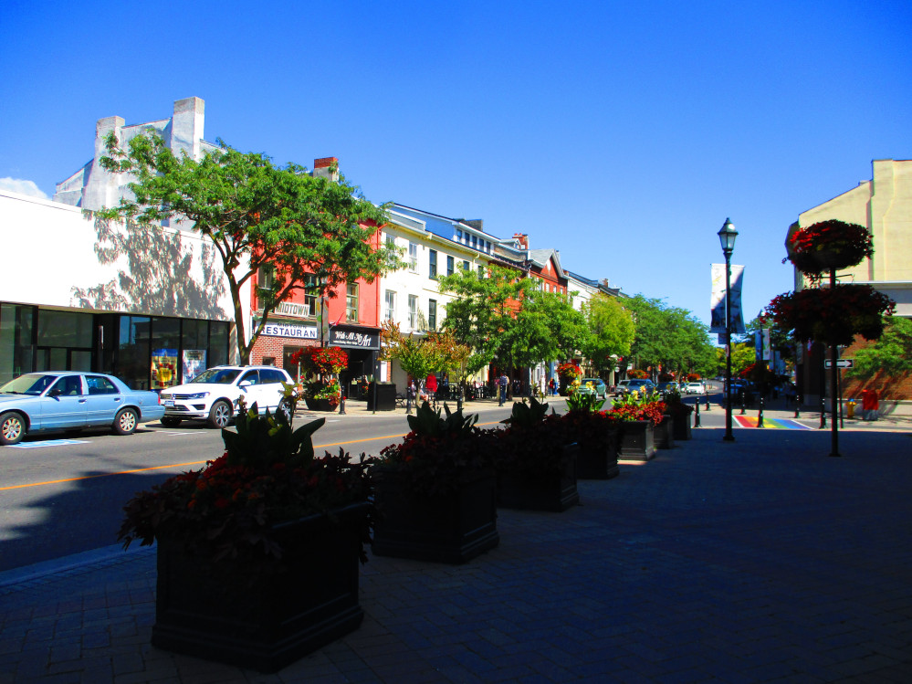
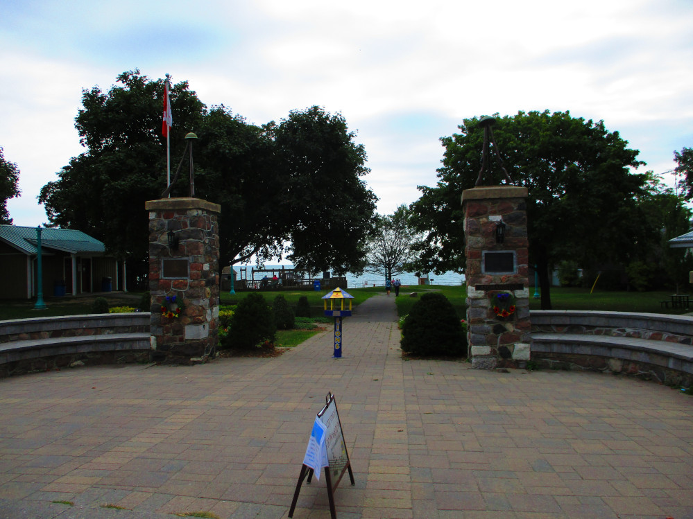
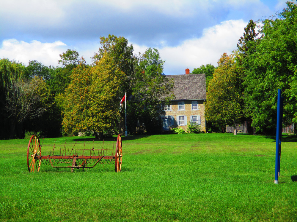
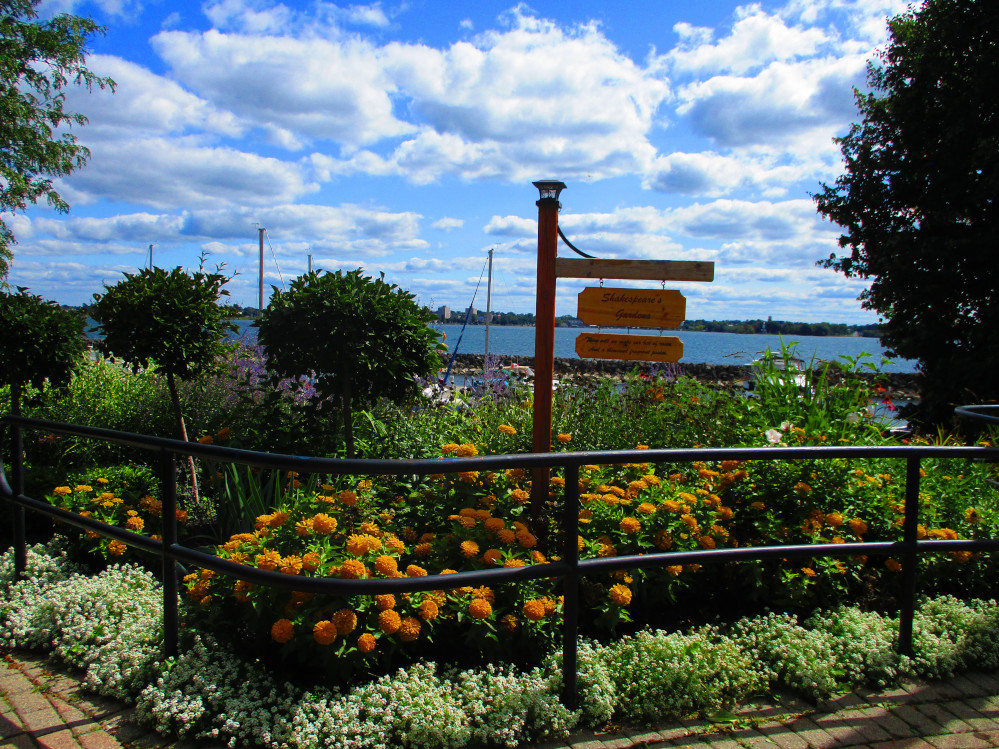
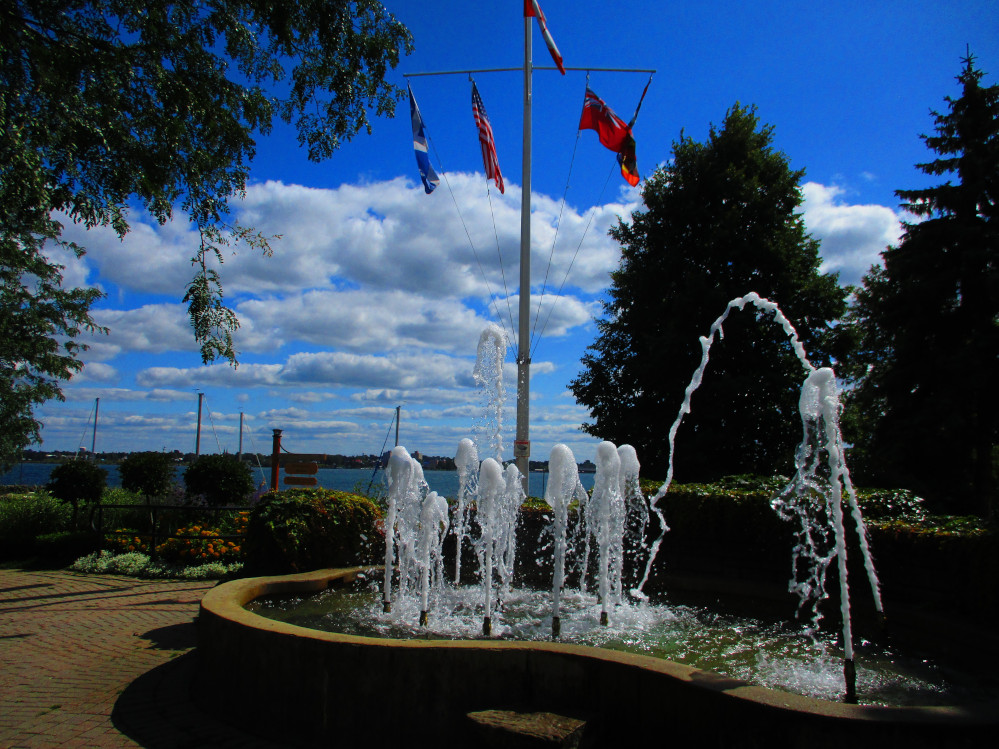
Windsor
I arrive in Windsor at 6 am, assemble my bicycle in
the bus depot, and start my trip by first going to the Detroit River
that’s just a block from the bus depot. It is a nice, bright,
sunny morning and a cheery way to start my ride of the Waterfront
Trail. I remember many years ago that Windsor waterfront had just a
green strip along the river with a sidewalk in some parts. It’s
become much more. There is a landscaped river front that includes a
trail for walking and bicycling along which there is a continuous
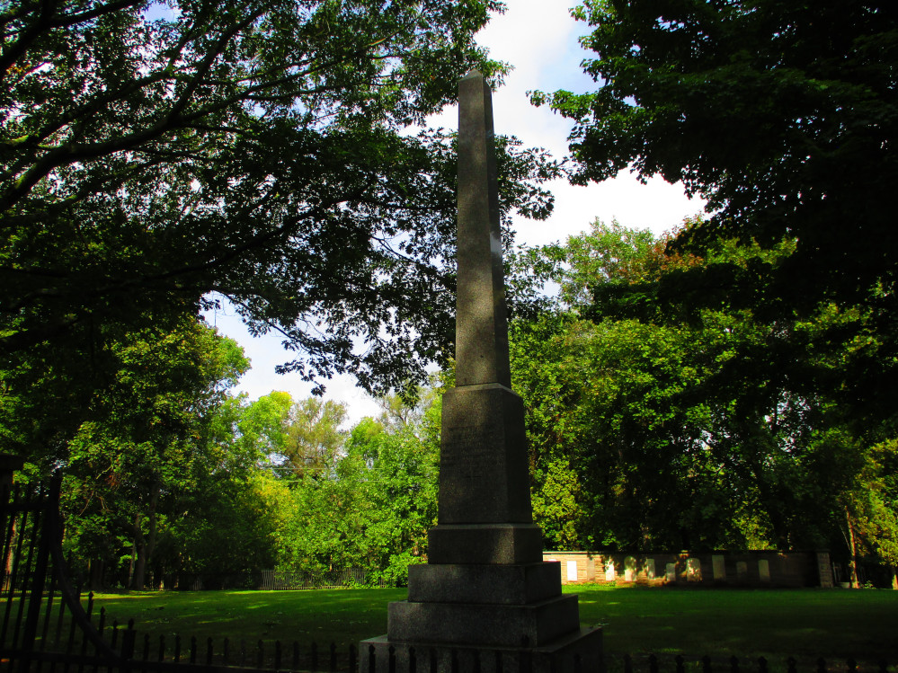
string of flower beds, monuments, and sculptures. I show pictures of
a few of these here. There are many more – a least 20 –
along these few kilometres of green space between the road and shore
in Centennial Park, Windsor Sculpture Park, and Dieppe Gardens along
Riverside Drive.
There are a number of people, both residents and
tourists, out and about this Labour Day morning appreciating the
beauty and calmness of the place. A few go to the Casino. Many are
walking the trail. I see others fishing off the dock beside the
Ambassador Bridge to Detroit. It is a holiday. There is little
traffic this morning. What a great day to appreciate Windsor’s
waterfront.
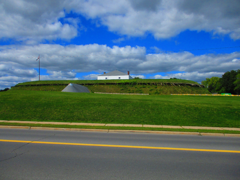
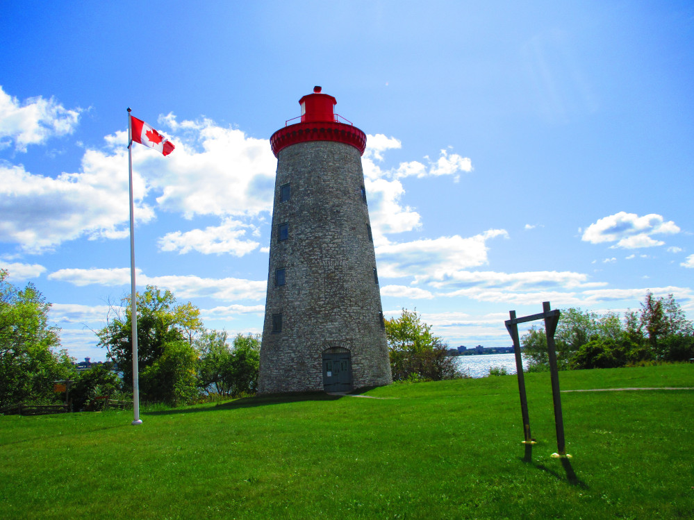
Amherstburg
I leave Windsor and travel downstream on Detroit
River to Amherstburg. Part of the route is a commuting road beside
many industries. I know when I am in Amherstburg when I start seeing
flowers again, and, I mean, lots of flowers as Amherstburg is a
contender in Communities in Bloom competition. I initially ride
through Amherstburg on Dalhousie Street and see the waterfront and
historic sites of Fort Malden and the Navy Yard. All are closed as
the time is still early. I then ride back through Amherstburg on the
main street, Sandwich Street, and stop at McDonald’s for more
breakfast of egg Mcmuffin having already eaten several granola bars.
I noticed a significant number of older people here and gather from
some that it is an area that people from Toronto often retire in as
they can afford a house, Amherstburg is a relatively warm place year
round for a Canadian municipality, and it is a scenic spot that is
calm and pleasant this morning. Everyone that I meet is cheery and
helpful.
The road from Windsor to Amherstburg is very flat.
There is a bicycle path along much of it too. The path makes it easy
to ride at any time of day, regardless of the traffic. The bicycle
path is smooth, too. Along this route, the towns are merged together.
One leaves Windsor knowing that one is out of downtown as there is an
industrial area, and, eventually, the sign says one is in Amherstburg
after really no rural area. The commuter road of 4 or 6 lanes
continues from one municipality to the next. I bet many residents of
Amherstburg work in Windsor and others travel there often. It’s
like one suburban area.
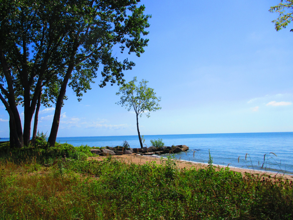
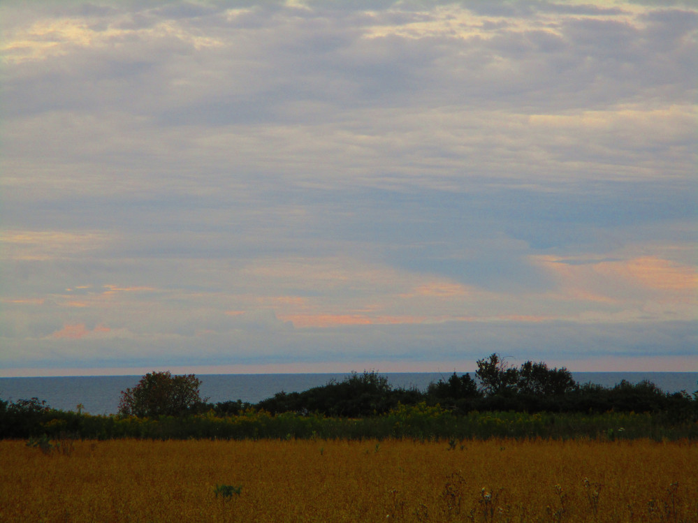
After Amherstburg, I’m finally in a rural area,
at last. The sun is still shining and the wind is at my back. I see a
few cyclists and talk to one while stopped and taking in a view of a
river outlet of Big Creek. This bicycle rider is somewhat eccentric.
He defies cleated shoes and rides a single speed bicycle even though
he wants to go fast and claims to be out on a little ride alone
though normally bicycles with some racers. He’s enjoying the
day too. Everyone that I meet is happy today. Later I ride a bit with
a local cyclist, a retired teacher. He’s riding back home after
fighting the wind, from a small town north of Leamington, to get
along Lake Erie and do his regular training route. Now, we’re
both going with the wind. What a great place to live, to ride and to
be. He’s amazed at my planned trip but is timid on partaking in
such adventures himself. One interesting place that he persuades me
to stop at is a beach that accommodates disabled people with wheel
chairs.
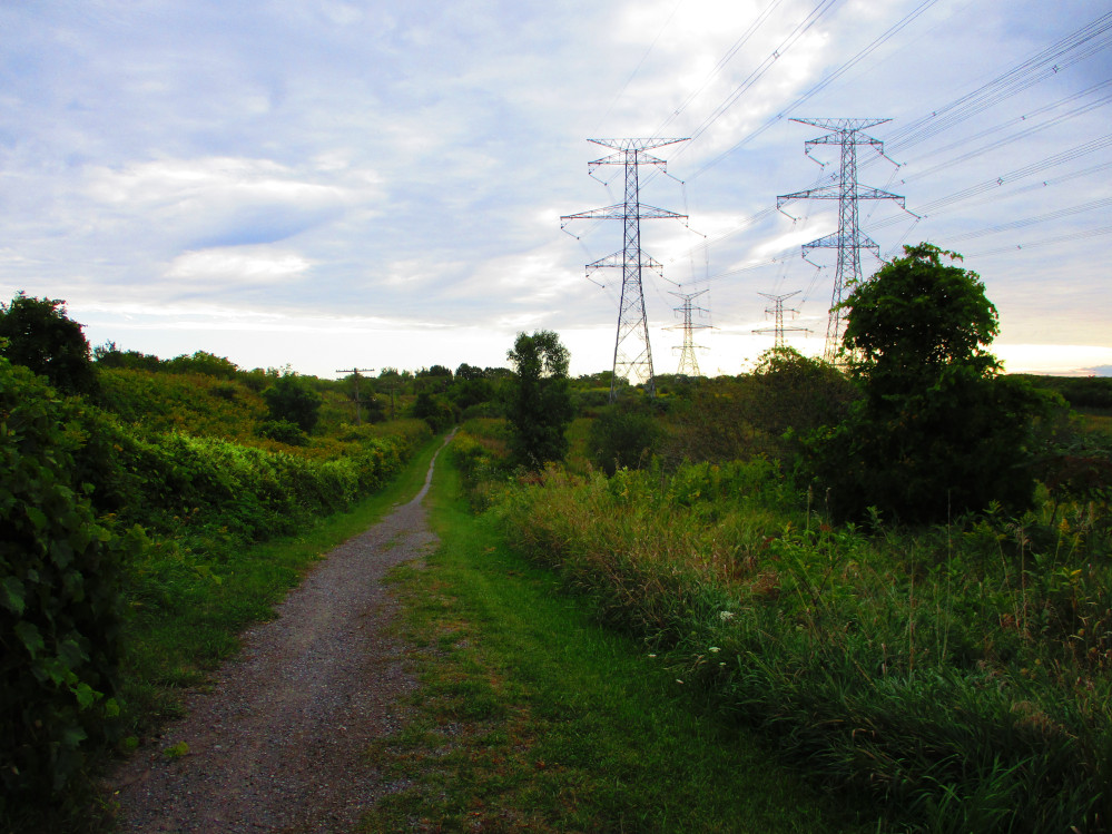
Another interesting part of this stop at Big Creek,
is that behind me, on the other side of the road are electric wires
that have metal reflectors attached to them. It’s my first time
seeing wires like this. Is it to scare the birds or... The birds
don’t mind. They appear to have become used to these strange
wire mates.
The feeling of being in a natural area starts to
overwhelm me when looking at Big Creek and grows throughout the day
as I see many beaches and many green leaves and flowers. I just keep
smiling and being happy to be here. There is lots of greenery and
expanses of water. It’s a great contrast from earlier today in
urban Windsor and Amherstburg. Unknown to me, at this point, is that
this natural feeling will continue for several days as I ride along
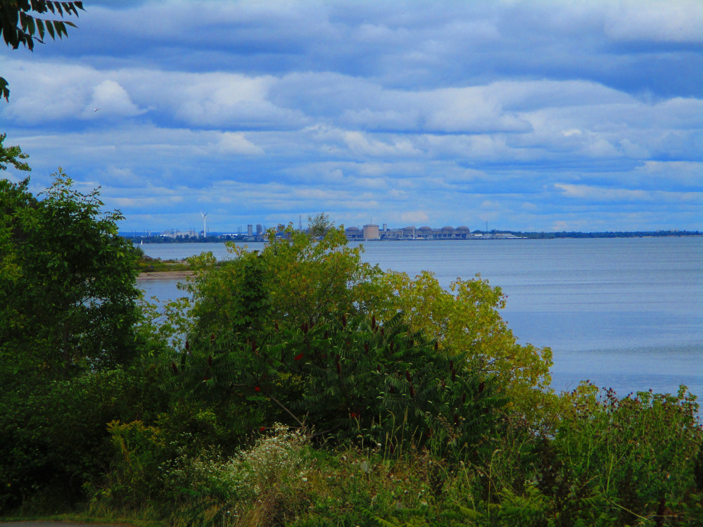
Lake Erie. The next big urban area is Fort Erie and Niagara Falls at
the east end of Lake Erie where I will turn left to follow the
Niagara River.
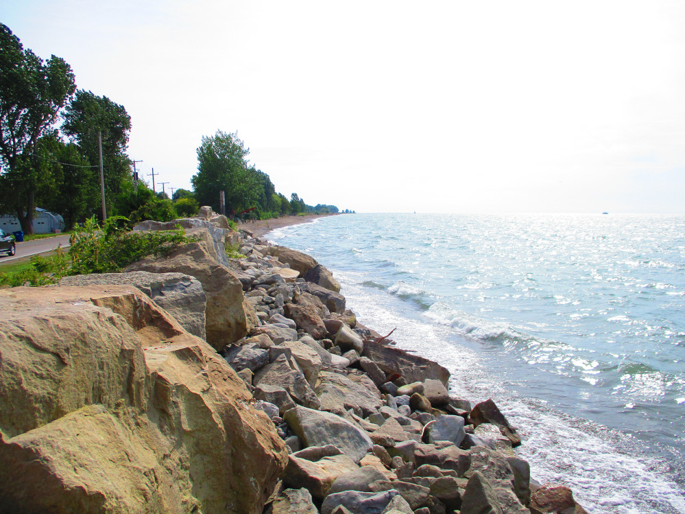
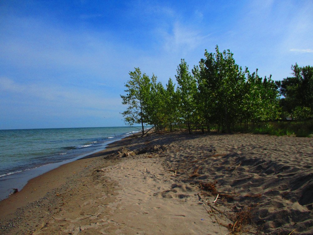
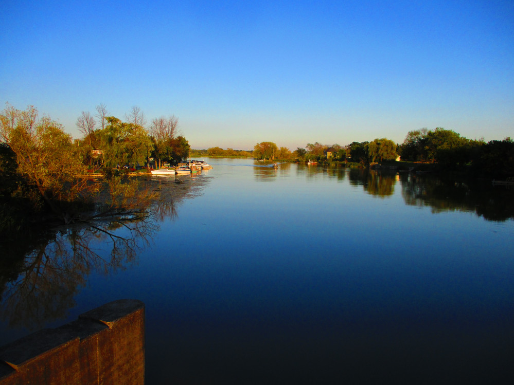
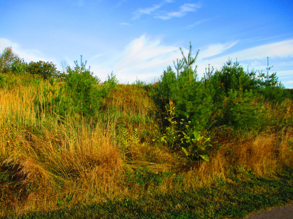
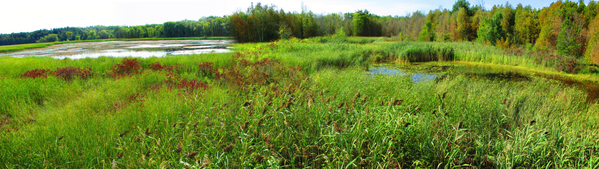
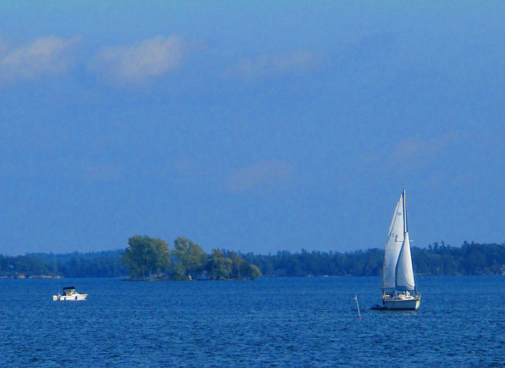
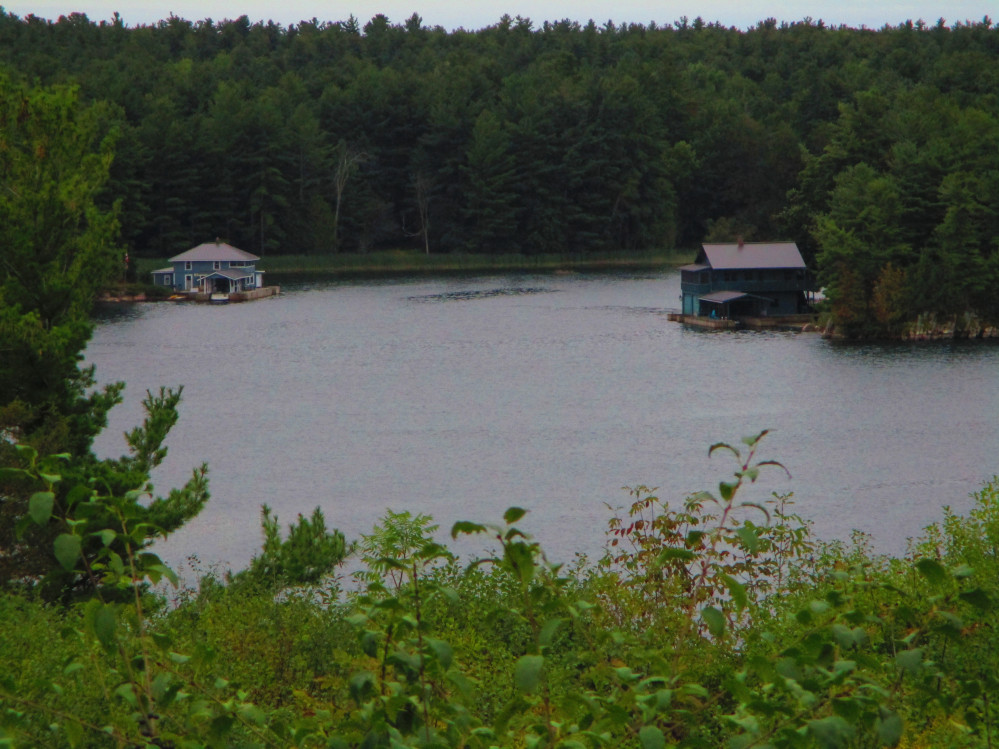
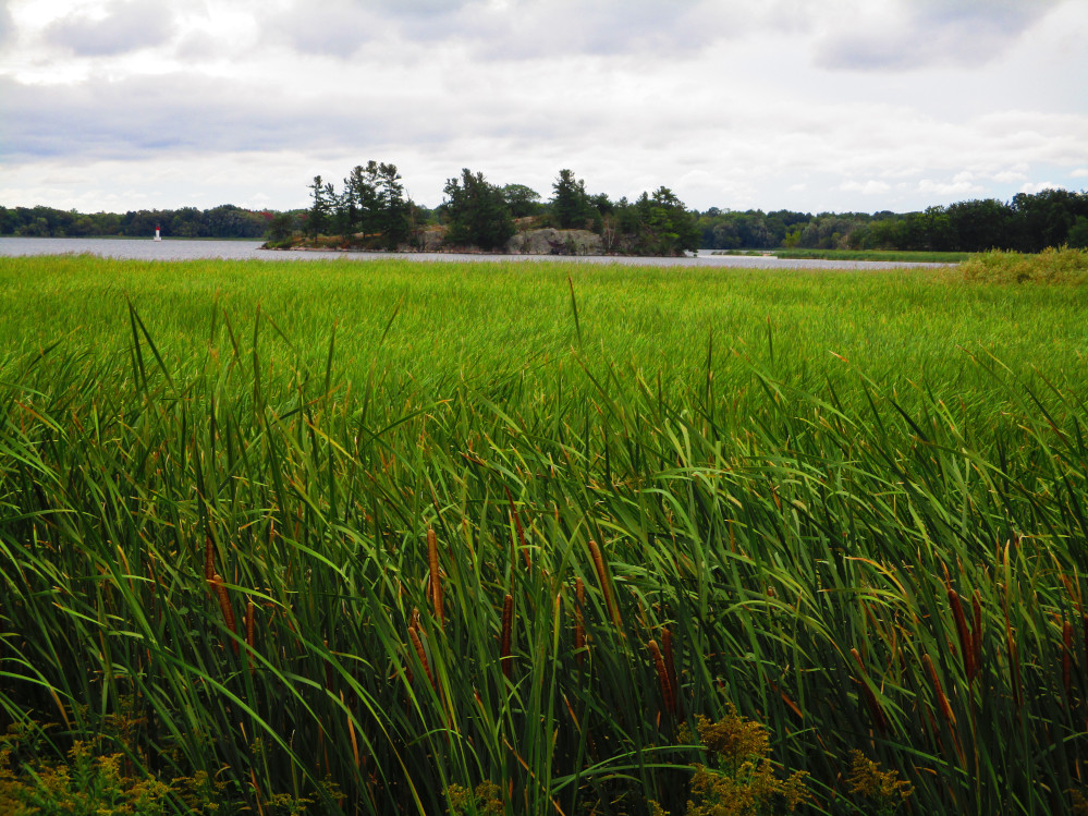
Big
Creek with Knapps Island on the right
|
Lake
Erie near Kingsville
|
Point Pelee
I continue riding on Labour Day and get to the tip of Point Pelee
after paying the fee at the toll booth at the entrance to the
National Park. There is a recreation trail most of the way from the
entrance to the Park to tip of Point Pelee. I ride the trail to the
tip and the road on the return trip so that I will see the beaches on
the west side of the peninsula on the way out and the east side of
the peninsula on the return trip. The east side is more in the lee of
the wind. It has more marshes; whereas the west side has beaches and
sand dunes.
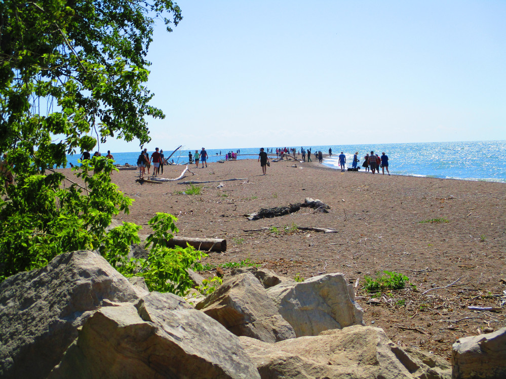
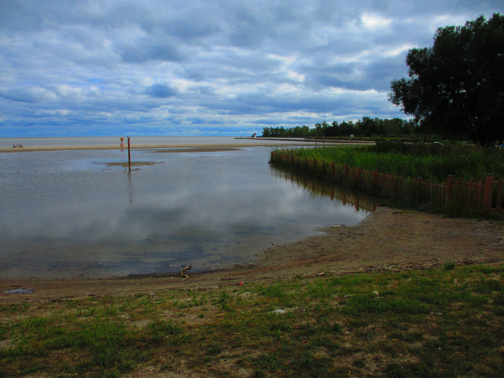
At the tip of Point Pelee, there are many people walking out to
what remains of the Point today. As I see and have read, high water
levels in Lake Erie and the Great Lakes in general have eroded Point
Pelee. I remember a much wider beach out to the Point a few years
ago.
There’s more to Point Pelee Park than the Point. There are
many hiking trails out into the swamps along the eastern shore and
towards the base of the peninsula where it is much wider than at the
Point. I’d love to hike these trails but am sort of hustling to
get to Wheatley Provincial Park today so just look out at the swamp
and take a few pictures from the elevated wooden lookout at the
beginnings of the trails. The land is very flat at the base of the
peninsula of Wheatley Park. It is all fields in which are growing a
variety of crops, many grains, small plants and vegetables.
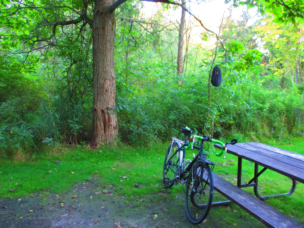
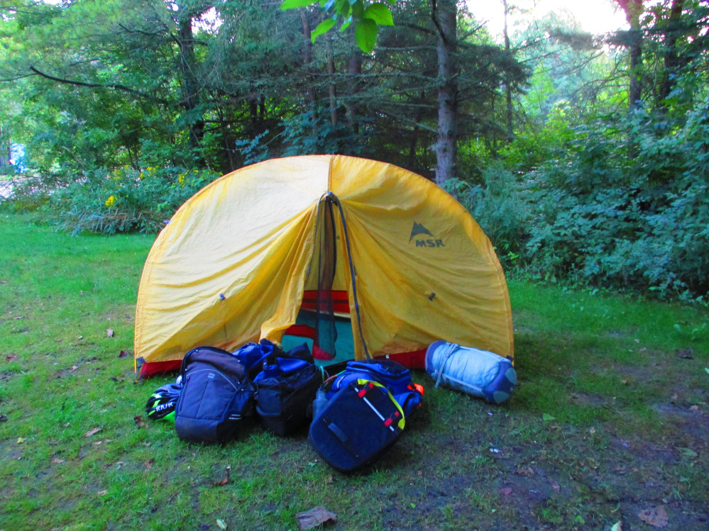
I do eventually get to Wheatley Provincial Park where I camp
overnight after there is pouring rain for an hour or 2. My tent is up
before the rain starts. The tent keeps all my gear dry and washes the
bike for free, eh? I walk around the Park a bit and note it’s
size when walking to where I stayed the last time I was here many
years ago. I see that here, too, the beaches are eroded by the high
water levels.
On the way to Wheatley Park, I encounter another cyclist who
offers a place to stay, but I decide to keep to my plan. He’s a
bit too insistent. After this I stop for a few groceries in a small
store in the town of Wheatley. There’s not much open today.
There was another, larger store and a mall open way back in the
“Leamington Supercentre” in the southern part of
Leamington, near where I took the right turn to go to Pelee Park.
I’ll stop there if I do this trip again though then I’d
have a heavier bicycle on the rustic trail to the tip of Point Pelee.
As I’ll be finding out in the next few days, the large stores
with fresh fruit and vegetables are few and far between on this part
of The Waterfront Trail. The store where I get a few provisions is
for sale. Now, do I want to live here? The proprietor is the only
person in the store. Nothing special. Just the basics. I buy 2 cans
of stew that I end up eating cold just as the pouring rain starts. I
will managed to heat up food most evenings on this trip and sometimes
have rice or noodles, but this is difficult on this day. It has been
a long day, too, and I need to sleep and rest. The strong tail wind
most of the day aided my travel through this almost flat part of
Ontario.
Point
Pelee
|
Point
Pelee
|
Point
Pelee
|
Point
Pelee
|
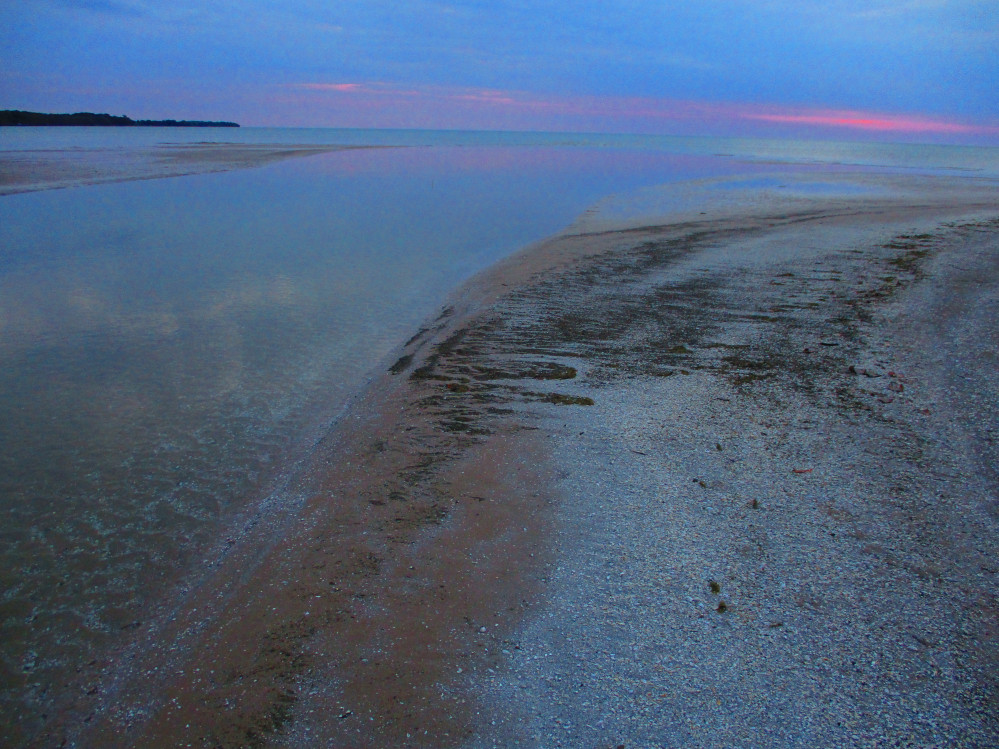
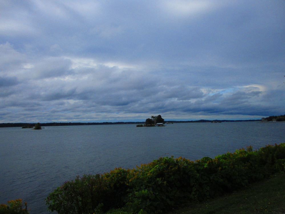
Erieau
The great cycling conditions from yesterday continue
with a moderate to strong tail wind, lots of sun and clouds, and a
warm temperature, but not hot. I continue to take in the farm land
and rural life. Historically, this part of Ontario thrived on tobacco
production. I see some remnants of this, but the time when many
people smoked has passed and tobacco as gold has died. The farms have
adapted to have other crops, oil wells, and large greenhouses. The
latter are like those that one sees in pictures of The Netherlands.
These are for producing fresh, local produce which is desired by
consumers in this era where more are concerned with environmental
issues and a greener world.
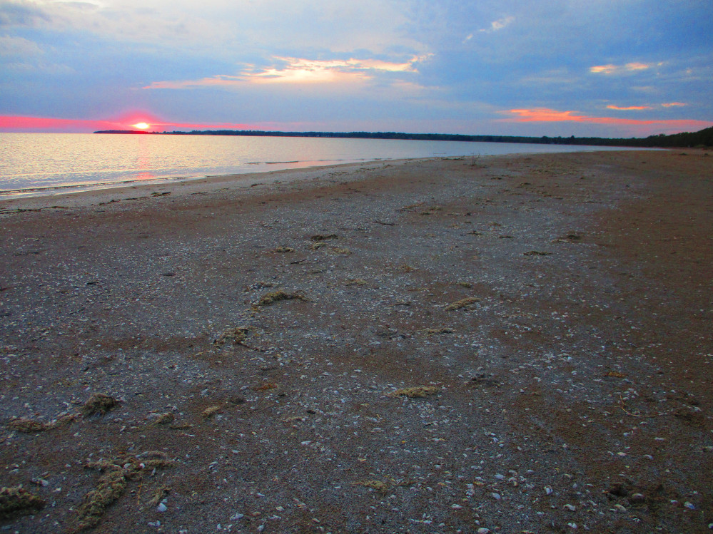
The cottage and tourism life continues in the midst
of the changes in the economy. There are still places like Erieau and
Rondeau where many people go in the summer to enjoy the warmth, the
beach, the sun, and relaxation. In the summer, localities like these
are packed with tourists with more on weekends. There are a few here
today, but this trip is after Labour Day when most children are in
school, and, the general feeling in many workplaces is that summer is
over and it’s time to show up and seriously do some work again.
This leaves resorts like these somewhat empty but still very
enjoyable for tourists like myself.
I encounter a stretch of road near Port Alma where
the road is closed. It’s still OK for bicycles, or at least
mine makes it through. The road is not eroded. It is just considered
unstable for large vehicles. This stretch is right beside large
greenhouses though I think the 2 are unrelated. I’m sure there
is less traffic before and after this segment of closed road as the
detour is quite long. This makes for better conditions for bicycling.
All the drivers, so far, are courteous to cyclists. Maybe this is due
to the recent implementation of a 1-metre rule in Ontario –
cars are required to stay at least 1 metre away from bicycles and
pedestrians.
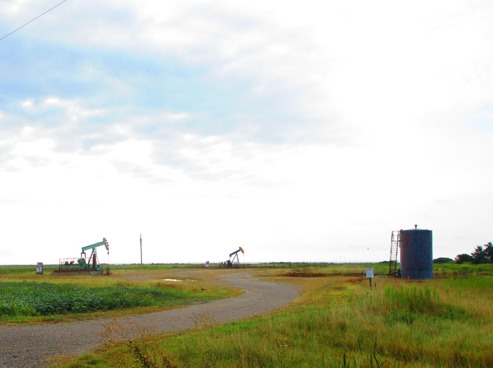
Oil
Wells
|
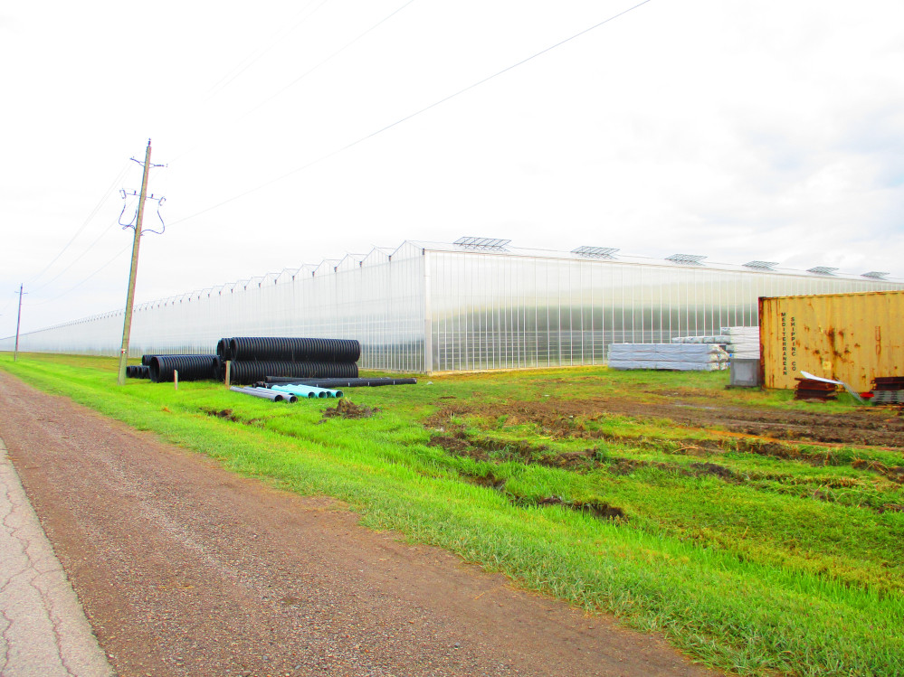
Large
Greenhouses being built near Port Alma
|
Talbot
Trail (Road #3) closed near Port Alma due to high water levels in
Lake Erie making the road unstable for cars.
|
Looking
towards Erieau along Lake Erie
|
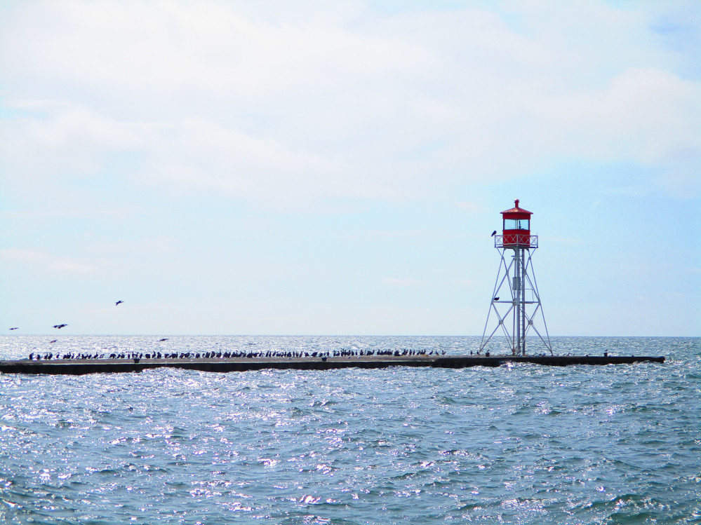
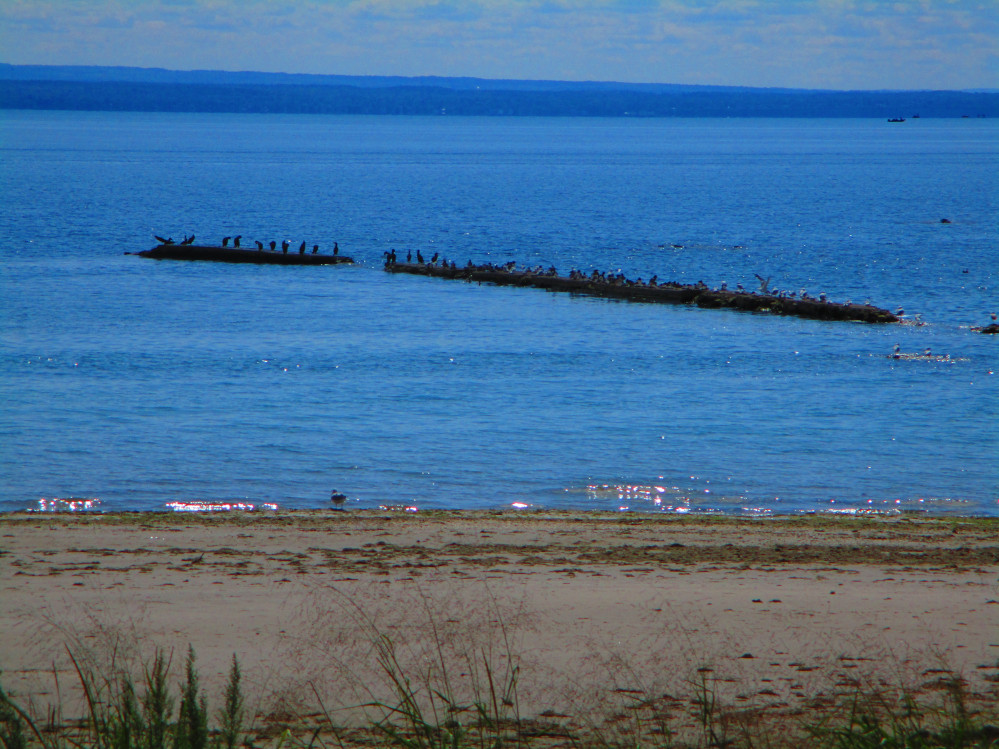
Sea
Gulls and Cormorants at Erieau
|
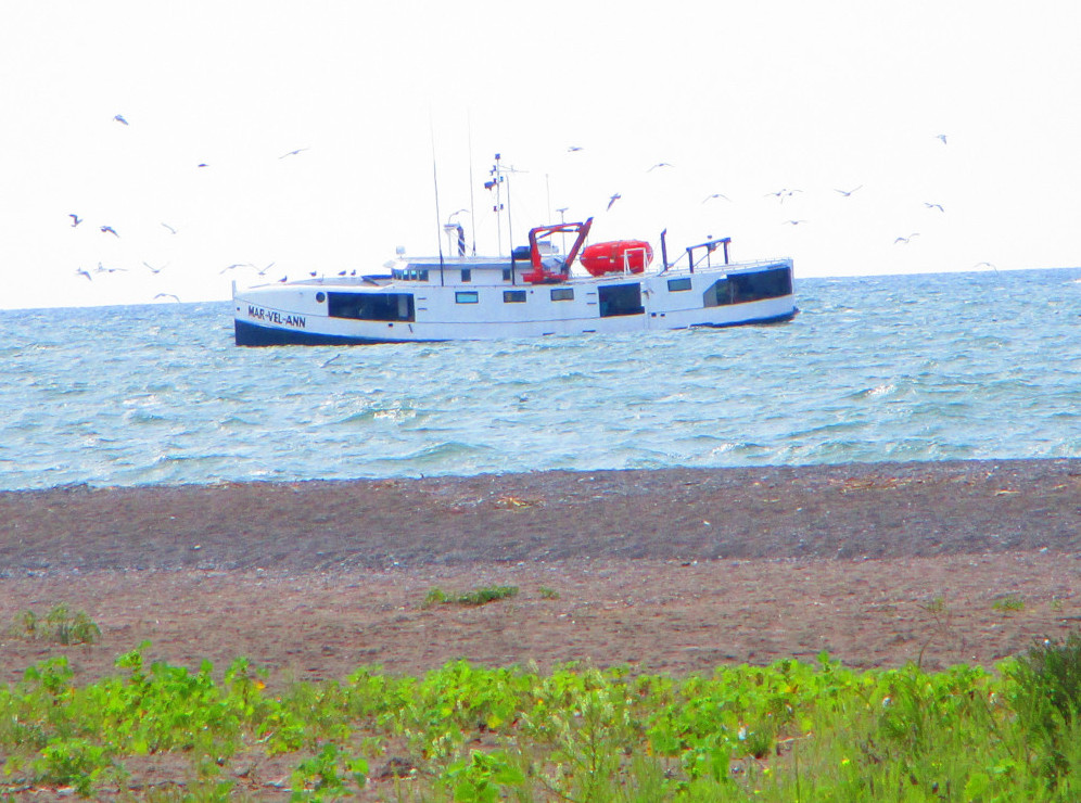
Fishing
Boat at Erieau
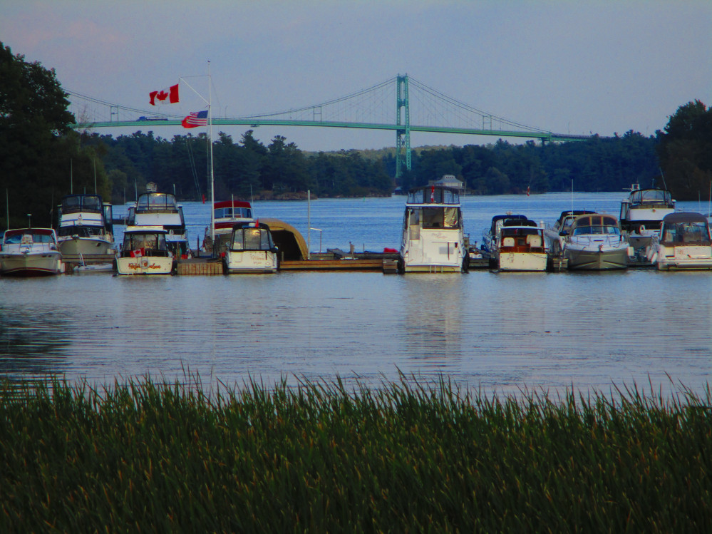
|
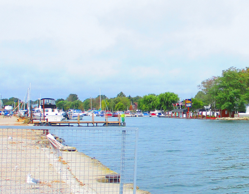
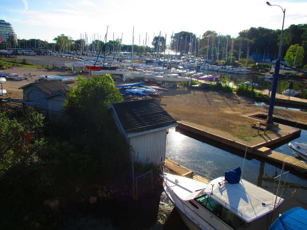
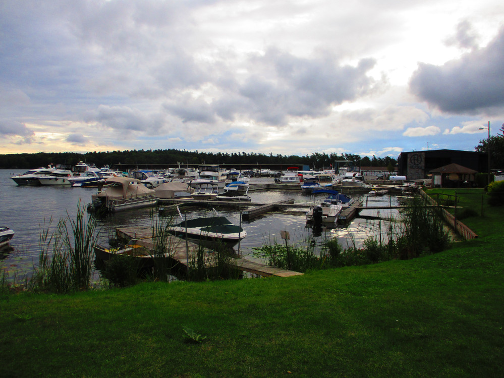
Erieau
Marina
|
Ross
Lane, Erieau
|
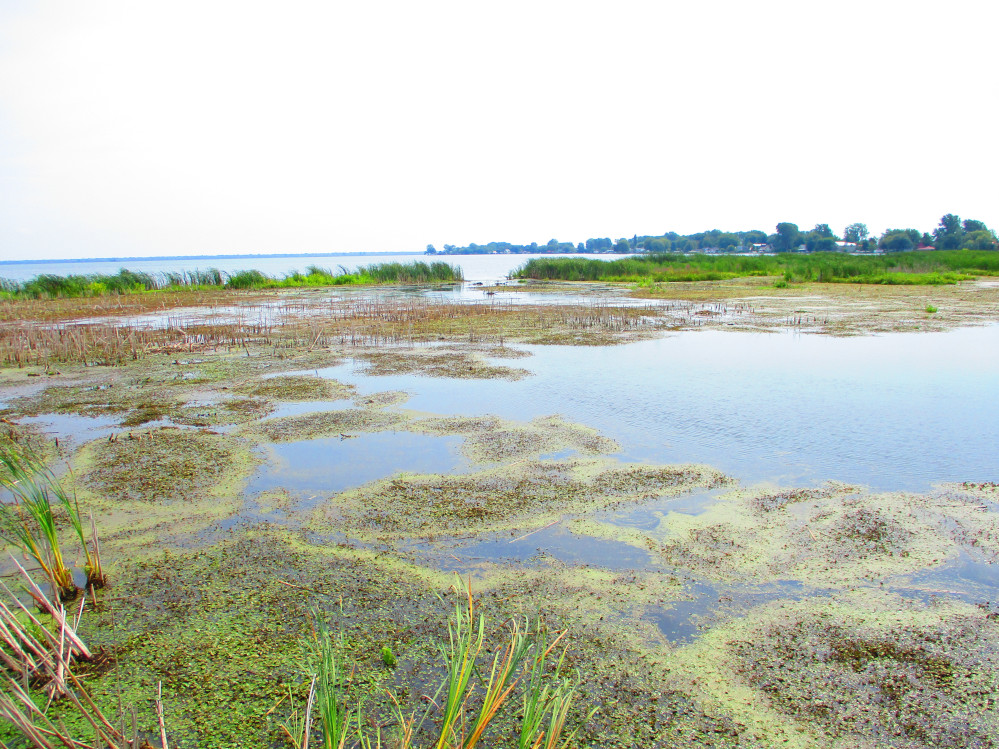
Erieau
Marsh
|
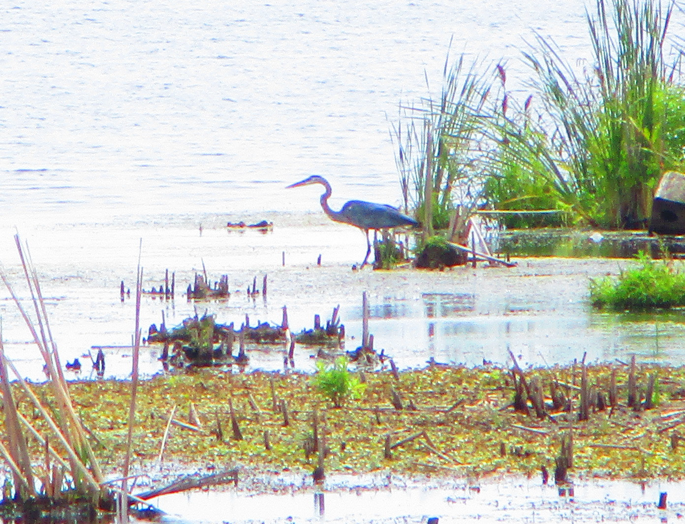
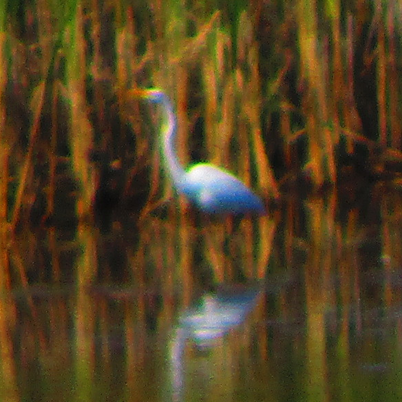
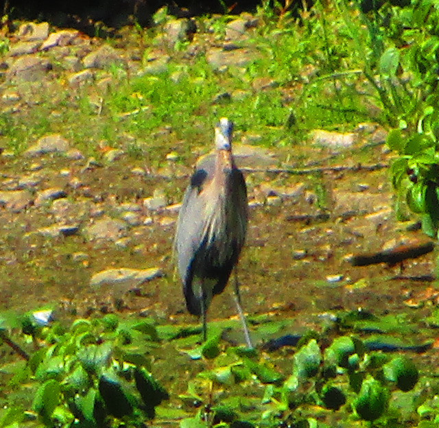
Erieau
Marsh – A Great Blue Heron? A Sandhill Crane?
In the notch that can see in prior picture on the
left
|
Rondeau
Pointe aux Pins is a peninsula running south into
Lake Erie at about 82 degrees west longitude. The majority of land
which comprises the peninsula is owned by the province of Ontario and
is designated as Rondeau Provincial Park that has a 125th
birthday this year.
I get to Rondeau Park in the mid-afternoon after
stopping to eat outside the Bayview Market, the local camping store
just outside the Park gates. I quickly put up my tent in the
campground and leave most of my gear there before taking a side-trip
to the end of the peninsula. It takes a few moments to get used to
bicycling again without carrying so much gear. The bicycle handles
much differently. I also leave my cleated bicycle shoes in the tent
and wear my running shoes.
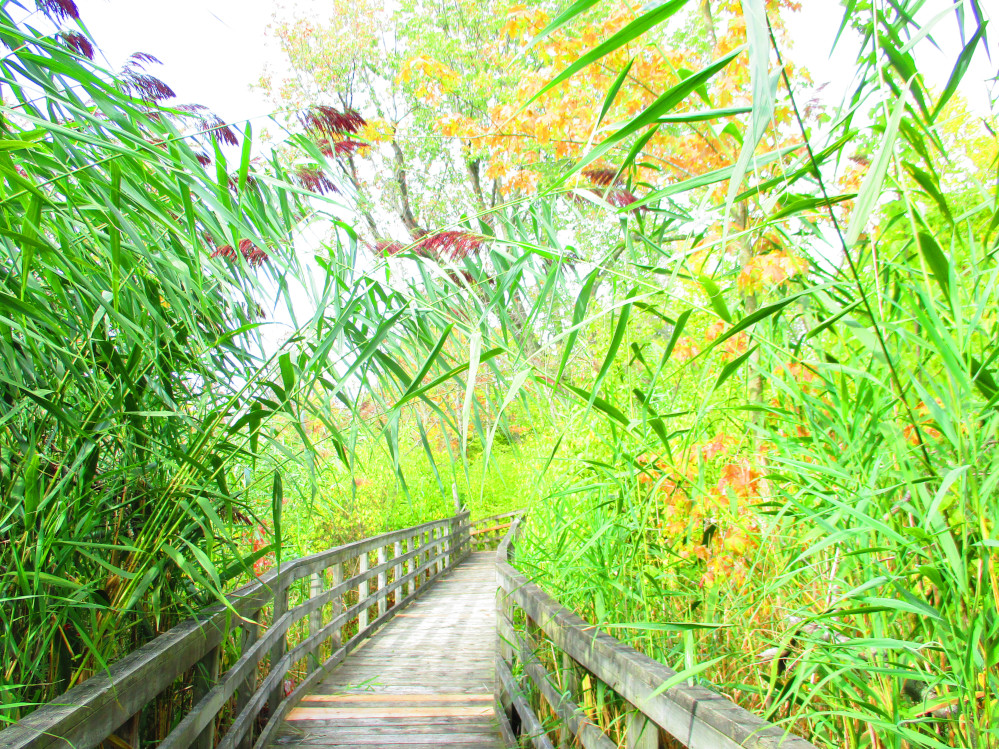
My first stop is Spicebush Trail. My jog of this
trail gets me back into a state of deeper appreciated of the bounty
of nature and the fun of being in it. I like it so much that I stop a
few times to listen to the wind rustling through the leaves and
reeds, and to appreciate the many tones of green along this trail
that goes through a sandy area and wetland behind the beach and has
lots of trees and swamp reeds along it. It is wonderful to once again
hear the wind rustling the leaves of the bushes and trees as I jog
along the trail and experience the warm fall day. There is sand under
foot and boardwalks over the few streams and ponds.
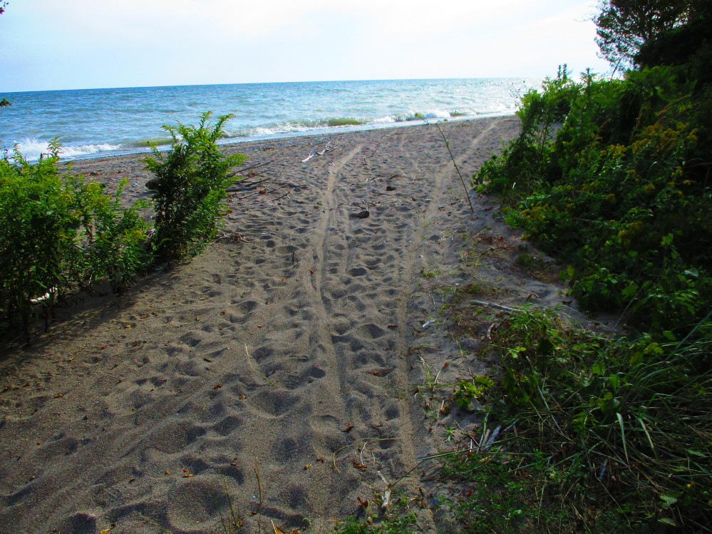
After Spicebush I cycle some more and stop at Beach
10 that is near the Visitor Centre. I look out at the expanse of Lake
Erie and walk the beach. There is sand everywhere and signs
encouraging everyone to help in slowing erosion of this sandy
peninsula by walking on the boardwalks and the plastic matting that’s
over the sand. It’s a real beach that one can dig one’s
toes into. I do more than this. I go in Lake Erie for a quick dip and
feel the current pulling me along the shoreline on this day with its
moderate wind and 40 cm waves. This force pulling one along the beach
is quite a different sensation than the normal onshore push of the
waves. I easily float several yards along the shore.
I survive swimming and ride further to the South
Point Trail that goes to the tip of Pointe Aux Pins. I leave my
bicycle at the trail head and easily walk to South Point. There is
evidence in the sand of other bicycles going all the way. Where I
walk, the trail shows signs of lake erosion due to high water levels
of the Great Lakes. Further along, the water has eroded the trail so
much that parts are washed out and it no longer goes around the
peninsula.
Instead of trying to bushwhack around the peninsula
in spite of the condition of the South Point Trail, I ride back to my
campsite on Lakeshore Road along the eastern shore of Rondeau. This
route takes me by many of the 300 cottages that remain in Rondeau
Park. They all look well kept. There is talk of preserving these
cottages and making this part of Rondeau Park into a heritage
conservation district, but not yet.
I must return soon to Rondeau to walk the Marsh
Boardwalk Trail as I did many years ago, find a Skink, explore
Rondeau Bay, and... well, there are just so many possibilities.
Rondeau:
Spicebush Trail
|
Rondeau:
Beach 10 on Lake Erie near Tulip Tree Trail and Visitor Centre
|
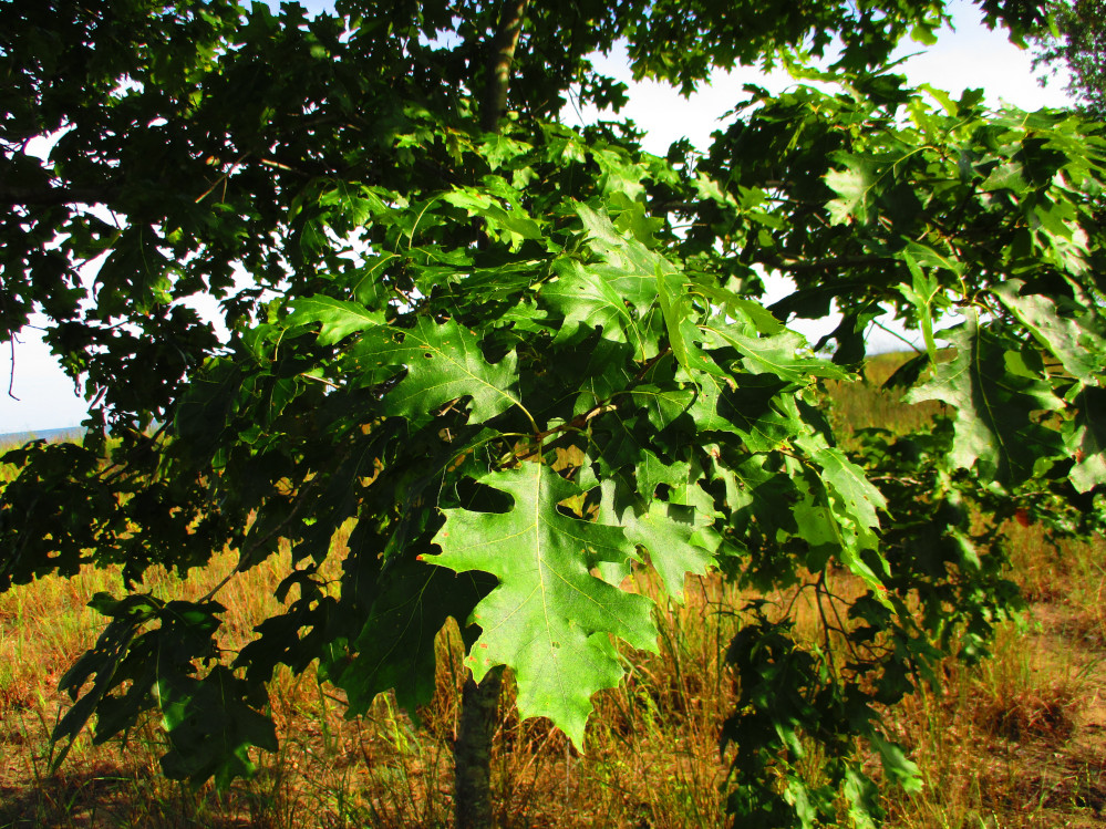
Rondeau:
Oak Tree – in Oak Savanna Ecosystem of the Carolinian Forest
|
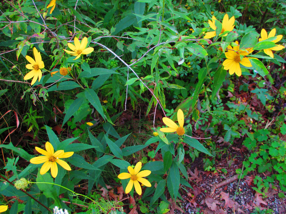
Rondeau:
wild Hepatica flowers
|
Rondeau:
South Point
|
Rondeau:
Historic Cottage
|
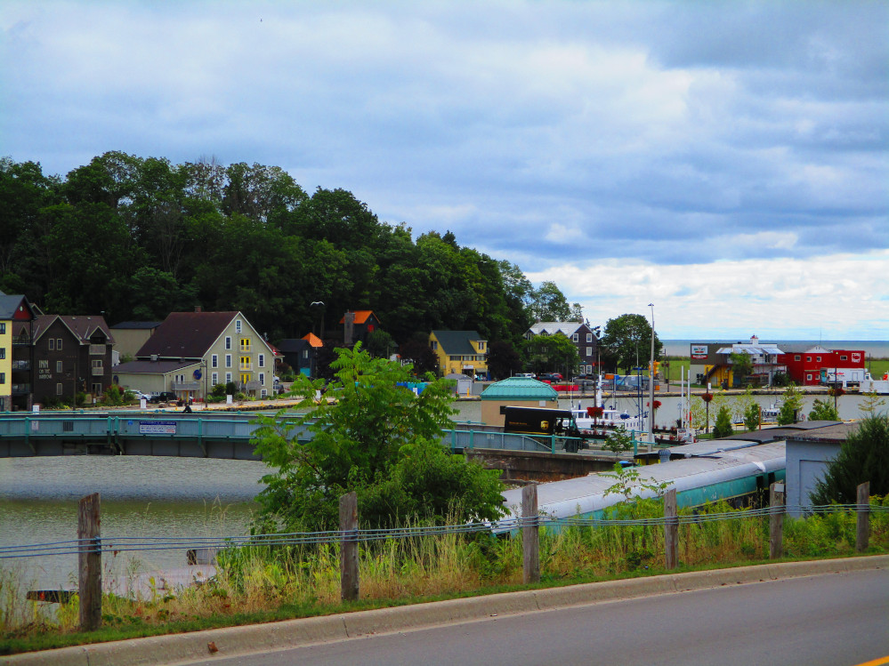
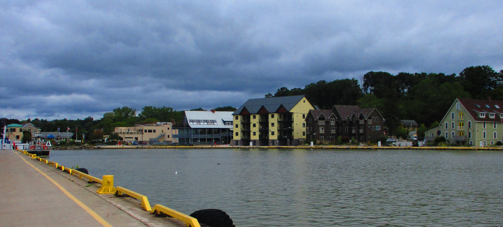
Port Stanley
The tail wind from the last couple of days becomes an
even stronger wind today. Unfortunately, it hinders my travel as the
wind is from the north rather than west as it was yesterday, and
today it blows at me and my bicycle from the left side rather than
the rear. I’m a tough cyclist. I continue.
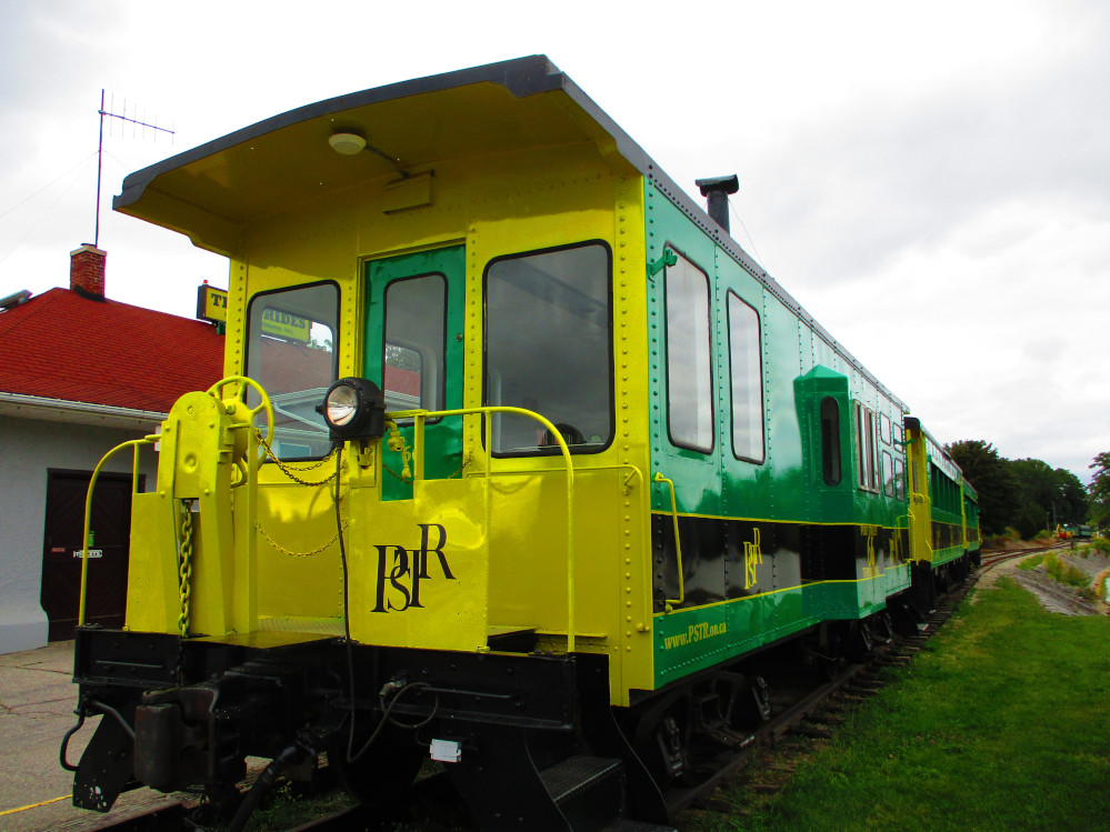
I slow down and walk a bit in Port Stanley. One
feature is the London and Port Stanley Railway – originally
built for trade and commerce transporting coal from Ohio to London
and St Thomas for many years along with other goods. The harbour at
Port Stanley was improved to accommodate the needs of the railway.
This railroad also has a long history of passenger travel to the
beaches on Lake Erie mainly for people from London and St Thomas, but
also from far and wide as the railway links to the former Canada
Southern Railway in St. Thomas. The London and Port Stanley Railway
continues to be a tourist attraction with many daily excursions in
the summer.
My travel today continues on mostly flat land with a
few minor hills. The weather is a bit more averse today with a few
showers and it is chillier throughout the morning and early
afternoon. This makes for fewer other tourists and enables one to
actually hear the birds, eh?
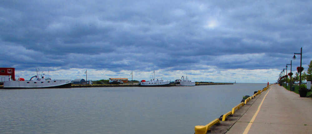
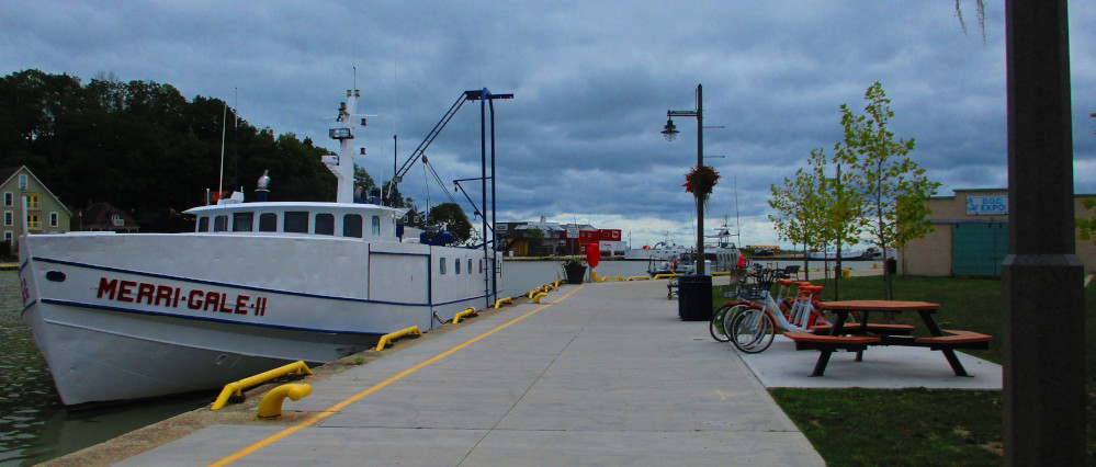
The port of Port Stanley is currently used by many
pleasure boats and for commercial fishing boats that catch walleye
(Sander vitreus) and yellow perch (Perca flavescens). “The
Ontario commercial catch in 2011 was about 26.5 million pounds, worth
more than CA$33 million. In general, 80% of the value of Ontario’s
commercial fishery is harvested from Lake Erie, where the catch
consists mostly of walleye and yellow perch. Although the scale of
the fishery in Lake Erie is impressive, it is only three-quarters of
its historic size. In the face of pressure from over-fishing,
pollution, habitat destruction, and exotic species, it is essential
that we effectively manage the health and subsequent yield of
remaining fish populations.”
https://www.conservationgateway.org/ConservationByGeography/NorthAmerica/wholesystems/greatlakes/coasts/wle/Pages/Commercial-Fishing.aspx
https://www.ocfa.ca/fisheries-industry
CBC radio and television went out with commercial
fishing people from Wheatley that I cycled by yesterday morning. I do
see commercial fishing boats in most of the harbours that I cycle
through. Wheatley is claimed to be the largest fishing community on
Lake Erie
https://www.cbc.ca/news/canada/windsor/cbc-spends-day-lake-erie-fishing-boat-crew-1.4711249
For an interesting history of fishing on Lake Erie see
https://pubs.usgs.gov/unnumbered/81373/report.pdf
The beach in Port Stanley is a popular spot for
swimming in the summer. It is in the west part of Port Stanley and is
separated from the harbour. There’s also Little Beach to the
east of the harbour. Both look like great places to be on warmer
days. Maybe even this afternoon.
Port
Stanley
|
London
and Port Stanley Railway
Started In 1856 To Carry Coal And Passengers; Now
Carries Tourists
|
Port
Stanley: Harbour
|
Port
Stanley: Beach
|
Port
Stanley: Fishing Boat in Harbour
|
Port
Stanley: Looking Back At The Harbour
|
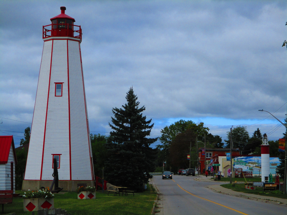
Port Burwell
I continue cycling along after a short stop to purchase some fruit
in Port Stanley. There is a good grocery store in a small mall on the
way out of Port Stanley. By mid-afternoon I’m in Port Burwell
where I stay in the Provincial Park even though the drinking water
supply is temporarily turned off due to a municipal water problem. By
morning, the water is flowing again and the toilets are open in the
Park. See, Port Burwell Provincial Park is really part of the town of
the same name, and is a major user of the town’s water supply
system. The Park does have a few outhouses which get used lots when
the water is turned off. Luckily there were just a few other campers
in the Park this evening. I choose a campsite near the outhouses by
the ball diamond.
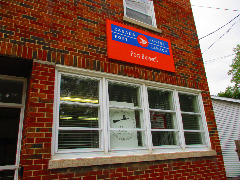
In the town of Port Burwell, I find the first Post Office on my
route. This enables the mailing home of the bag that contained all my
gear during the bus trip from Ottawa to Windsor. There is a box
exactly the right size for the bag at the Post Office. I guess now
I’m destined to ride all the way home and complete this trip,
eh?
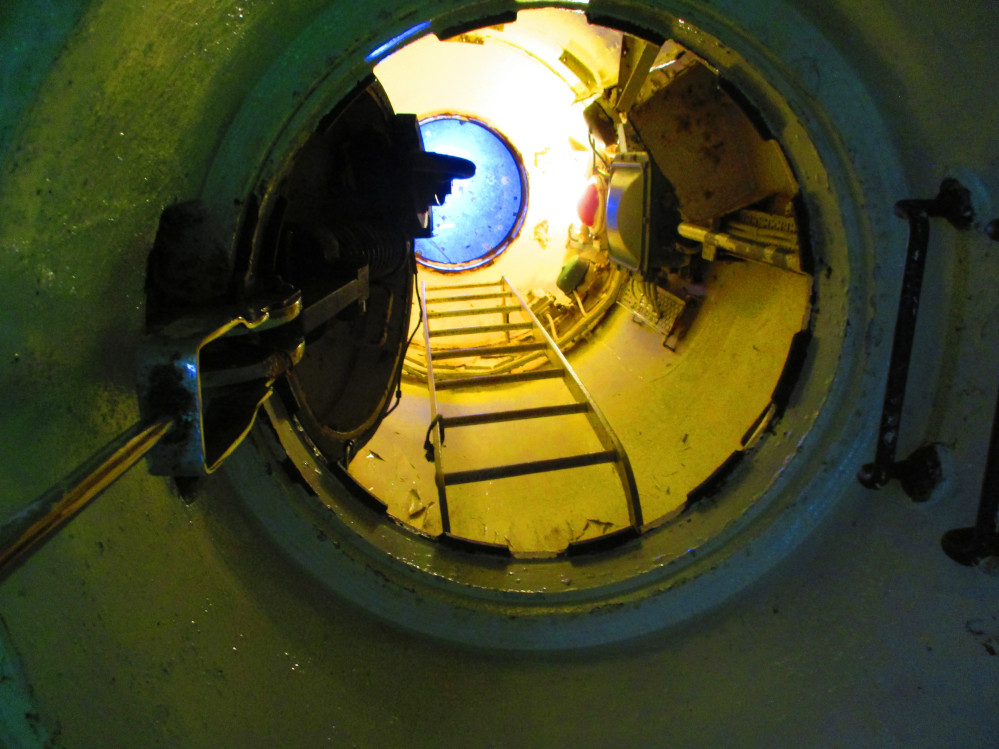
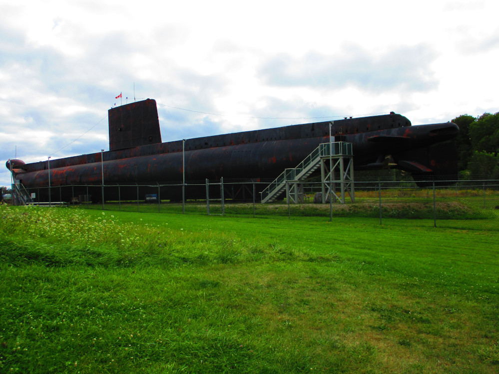
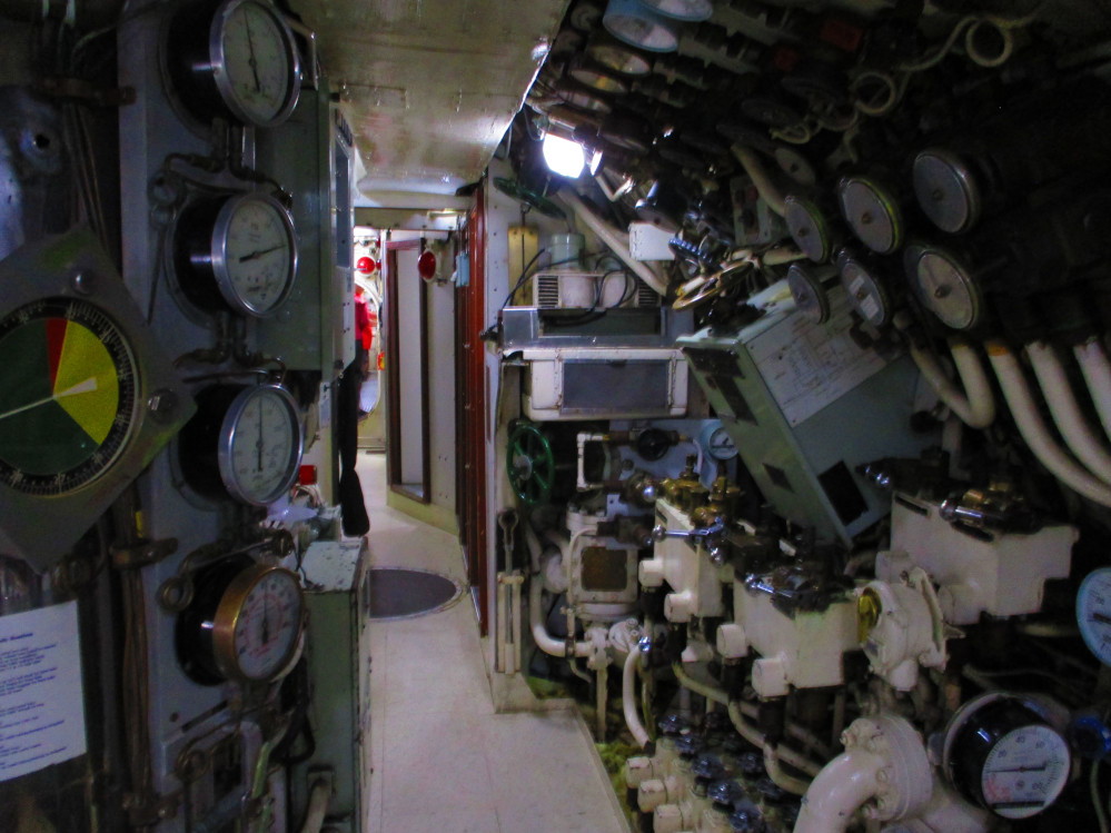
One interesting facet of Port Burwell is The HMCS Ojibwa
submarine. It is to be part of the planned Elgin Military Museum. I
am standing up the hill taking a picture. 2 other tourists walk by
and said Hello. They ask if I new how to get into the submarine. My
plan, at that point, is to just take a picture and move on. I think
at least one of them has a military back ground and is interested in
the lives of his comrades. They then proceed to enter the front of
the submarine and I follow, as we have just walked down a hill to the
back of the submarine so missed talking to the volunteer at the
parking lot on the other side of the submarine. So, that’s how
these other tourists lead me on to another experience and having a
new perspective. I now have pictures of the interior of the submarine
and have a better grasp of the fate of Canada’s sub-mariners
during the Cold War just a few decades ago.
It’s fortunate that I meet these folk to lead me into the
submarine as it closes for the day just as we escape out the back.
Spies, eh? We learn lots and take many pictures to report back to our
handlers at headquarters, eh? One of the other tourists does know a
lot about military equipment. He chats continually about it as we go
through the submarine. Escape is difficult once one becomes
encompassed. We do talk a bit with the volunteers as we leave. One of
the other tourists is quite interested in the military and knows
quite a bit about this submarine and how it compares to others. This
is definitely a modern relic as it was launched in 1964. The town of
Port Burwell saved HMCS Ojibwa from the re-cycle bin in hopes of
attracting tourists. It appears to be doing that in it’s second
life.
Port
Burwell: Flooded Beach
|
Port
Burwell: Robinson Street
|
Port
Burwell Post Office
|
Port
Burwell: HMCS Ojibwa
|
Port
Burwell: HMCS Ojibwa
|
Port
Burwell: HMCS Ojibwa
|
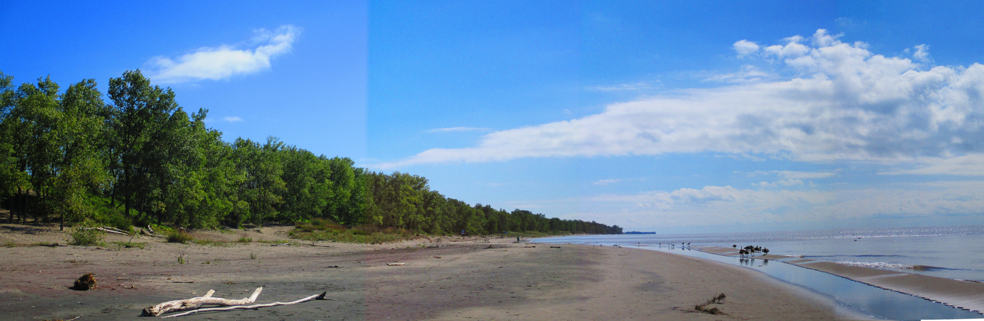
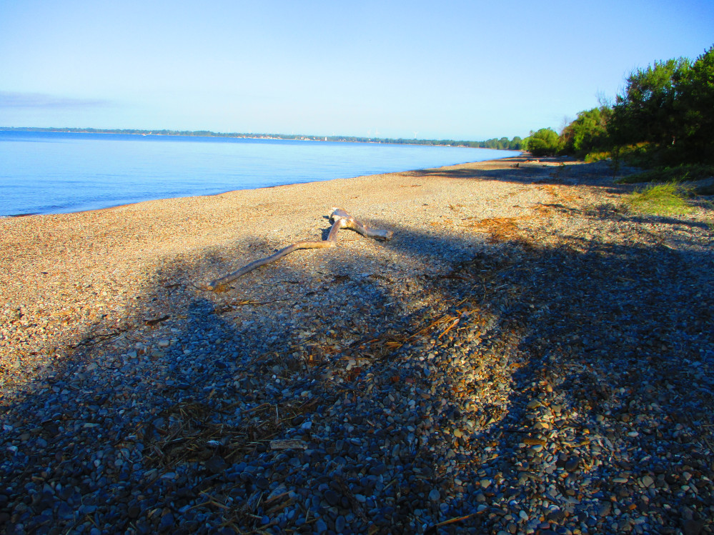
Long Point
The sun and warm weather is back with the trip again
today. Yesterday morning was just a short reprieve to remind us of
the coming winter? This IS Canada, eh?
Shortly after Port Burwell is Long Point. I am there
by mid-morning. I again go to the beach and have a short swim. It’s
just so exhilarating to swim in such a large lake with a long, sandy
beach that appears to go on forever, or at least, to the horizon.
It’s such a great place. I almost stay another night here and
walk the beach. I recommend it.
On my way to Long Point Provincial Park and on the
return trip I stop for a few minutes to take in Big Creek National
Wildlife Area. I again feel the draw of nature, the number of colours
of green, the many kinds of waterfowl, and the expanse of the local
marshes. In the National Wildlife Are, Phragmites are controlled
whereas, they are not on the other side of the highway. One does
notice the difference.
Travel is mostly very flat in these parts, but there
are these hills a few kilometres east of Long Point. These are the
largest and longest steep uphills of the trip. I end up walking part
way up one hill as to not ruin my stamina for the rest of the trip.
These killer hills are just after Turkey Point Provincial Park near
Normandie and Fisher’s Glen. It’s the steepness, more
than the length, that can ruin a trip, but these hills are long
enough as to take more than 10 swift cranks of the pedals on the
bicycle. Even 100 won’t do it. By then, one may be half way up.
Looking
towards the tip of Long Point
|
Big
Creek National Wildlife Area, Long Point
|
Long
Point: Phragmites
|
Port Dover
Port Dover is known for it’s motorcycles or at least as a
gathering point for those who have motorcycles. I was here once on a
Fridaty13th and the place was packed with motorcycles. I
timidly leave these folk out of my camera’s view finder this
time around.
There are other interesting facets to Port Dover as can be seen in
these pictures. I am a bit rushed by this time as the time is
mid-afternoon and I still have a ways to go to the next campground in
a Provincial Park. There’s a small beach in the town of Port
Dover. I go there. It is well kept.
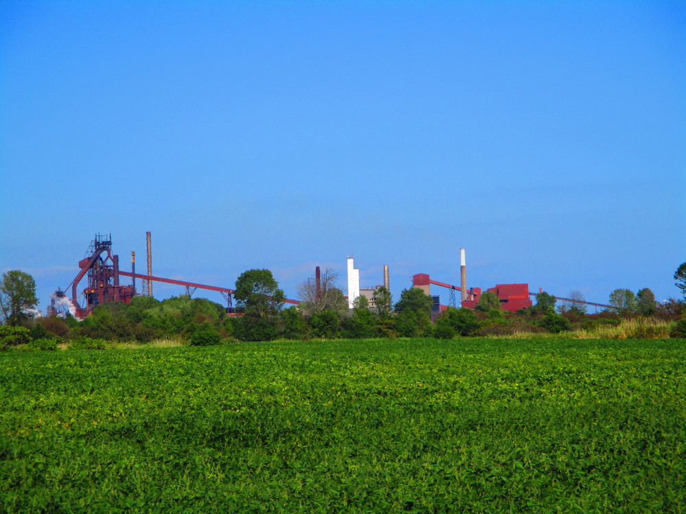
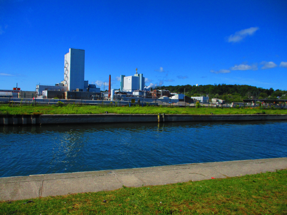
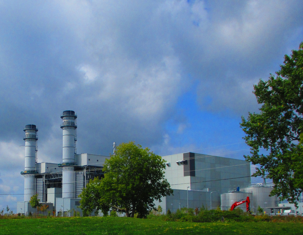
Soon after Port Dover is Nanticoke. This is an industrial area
with a steel plant, oil refinery, and electricity generating station.
I bicycle through some of this industry.
Nanticoke is the location of the Nanticoke Generating Station for
electricity of OPG Ontario Power Generation. Wikipedia points out
that this was coal powered and one of the largest generators of
greenhouse gas in Ontario. The plant became solar powered in April
2019 with a capacity of 44 MW, or about 1% of it’s former size
of 4000 MW.
Wikipedia tells us other interesting facts about this site’s
history: “The Nanticoke Generating Station is built on the site
of the Battle of Nanticoke, where in 1813 the Norfolk volunteer
militia routed a band of American marauders who had been pillaging
area farms and terrorizing the country, an exploit that inspired the
British military forces and the people of Upper Canada during the War
of 1812. The site was designated a National Historic Site of Canada
in 1924.”
Port
Dover harbour
|
Port
Dover: Lighthouse Festival Theatre
|
Port
Dover
|
Nanticoke’s
industrial area
|
Rock Point
After Port Dover, I head for Selkirk Provincial Park
where I plan to camp. I get there and find it is closed for the
season and there is an official looking person parked out front. I
decide to bike through Dunnville to my next potential camping spot,
Rock Point Provincial Park. I stop and mount and turn on my bicycle
lights for the last few miles on the access road into the Park. I get
there at 8 pm after travelling about 100 miles. I still camp near a
washroom and shower and heat up some food to eat.
I am ready to travel at the usual time, early the
next morning, as the Sun comes up. Some deer greet me as I leave the
campground. They like this park as much as I do. First I visit the
beaches at Rock Point. It’s name fits. Rock Point is a good
park overall with many trees and trails and rock beaches for
swimming. It’s quiet and peaceful. Not quite as great as Sand
Banks and Rondeau, say, but a quiet and pleasant place to be at the
mouth of the Grand River.
Grand
River, Dunnville
|
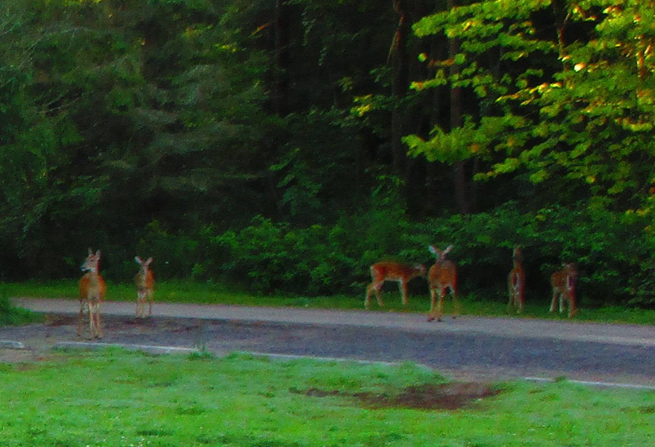
Deer
enjoying Rock Point Park in the morning
|
Rock
Point Provincial Park
|
Rock
Point Park
|
Rock
Point Campground
|
Rock
Point Campground
|
Fort Erie
I cross the Welland Canal in Port Colborne and then
find a nice, straight, paved bicycle trail. It goes from Port
Colborne to Fort Erie. I take it part of the way. It is the fastest
way to travel by bicycle on this route. There are lots of other
cyclists on it. Everyone from racers to casual riders. Many are doing
their daily fitness. I talk to one. He is a retired consultant from
Toronto who lives here now. He’s enjoying retirement. He tells
me tall tales of other riders who he has met on this trail and how
almost all through riders that he’s met take the trail, well,
duh, yes, if that’s his route, too, eh? I encourage him to ride
the Waterfront Trail from end to end like I am. He has excuses. I
don’t. I’m doing it. He continues on the trail when I
leave it to see some of the communities along the way like Crystal
Beach and the shoreline of Lake Erie that is almost all taken up by
private homes and cottages.
I stop at the Mather Arch that is dedicated to the
architect of the Peace Bridge between Fort Erie and Buffalo, New York
and the continued peace between the 2 countries. It’s in much
better shape than when I last saw it as it was restored in 2001.
A couple of blocks away is a bicycle store that has
great ratings on the internet, Steve’s Bicycles and Repairs.
Apparently, Steve knows how to fix almost anything and does a great
job. The store is also conveniently located, right on the Waterfront
Trail and the Niagara Parkway where there is a shoreline trail from
Fort Erie to Niagara Falls and Niagara-on-the Lake.
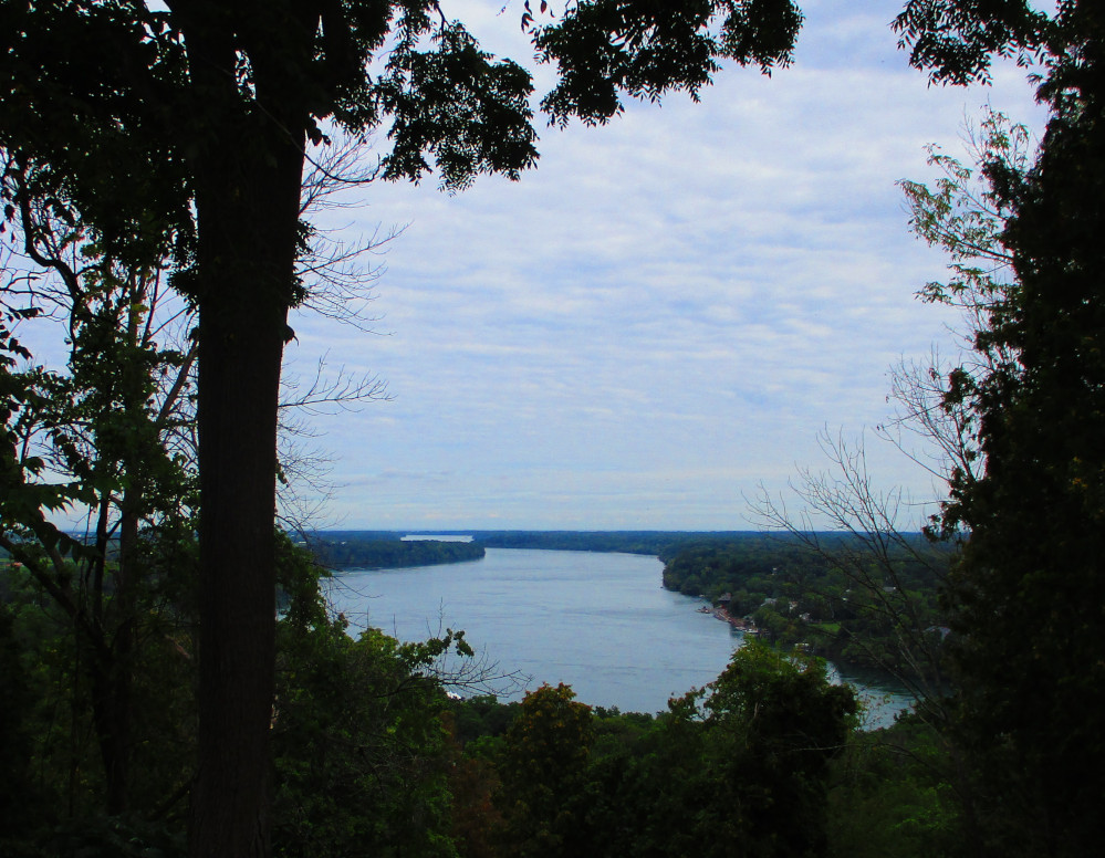
There’s a sign near by about the most recent
ferry landing connecting Fort Erie and Buffalo. Ferries continued
until 1950 even though the Peace Bridge was built in 1927. The
Niagara River is quite wide at this point in comparison to it’s
width at Niagara Falls where one can almost throw a baseball across.
Looking
out to Lake Erie along Welland Canal in Port Colborne
|
Bridge
Over Welland Canal, Port Colborne
|
Birds
Enjoying Lake Erie – Cormorants and Sea Gulls – with
shore of New York in the background
|
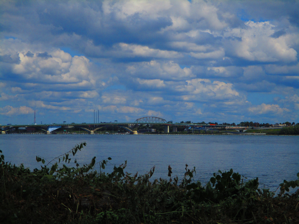
Peace
Bridge to Buffalo From Fort Erie
|
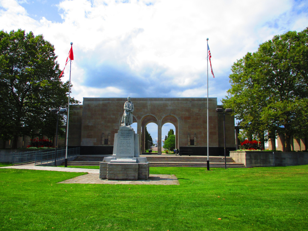
Mather
Peace Arch, Fort Erie, with War Memorial in front
https://www.niagaraparks.com/visit/weddings/mather-arch-park/
|
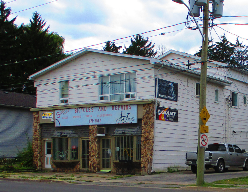
Steve’s
Bicycle Store, Fort Erie, just downstream from the Peace Bridge On
Niagara Parkway
|
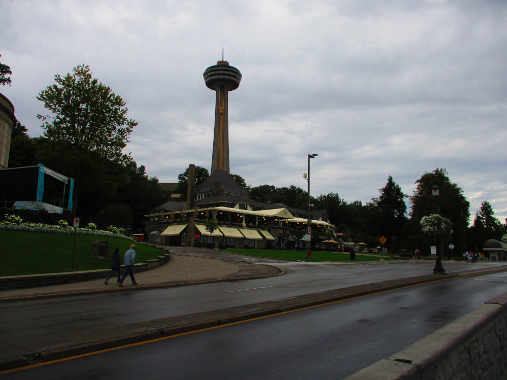
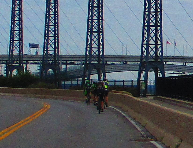
Niagara Falls
So far, the weather today is a wonderful continuation
of the recent sunny and warm conditions of recent days. As I travel
down the Niagara River, rain starts, clouds lower the ceiling in the
sky, a hazy mist descends on us all, and the temperature drops a bit.
This enables better pictures of THE FALLS between the rain drops, eh,
as there are fewer tourists to get in the way. Before getting to the
Falls, I note the century-old old barge above the Falls, the iron
scow. It’s hundred year anniversary was just a year ago on
August 9, 2018. The iron scow has since moved, on Halloween 2019. It
is now 50 metres closer to the brink of the Horseshoe Falls.
https://www.cbc.ca/news/canada/hamilton/iron-scow-horseshoe-falls-1.5344845
The wind is also blowing in a direction towards the
Canadian shore, right at the falls. This, too, chases away many
tourists. For me, time for a rain coat, but, then, I too experience
not being able to see much since the haze is so thick. It’s
great to see the Horseshoe and American Niagara Falls again when I’m
out of the haze. As usual, there’s an enormous amount of water
flowing over them. Ah, the power of nature. I get a good picture of
the Falls with a telephoto lens, from a few hundred metres away, when
the rain stops momentarily.
I’m staying today at the HI Hostel. I find it
near the second bridge downstream from Niagara Falls with the aid of
the Maps.me app on my phone. Everyone is happy to see me at the
Hostel. I soon put my bicycle in the basement and wash the few
clothes that I have. I even manage to help out a bit by emptying the
dehumidifier in the basement where I’m washing my clothes. I’m
in a 4 person room on the second floor with 1 other male person, this
being the slow season of hostel use. The Hostel is undergoing a
change of short-term staff. There are new people from The
Netherlands. There’s another person there from my home town of
Ottawa. There is chatter about bicycling in the Niagara area and how
it compares to cycling in The Netherlands. The Niagara HI Hostel
rents bicycles. The Niagara region is a great place to bicycle with
many trails. Trips can be enhanced by integrating them with city
buses. One common trip is to ride a bicycle to Niagara-On-The-Lake
and put the bike on the rack of a city bus for the return trip. There
are many good tourist sites to see along the way, but there is a big
hill up the Niagara Escarpment on the way back.
I cook some food in the evening and talk to a man
from The Netherlands. He’s been out riding around and likes the
area. He’s looking for more challenges.
Breakfast is included in HI Hostel fees so I fill up
with lots of coffee and toast and cereal in the morning. This is
unlike many morning when I have a couple of granola bars so I can get
going quickly. I then stop later in the morning to eat, potentially
at a McDonald’s for breakfast of an egg McMuffin though the
latter have been scarce, so far, on this trip? Today, I drink lots of
coffee and am about an hour later hitting the road. That’s OK.
I also chatted to other people about their experiences on the road
and their current plans.
Once I get started I follow the Niagara Parkway to
Niagara-On-The-Lake. The Sun works hard on being seen this morning as
there is still haze from last night’s storm and mist along the
Niagara River. All this clears after an hour or two and I have is a
nice, bright, sunny day.
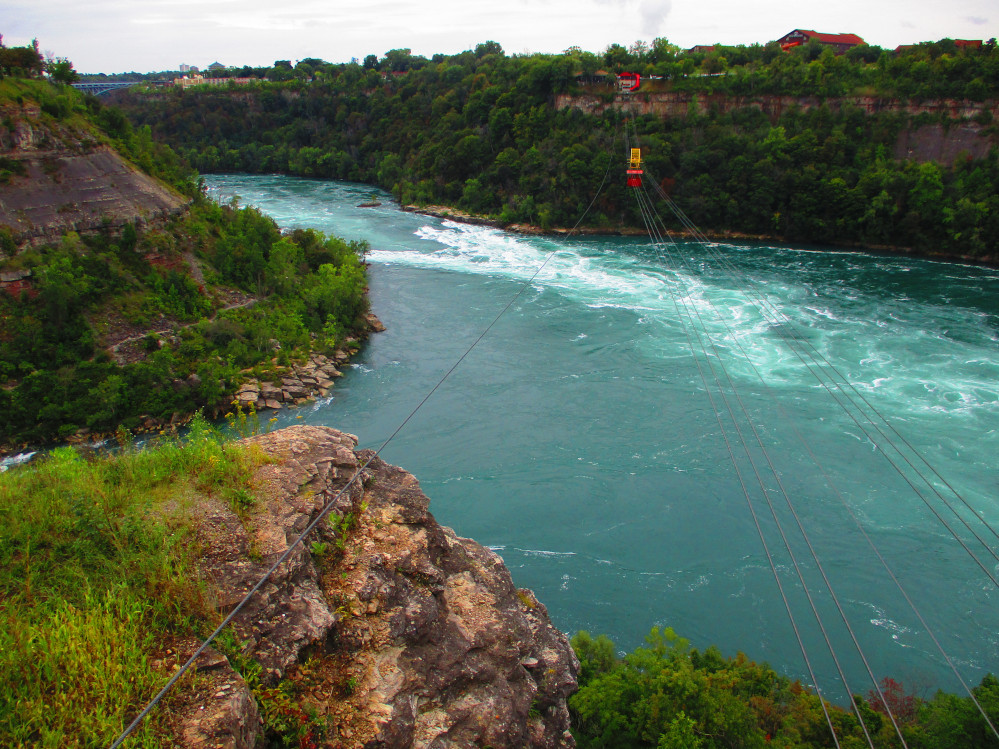
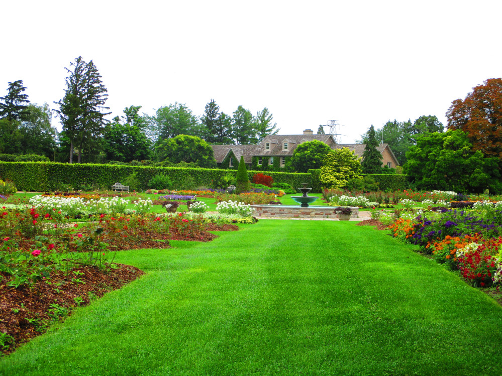
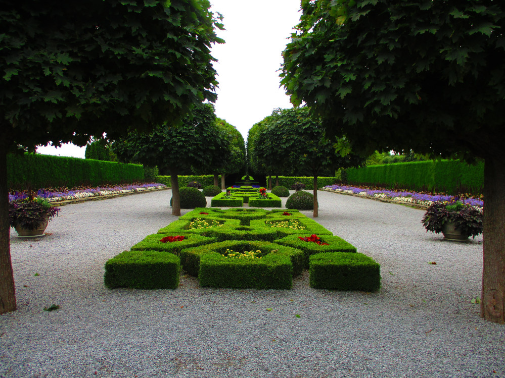
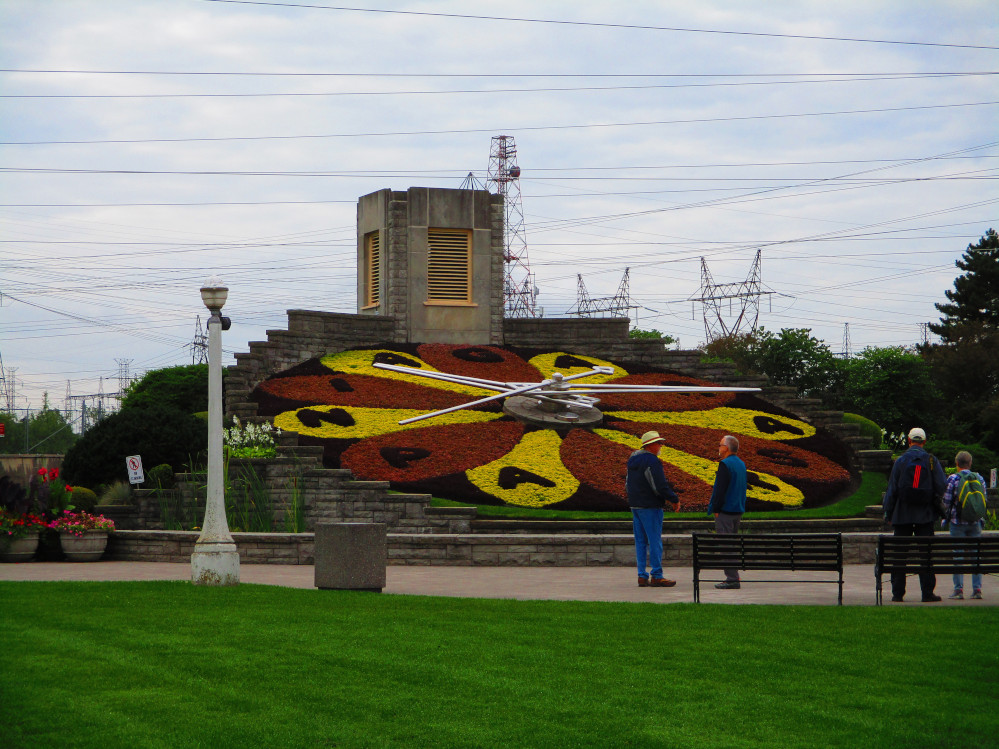
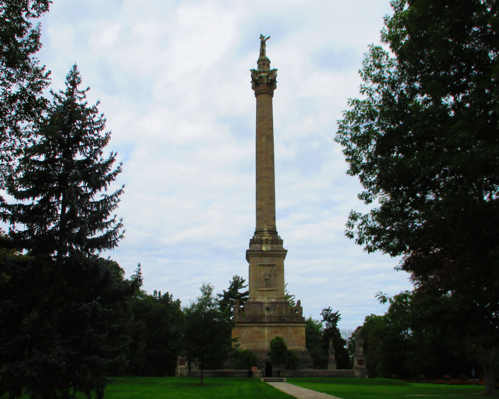
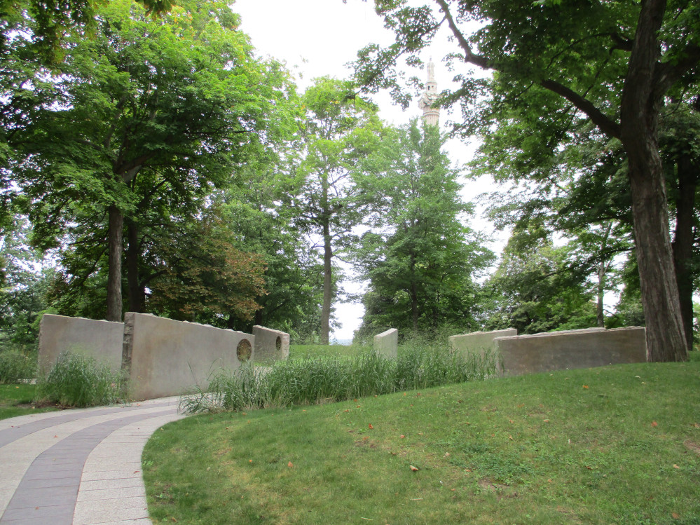
Along the Niagara Parkway, I stop and look at the
Whirlpool Rapids, the Niagara Parks Botanical Garden, the Floral
Clock, and Queenston Heights where I see the Brock Monument, the Six
Nations and Native Allies Commemorative Memorial, and Laura Secord’s
monument. These are all in memory of contributions in the War of
1812, or Canada’s war, over 200 years ago, to continue being a
nation independent of the United States. Canada is an ally of United
States in the current era. How times change, eh?
We still have these memorials at Queenston Heights:
At the end of the Niagara Parkway, I am in
Niagara-On-The-Lake where I have bicycle problems. Something is
rattling loudly. Some bolts are loose and some are lost. Luckily, I
have a few new ones in my repair kit and am soon on my way.
In Niagara-On-The-Lake, I ride by Fort George
National Historic Site and down the main street named Picton Street
where I note the Memorial Clock Tower. The latter is a memorial to
local people who were killed in World War 1. Fort George was built in
1796 and played an important role in War of 1812. I visited it many
years ago, but am pressed for time on this trip so just take a quick
picture. There are lots of possibilities in this tourist town.
Wikipedia indicates that it has the oldest surviving golf course in
North America.
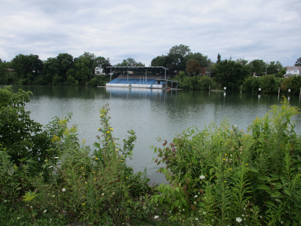
St Catharines
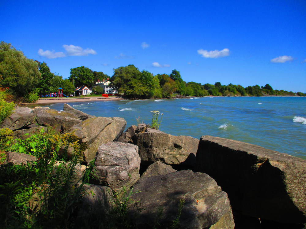
I was soon out into a rural area again. There are many farms. This
region is known for it’s production of fruit and market
gardening of vegetables. Some farms grow grapes and have wineries.
In St Catharines I go by one of Canada’s oldest, premier
rowing courses. It is more than a century old and has been renovated
a few times. This is the location of the annual Royal Canadian Henley
Regatta and has been used for other international rowing events as it
meets FISA class A standards. I stop for a break from the cars and
eat a bit and take a few pictures.
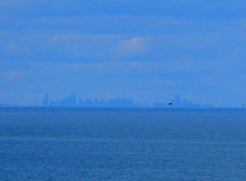
This part of the ride is on roads beside or close to, Lake
Ontario. At one point, Toronto is visible across the Lake. So close,
but yet so far. I’ll be there tomorrow. Most of the route has
paved shoulders and the amount of traffic dwindles after St
Catharines. At one point, I tire of riding beside Lake Ontario and go
inland to Main Street or Road 81 that becomes highway #8 close to
Hamilton. This is an old local road. I ride through Grimsby, Winona,
and Fruitland. I see many small businesses, farms, and agricultural
processing facilities including that of ED Smith.
The weather improves gradually during the day. When I start in the
morning there were still heavy clouds, remnants from last night’s
storm. These gradually thin out so I see the Sun from time to time.
The temperature is warm, but not hot. It’s just great weather
for bicycling.
Royal
Canadian Henley Rowing Course on Martindale Pond, Port Dalhousie,
St Catharines
|
Royal
Canadian Henley Rowing Course, Port Dalhousie, St Catharines
|
Toronto
Is Just Across Lake Ontario
|
Grapes
for local wineries
|

Huge
greenhouses
|
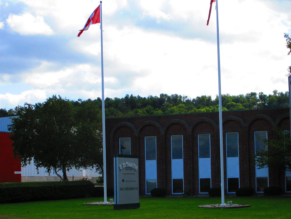
ED
Smith Foods Ltd – jams, jellies, pie fillings, etc.
|
The West End of Lake Ontario - The
Golden Horseshoe
Hamilton
The trip now enters the large metropolitan urban area of The
Golden Horseshoe at the west end of Lake Ontario.
I continue heading towards Bronte Creek Provincial Park where I
plan to camp this evening. In Hamilton, I turn right on Grays Road
and take it to Lake Ontario where there is a wide bicycle path that
goes all the way to Burlington. There has been a path here for many
years. Now it is wider with a segregated area for bicycles. It’s
great to see so many out today, all kinds of users from children just
learning to racers out for a leisurely spin. There are crowds of
people having picnics in the continuous parks along the Hamilton lake
shore. There are also enthusiasts in the Wild Waterworks aquatic
facility and pool in Confederation Beach Park. It’s crowded on
this warm Saturday in September. These parks seem to go on forever
and ever. I like it. It is great shoreline to experience nature along
and there is a tail wind so it’s all quite enjoyable. There are
Confederation Beach Park, Skyway Park, Hamilton Beach, Dieppe
Veterans Memorial Park, and maybe a few more.
I continue riding along a bicycle trail along the waterfront part
way through Burlington through Waterfront Park. Then, I take
Lakeshore Road to Bronte Road. There are massive estate homes all
along this part of the lake shore. Many have been here for many
years. Burlington is historically a rather upscale place, eh? Or, at
least in this part along Lake Ontario. I do stop and purchase some
food in a Food Basics store in a small shopping centre. Shortly
afterwards, I stop at Burloak Waterfront Park and have one last view
of Lake Ontario for today. After a few more blocks I find Bronte
Road. At first it is narrow; then it gets wider and I see a bicycle
path along the opposite side of the road. I take the path. Somehow, I
go too far on Bronte Road, and then ask a few people who are out
walking for directions and look at the Maps.me app on my phone and
remember being here before. It’s not far and there is a bicycle
path beside Bronte Road so I can easily hesitate, stop, and check
maps.me for directions. Eventually, I even see a small sign to Bronte
Creek Park’s camping area and head that way along Upper Middle
Road. Bronte Creek Park is a hidden patch of greenery and wild nature
along Bronte Creek, amidst a metropolitan area of wide streets filled
with cars, large apartment buildings, and mega stores. Bronte Creek
Park is truly a peaceful spot. I can hear the crickets.
Hamilton
Beach Trail – Lookout Point in Confederation Beach Park
|
Burlington
|
Looking
back towards Hamilton from Burlington
|
Bronte
Creek Provincial Park
|
Toronto
I Ride into Toronto on Lakeshore Road and the bicycle
path beside it and Queens Quay. I see a metropolitan landscape with
many very tall apartment buildings that become office buildings
closer to downtown where I ride by Harbourfront. This all looks
somewhat familiar as I lived in west-end Toronto many years ago.
Before this I went by Ontario Place. There are many parks along
Toronto’s Waterfront. Along Queen’s Quay, I meet an old
friend Alex who shows me the Waterfront Trail the rest of the way out
of Toronto. We first ride the Martin-Goodman Trail which is the name
of the Waterfront Trail in this part of Toronto. We go through the
Port Lands and see Cherry Beach. Next we go out to the headlands in
Tommy Thompson Park and along the boardwalk at Woodbine Beach,
spending very little time at any place in particular. One could spend
many days seeing Toronto, eh? After this the trail goes along a
number of side streets and Kingston Road in parts. Eventually, one
views Bluffers Park though I did not go down today. Next are some
streets and trails leading to seeing The Guild Inn that reminds one
of McKenzie King Estate, closer to home in Gatineau Park, because
both have similar transported pieces of old buildings and sculptures.
After this are several side streets in Scarborough and a bit of
Kingston Road, all leading, obscurely to a prepared, paved bicycle
trail that goes all the way to Ajax along the shore of Lake Ontario.
This trail avoids the traffic on Kingston Road and Highway 2.
At one point, I end up scrambling up a hill on a path
just before The Guild Inn. This may or may not be on the official
Waterfront Trail that is only marked in spots. The trail where I
walked up this steep hill is, at least, a public pathway with
evidence of heavy usage. I’m unsure how to find this trail to
Ajax. It looks like, by that time, we were on Lawrence Avenue East
and turned right on the trail through Lower Highland Creek Park. I
see other ways to get to this trail along Beechgrove Drive or
Cooperfield Road. I’m unsure of my exact path here as I was
following a friend who lives close by. We parted at the trail head of
the wide, paved Waterfront Trail headed to Ajax from Toronto. There
is only 1 small section that suffered damage from this year’s
high water levels of the Great Lakes. I walk around this short strip
of damaged trail.
Oakville
Harbour
|
Ontario
Place
|
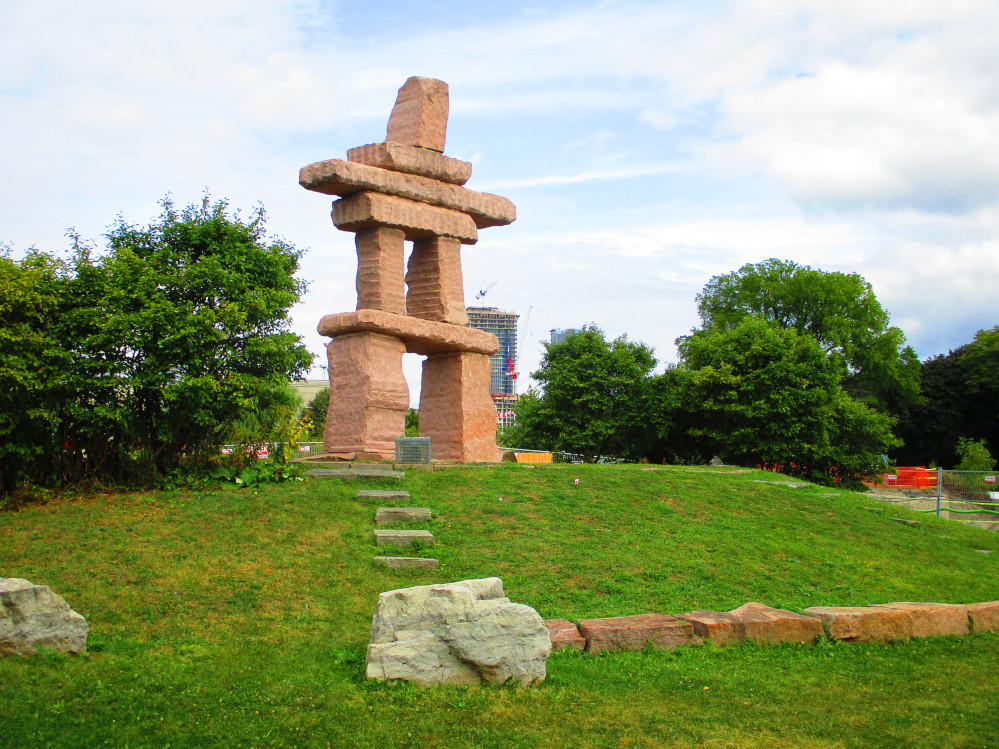
Toronto
Inukshuk Park just east of Ontario Place
|
Queens
Quay
|
Boardwalk
in The Beaches, Toronto
|
Scarborough
|
The
Guild Inn, Scarborough
|
The
Guild Inn, Scarborough
|
Ajax
I followed the wide, paved Waterfront Trail along
Lake Ontario all the way to Ajax. There is only one small stretch of
storm damage on this trail due to the high water levels of Lake
Ontario and the Great Lakes his past summer of 2019. This erosion is
perceived as an important problem that is leading to community action
as defined by this flyer.
This path has a huge number of people on it. So many,
that I need to slow down and even stop at times to avoid having an
accident. Like on the path along Lake Ontario in Hamilton, the users
here range from 1st time riders to experienced racers out
training. What a great way for bicycle riders to get to know each
other – create a path that they all like and get it so crowded
that they meet and even chat at times.
By the time I get to Ajax, the sun is falling and I
take the main road rather than the side streets of the Waterfront
Trail through Ajax and Oshawa. In Oshawa I head towards GM Canada
Headquarters where I find a trail through the McLaughlin Bay
Wildlife Reserve that leads to west end of Darlington Provincial Park
where I stay 1 night. Note that car drivers need to go around a
circuitous route to the main entrance of Darlington Provincial Park.
Bicycle riders can follow a path from the parking lot at GM
Headquarters. There are other people out hiking along this path this
evening. I ask, and they reassure me that I’m headed in the
right direction. The path is longer than I remember from last time
though then I was staying in one of the group campgrounds that comes
up first in Darlington Provincial Park. The main campground is a bit
further along... it’s a ways since Darlington Provincial Park
is large. There are many campsites and other facilities including a
beach.
Before this I stopped for food at a couple of stores
in Oshawa. The first, Ajax Foodmart looks like a discount
store and does have good prices, but only has a few items so then I
need to go to the No Frills grocery store across the street to
fulfill my needs. It’s in yet another huge shopping centre of
mega-stores. This is all very much the land of cars and pavement
though there are many houses in huge suburbs rather than just huge,
very tall apartment buildings as in central Toronto.
Waterfront
Trail From Scarborough To Ajax
|
Waterfront
Trail From Scarborough To Ajax
|
Ajax
|
Ajax
|
Bowmanville
The Waterfront Trail starts returning again to rural
areas with a few small towns, after Darlington Provincial Park. The
first part of today is through the Municipality of Clarington. This
includes Courtice, Bowmanville, Port Darlington, Wilmot Creek,
Newcastle Village and Port Granby. Clarington forms the eastern
boundary of the Greater Toronto Area.
There are a few suburbs at first today, but as the
day progresses, I see more farmland and small towns that only have
old buildings in them rather than huge suburbs of new housing. I take
the dirt trail through Bowmanville Westside Marshes Conservation Area
shortly after exiting Darlington Provincial Park rather than a
circuitous route on roads, and continue riding on the edge of
Bowmanville Harbour Conservation Area. I then stop at Port Darlington
East Beach Park and eat a granola bar or 2. It has a nautical theme
for children’s playground toys.
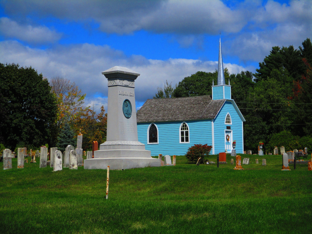
Port Hope & Cobourg
Port Hope and Cobourg are 2 towns that are 7 km
apart. Both are about the same size with populations of between
15,000 and 20,000.
I look around Port Hope for over an hour. Port Hope
has the best-preserved 19th-century streetscape in Ontario due to
it’s slow growth. There are over 270 heritage designated
buildings.
Port Hope is connected to uranium and radioactive
waste. There has been a facility for uranium processing in Port Hope
since 1933. The current owner is Cameco, the world’s largest
publicly traded uranium company. One output of this industry was that
Port Hope had the largest brownfield in Canada of historic low-level
radioactive wastes. This waste is projected to be cleaned up through
soil remediation by 2022.
The noted Canadian environmentalist and writer Farley
Mowat spent his later years in Port Hope and is buried here. Mowat
had some training in zoology at University of Toronto and was an
officer in the Canadian Army in World War 2. Many of Mowat’s
books can be linked to his personal experiences in Canada’s
north while working in expeditions that were exploring the flora and
fauna of the region. Mowat won many awards for his books and writings
though they were seen as controversial by many readers. Some critics
claim Mowat’s tomes to be more works of fiction than truthful
accounts. Mowat focused on environmental issues in Canada and the
plight of the Inuit, Canada’s northern people.
I stop for a snack at Food Basics grocery store when
leaving Port Hope. As I write this diary I note that the historic
railroad station is still in use in Port Hope. It’s near the
West Beach.
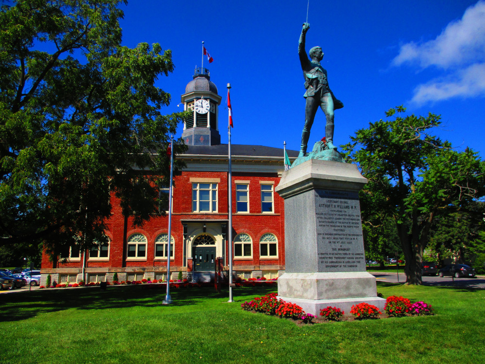
Port
Hope Town Hall with statue of Lieutenant Colonel Arthur Williams,
a local hero, who died of illness in 1885 while fighting in
Canada’s North-West Rebellion
|
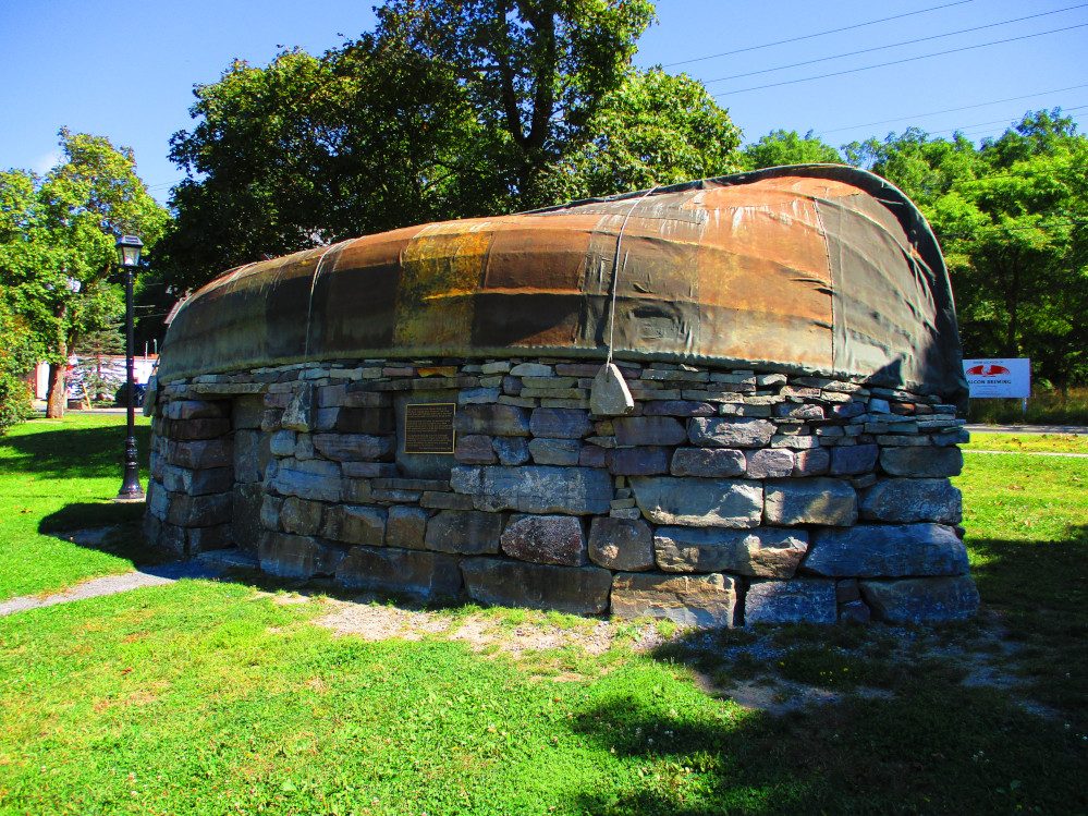
Replica
Of An Open Boat Used By Walrus Hunters From Great Britain In
Canada’s North Before The Time Of Columbus And Before The
Vikings According To The Plaque Attached To It
Replica Celebrates Farley Mowat’s Book The
Farfarers. Farley
lived in Port Hope.
|
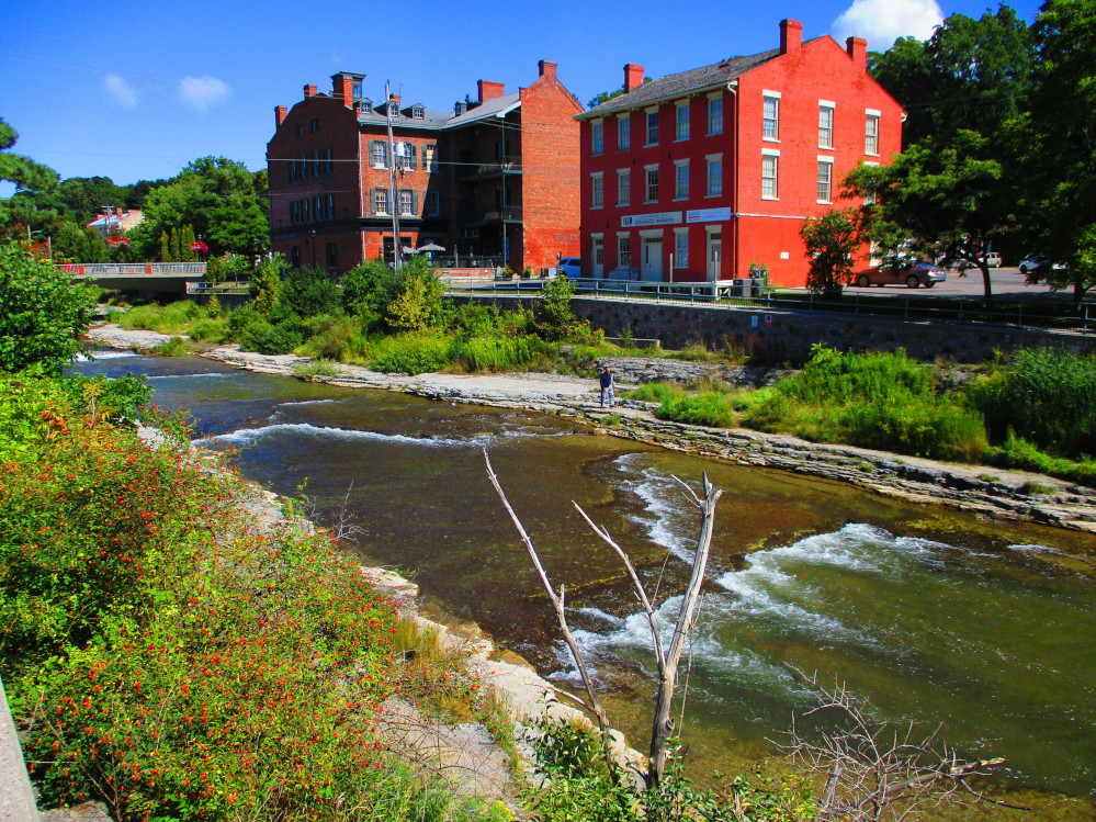
Ganaraska
River, Port Hope
|
Cameco
in Port Hope at mouth of Ganaraska River – the world’s
largest publicly traded uranium company
|
East
Beach, Port Hope
|
Robertson
Street, Port Hope showing it’s 19th Century streetscape in
this historic main street
|
I move quickly through Cobourg after spending so much time in Port
Hope.
Victoria Hall in Cobourg was built in 1860 with the hopes that
Cobourg would become Canada’s capital. It was officially opened
in 1860 by the Prince of Wales who later became King Edward VII. It
is considered to be an impressive stone work with a bearded faced
keystone over the main entrance, an elegant pediment supported by 4
Corinthian columns, and a massive, column ringed cupola. Victoria
Hall was designed by Kivas Tully and built by Charles Thomas Thomas
who was born in England and was a noted master stone carver and
building contractor, at that time in history.
Both Port Hope and Cobourg were settled by United Empire Loyalists
like many of the towns that I ride through along Lake Ontario and the
St Lawrence River. Some towns were founded before but had large
increases in populations with the influx of United Empire Loyalists
after the American Revolutionary War from 1775 to 1783.
Victoria
Hall, Cobourg
|
King
Street, Cobourg
|
Cobourg
Harbour
|
Cobourg
Beach
|
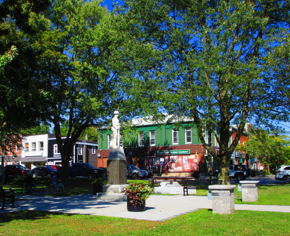
Grafton and Colborne
Grafton has the story of town that used to be though
is now not completely a ghost town. The population is now less than
1,000. At one point Grafton was an overnight stage coach stop on the
run from Toronto to Kingston, and later was a major stop on the
railroad. Also, Grafton was larger when there was a Canada Canning
factory south of the current town site, near the railroad tracks. It
is now almost all demolished as are the factory homes that were
located nearby. A couple of buildings remain. I see these but fail to
recognize their significance.
https://www.ghosttownpix.com/ontario/towns/graftons.html
Grafton is now in the midst of a thriving
agricultural industry and there are a few related businesses, a gas
station, an arena, some churches, a spa and an inn.
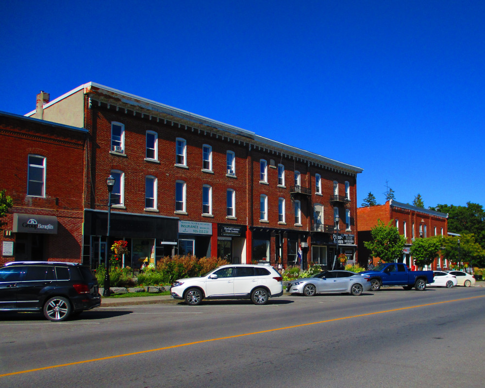
Colborne, like Grafton, is small with a population of
2,000. Colborne is officially part of township of Cramahe and
contains the township hall. Colborne was not a UEL town, but was
started at a later point in history.
Colborne is the site of the Big Apple that drivers
see when going along the 401 Expressway. I miss it this trip. It has
a diameter of 11 metres. It’s worth a side trip to see this
monstrous apple.
The distance between Grafton and Colborne is 12 km on
the main road. I ride a longer 16 km route south of town that goes
more along Lake Ontario. It’s a very peaceful ride with maybe 2
cars passing me on the whole trip. It’s very rural with mostly
farms though there are some cottages, hobby farms, and estates. The
weather adds to the bliss of the trip. The Sun comes out, there’s
a modest tail wind, the temperature is warm.
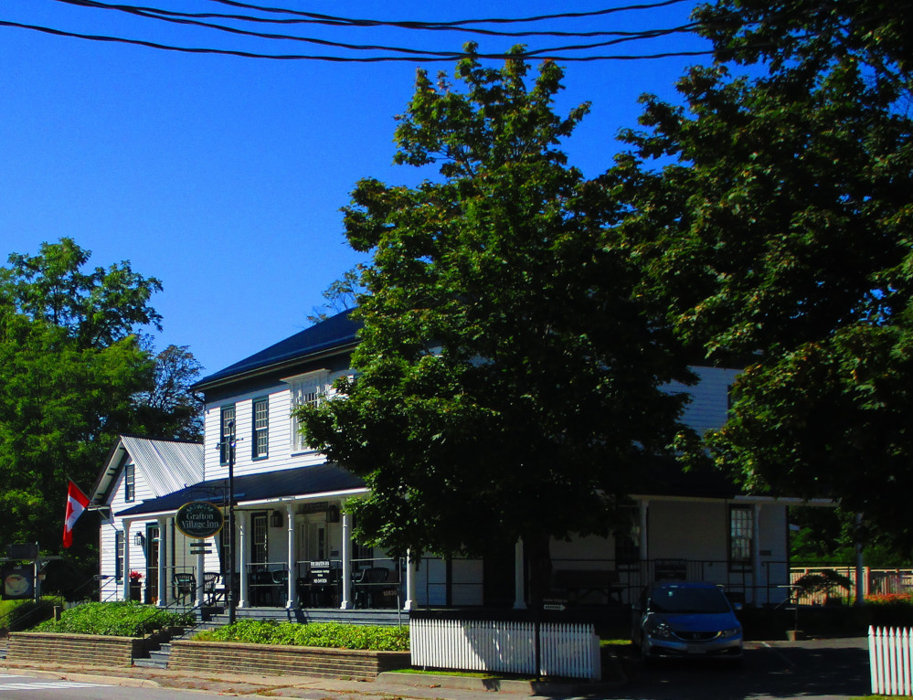
Grafton
Village Inn has welcomed guests since 1820
|
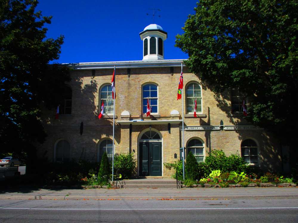
Grafton:
Alnwick / Haldimand Municipal Building
|
Colborne:
War Memorial
|
King
Street, Colborne
|
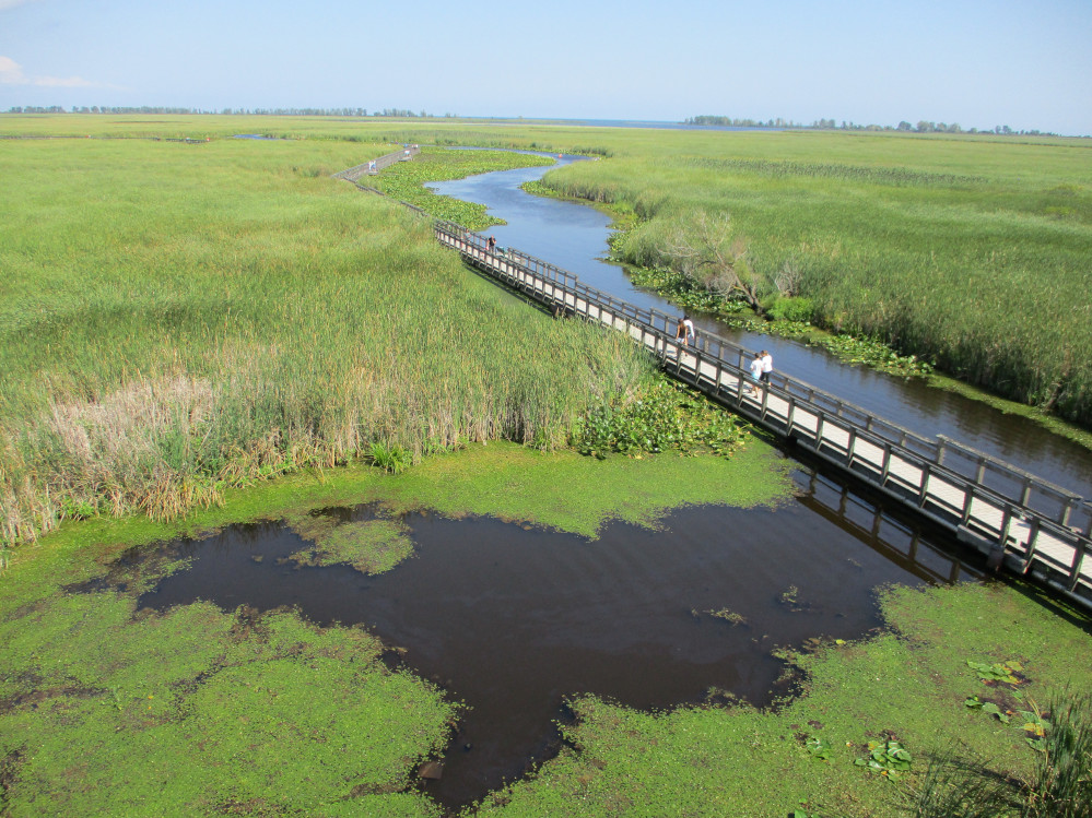
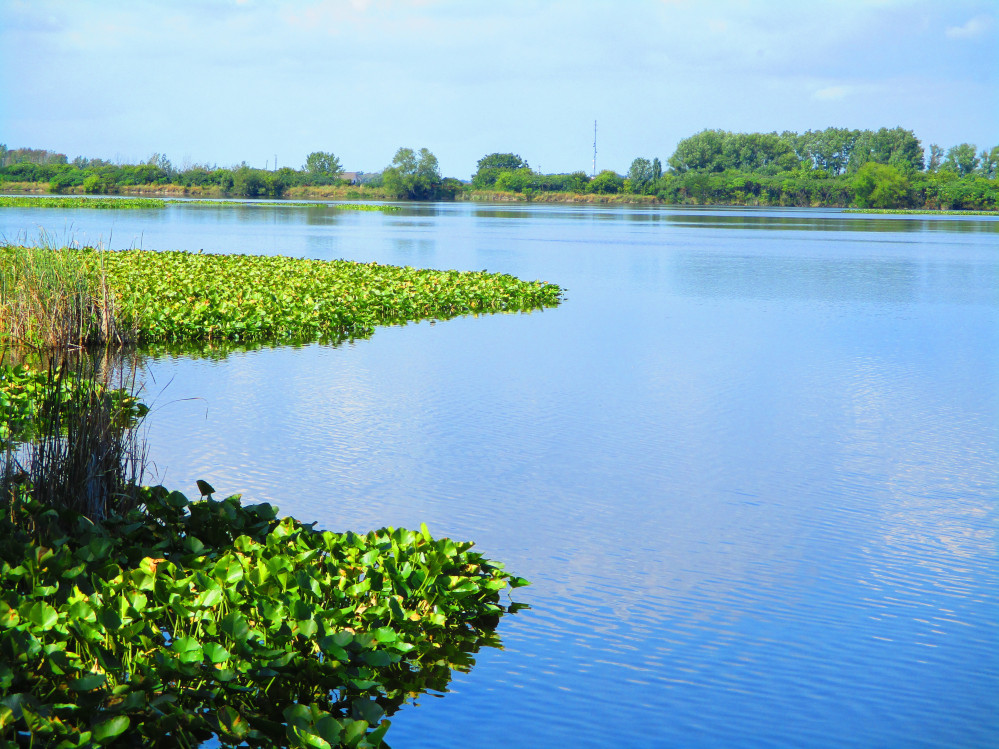
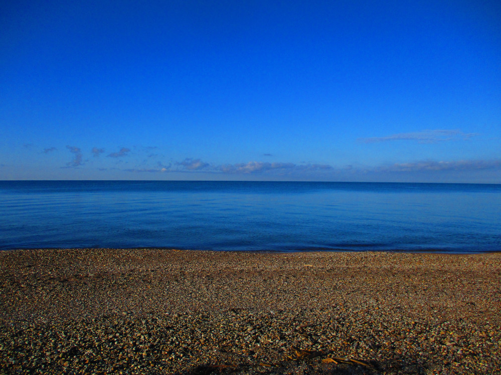
Presqu’ile
Presqu'ile Provincial Park is noted as a site for
nature appreciation, and particularly bird watching. The Park is a
major stop over in bird migrations in both spring and fall. The
spring migration has waterfowl in March and warblers and shorebirds
in May. I do remember visiting the park during a spring migration. It
was worth it. The birds attracted to the Park have changed in recent
years with more Mute swans and Great Egrets breeding.
I arrive at Presqu'ile Provincial Park at 6 pm after
buying food at Sobeys in Brighton. After setting up camp, cooking,
and eating, I wander around the campground and take a picture of the
full moon from the beach. Just off the shore are Gull and High Bluff
Islands. Both are a nature reserve for birds.
I spend a few hours getting to know Presqu'ile Park
better in the morning. I take a path and road, Lighthouse Lane, along
the Lake Ontario shore to the lighthouse at the tip of Presqu'ile. On
the way to the point, I note 2 of the Park’s cottages: Cousins
Cottage that is currently the Nature Centre, and Stonehedge Cottage
where park staff live in the summer. Near the lighthouse is a large
Lighthouse Interpretive Centre that is attached to the much small,
restored Lighthouse Keeper’s Cottage. Along this route and
throughout the park, are lots of trees and greenery. Along the shore
of Lake Ontario is a sandy beach. It is all a pleasant natural area
where one can hear the leaves in the trees blowing in the breeze.
I return from Presqu’ile Point on Bayshore Road
that runs along the protected Presqu'ile Bay. There are private
cottages along this side of the peninsula that have become year-round
residences. I pause many times along this route so I can better
appreciate the natural sounds and colours. I stop longer at Calf
Pasture Point and the Marsh Boardwalk Trail. The Calf Pasture is
formerly The Atkins Farm which was the last farm on Presqu'ile. The
Atkins Farm supplied campers and cottages with fresh milk, cheese,
and other supplies in the era before fast-moving modern
transportation, in the first half of the 20th century. The
Farm closed in 1956.
Friends of Presqu'ile is an active volunteer
organization “supporting vital renewal, research, ecology,
community engagement and education programs in Presqu’ile Park
-- one of Ontario’s natural treasures.” The Friends are
also noted for their juried Arts and Crafts Show in the late fall,
called “Christmas at Presqu'ile.”
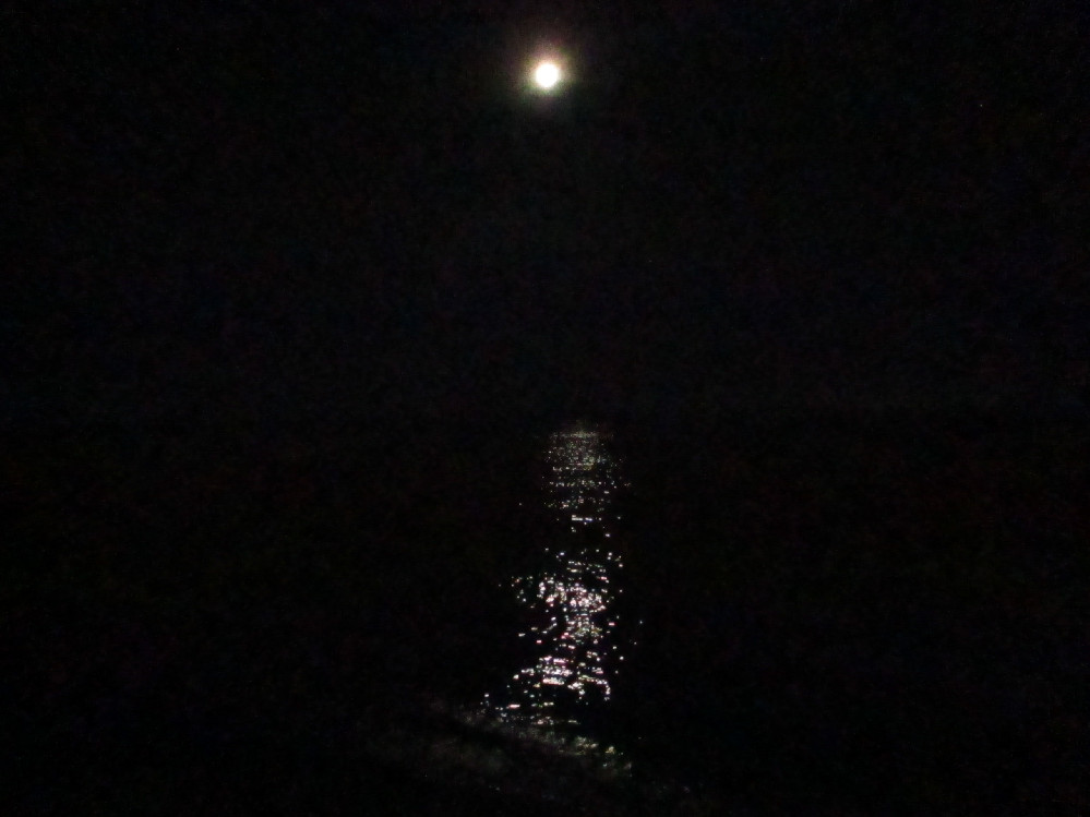
A
Full Moon at Presqu'ile Park
|
Presqu'ile
Park, Stonehedge Cottage, beside the Nature Centre
Stonehedge Cottage is used as staff housing in the
summer and for the Tea Room during Christmas at Presqu’ile
craft show.
|
 Lighthouse
Interpretive Centre, Presqu'ile Provincial Park – old
lighthouse keeper’s house restored on right side of building
Lighthouse
Interpretive Centre, Presqu'ile Provincial Park – old
lighthouse keeper’s house restored on right side of building
|
Presqu'ile
Park
|
Near
Presqu'ile Point: currently lake water is high and there is
evidence of prior flooding this year
|
View
From Raised Platform At Start Of Marsh Boardwalk Trail, Presqu'ile
Provincial Park
|
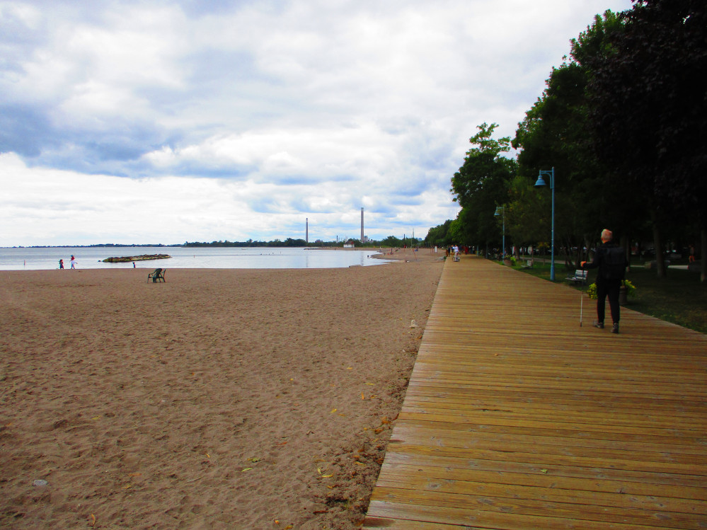
Prince Edward County & Sandbanks
Park
I leave Presqu’ile as noon is approaching and
continue riding around Presqu’ile Bay eventually going across
the Murray Canal to Prince Edward County, and, then, awhile later,
follow the Loyalist Parkway through Consecon where I stop for a snack
and take a side loop along the shore of Lake Ontario. It’s all
much the same: quite flat with lots of trees and greenery, a few
farms, some houses and cottages and small hamlets. I get a few
supplies at Piersons Foodland in the town of Wellington. I see now
that an alternative place to get supplies is in Bloomfield. It comes
later. By that time, I am focused on getting to Sandbanks Park.
The Sun is out today and the temperature is warm,
great for cycling. The wind is from the west and hinders my travel,
at times, when it is from the right side. The wind hinders my travel
even more after I take Stanley Street out of Bloomfield and it veers
right to go westward to Sandbanks Provincial Park. The Park lives up
to it’s name. There are sand dunes and beaches everywhere. I
get a campsite in the not-as-sandy part of the Park. As dusk
approaches, after a short rain shower, I head for the beach along
with many other campers and watch the Sun go down in a memorable
sunset. The temperature gets a bit chilly but the sunset is worth a
million.
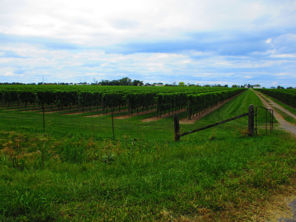
Prince Edward County is becoming noted for the number
of wineries that started up in the last few years.
Prince
Edward County: Looking Out At West Lake, A Sand Bar, & Lake
Ontario.
The sandbar is in Sandbanks Provincial Park. It
looks so close, but is a few hours travel to get there.
|
Prince
Edward County Has Many Wineries
|
Village
of Wellington, Prince Edward County
|
Wellington,
Prince Edward County With Afghanistan War Memorial On The Right
|
Outlet
Beach, Sandbanks Provincial Park
|
Outlet
Beach, Sandbanks Provincial Park
|
Outlet
River, Sandbanks Provincial Park
|
Sandbanks
Provincial Park
|
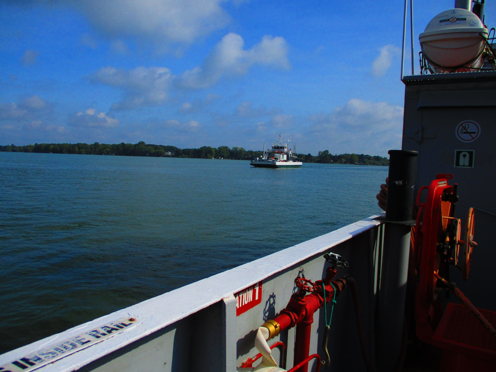
Picton & Glenora Ferry
I leave Sandbanks Park on a foggy morning heading
along the road through Cherry Valley and then to Picton. I stop for
breakfast at McDonald’s in Picton. I see now that I missed the
airport and former military base that played a key role in training
flyers during World War 2. More recently, it is noted as a site for
many movies and films. At other times, it is just a municipal
airport.
Next stop is the Glenora Ferry after a few hills.
Though the land is basically flat, the road goes up and down about 10
metres in elevation a few (too many) times in the 10 km stretch from
Picton to Glenora Ferry. There are many well kept homes all along
here on the Bay of Quinte.
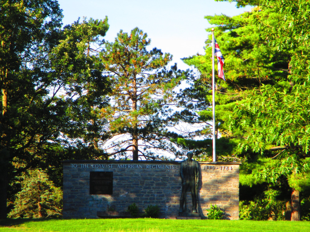
Shortly after Glenora Ferry, I arrive in Adolphustown
at the UEL United Empire Loyalist Heritage Centre and Park that is a
protected heritage site. I take a picture of the oldest UEL monument
in Canada, and pause and appreciate this spot where the first United
Empire Loyalists landed in Ontario in 1784. There is also camping
here which I almost used, but ended up at Sandbanks last night,
instead. I take a picture of the UEL Heritage Centre that is in
Allison House. It is closed today. I must come back some time and
look in the Heritage Centre as there have been considerable additions
to its collection in recent years. Allison House was constructed in
1876 by D.W. Allison, a former MP for the area.
I continue riding along the flat Loyalist Parkway all
the way to Kingston. Along the way I note 2 electrical power plants:
The Lennox and Napanee generating stations. The Lennox Generating
Station is over 40 years old while the Napanee plant is just being
built. Both are for periods of excessive peak demand. Both are gas
powered and the Lennox plant can also run on oil.
Picton
|
Glenora
Ferry
|
Allison
House in UEL Park that was constructed in 1876 by D.W. Allison,
and now contains UEL Heritage Centre
|
UEL
Monument 1884 – oldest Loyalist Monument in Canada
|
Looking
Back At Prince Edward County
|
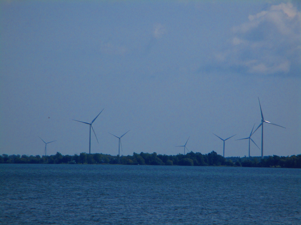
Wind
Power On Amherst Island
|
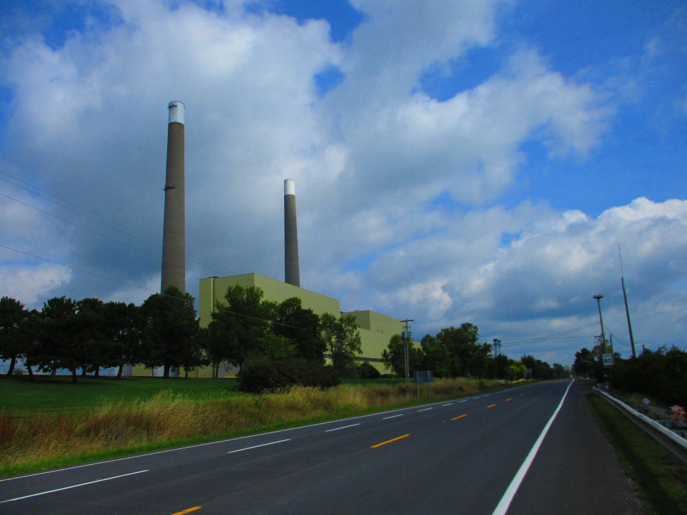
Lennox
Generating Station, Ontario Power Generation - Oil & Gas
Powered Generating Station Used In Periods of Peak Demand For
Electricity
https://en.wikipedia.org/wiki/Lennox_Generating_Station
|
Napanee
Generating Station - A Gas Powered Plant Under Construction That
Is To Be Used In Periods Of Peak Demand For Electricity
https://www.quintenews.com/2019/08/02/213048
|
The East End of Lake Ontario –
Kingston
The Loyalist Parkway continues to Kingston. Short way
along is a park for the Loyalist Parkway Gateway where Queen
Elizabeth II commemorated the parkway in 1984, the 200th
anniversary of the UEL landings in Adolphustown.
A bit further on, I get some food at Foodland in the
Loyalist Plaza in Bath. It’s a large, modern store. Bath was
established by Loyalist settlers in 1784 making it over 200 years
old, but, somehow, it is still much the same size, only being
enlarged recently as a suburb of Kingston. Bath stayed small since it
was bypassed in 1816 by the ‘Kingston-York’ Road (County
Road 2) and in 1856 by the Grand Trunk Railway. There are still many
historic sites and buildings in Bath since these have continued to be
used rather than demolished by rampant growth as in some other
locations.
The weather remains wonderful today with Sun, a few
clouds, warmth, and even a tail wind as I glide along the last of the
shore of Lake Ontario of this trip.
There are so many things to see and do in Kingston,
but this trip, I just ride along the waterfront with brief stops at
parks and in front of city hall. On the trip into Kingston, I go
through Lemoine Point on the main dirt path and follow Front Road.
This route takes me along a route that is close to the water, goes
beside Kingston Airport, has lots of trees and greenery, and has less
traffic. In the main part of Kingston, I ride along the Waterfront
Pathway in Breakwater Park after passing St Lawrence College,
Portsmouth Olympic Harbour, and the remains of the Kingston
Penitentiary (no longer used). The sailing events of the 1976 Summer
Olympics in Montreal occurred in Portsmouth Olympic Harbour. It is
still active and the location of the annual CORK Canadian
Olympic-Training Regatta Kingston.
Kingston is much older with European settlement
starting in 1673 and aboriginal encampments before that time due to
its strategic location at the mouth of the Cataraqui River and on the
Canadian shore where Lake Ontario dumps into the St Lawrence River.
Kingston continues as a military town with a large base and the Royal
Military College. The Waterfront Trail goes by both of these after
crossing the Cataraqui River on the La Salle Causeway. In here, I
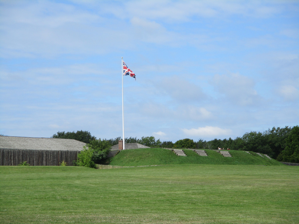
also passed by the Fort Henry National Historic Site. The Fort was
built during war of 1812 to protect the Kingston harbour. It is
currently a tourist site with reenactments of life in 1812.
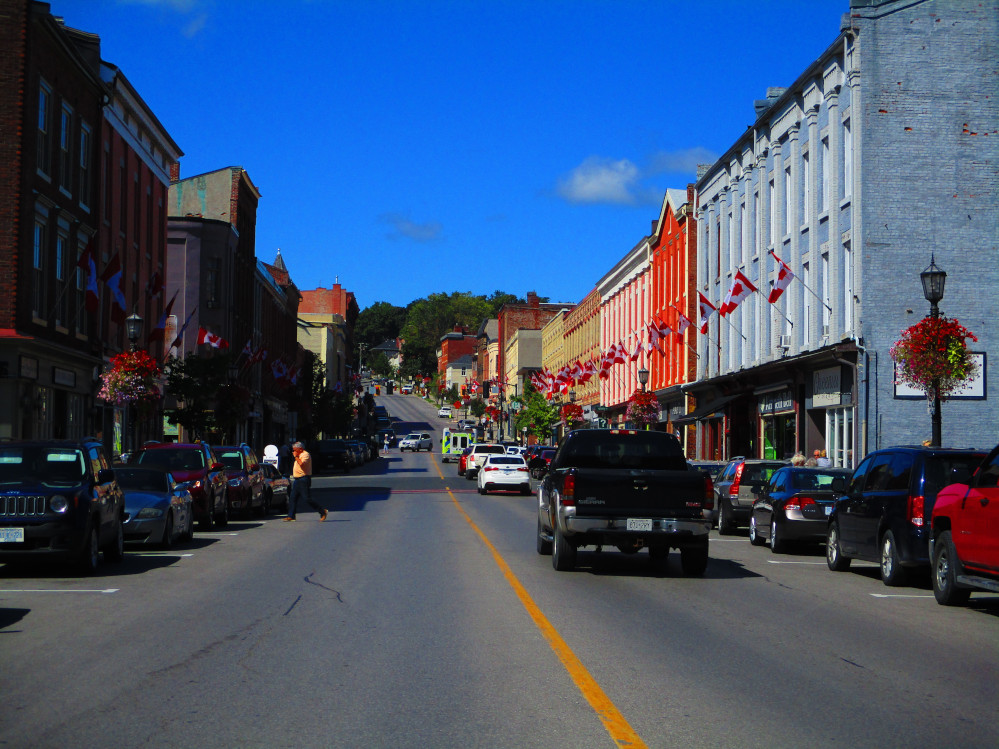
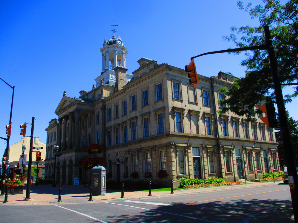
Kingston is also the largest urban area I’ve
seen since the greater Toronto area and the Golden Horseshoe. Near
downtown Kingston, I go by many historic buildings and the city hall
of limestone brick work. Even today on a week day and not in the core
tourist time, there are many people near downtown and in the park in
front of city hall. I walk a few blocks to see the sites though
briefly, and survive in the traffic. There’s a park in front of
City Hall from which one can view the harbour and look across at
Royal Military College. It’s magnificent.
Loyalist
Parkway Gateway, 531 Main Street, Bath
|
Waterfront
Pathway, Breakwater Park, Kingston
|
Royal
Military College viewed across Kingston Harbour
|
La
Salle Causeway, Kingston
|
The St Lawrence River
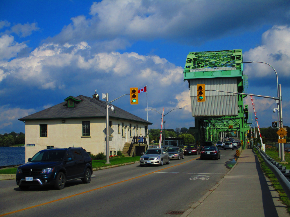
Gananoque & 1000 Islands Parkway
Today I’m headed for Ivy Lee Campground after
going through Gananoque. I stop at the No Frills grocery store in
east end Gananoque for some more food after riding along the
waterfront. It’s getting later and I want to get to camp.
This is a big tourist area. After Gananoque, is the
1000 Islands parkway. This is beside the St Lawrence River that at
this point has many small islands in it. Thus the name “1,000
Islands” for this part of the River. The road allowance for the
Parkway is very wide as, at one time, this was to be the location of
the local expressway. Luckily, the opinions of local residences
prevailed, the expressway was built further inland, and the Parkway
lands became property of St Lawrence Parks Commission. There’s
now a recreation and bicycle path in one half of the original road
allowance. It’s a beautiful place to bicycle and drive as much
of the time the road is right beside the shore of the St Lawrence
River rather than having houses in between. Onshore, and on the 1,000
islands, I see both modern homes and some ancient luxurious estates
that are some of “the most luxurious cottage estates in Canada
and the United States.”
I arrive at Ivy Lee Campground at about 6 pm. After I
have my tent set up and my sleeping bag blown up, another camper
arrives and claims that they were here before and this is THEIR
CAMPSITE. OK! I move across the campground to leave you and your huge
motor home on this site. After a bit there is a short rain shower. My
tent is up by then and all my stuff inside it. I bet those in the
motor home don’t even notice the rain.
Ivy Lee Campground is a pleasant little park. Many
people come here to scuba dive in the summer. Others come to ride on
the recreation path along the length of the 1,000 Islands Parkway.
Another big attraction besides boating, fishing and swimming, is just
being a tourist and seeing things like the Boldt Castle and Fort
Henry, or doing zip lining at the latest attraction.
I leave in the morning at the usual early time after
getting up just after sunrise. It’s a bit chilly this morning,
but soon warms up. Fall is coming, eh? There’s still much of
the 1,000 Islands Parkway to explore. 1st I stop to take a
picture of Darlingside, a historic stop of river traffic, that is
about a km from camp. Darlingside was at one time, an important wood
depot for steamships travelling between Kingston and Montreal.
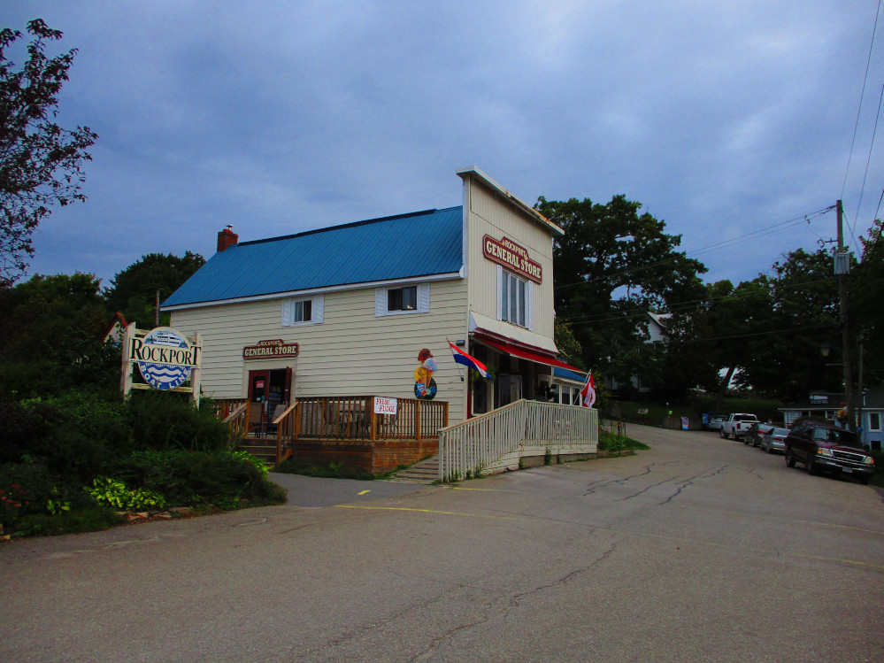
I later have short stops at both Rockport and
Thousand Islands National Park. There are more pleasure boats than
tourists at Rockport today. The Thousand Islands National Park shows
signs of flooding by the high water levels in the Great Lakes this
summer. I later stop at Brown’s Bay Park for a snack of granola
bars. It’s a great place to swim. As the pictures show, the
1,000 Islands Parkway’s beauty is enhanced by it’s
location beside the St Lawrence River and the abundance of trees.
The whole region along the 1,000 Islands Parkway is
part of the Frontenac Arch Biosphere Reserve that is recognized by
UNESCO as having ecological, historical and cultural uniqueness. The
Frontenac Arch is an ancient granite bridge that goes from the
Canadian Shield in the north to the Adirondack Mountains to the
south. This Biosphere Reserve links the habitats of Algonquin Park in
Canada and Adirondack Park the United States.
I see the Frontenac Arch in numerous rock outcrops
along the 1,000 Islands Parkway and in the Thousand Islands
themselves. I could see even more rock outcrops that look like the
Canadian Shield on a side trip along Road 3 north of Lansdowne and in
Charleston Lake Provincial Park. I’ve done this route before,
but not today. An scenic side trip is to camp at Charleston Lake
Provincial Park.
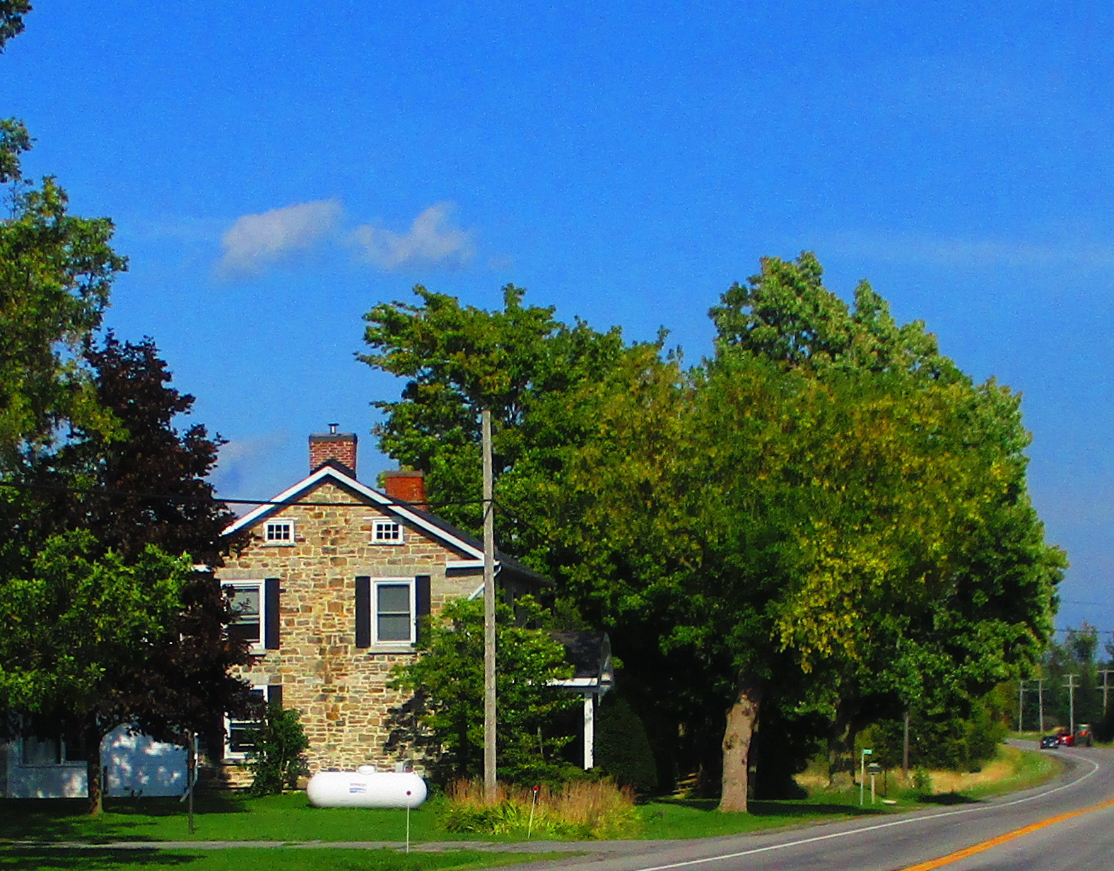
Stone
House along the road to Gananoque
|
Stone
House along the road to Gananoque
|
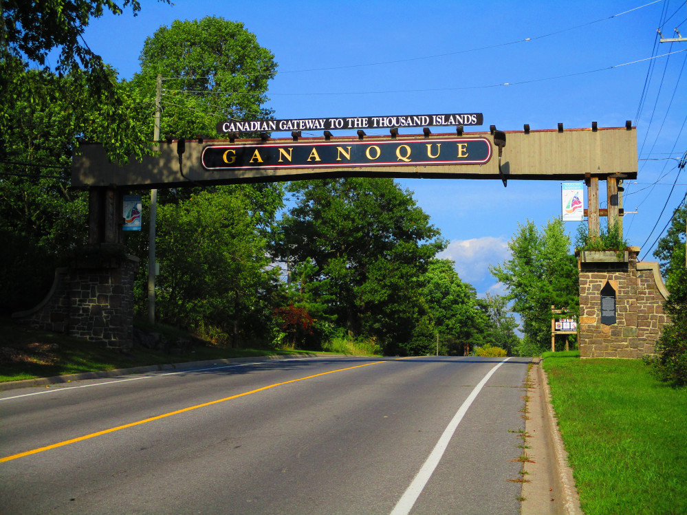
Renovated
Gateway Arch In Gananoque
|
Boats
In St Lawrence River At Gananoque
|
Gananoque
|
King
St, Gananoque
|
Ivy
Lea
|
Darlingside
- A Historic Wood Depot & General Store That Was Essential For
Travel By Steamer Along The St Lawrence River in 1830s & 1840s
|
Rockport
|
Rockport
|
Some
trees have fall colours
|
1000
Islands
|
1000
Islands
|
Brown's
Bay Provincial Park
|
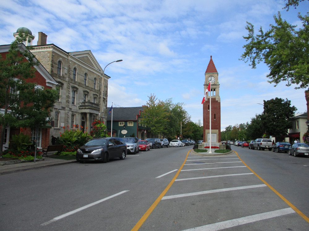
Brockville
I stop at the Metro food store as I go into
Brockville and get a snack. Brockville has UEL origins, having
started in 1784 by those displaced by the British withdrawal from the
American War of Independence. Brockville was originally called
Elizabethtown, but this was unpopular name and was changed during the
1812 war in honour of General Brock who died in battle at Queenston
Heights near Niagara Falls. I ride over Brockville’s railway
tunnel that was built in 1860. It’s beside the Blockhouse
Island Road that has green space and park on both sides and takes one
on a causeway into Tunnel Bay. This is a good side trip enabling one
to look across the St Lawrence River to Morristown, New York and see
the Brockville Rowing Club that is just down stream. It is having
it’s 125th anniversary this year.
I stopped along here and eat another granola bar for
a snack. There are often many divers at Canteen Park just a bit
further along Brockville’s well kept waterfront that has many
parks and marinas as recreational boating is popular along the St
Lawrence River in the Thousand Islands. I see a few divers here
today.
Brockville has many industries, as well as tourism,
unlike, say, a town like Gananoque that is basically almost all
devoted to tourism. One grand street to ride up hill on is Broad
Street going by the war memorial to see the courthouse behind the
courthouse green. There are always many flowers planted along this
route in the summer, and there is lots of limestone architecture from
the 19th century. The courthouse is a national historic
site constructed in 1842.
After Brockville, I continue along he St Lawrence
River. In this stretch, the road is near the River that I can see
most of the time. There are many homes along the River. One is
Homewood, a field stone building built in 1800 by Dr. Solomon Jones.
It is a National Historic Site.
A bit further on is The Blue Church. It was
originally built in 1890. The first 2 versions burnt down. This is
the 3rd edition of 1845. Beside The Blue Church is a
monument to Barbara Heck, the founder of Methodism in America.
St
Lawrence Park, Brockville
|
Homewood
|
The
Blue Church
|
|
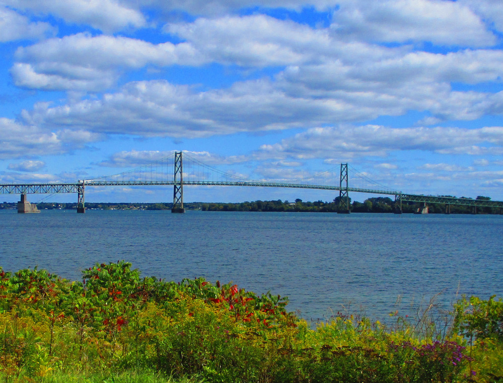
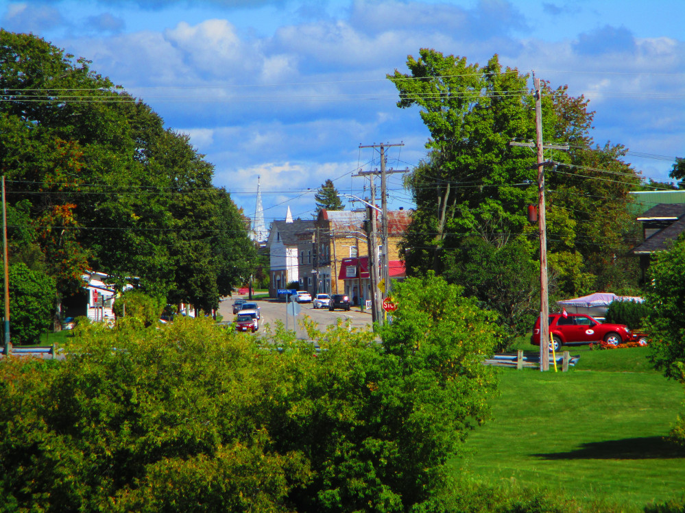
Prescott
On the way into Prescott, I ride by the Canadian
Coast Guard base. This base is one of 12 in Canada that has MCTS
Marine Communications and Traffic Services. After the Coast Guard
base, Prescott has parks along it’s waterfront and a marina.
Right beside the marina is the outdoor stage of the St Lawrence
Shakespeare Festival that has Shakespearean plays in the summer.
In early Canadian history, Prescott was seen as a
strategic location since it was at the head of series of rapids that
stretch all the way to Montreal. These rapids disappeared with the
building of the St Lawrence Seaway. The presence of the rapids also
led to the establishment of a forwarding industry in Prescott until
railroads were built, since, in contrast to the rapids downstream,
upstream to Kingston is smooth sailing.
Fort Wellington is located in Prescott. It was
originally built for the war of 1812 because of Prescott’s
strategic location. The current fort was built in 1838 due to the
Rebellions in Upper Canada in 1837 to 1838 and associated Patriot
War. Militia from Fort Wellington participated in the Battle of the
Windmill.
The Battle of the Windmill was in 1838, in the
aftermath of the 1837 rebellion in Upper Canada. In brief, a group of
Americans, the Hunter Patriots, mistakenly thought that most
Canadians detested British rule and wanted to join the United States.
The Patriots established a small army and attempted to attack
Prescott, but only captured The Windmill, downriver in Newport, a
couple of kilometres downstream from Fort Wellington. Eleven
Patriots, including their leader, were captured after they
surrendered unconditionally, had a trial and were executed by
hanging. 60 other participants were banned to Australia. The windmill
was converted to a lighthouse in 1873 to tell ships of the location
of Windmill Point. Now, did this skirmish lead to the formation of
the Dominion of Canada in 1867 that is more democratic than the prior
era of British rule that was biased towards a clique of rich, white
residents?
King
Street, Prescott
|
Prescott
Harbour
|
Shakespeare's
Gardens, Prescott
|
Shakespeare's
Gardens, Prescott
|
Fort
Wellington National Historic Site, Prescott
|
Battle
Of The Windmill National Historic Site, Edwardsburgh/Cardinal,
Ontario
|
Cardinal
Shortly after visiting the historic site of the Battle of the
Windmill, I ride by the Port of Johnstown and, then, under the
Ogdensburg/Prescott International Bridge in Johnstown. The amount of
traffic and number of trucks along this section has increased since
the establishment in 2008 of the Johnstown ethanol plant in the
industrial area just inland from the Port of Johnstown.
Unfortunately, too, the paved shoulder here is either very narrow or
does not exist. The road, itself, needs repaving and has broken
edges, too. Conditions get better after I ride under the Ogdensburg
Bridge to USA. A few years ago, I saw people fishing from the dock of
the Port of Johnstown, but now it’s all cordoned off and an
area of high security and no one fishes here any more. For similar
reasons, I used to be able to ride across the dock after visiting the
site of the Battle of the Windmill. Now, this route is blocked by a
high-security fence. Today, I need to re-trace my route back to the
main road to continue to Johnstown and Cardinal.
All along here many sections of the road pass close to the St
Lawrence River so I can see across it to the United States and see
remains of prior canals that existed before the St Lawrence Seaway
flooding.
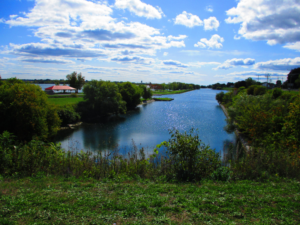
Even before the era of the UEL, pioneers made use of the Galop
rapids in Cardinal as a source of power for grist and saw mills. The
Galop rapids were bypassed by ships using the Galop Canal from 1846
until the opening of the St Lawrence Seaway that flooded the rapids
on July 1, 1958.
Ogdensburg/Prescott
International Bridge
|
Dundas
Street, Cardinal
|
Galop
Canal, Cardinal
|
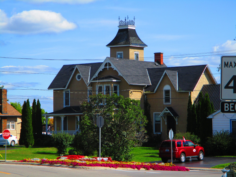
2011
Dundas Street, Cardinal
|
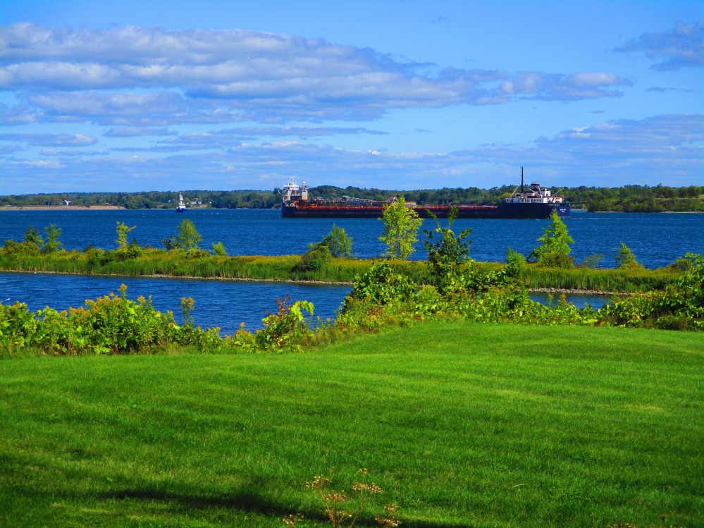
A
Lake Freighter in St Lawrence River across the Galop Canal in
Cardinal
|
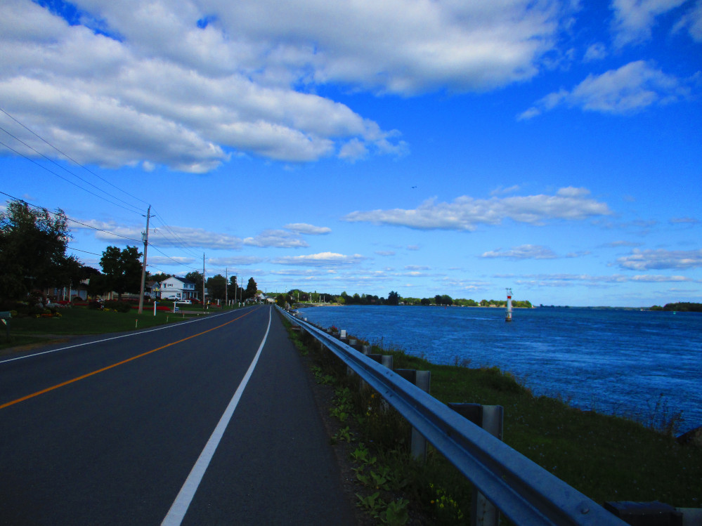
St
Lawrence River, Mariatown
|
Morrisburg
A bit further on after going through Iroquois, I take
Lakeshore Drive through Mariatown to Morrisburg. In Morrisburg, I buy
a few provisions at Laura’s Valu Mart.
Just after looking at some historic plaques in
Morrisburg I have a flat tire. Somehow, a thin strand of stiff nylon
made it through my almost impenetrable bicycle tire or someone had
planted a small tack on the road. In the end, I walk to the
conveniently located Canadian Tire store after have problems fixing
the tire and after changing from bicycle shoes to running shoes, eh?
I’m lucky that the store is about a mile away.
While trying to fix the tire I refuse a ride for
myself and just my tire to the store since I want to keep all
equipment together. I eventually get to Canadian Tire store and get
tire fixed. I then proceed to Riverside Cedar Campground since it’s
close rather than going to my planned stop at Woodlands Campground on
Long Sault Parkway. I note of thanks to the staff at Canadian Tire
for letting me fill up the tire with a floor pump that they had for
sale. It’s much faster. The bike now goes again. But, I think
the pump is set up for mountain bikes so the tire is still a bit
squishy. Tomorrow, I’ll meet a racer who’s out training.
He helps me fill the tire up to pressure with his air cylinder.
Thanks to him, too!
Central Morrisburg has a park along the river, too.
There’s a public dock and a beach.
Many of the older houses in Morrisburg are in their
original locations, but 80 homes were relocated due to flooding of St
Lawrence Seaway. The flooding also damaged the downtown area. Before
the flooding, it was relocated to a shopping centre. In contrast to
many villages that were lost due to the Seaway flooding, both
Iroquois and Morrisburg were relocated to accommodate the increased
water level when flooding began on July 1, 1958.
One significant historic event near here, that has
impacted the whole world, is the invention of the McIntosh apple on a
farm near Williamsburg.
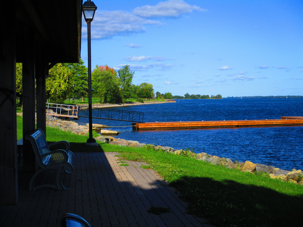 Morrisburg
park along the waterfront
Morrisburg
park along the waterfront
|
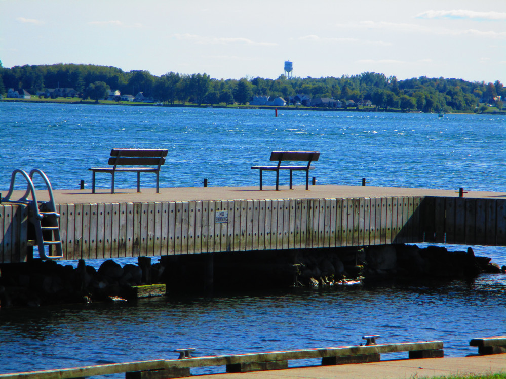 Morrisburg
Public Dock, looking at water tower in Waddington, New York
Morrisburg
Public Dock, looking at water tower in Waddington, New York
|
Battle Of Crysler Farm National
Historic Site
This morning it is a bit chilly. I soon leave
Riverside-Cedar Campground after a good night’s sleep as I was
in a part of the campground set back quite a distance from the main
road. I could hear some loons, the wind blown leaves in the trees,
and the crack of branches as I walked along the shore in the
Riverside Cedar Campground last evening. This morning, I am only on
the main road for a short distance. I’m soon at the Historic
Train Station that is relocated from Aultsville, one of the villages
lost due to the flooding of the St Lawrence Seaway. I turn off the
main road at this point and go to see the monument for the Battle of
Crysler Farm in the War of 1812. The Canadians and British won though
they were outnumbered. This event was a critical battle in the War of
1812. One result was that the Americans abandoned their St Lawrence
campaign and assault of Montreal.
Near by to the memorial to the Battle of Crysler’s
Farm, is the Pioneer Memorial to the 10 lost villages with the
flooding of the St Lawrence Seaway. The actual site of the Battle of
Crysler’s Farm is also flooded. The memorial from that site is
now atop a hill right beside the St Lawrence River, overlooking the
actual site and looking over at New York in the United States. There
are other memorials in this park. There is one to the Loyalist
American Regiments from the much earlier American War of Independence
1775-1784.
Beside the Pioneer Memorial is Upper Canada Village.
It contains many historic buildings from the lost villages and other
sites that were flooded by the St Lawrence Seaway. Upper Canada
Village attempts to depict life in rural English Canada in 1866. This
includes a number of mills and farming with historic strains of crops
and livestock. This is an interesting place to visit for a day, at
least, on a slower trip. Today, I ride by and go around Upper Canada
Village on a back lane that is part of the Waterfront Trail.
Upper Canada Migratory Bird
Sanctuary & Long Sault Parkway
This trip concludes with a ride on a paved trail
through the Upper Canada Migratory Bird Sanctuary and a ride along
the Long Sault Parkway to Long Sault. I show a few pictures of the
wildlife and natural vistas that I see. I find the trail to be a part
of the trip to ride through slowly as there are often birds and other
critters along the way.
The Long Sault Parkway appears to go over a number of
islands with causeways built between the islands. Actually, these are
created islands. They were tops of hills before the flooding of the
St Lawrence Seaway created Lake St Lawrence. If I were to continue
towards Cornwall, I’d go by the Dam and Powerhouse that created
this Lake and that I catch glimpses of when riding along the Parkway.
There are a number of beaches, camp grounds, and picnic sites along
the Long Sault Parkway.
At the conclusion of this trip I continue bicycling
home to Ottawa where I arrive in the evening concluding this scenic,
exciting and fast moving trip of 1500 km in 12 days.
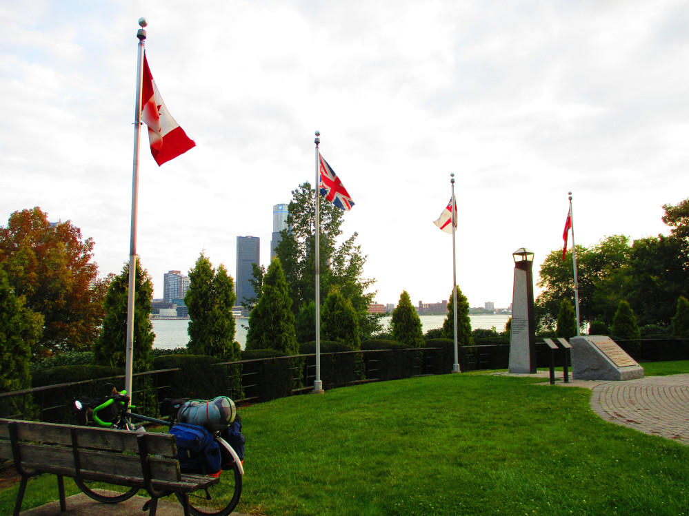 My
bicycle in Dieppe Gardens at the start of the trip
My
bicycle in Dieppe Gardens at the start of the trip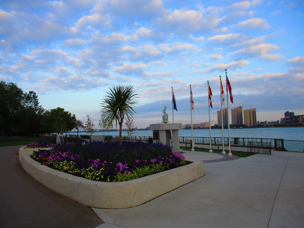
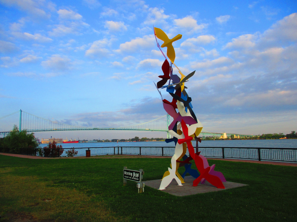
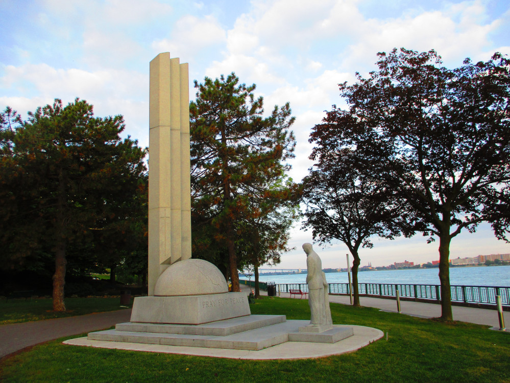
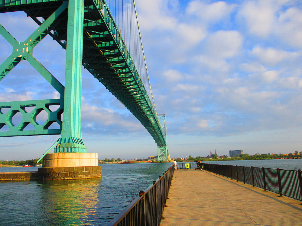 People
fishing in Detroit River on dock beside Ambassador Bridge between
Windsor and Detroit
People
fishing in Detroit River on dock beside Ambassador Bridge between
Windsor and Detroit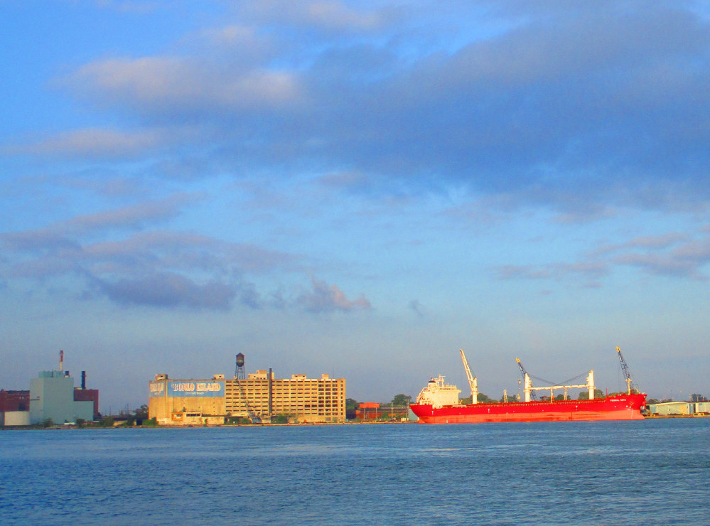
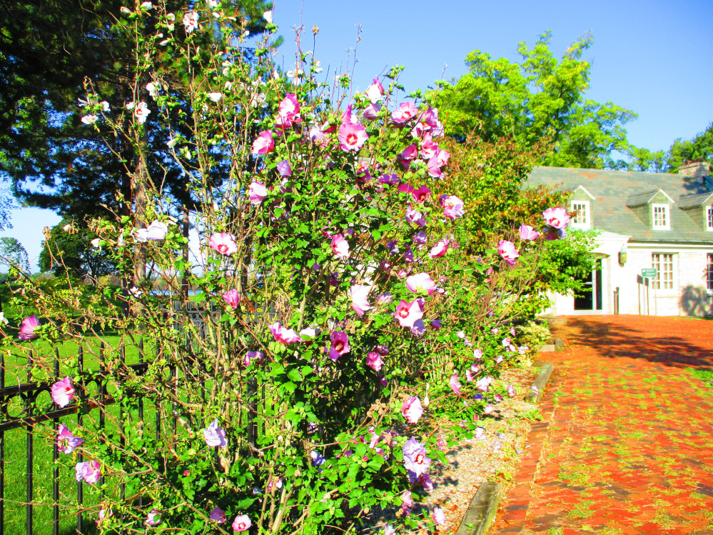
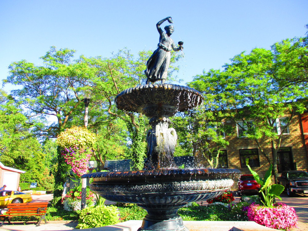
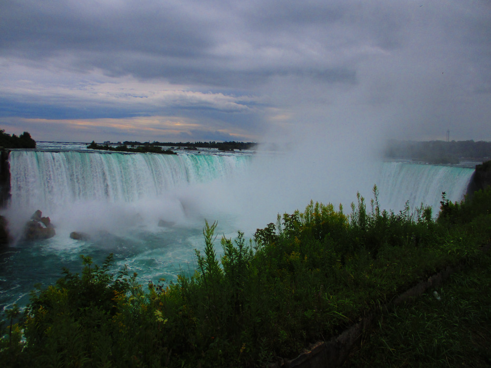
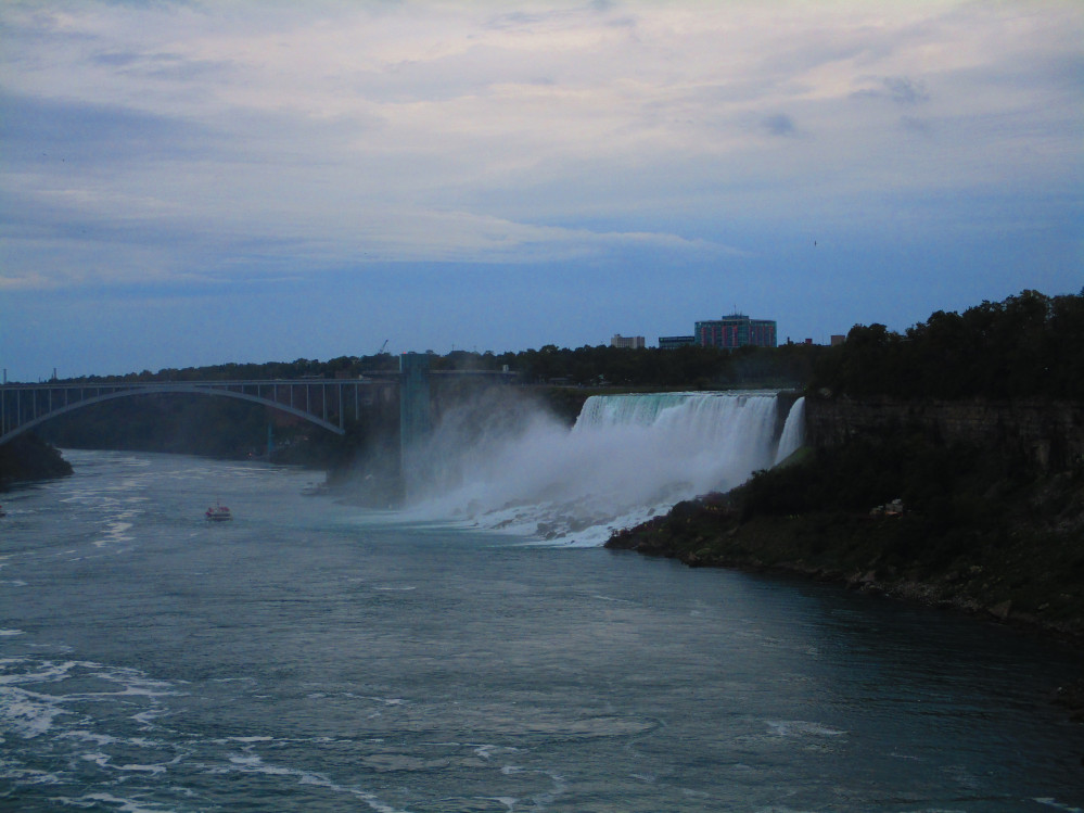
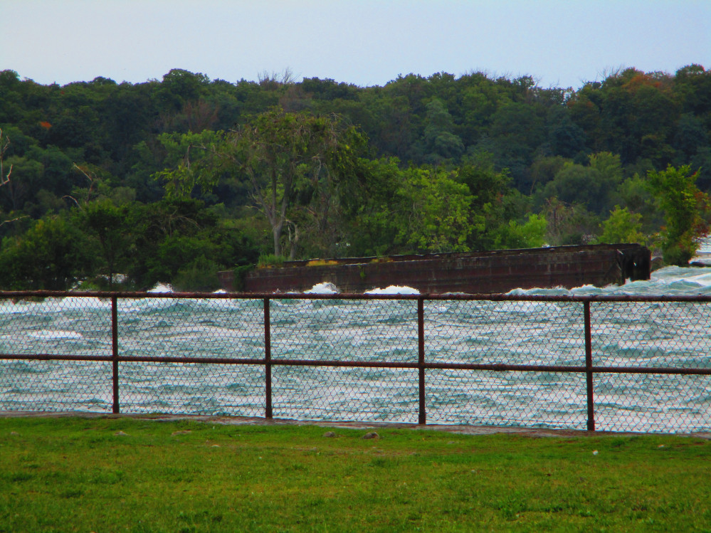 Iron
Scow just upstream from Horseshoe Falls
Iron
Scow just upstream from Horseshoe Falls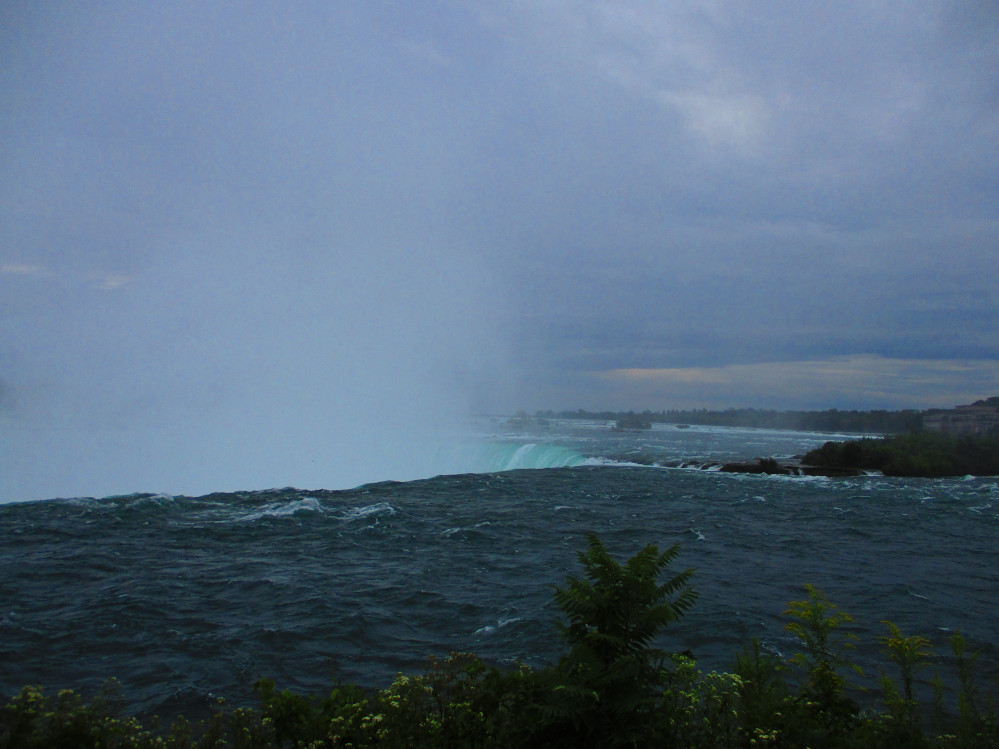 The
Brink of Horseshoe Falls
The
Brink of Horseshoe Falls