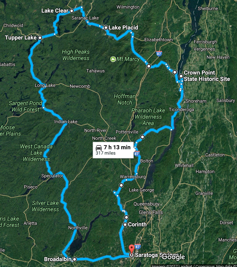
Table of Contents
This tour is almost completely in Adirondack Park in northern New York state. The Park is part of New York's Forest Preserve of which about half is privately owned so the tour goes through many town as well as forested areas. A review of the pictures taken on this trip, finds many dull days and others with rain. For the first few days, one almost started to believe: “When it's not raining, it's pouring!”
|
|
Table of Contents
|
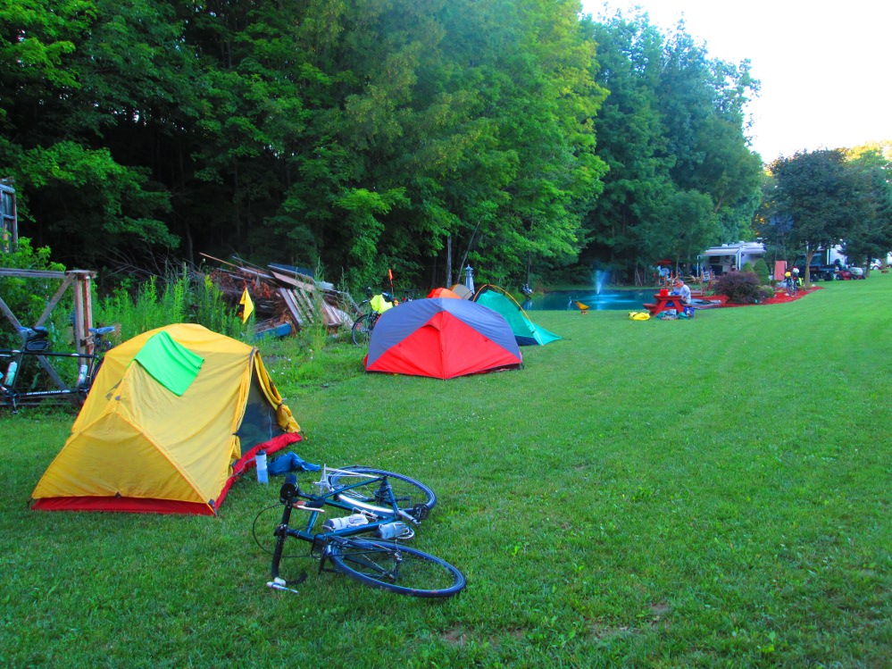
The group on this tour are survivors. All 7 survived the trip. Besides the wet weather, they overcame riding up or down hills and mountains, with few level areas and much elevation gain most days with grades of 12% to 15%. To say the least, this trip was challenging, at times. We also camped many nights in the rain with the only indoor accommodation being in Lake Placid at Spruce Lodge.
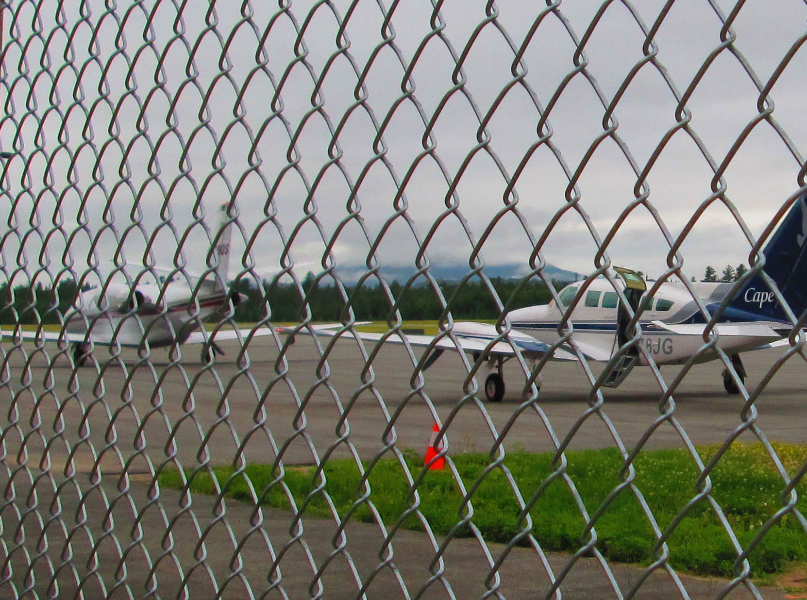
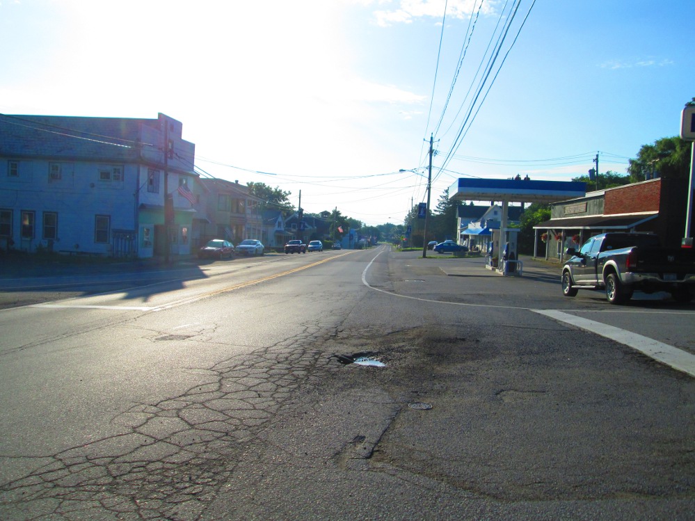
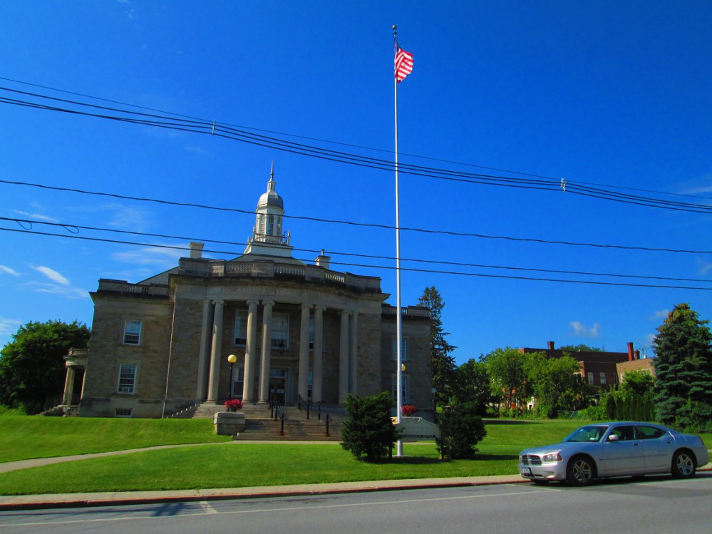
The tour starts in the popular tourist city of Sarratoga Springs that is noted for a spa and horse racing. I found it packed with tourists when I drove through it on the way to our campsite.
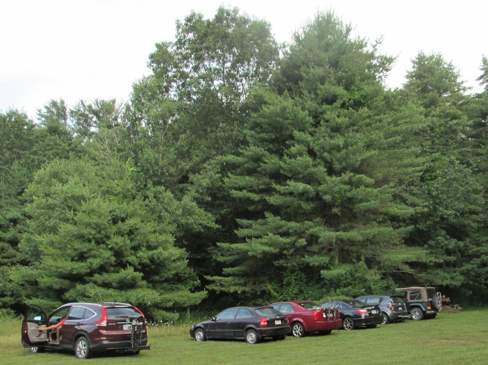
We all left our cars behind in the empty field where we camped the first night.
|
|
|
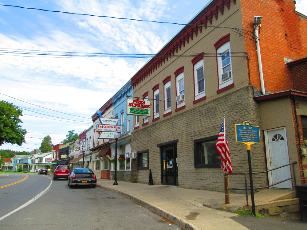
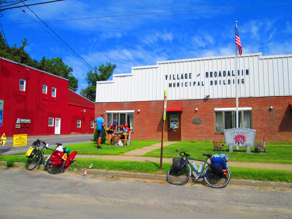
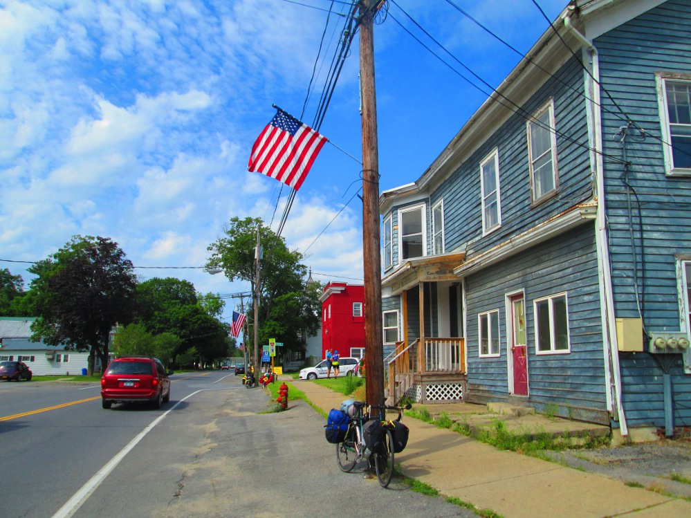
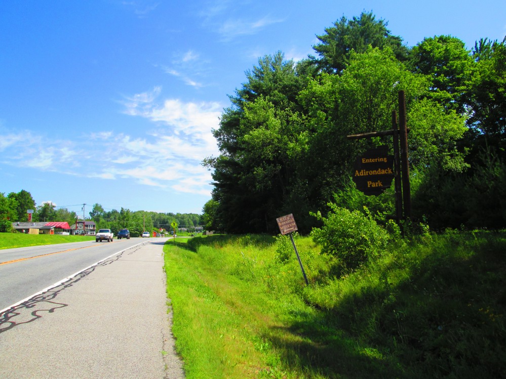
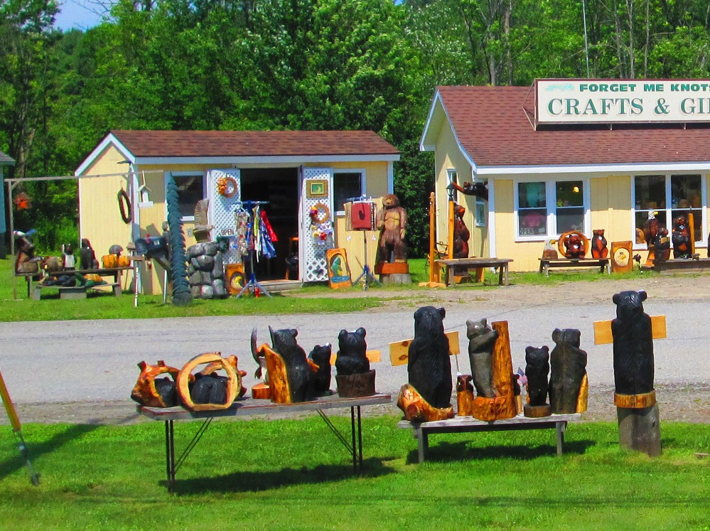
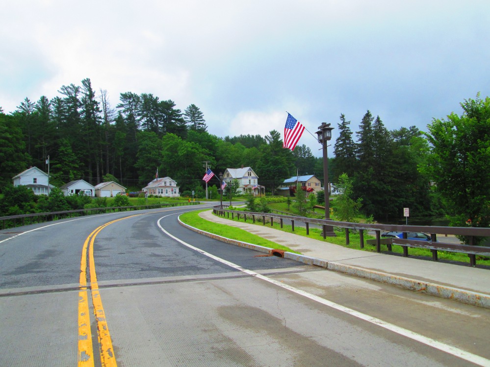
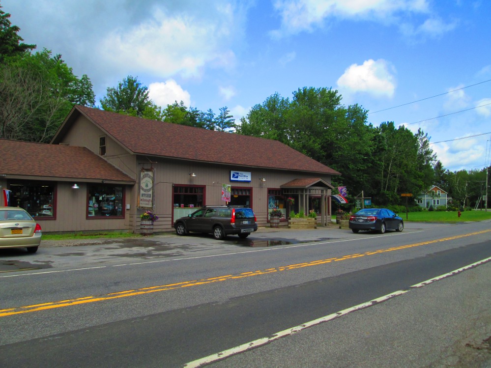
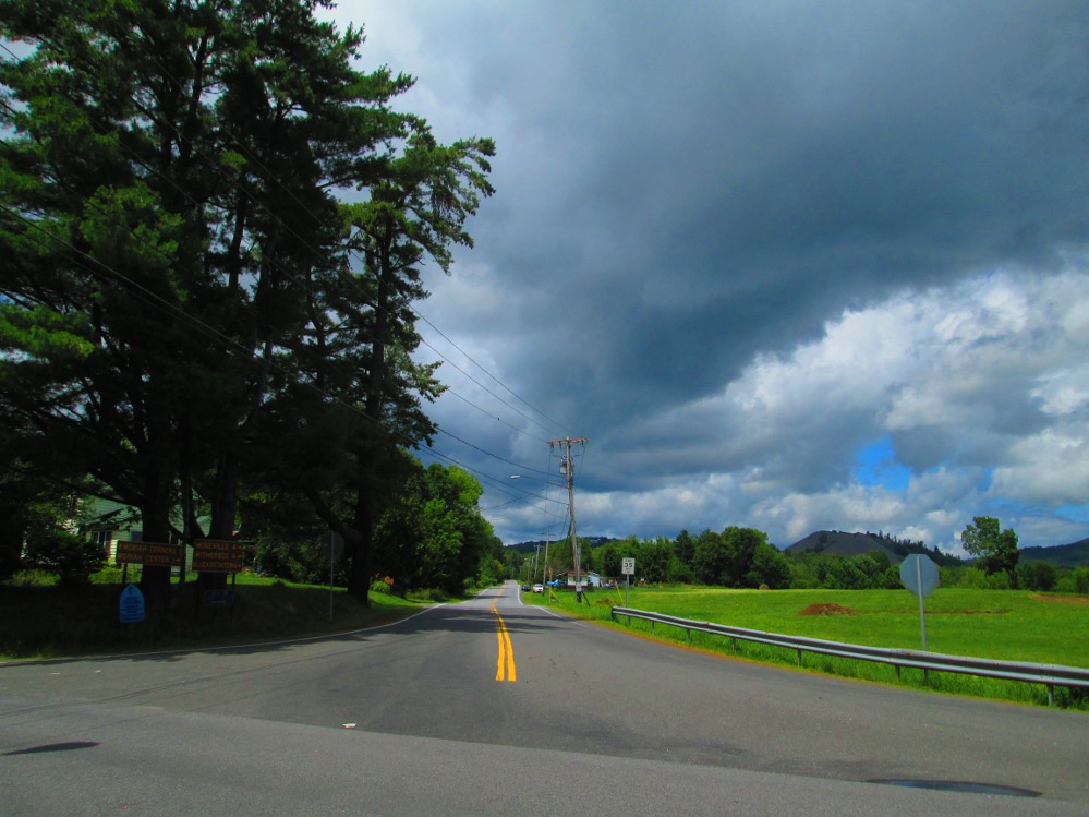
The road from Sarratoga Springs to Broadalben gets busier as everyone wakes up, and stays that way. As it is, this is one of the busier roads of the tour for a few days. Many tourers stop for an extended break in Broadalben. This town was settled in 1770 and is named after the Broadalbane Region in Scotland that is also hilly. At Broadalben, the tour turns right on highway 30, the Adirondack Trail, leaving highway 29 behind. We are soon in Adirondack Park.
|
|
|
|
|
|
|
|
|
|
|
|
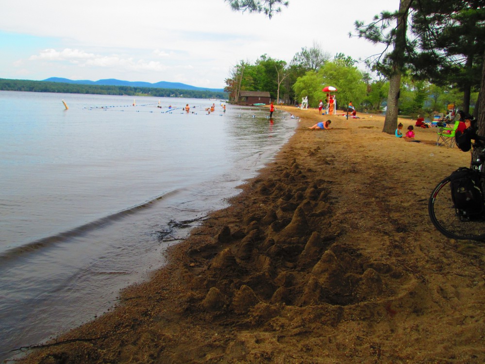
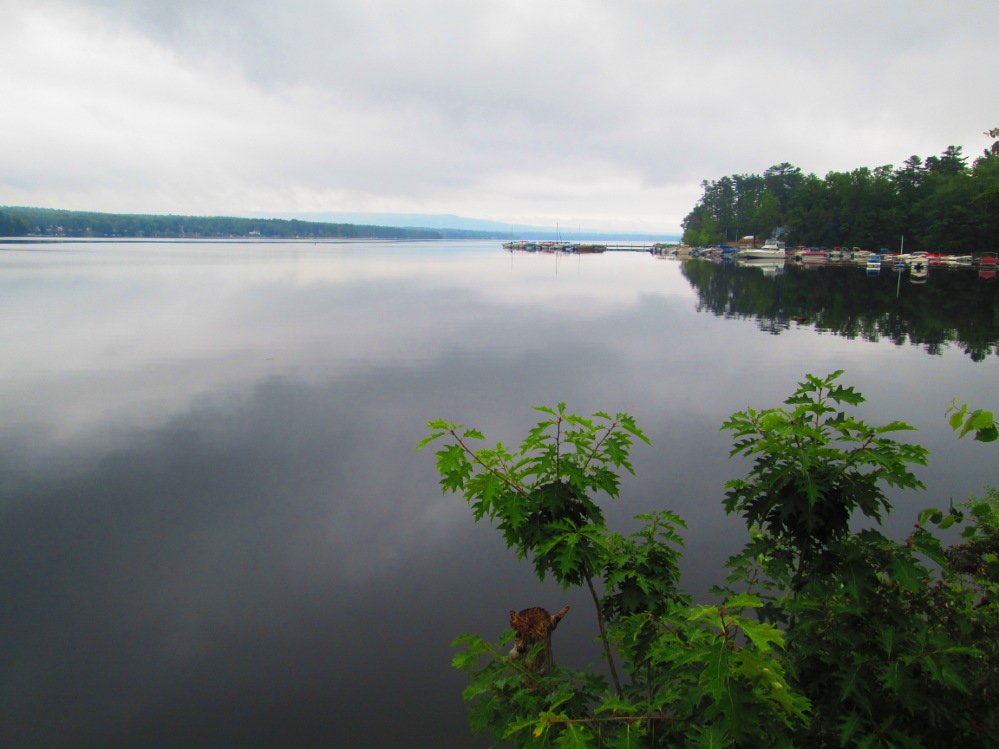
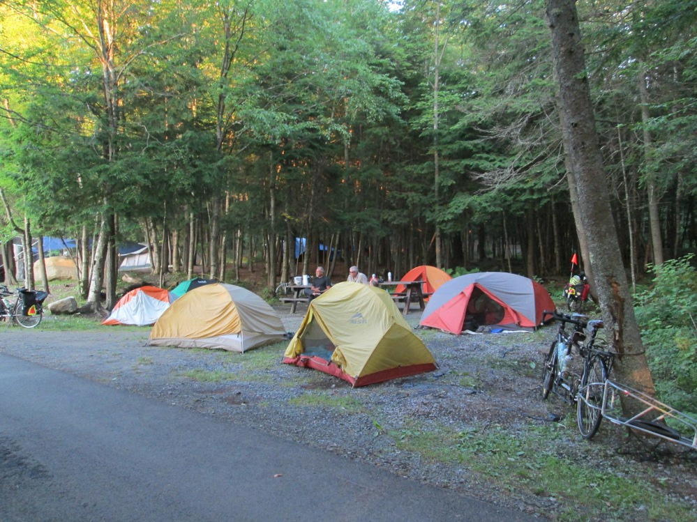
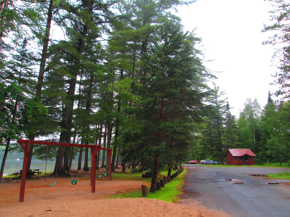
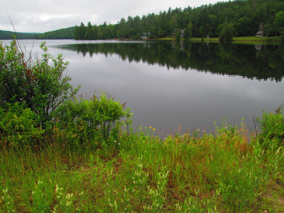
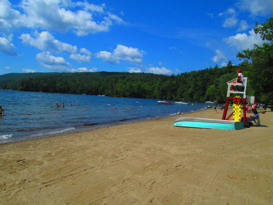
The destination of the first day of travel is Northampton Beach State Park. We purchased groceries in the nearby town of Northville. Both are on Great Sacandaga Lake that was created as a reservoir in 1930 for hydro-electric power and flood control, by regulating the flows of the Hudson and Sacandaga Rivers. It was named Great Sacandaga Lake in 1960s to promote tourism. Northville was the setting of a 1997 two-part episode of the television series The X-Files.
The local area between the campground and Northville is quite flat unlike the hills before and after this rest spot. There are lots of homes and cottages along this route by the Lake. The State campground has good accommodations and I, like many others, do go swimming at the supervised beach where there's a lifeguard.
There's lots of rain overnight that stops by breakfast. We all pack up our wet gear, that would take forever to dry, in the forested area where we camped.
|
|
|
|
|
|
|
|
|
|
|
|
|
|
|
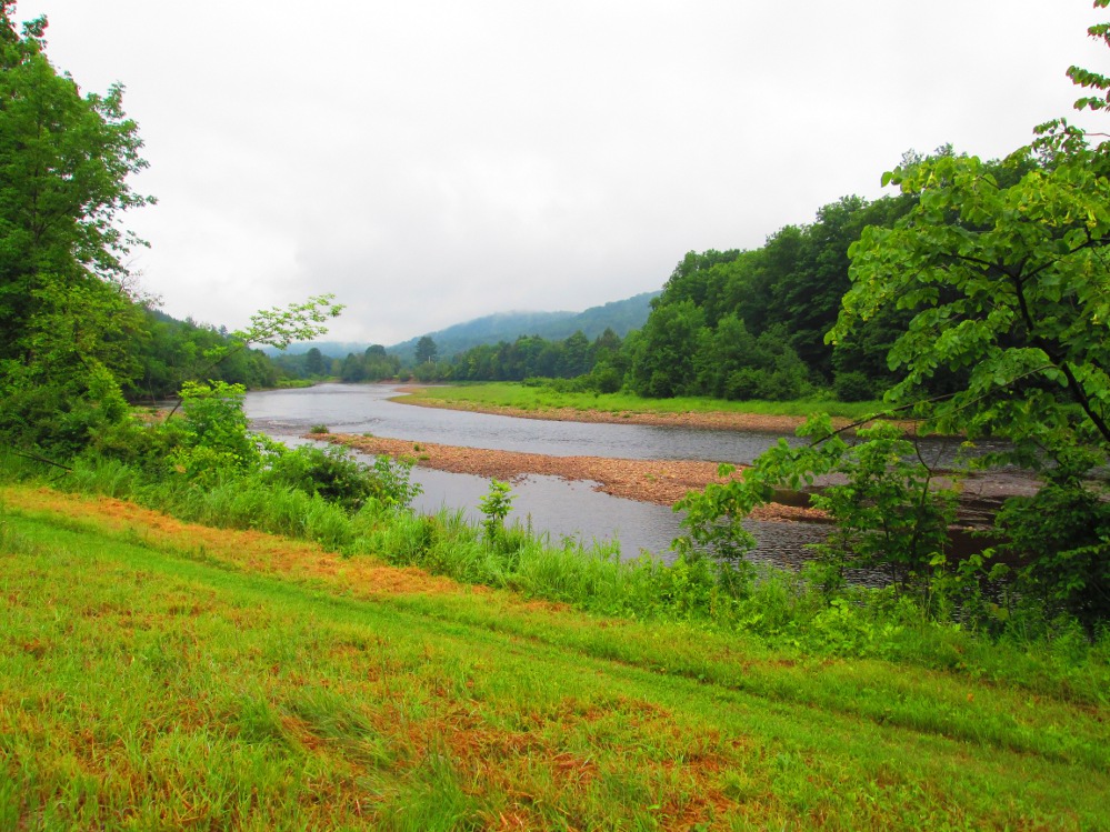
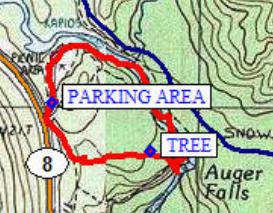
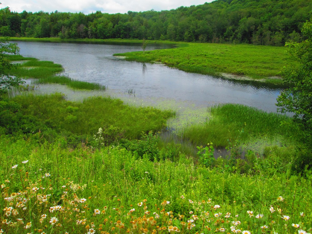
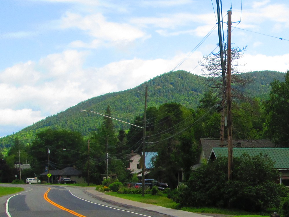
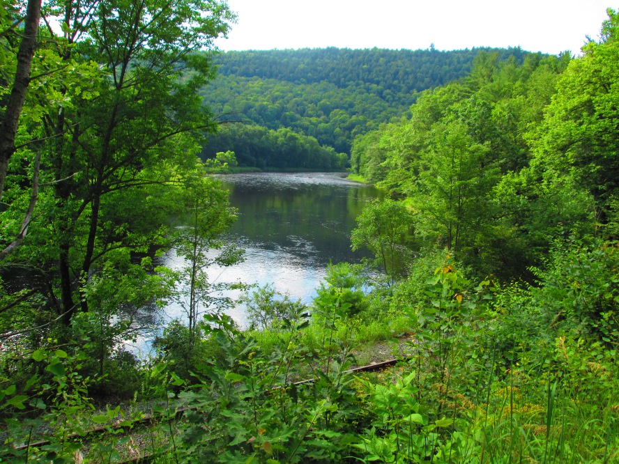
The first part of the day after Northampton Beach is somewhat flat as it goes up the valley of the Sacandaga River. Soon the ride is in the hamlet of Wells. All is quiet in the early morning except for some people working on the dam to Lake Algonquin.
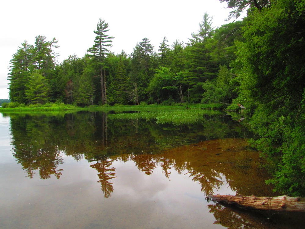
The hills begin soon enough. There are some rolling hills and a few steep climbs, but overall this is a great valley to cycle through. I see the Sacandaga River many times through the trees, and am amazed by its beauty and strength. I note that this is something I did not see when driving along this road in a car. I was moving to fast to notice. Now, on the bicycle, I can take it all in … the River and the landscape and the hills and mountains.
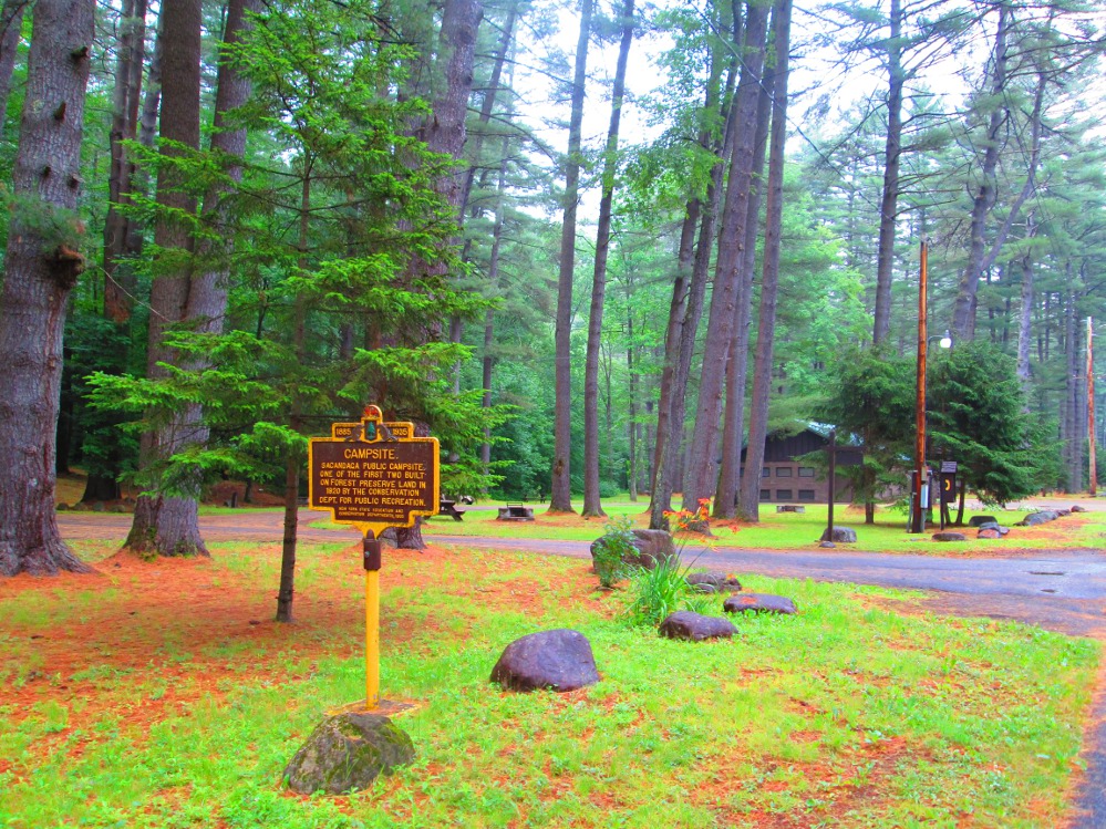
I follow the old road beside the Sacandaga River and go through Sacandaga State Park. It was one of the original state parks in New York. The barrier on the road ,at the north end of the Park, is easy to get around. It's more pleasant than the highway, and avoids one hill.
|
|
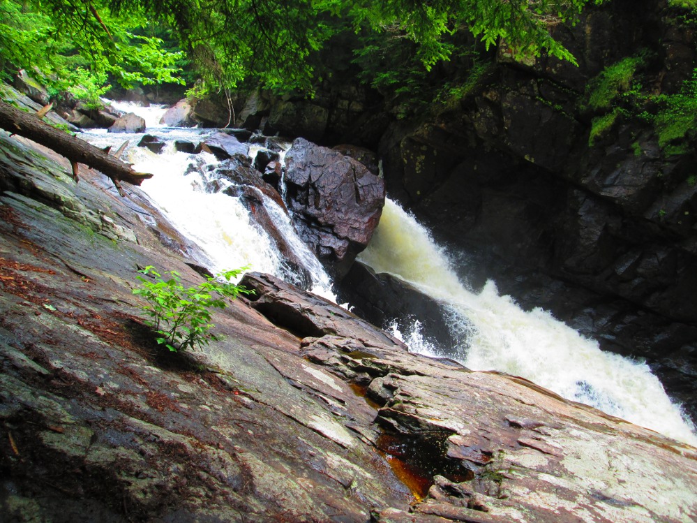
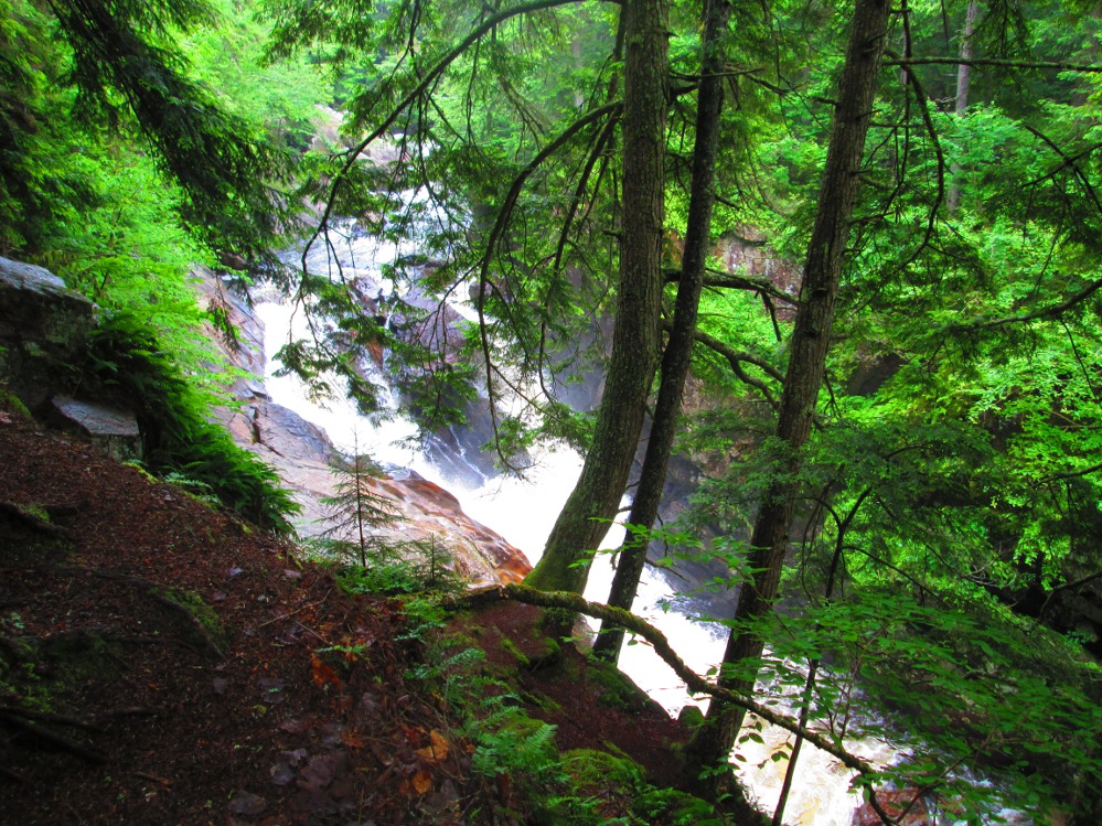
About 5 miles after Wells, I stop and do a 15 minute hike to see Auger Falls. This is a short trail with lots of roots and rocks. There are family groups doing this hike, too. I meet one as I'm starting the hike. They encourage me. And, see another starting out when I am back at my bicycle. The hike is worth it. Auger Falls is a cute little falls on the Sacandaga River. There is lots of water flowing over the Falls, probably due to the recent rain? |
|
|
|
|
|
|
|
|
|
|
|
|
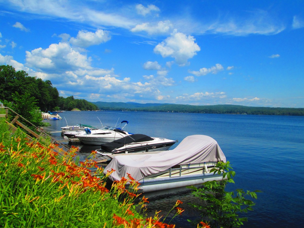
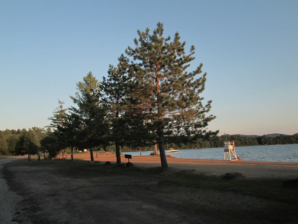
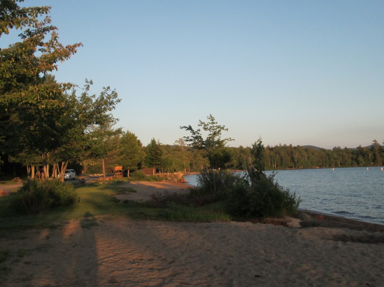
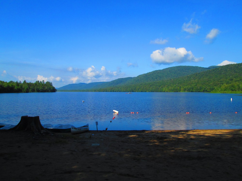
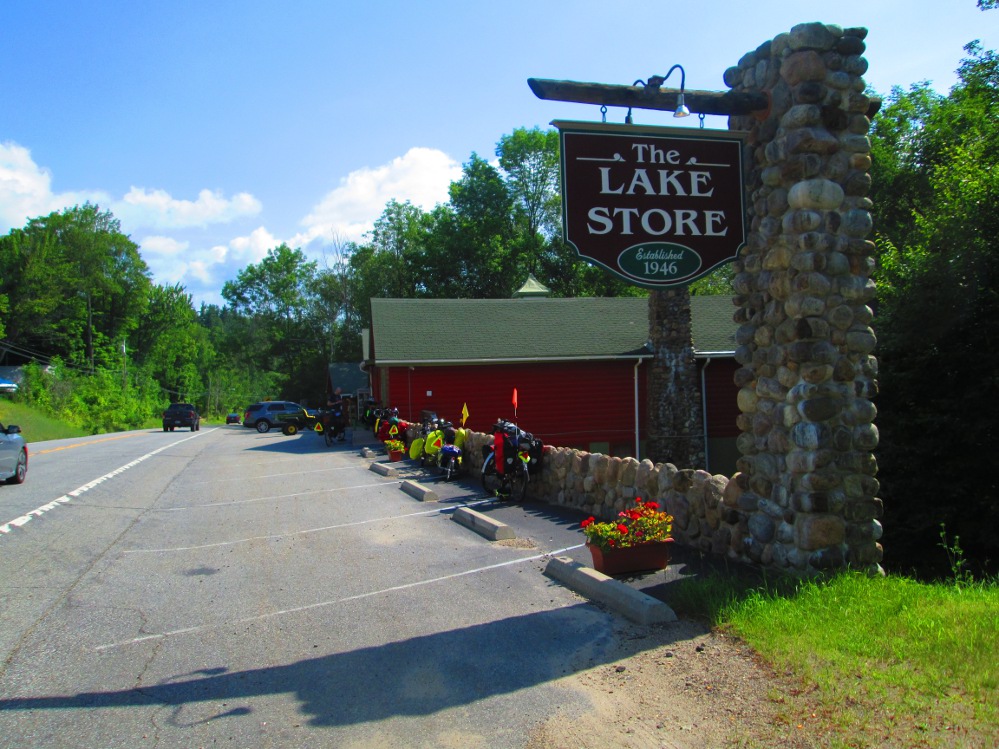
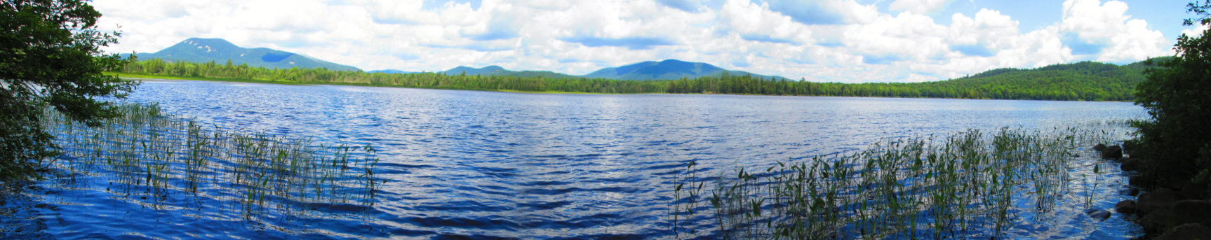
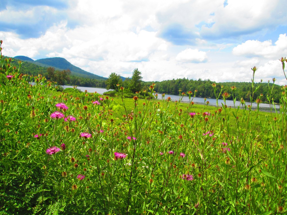
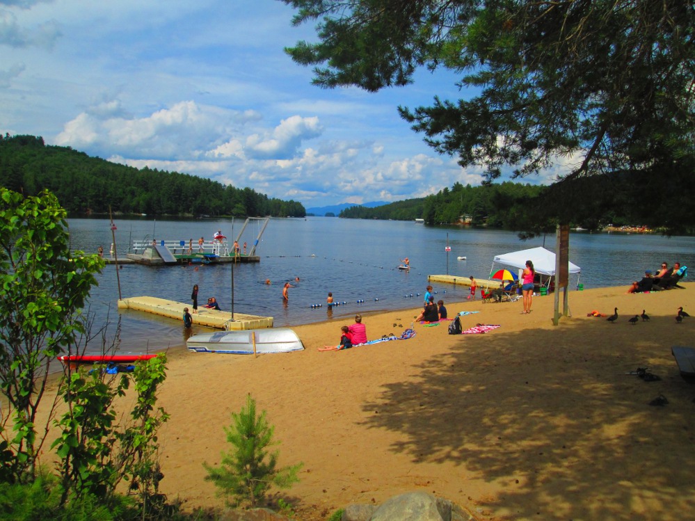
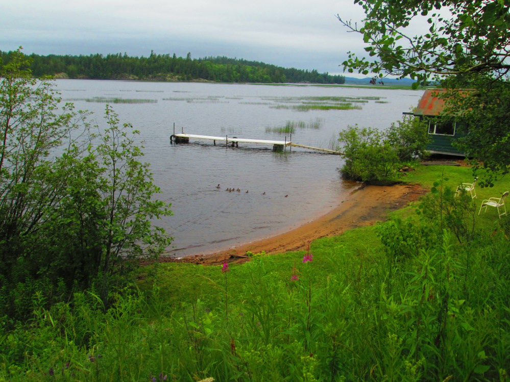
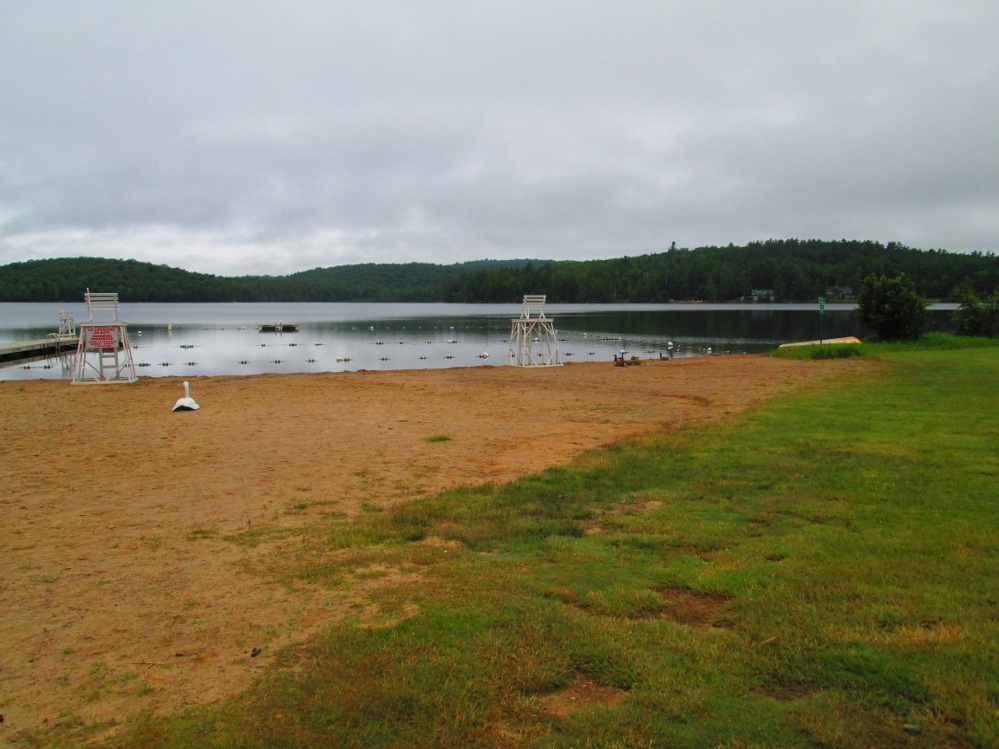
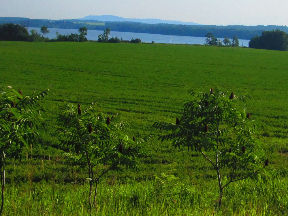
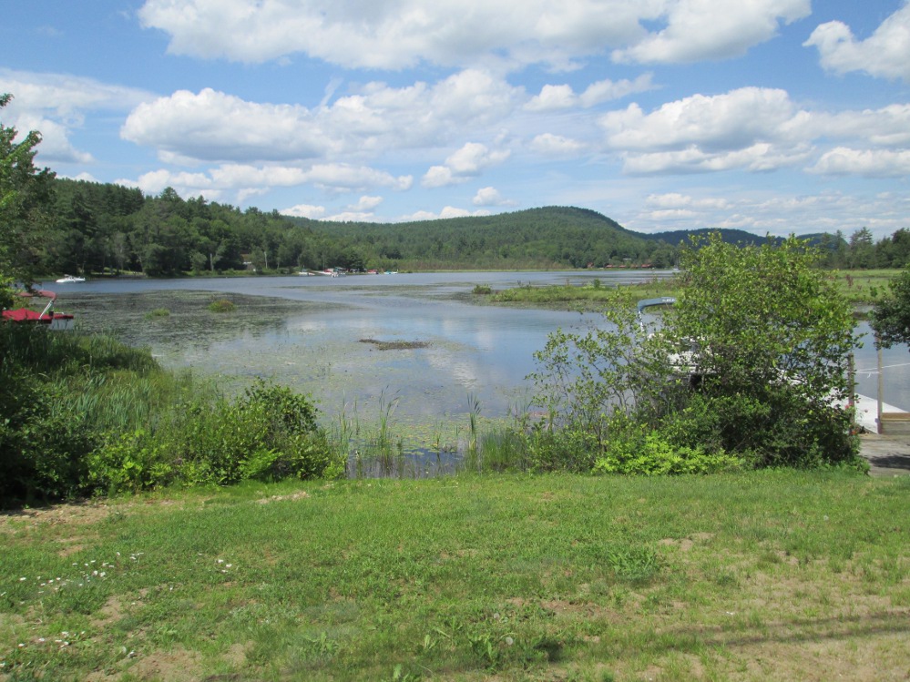
Today's campground is at Moffitt Beach State Park on (another) Sacandaga Lake just after passing through the village of Speculator. The townsite of Speculator is on Lake Pleasant where I take a few pictures. Lake Pleasant and Sacandaga Lake are joined by the Sacandaga Outlet, a short stream that flows under Route 8 shortly after (west of) the turn off to Moffit Beach State campground.
I swim again at today's campsite and go for a short hike along the beach. It's just so pleasant enjoying the peace of nature after today's road with its cars and trucks, and, definitely, a sharp contrast the living in the city, eh? I can see how many people come here to relax. The water in Lake Pleasant is warmer; I estimate 72 F? There is again rain during the night. It does stop just before we awake in the morning so we have a relatively dry breakfast.
In ancient times, Speculator was the hunting and fishing grounds of Mohawk and Algonquin tribes who came here in the summer. Speculator evolved into a tourist town, starting in the 1850s, when many hotels were built. The tourist attractions included hunting and fishing, and adventures deep into the woods of the evolving Adirondack Park. There was also a lumbering era with several saw mills close by. Tourism continues today in this all season vacation area, including skiing in the winter on the nearby Oak Mountain.
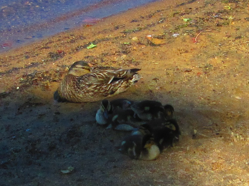
In the morning, I take a short break at the 15 mile point, at Lewey Lake campground, another well-kept state park. It's so peaceful that there are baby ducks sleeping on the beach.
|
|
|
|
|
|
|
|
|
|
|
|
|
|
|
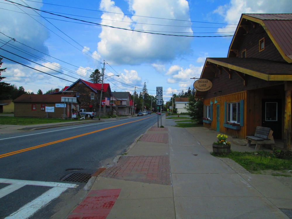
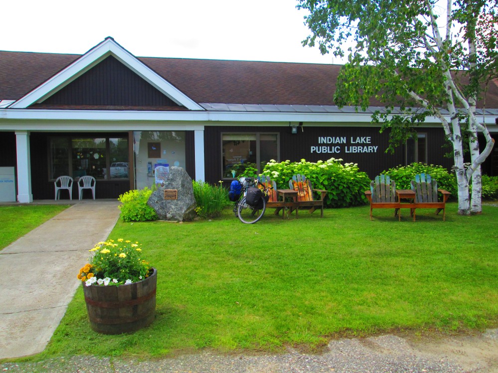
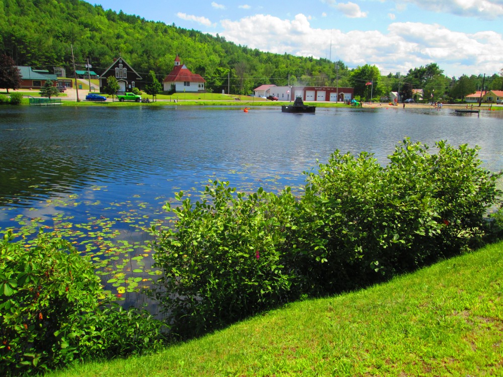
Shortly after Lewey Lake is Indian Lake. The Lake, itself, is 12-mile (19 km) long with lots of hills beside it making it seem to go on forever? There are lots of cottages and houses along the Lake. 2 miles further on is the town site of Indian Lake where I stop and use the Internet at the public library. It is nicely set up with 24 hr WiFi and chairs outside to sit and use the WiFi! I keep up with the news of life outside.
Thoughs I didn't see any, Indian Lake is known as “The Moose capital of the Northeast.” I did see 3 deer crossing the highway early in day and a fawn later, across the road from the Adirondack Museum.
Indian Lake did inspire Tony Romeo to write the 1960s hit single INDIAN LAKE for The Cowsills.
Indian Lake is also known as the "Whitewater Capital of New York State." Rafting occurs on the Indian and Hudson Rivers, about 10 miles east of our route on this trip.
For some of us, there's the Black Fly Challenge mountain bike, and cyclocross race to return to every June.
|
|
|
|
|
|
|
|
|
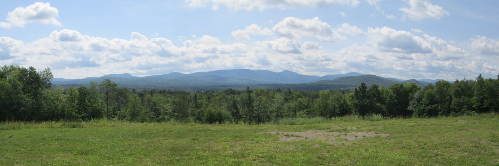
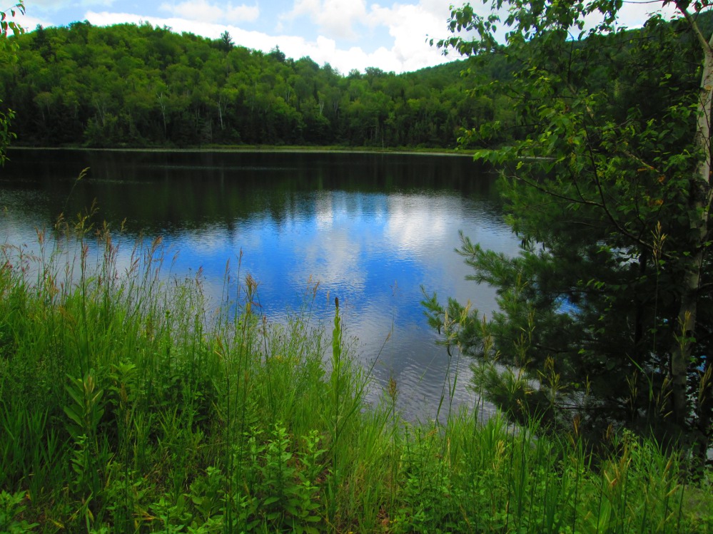
On the road to Blue Mountain Lake, I see many great trails to hike this morning. I choose the hike the short trail to Rock Lake. It's calming to be off the road and feeling at one with nature. Refreshing! It's sunny at first, but there's a short rain shower when I'm on this brief hike! The rain just keeps on coming! No wonder it's so green and healthy.
The town of Blue Mountain Lake is on a lake of the same name. It is again a tourist area for hiking, boating, camping and relaxing with one hotel featuring rooms that lack all electronic distractions like televisions, radios, and telephones. The ultimate spot to relax, eh? There's popular hiking on Blue Mountain and Castle Rock.
I expect to find many of our group up the hill from Blue Mountain Lake at the Adirondack Museum where they planned to stop, but in the end, I find them in the next hamlet of Long Lake, outside a grocery store. Yum! Some, claim that the hill beside the Adirondack Museum is one of the steepest that they have ever climbed. It is steep! Remember, I saw a fawn part way up the hill on the right, opposite the Adirondack Museum on the left.
In Blue Mountain Lake, in 1881, Frederick C. Durant, cousin of William West Durant, built Prospect House, the first hotel in the world to have electric lighting in every room? It was engineered by Thomas Edison who frequently visited the area.
|
|
|
|
|
|
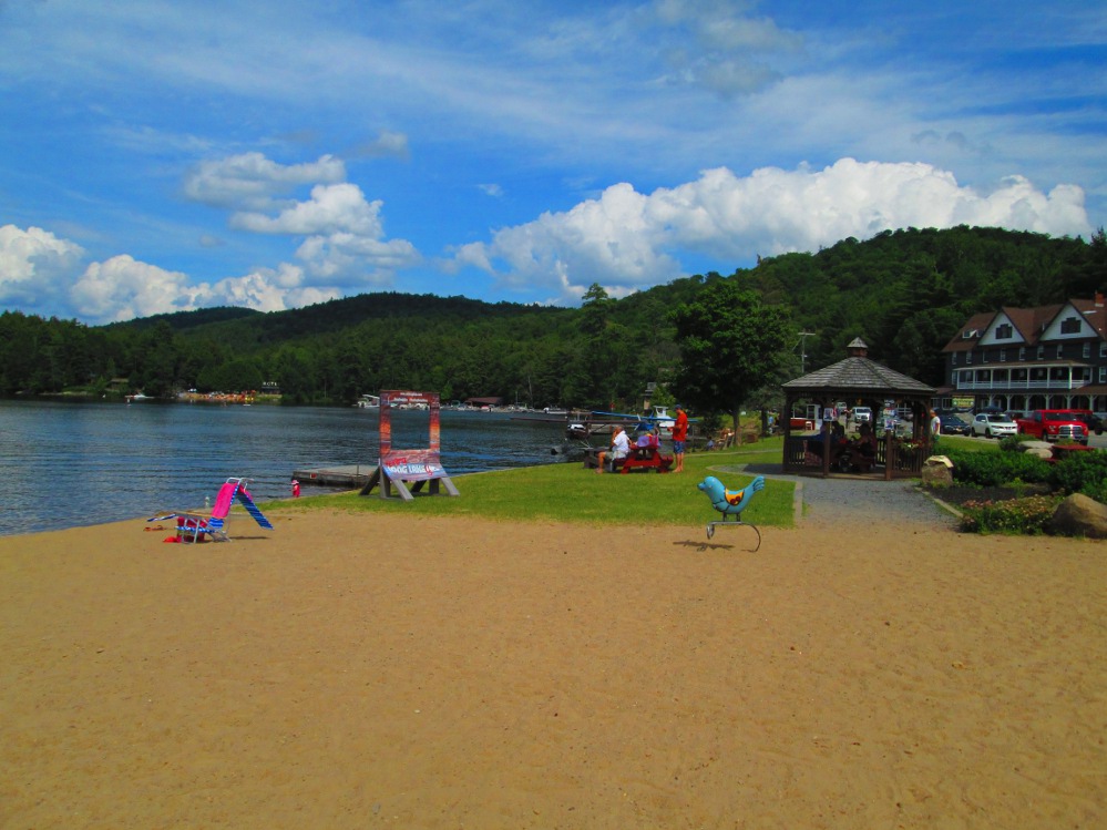
The hamlet of Long Lake is beside a 14 mile long lake of the same name. The town was established in 1837; some of the houses look like they are that old though most of the town was destroyed by fire in 1908! The town was somewhat isolated until a road was built in 1892. Before that, most visitors came by boat along the Raquette River of which the lake of Long Lake is a widening. This “Highway of the Adirondacks” is celebrated each fall with The Adirondack Canoe Classic, a 3 day canoe race with 250 entrants.
Today's camping is a few miles after Long Lake at Eaton Lake State Campground. It's also a good place to swim after skipping by the public beach in Long Lake. Our group purchased food in Long Lake at Northern Borne Store on the short Main Street that is packed with parked cars and a traffic jam. The Store is beside Long Lake Helms Seaplane Base.
|
|
|
|
|
|
|
|
|
This trip now enters the Tri-Lakes region: Tupper Lake, Saranac Lake, and Lake Placid. The road into Tupper Lake is somewhat flat after the first 10 km of hills, and has a wide shoulder for the last bit. We meet some local cyclists out training on this route.
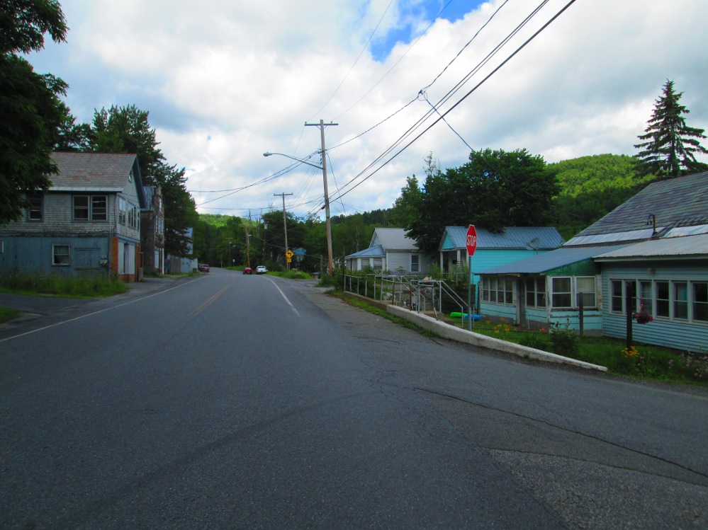
Tupper Lake is like 2 towns with a big park and open area in between. Both towns were joined into the town of Tupper Lake in the 1940s. The town to the north and west was called Faust, and, then, The Junction, a name based on being the junction of railroad lines. The town to the south and east is the original Village of Tupper Lake. This village was originally settled for lumber production starting in 1844 and grew after it gained railroad service. Tupper Lake was once known as the largest lumber producer in New York state. Most buildings in town were built after the great fire of 1899 and remain to this day as the dominant occupants of this historic site.
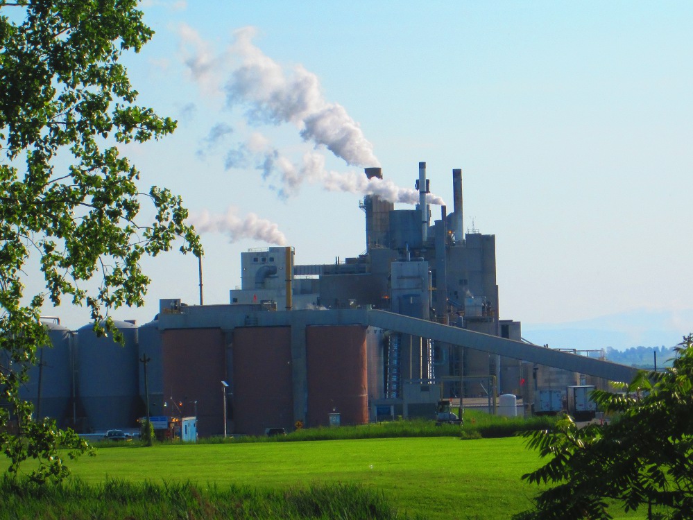
The space between the Tupper Lake and Faust was the home of the mill of the Oval Wood Dish Corporation for over 50 years, starting in 1916 when it moved here from Traverse City, Michigan. It originally produced wooden dishes and cutlery. Across the street from the remains of Oval Wood Dish Corporation is the site of the Tupper Lake Woodsmen's Days in early July each year.
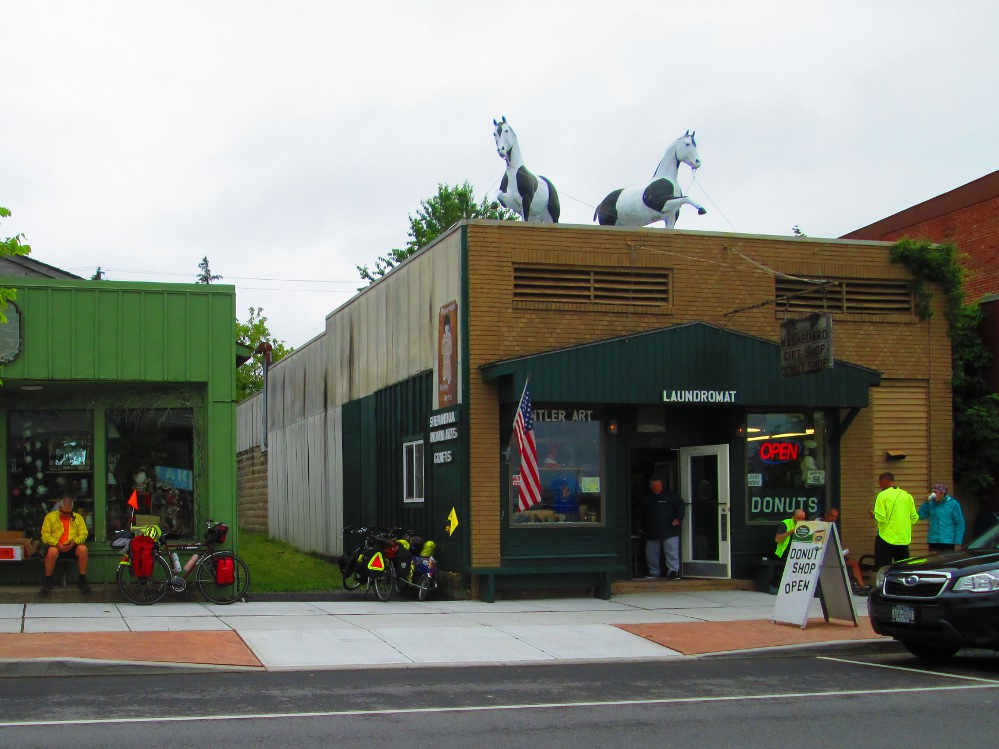
Our day in Tupper Lake is overcast with the occasional rain shower and heavier rain in the afternoon. The official route of the trip goes through the village of Tupper Lake. Many riders follow this route after stopping for a fresh donut at The Washboard Donut Shop and Laundromat. Yummy donuts!
I decide to look around and start exploring by walking on a trail beside Raquette Pond through Tupper Lake Municipal Park, riding to The Junction on Demars Boulevard, and following the same road, that is now called Main Street, to the other side of The Junction. In the junction is a mini-main-street that looks a bit more run down than that in the Village of Tupper Lake.
The trail along waterfront is impressive and has many historical exhibits. Further on, just before The Junction I see paintings of various historical scenes. Just before these are the remains of the Oval Wood Dish Corporation including a large smoke stack with a faint OWD painted on it, and a large factory building that is currently marked “For Lease.” After OWD ceased operation, this building was occupied by a factory making plastic cutlery for many years. The factory owners sold out to Jarden Plastic Solutions that moved this production facility elsewhere a couple of years later.
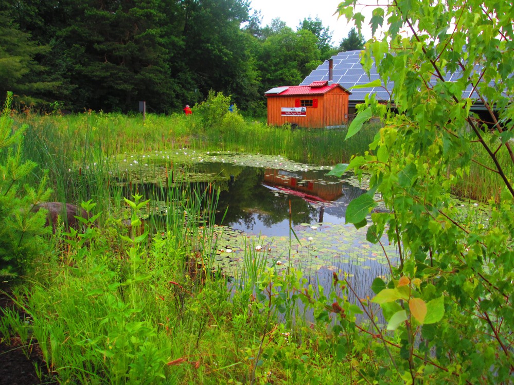
On the way out of Tupper Lake, I stop at The Wild Center, a museum about the natural history of the Aidrondacks. It opened slightly over a decade ago in 2006. There's lots to see at this museum:
I'm impressed by a globe on which a computer projects from inside, things that are happening or in historical patterns of their activity, like weather patterns, and the bright lights on the earth's surface, etc. The computer “turns” the globe to any angle, including sideways and upside down.
There is and art exhibit right now at Museum of peoples' impressions of a forest. Many are intrigued by roots of trees, one sees bugs.
I walk through the iForest. It is an outdoor exhibit in a small forest where there is continuous music that was specially composed for the forest.
After The Wild Center, on the way out of Tupper I see several large buildings that have an institutional style. These buildings comprise a large treatment center that was a large hospital and home for veterans from 1922 to 1962. After that it became a state home for those with severe disabilities. Today it is called the Sunmount Developmental Disabilities Service Office.
|
|
|
|
|
|
|
|
|
|
|
|
|
|
|
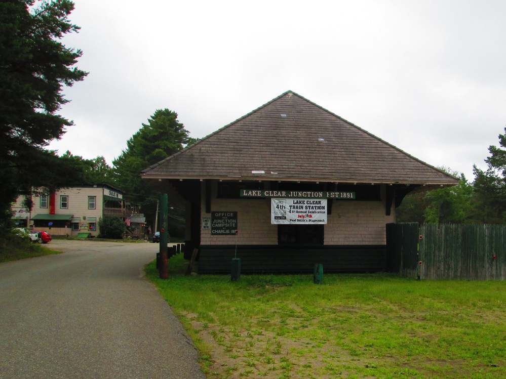
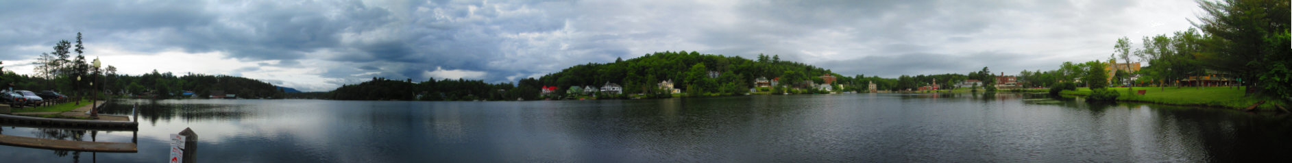
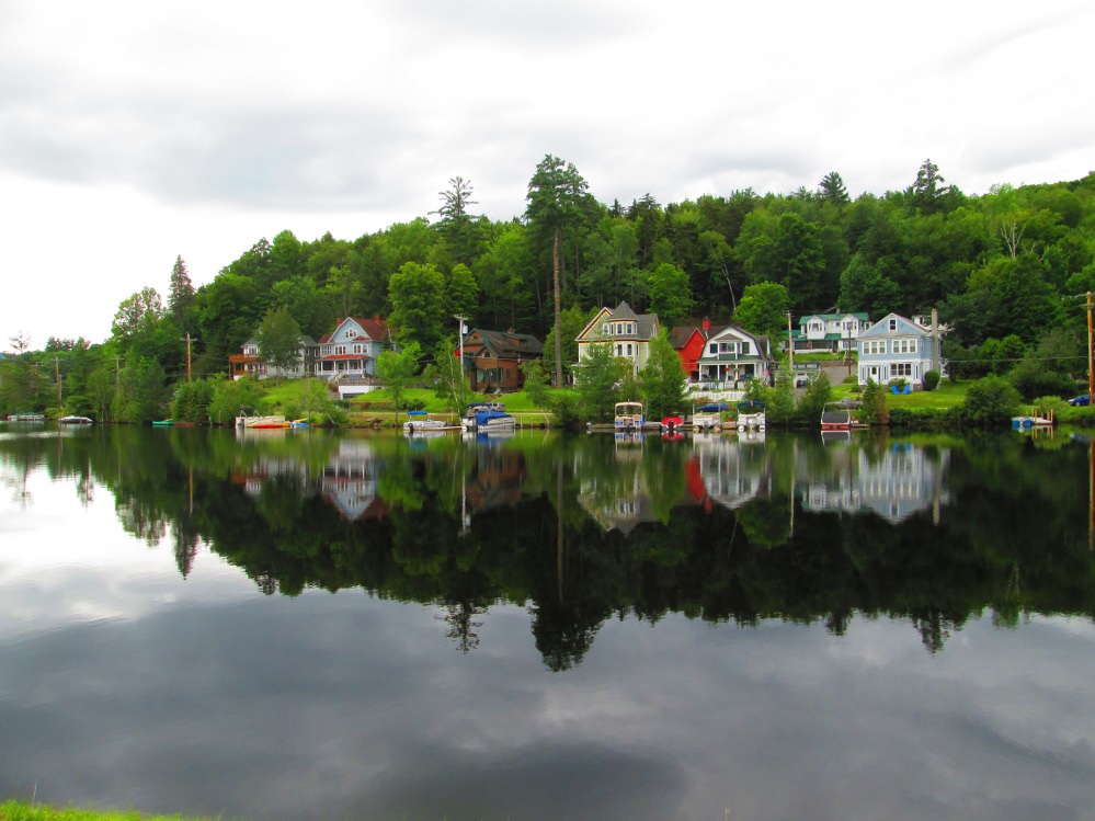
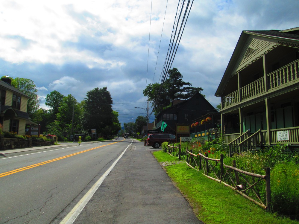
Our route is almost flat after Tupper Lake, particularly when #30 leaves #3. Now we're basically in an area of small lakes with houses on many of them. Undoubtedly there are many 2nd homes mixed in here. I stop many times and take pictures. The bicycle riding is better this afternoon with few cars on #30 road. The road does wind a bit, but there are few hills. This area near Lake Clear is a traditional tourist area that grew when the railroad got here in 1893. Canoeists like thies part of Adirondacks too as it is relatively flat with a few small lakes.
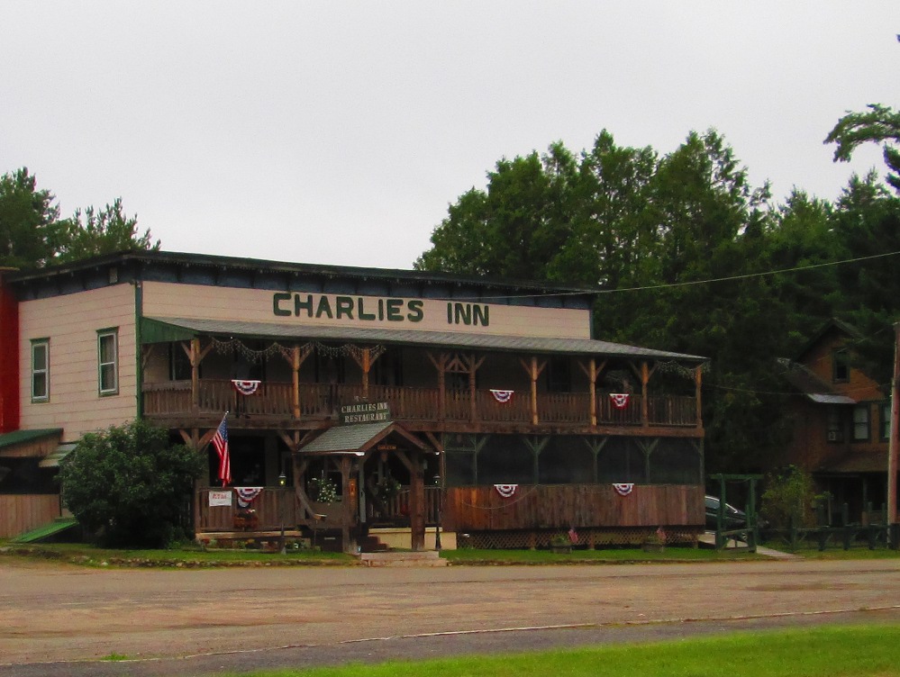
This evening we camp at Charlie's Inn & Campground in Clear Lake Junction that was originally built to service the railroad. We also eat their top-of-the-line food at reasonable prices. I do up my notes in their laundromat as it has a few chairs and an electrical plug in. I'm reserving my laundry day for tomorrow in Lake Placid where the group is in indoor accommodation. Camping sites are on thick grass which is nice. Unfortunately, there is no swimming at the campground this evening as it is not directly on a lake. It is a bit chilly, too, in the late afternoon at Charlie's Inn. I now see that Lake Clear is about a mile away. Is there a beach close by, too? Google maps shows one a mile further north along road 30. There are lots of trees that hide these things! I'll swim there next time, eh?
|
|
|
|
|
|
|
|
|
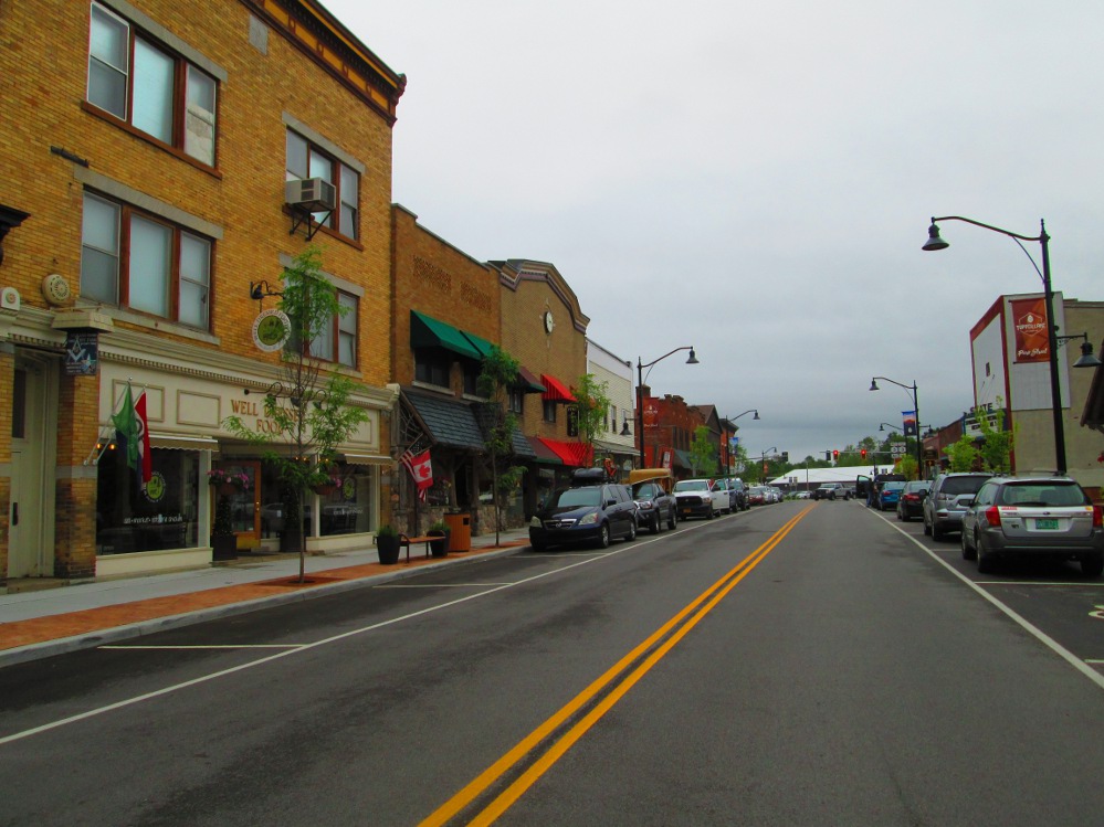
Saranac Lake is the second of the tri-lakes on this tour. I take lots of pictures in Saranac Lake where I do ride through town and downtown rather than taking the by-pass route that our tour follows. On my way out of Saranac Lake, I have a short chat with 2 summer staff who are reminding boaters at a boat ramp on Lake Flower to clean their boats and not spread invasive species.
Saranac Lake was first settled in 1819 when it had a dam and saw mill. The town became an international centre for the treatment of Tuberculosis from 1890 to 1950. Saranac Lake is currently a tourist centre with many parks along Lake Flower that are now owned by the town, but were started by Village Improvement Society. Tourism is further enhanced by the occurrence in Saranac Lake of the Empire State Winter Games for amateur athletes. The plan is to continue these games, though the Empire State Games have had problems surviving before.
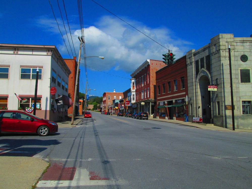
I did ride by the Saranac Lake Community Store. It was planned and opened in 2011 to replace the services of an outlet of the now-bankrupt Ames Department Store. The decision was made to have the local Community Store after the town deciding to not approve the building by Walmart of a super-centre of 250,000 square feet. The end result is that Saranac Lake continues to have a thriving Main Street with many small businesses.
|
|
|
|
|
|
|
|
|
|
|
|
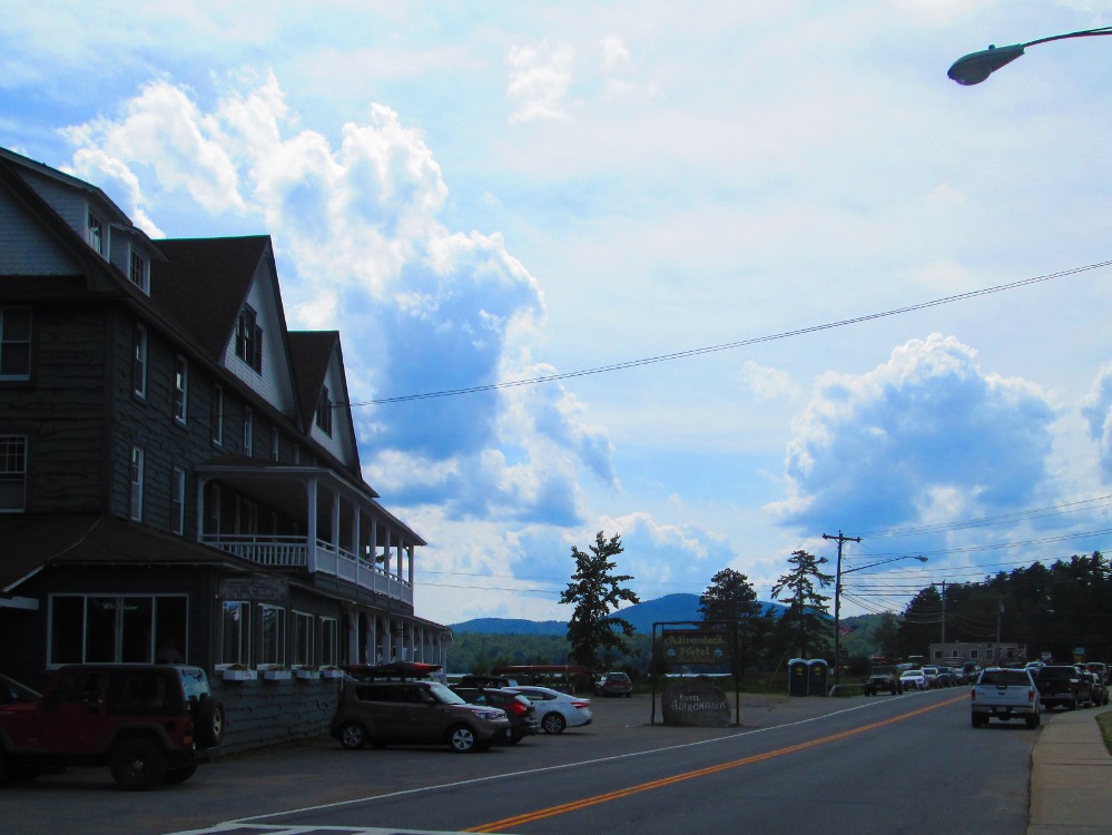
I spend most of the day in the Village of Lake Placid, the 3rd Tri-Lake municipality, as it is about 30 km from last evening's camping at Lake Clear.
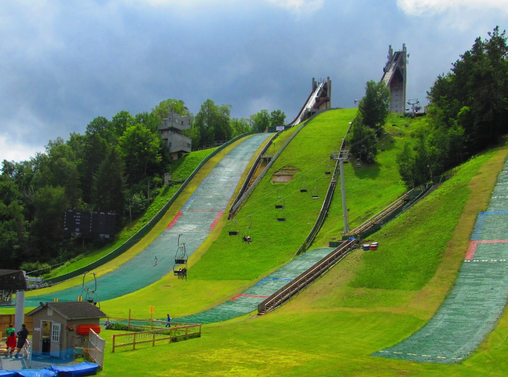
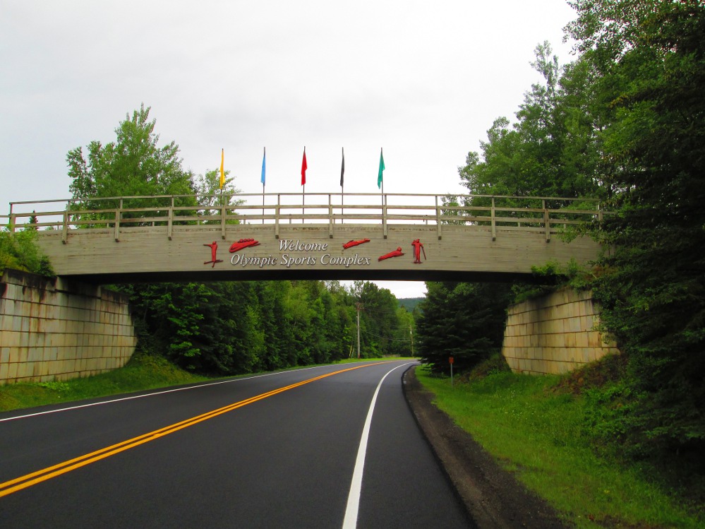
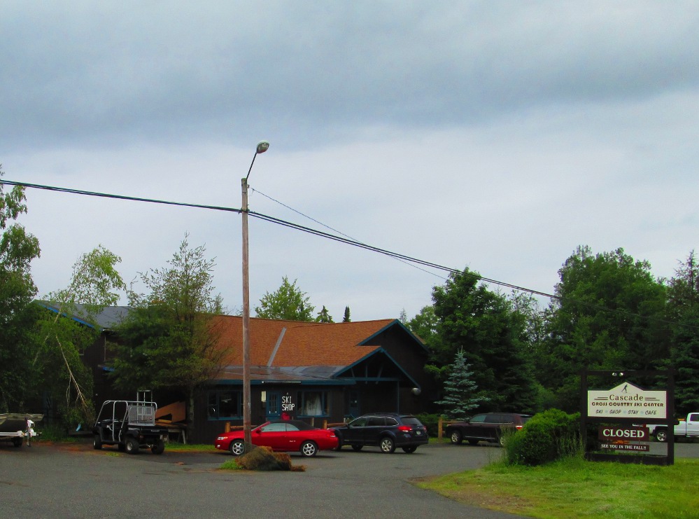
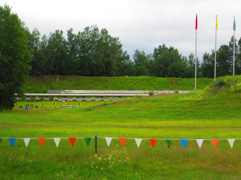
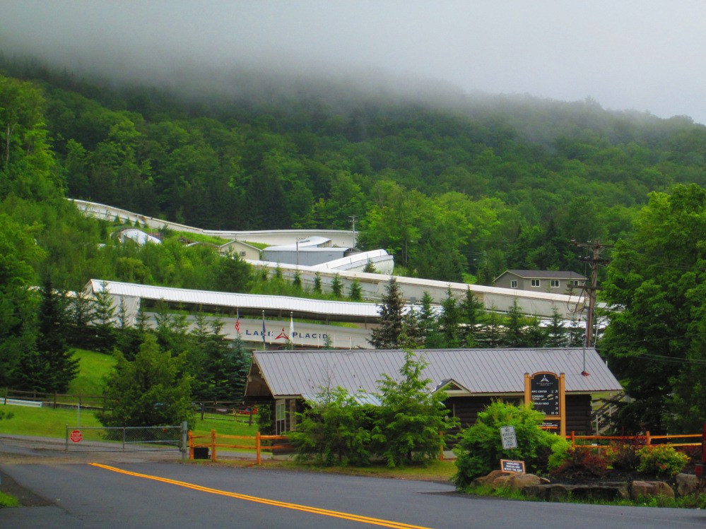
I leave the crowded highway of our tour as fast as I can, a bit after Ray Brook, and turn onto the Military Road, a back-road to Lake Placid and follow it to Mill Pond Drive. Military Road bi-passes the town and is faster when one is going hiking and starting at the Adirondak Loj of the Adirondack Mountain Club that we'll see the road to on the way out of Lake Placid. Along the way, I note the Olympic Training Center at the side of the road. Since then, I've read that athletes from many sports train here though concentration is on Bobsled/Skeleton, Luge, Freestyle Ski, and Biathlon. Later today, I will see the Olympic Ski Jumping Complex. Tomorrow, I'll turn off the road to be awed by the facilities at the Olympic Sports Complex for Bobsled/Skeleton, Luge, and Biathlon. Just before this is a great place for cross-country skiers to stay – the Cascade Cross-country Ski Center. It has trails connecting to those of the Cross Country and Biatholon Center of the Olympic Sports Complex. Skiers delight!
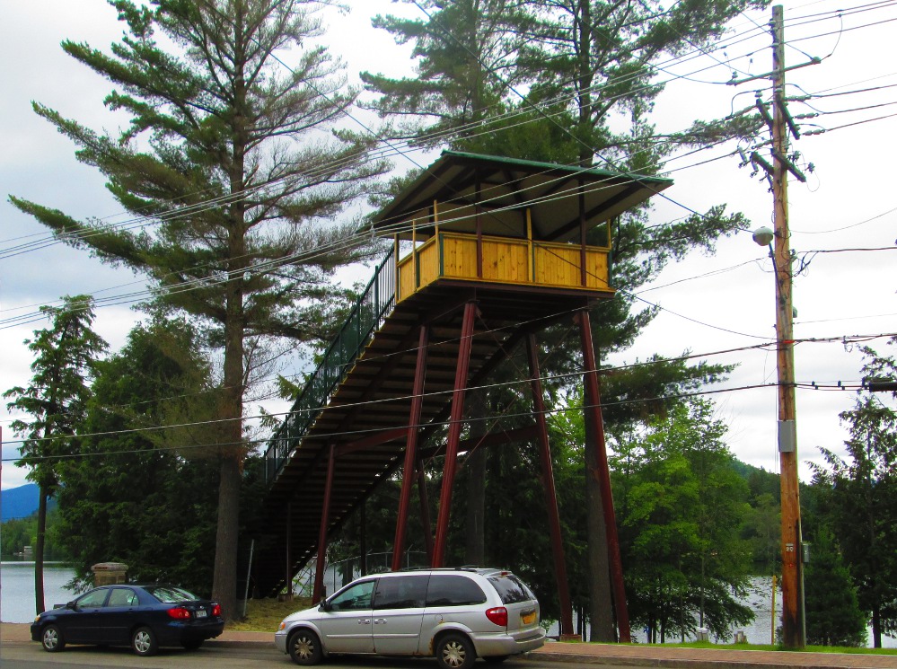
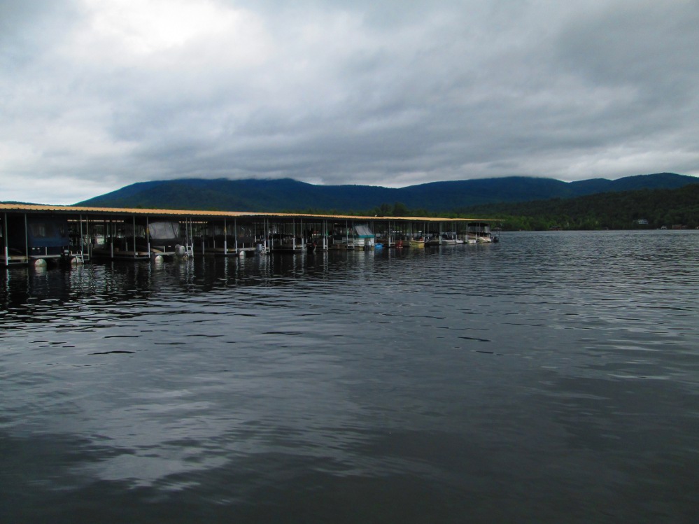
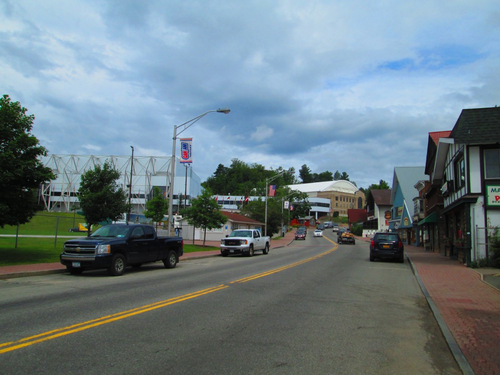
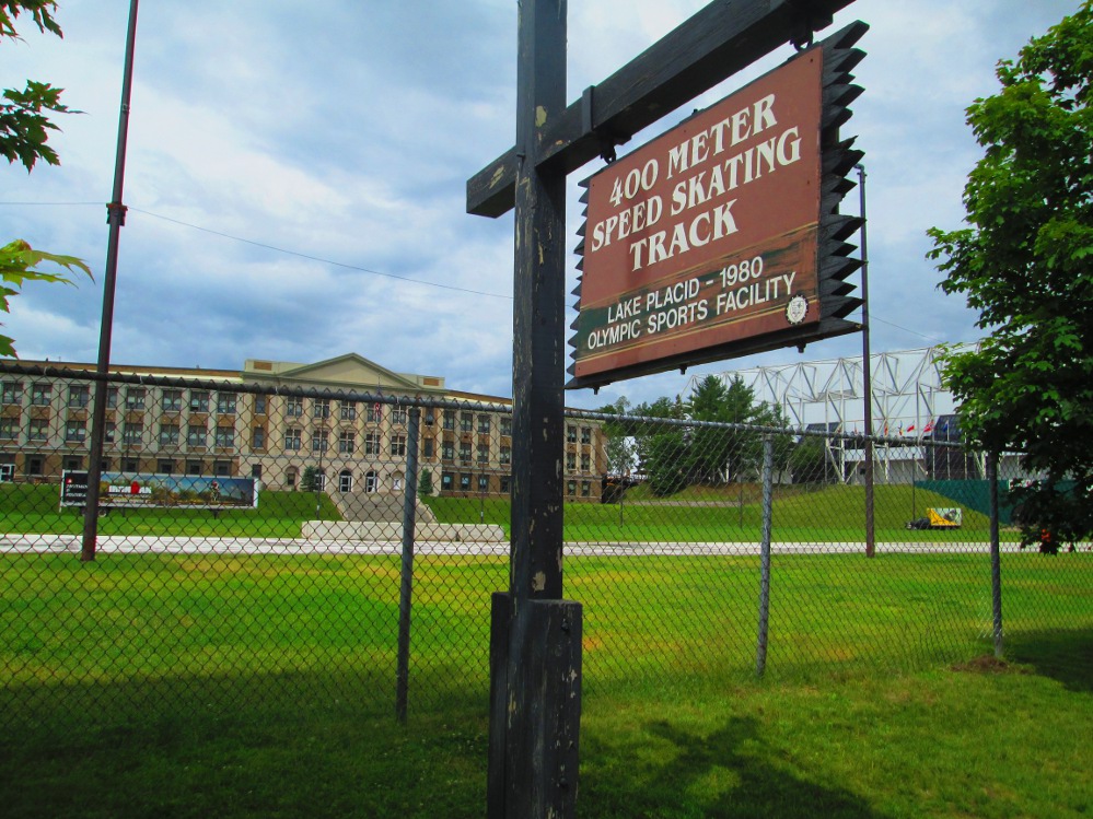
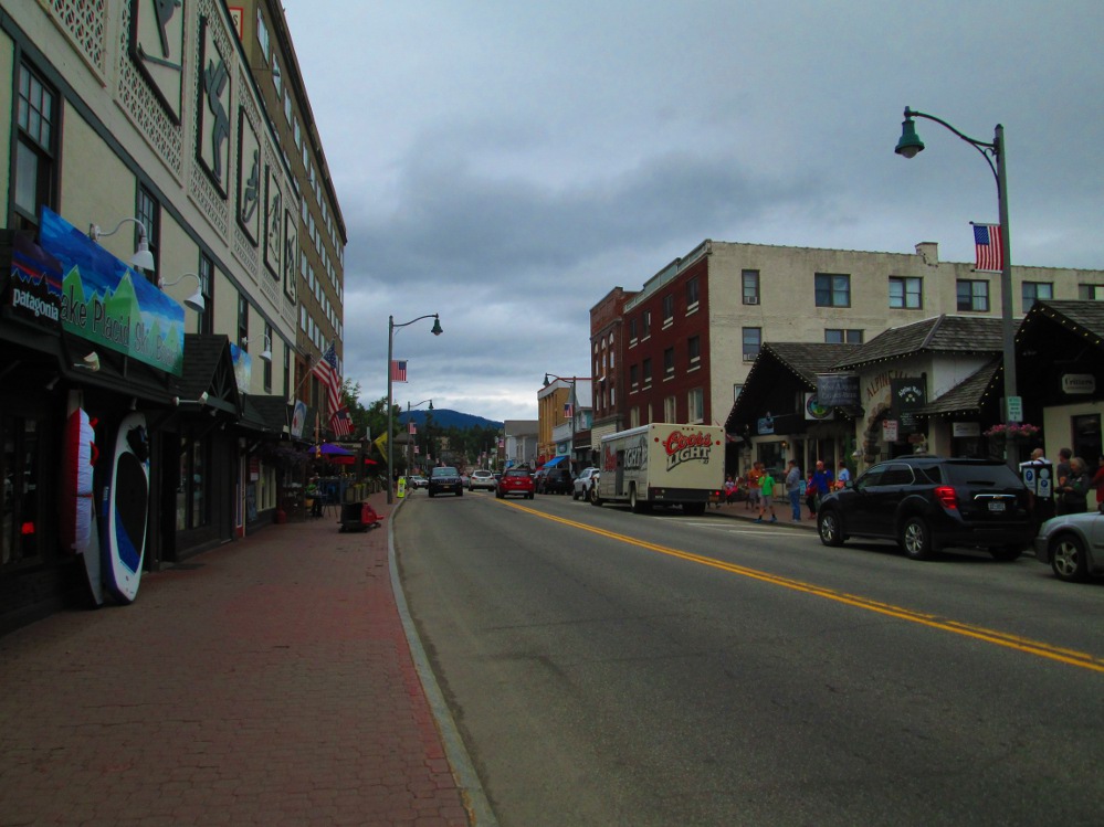
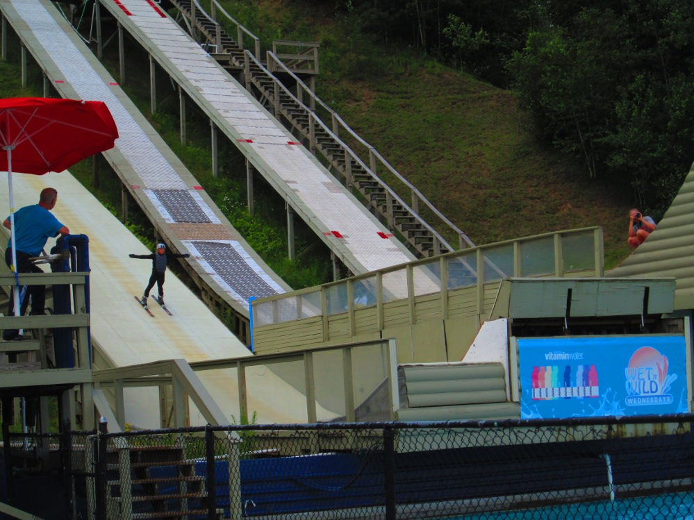
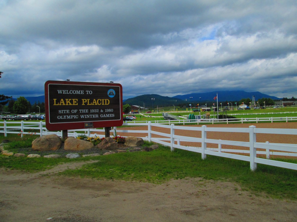
Lake Placid is famous for hosting the Olympic Games in 1932 and 1980. One of my first diversions in Lake Placid is to ride a couple of laps on the outdoor 400 meter speed skating track from the 1980 Olympics. There are lots of signs here for the Lake Placid Ironman Triathlon and 80.3 half that happens in a few days. After this, I walk around much of downtown Lake Placid with my loaded bicycle as I bet that our accommodations at Spruce Lodge will only be available at 2 or 3 pm. There are many stores selling sports equipment and tourist souvenirs, and crowds of tourists to buy these, or at least gawk at them.
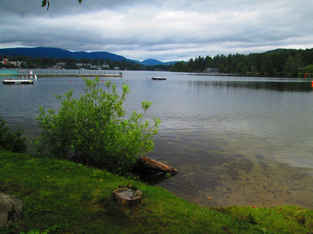
Next, I cycle around Mirror Lake, an amazingly flat route. Mirror Lake is the lake beside which the Village of Lake Placid is built; whereas, Lake Placid, the lake, is a bit further north from the Village. It is the major source of water for the Village of Lake Placid. I do see Lake Placid, the lake, by taking a side trip of about 100 yards when riding around Mirror Lake. Mirror Lake Drive is partly closed due to construction of new sidewalks and paths. The workers allow me to walk through this part. This IS a tourist town, after all! There are lots of people walking around the Lake. There are many mansions along Mirror Lake Drive, amidst the other posh accommodations available in a few low-rise hotels. This surely is built for the well-to-do, reminiscent of how Lake Placid became a vacation spot for the rich and famous in the late 1800s. There are other accommodations elsewhere, nearby, for the rest of us.
I see one Olympian or triathlon champ go into Mirror Lake near the Lake Placid Public Beach. He looks like he's going to swim all the way around the Lake. I decide to go swimming, too, but not quite as far. I change in the beach house. There are lots of lifeguards sitting around chatting, waiting for the afternoon crowds to arrive, eh, or, at least return after lunch? What else can one do on a bright, but cool, summer day?
Just beside the beach is this huge toboggan slide that we can all use when there's snow – The Gerald F Cassidy Memorial Toboggan Slide Park. It was built in 1965, in memory of one that was torn down in 1945. Annual toboggan races are held every year. It shoots people out into the middle of Mirror Lake. Not today, though, but something to do when we return to ski in the winter?
|
|
|
|
|
|
|
|
|
|
|
|
|
|
|
|
|
|
|
|
|
|
|
|
|
|
|
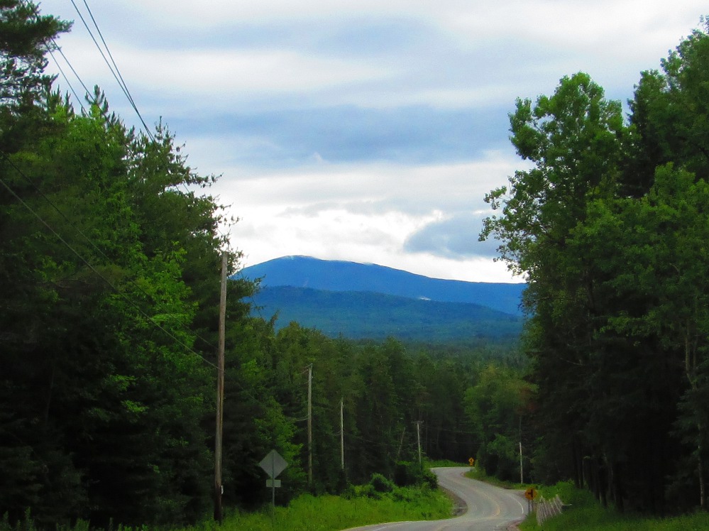
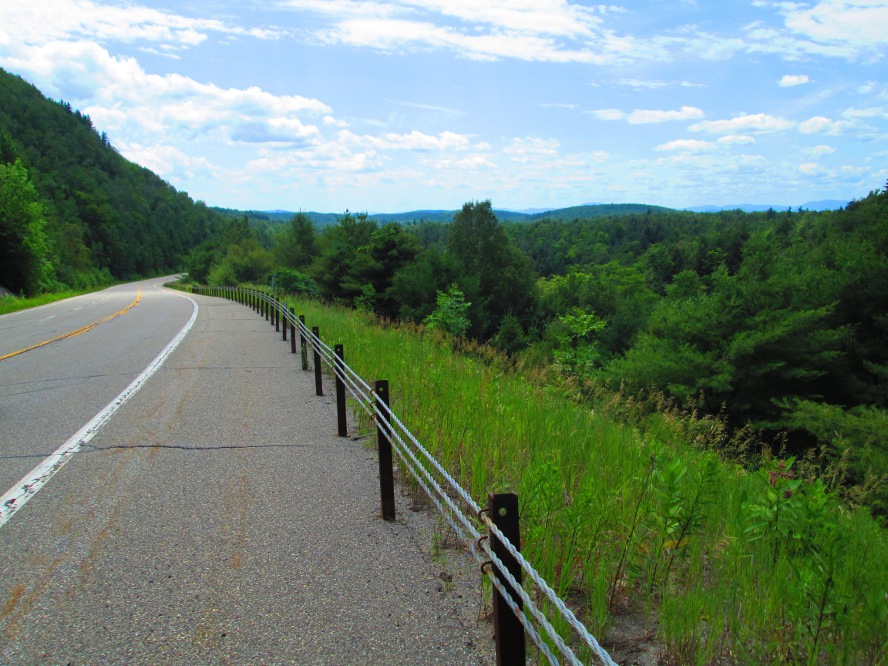
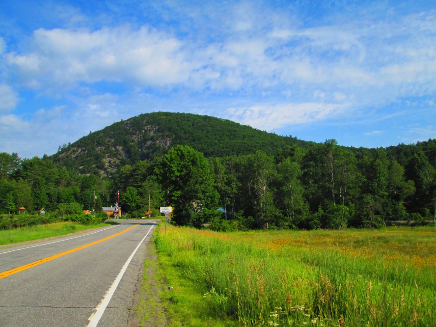
The route is soon into the Keene Valley of the Ausable River after leaving the Olympics behind. It's very peaceful cycling here. Also, the sun shone through the clouds and many clouds disappeared making for a pleasant, warm summer day in the mountains. I'd say the largest difference is that the atmosphere is that of more-relaxed tourism and vacation spots, a contrast to the faster life with the super-powered athletics and Olympians in Lake Placid. On the other hand, there are large mountains with hikers and rock climbers in Keene. The highest summit is Mount Marcy, elevation 5,343 feet (1,629 m). Hikes up it are very popular. There's lots happening in the valley, too, as I see from my bicycle.
The region appears to have recovered from the heavy flooding of Hurricane Irene in 2011 when a critical trail bridge over Marcy Dam was washed out, the Fire Station in Keene almost fell into the raging Gulf Brook, and the area was isolated for awhile as there was much damage to roads and highways. I missed looking directly at the Fire Station as it is to the left a couple hundred yards on road 9N, just after our route went across the Ausable River.
The settlement of Keene began in 1787 and there were soon lumbering and iron industries with their sawmills, forges and gristmills. Growth was stalled due to the lack of good transportation to the area. Life became more one of conservation with the creation of Adirondack Park in 1882. The area became truly wired-in in 2011 when 97% of homes, including those in rural areas, got broadband service.
|
|
|
|
|
|
|
|
|
|
|
|
|
|
|
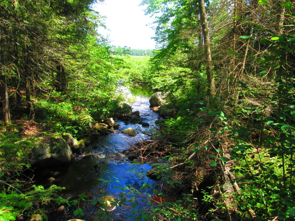
When road 73 ends, take road 9 to ride under interstate #87 and turn left on Tracy Road. The road is much quieter. I soon stop at a stream to enjoy the silence for a short break when I can actually listen to nature – the wind in the tress, the sound of a stream, a few birds.
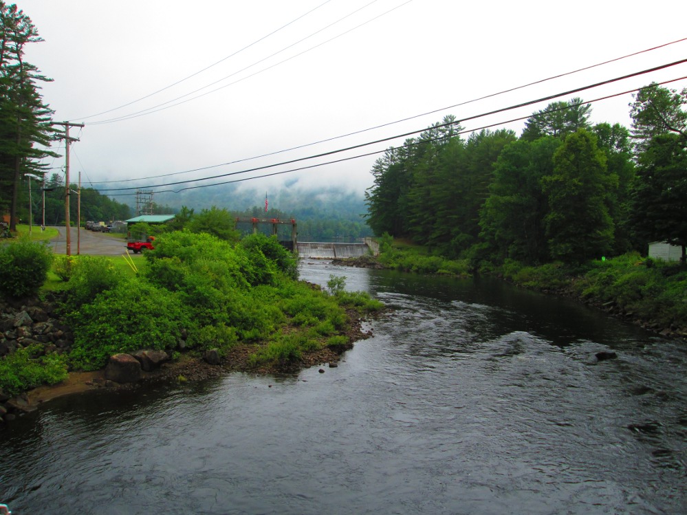
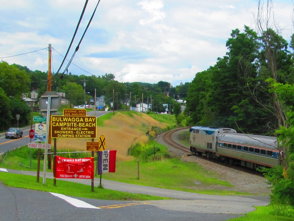
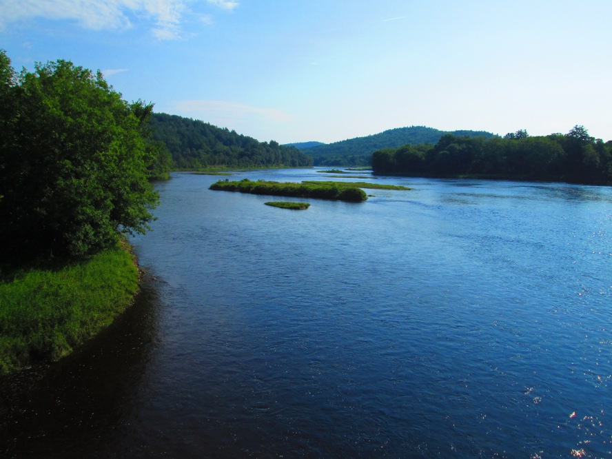
The trip soon enters a poorer area that was once profitable iron mining many years ago. The iron was transported to Port Henry first on Plank Road, then on a railroad. Part of today's bicycle ride is along the same Plank Road. One of the first blast furnaces in the United States was constructed in Port Henry in 1822. Iron ore and steel were easily transported from Port Henry on Lake Champlain and the Champlain Canal System.
A number of small towns along today's route had iron mines that produced much of the steel for use in weaponry of the Civil War. Today's ride goes through the two former company towns of Mineville and Witherbee. Mineville was also known as a locale for union organizing, particularly in 1912. There were numerous strikes at the iron mines, starting in 1880. Mining was a dangerous activity. There was considerable violence during these strikes, that added to the already dangerous working conditions in the mines. After much labor unrest, the final owner of the mines, Republic Steel Corporation, reluctantly agreed to a union contract in 1946.
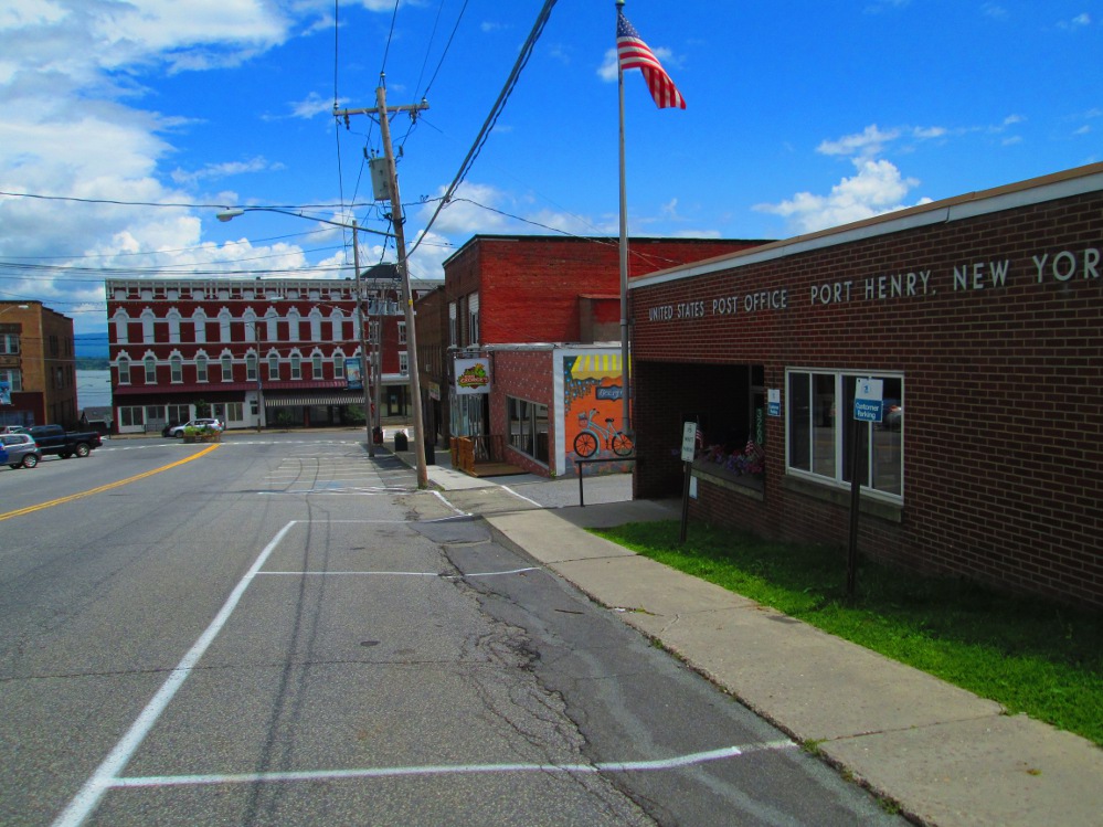
I talk a bit about the history of unionization, pro-union towns and company towns with a man on a motorcycle that I meet outside a small museum about the steel industry that is beside the city hall in Port Henry. The current city hall of Port Henry (town of Moriah's offices) is the old headquarters of the steel company Witherbee-Sherman that became Republic Steel.
The weather is variable today. Temperatures are warm. Rain almost happens in the morning and afternoon with a few light showers. These are followed by a heavier rain storm in the late afternoon. I conveniently am just outside the Crown Point Historical site at this point so I pay the fee and go inside to see displays and a short movie. The storm has stopped when I exit the building. Some other members of our trip got soaked!
|
|
|
|
|
|
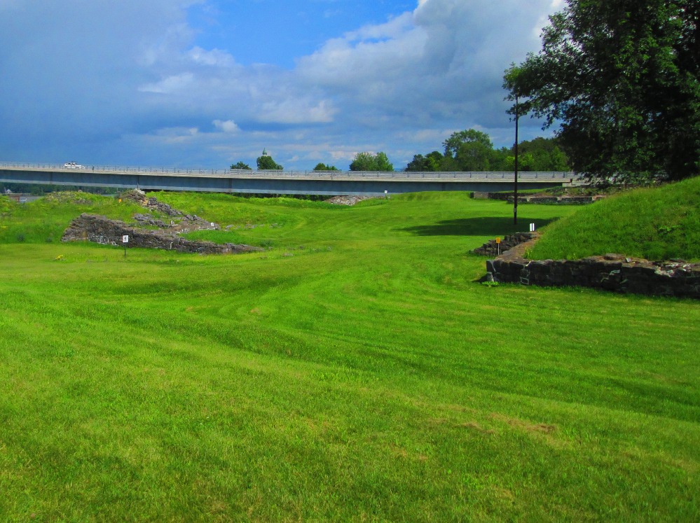
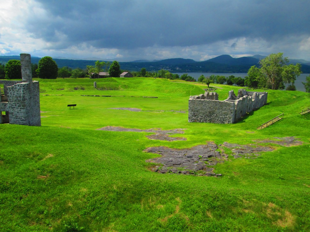
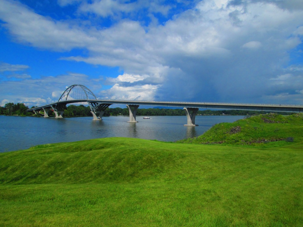
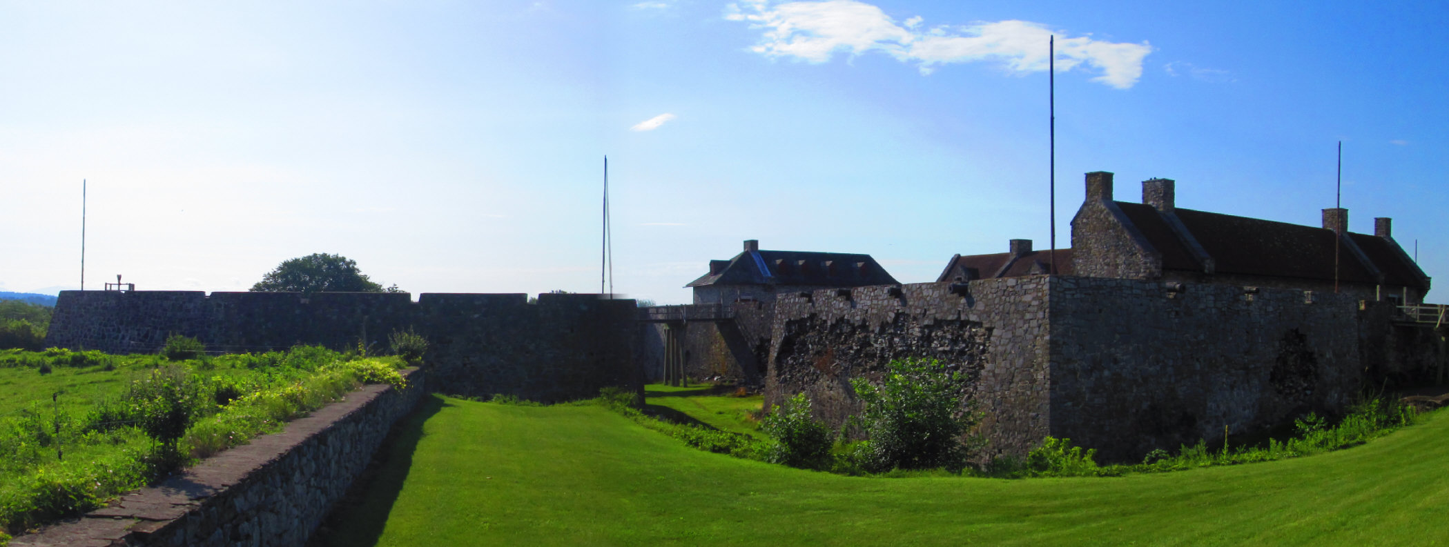
After Port Henry, our route is along the shore of Lake Champlain. I do a little bit of extra mileage and see the Crown Point Historical site. It's well worth the extra couple of miles. There are ruins of both French and British forts at the narrows in Lake Champlain. The French fort, St. Frederic was the first. The French blew it up when they left when heard that the British were coming. The British decided that they wanted the site, as it is at the point where Lake Champlain enters Hudson River, a critical point in fur trade. British planned a large raid of the site in 1759. When they got there they found Fort St Frederic blown up by the French. The British immediately start work on a Fort Crown Point. They planned a very large fort. Their plans slowed down when peace was declared in 1763 and French gave Quebec to the British. The fate of the fort deteriorated further when the powder magazine blew up. It all started when Jane was cooking for the soldiers and had a chimney fire due to the chimney sweep being a bit laggard on cleaning the chimney. The Fort was eventually abandoned by British, with just a few soldiers there. This allowed the American revolutionaries raid fort in 1775 and use cannons from fort to repel and defeat the British in Boston.
I advise camping at the Crown Point campground of the state of NY that is on the shore and much nicer environment than where our group camped at Maple Ridge Park.
|
|
|
|
|
|
|
|
|
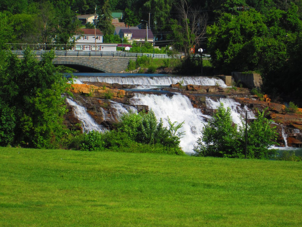
The first big stop today is at Fort Ticonderoga that was called Fort Carillon when owned by the French. The legacy of Fort Carillon continues today with the Quebec flag modeled on the Carillon flag. In the original Battle of Carillon the French defeated the British in 1758. The following year, in 1759, the British returned to defeat the French in the Battle of Ticonderoga in which the French abandoned the fort after trying to blow it up, but the fort withstood the complete obliteration of it's powder magazine. Fort Ticonderoga is at another narrows in Lake Champlain and dominates the by the short, fast-flowing, 3.5 mile long, La Chute River that goes between Lake Champlain and Lake George. These were critical transportation routes in the 1700s. I later see the falls of the La Chute River when in the Town of Ticonderoga.
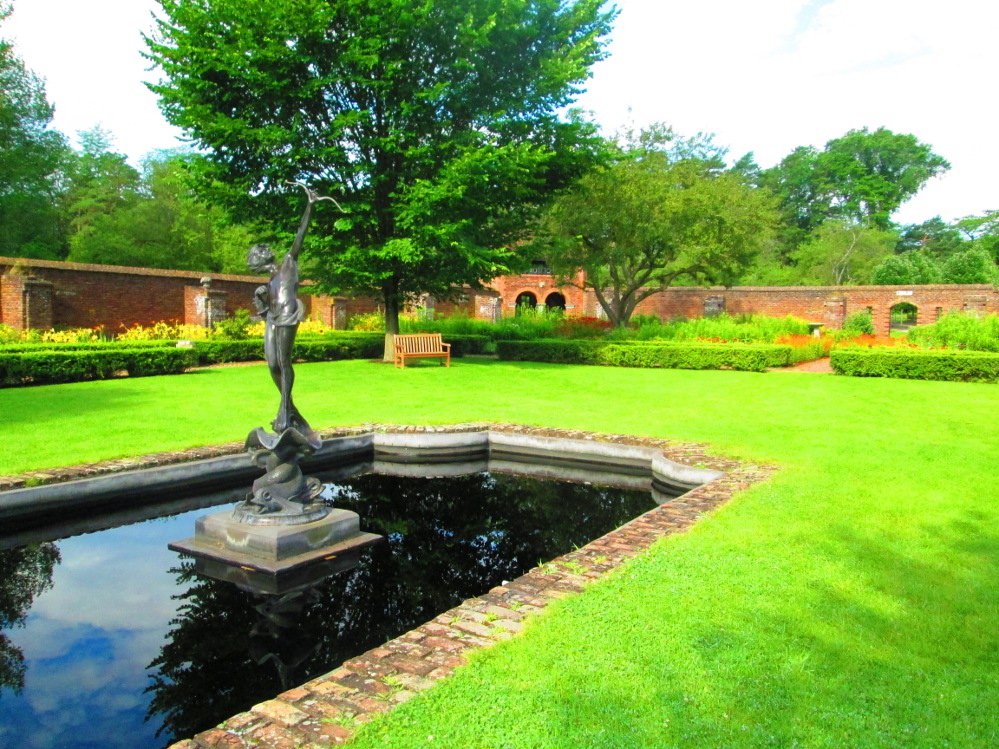
Just as interesting as the fort at Fort Ticonderoga are the mansion, grounds and garden of William Ferris Pell, a businessman in New York in his family's business, and a horticulturalist, who purchased this site for a summer home. I walked through this estate and took several pictures. Pictures tell half the story. It's a lush grounds to visit. This estate and the fort are maintained today through the efforts the by Fort Ticonderoga Association.
|
|
|
|
|
|
|
|
|
|
|
|
|
|
|
|
|
|
|
|
|
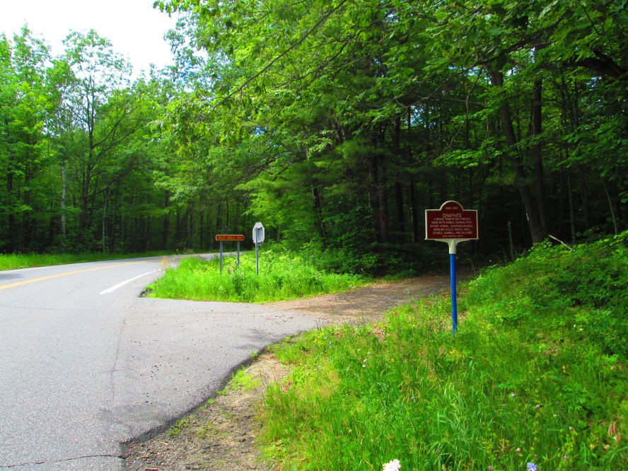
A sunny, warm day, at last! The tour follows the La Chute River to Hague on Lake George. This is an older summer vacation area for residents of New York and Boston. There are many estates and older homes. For us, Hague marks the beginning of a long climb up Graphite Mountain Road. Some say it is 6 miles; others claim it to be 8 miles! Everyone stops for a snack, before the climb, at The Hague Market at the foot of the hill.
I also stopped just before Hague at Rogers Rock State Park where there is another great beach for swimming. It would be a great place to camp, too.
One speedy cyclist passes me when I'm going down the big hill on Graphite Mountain Road. I think he is doing this as a training ride!? I guess I do stuff like that at home, eh? There was another young woman going up the hill. Great to see so many other cyclists out on the road.
|
|
|
|
|
|
|
|
|
At the bottom of Graphite Mountain Road the trip is soon in hamlet of Brant Lake the town of Horicon and the water-filled Brant Lake is beside our route. The roadside view of palatial homes continues. Wikipedia says “Brant Lake has been a popular fishing and hunting area among wealthy visitors including Theodore Roosevelt. Around 1900, several hotels began catering to these wealthy visitors.” From what I'd see, I'd say this tourism continues. There are now also facilities for those with more moderate incomes such as Rancho Pines Campground where the group stays. It has an r.v. Park and there are others just down the road.
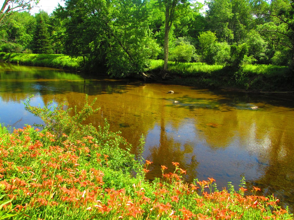
In the midst of all this finery, we all stop at The Hub for at least a pop. Our group later returns here for nutrition at supper time after setting up our camp. It's for folk like us. It is a seasonal restaurant and pub for bicyclists and others. I have my almost daily swim on the opposite side of the pond to The Hub in a public swimming area just across the street from Horicon's city hall. It's relaxing to flex the back muscles by swimming.
Now, did I swim in Brant Lake or just a widening of Spuytenduivel Brook or Schroon River due to a small dam? I'm not sure. Nevertheless, the swim was refreshing and the water was clear.
I talk to a couple at The Hub who have residences locally and in New Jersey, about 20 miles from downtown New York. They enjoy bicycling here much more than in New Jersey where there are dangerous roads and crowded parks. Actually, it sounds like they just took up bicycling after buying a residence in Brant Lake. They often drop by The Hub.
There is so much to see in this stretch that every person in our group missed the sign of “Palisades Road” that goes around the other side of Brant Lake. Now, according to google.com the sign is right at the street corner. I do need to go back some day and check this out … is google.com out of date?
|
|
|
|
|
|
|
|
|
|
|
|
|
|
|
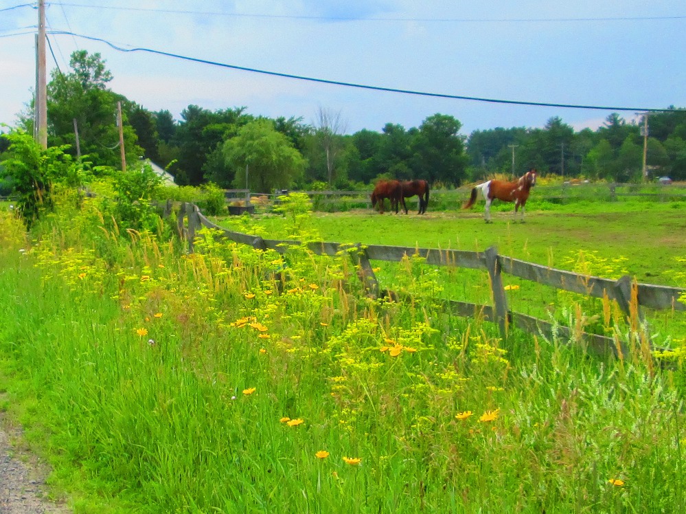
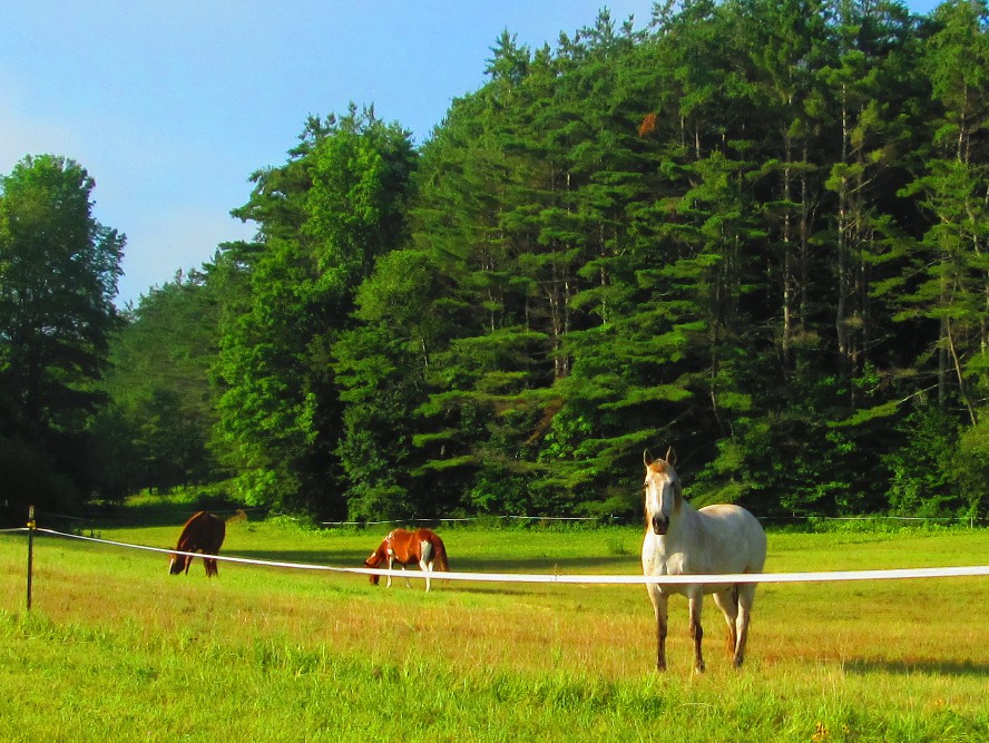
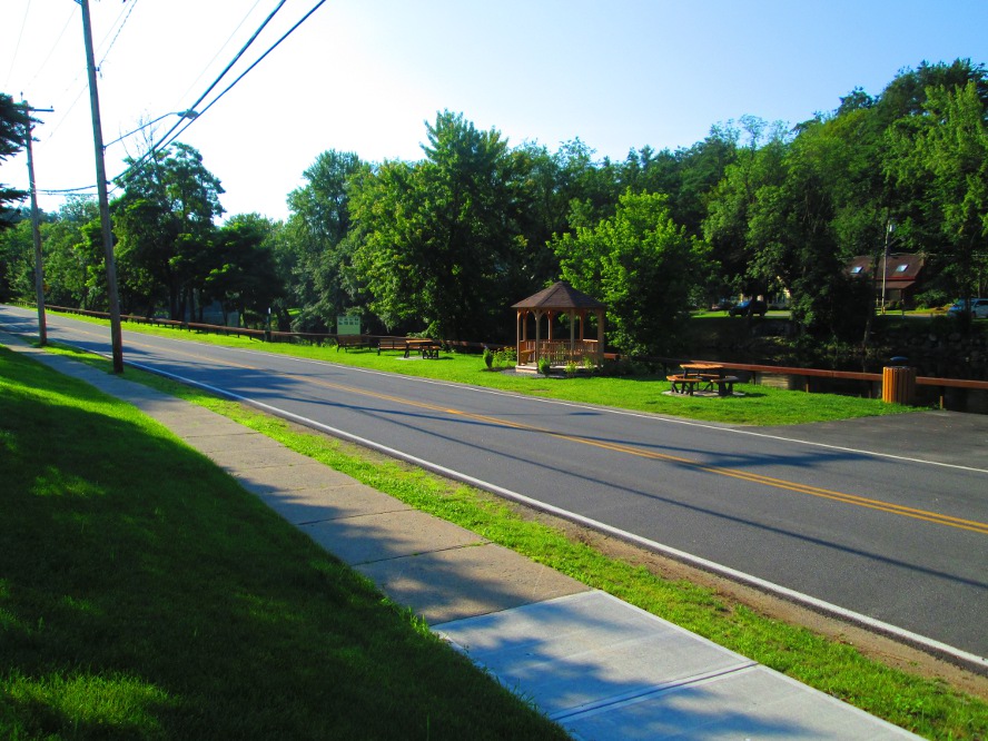
Though the route is still on secondary roads in Thurman we all look with longing to the roads along Schroon River earlier today where there were almost no cars. There are a few more cars in Thurman. The traffic load gets worse after Corinth where the group diverges from the planned road to get to a campground. As yesterday, the view today is of rivers and lakes, wealthy homes, and small farms. Many of the small farms have well-groomed horses.
|
|
|
|
|
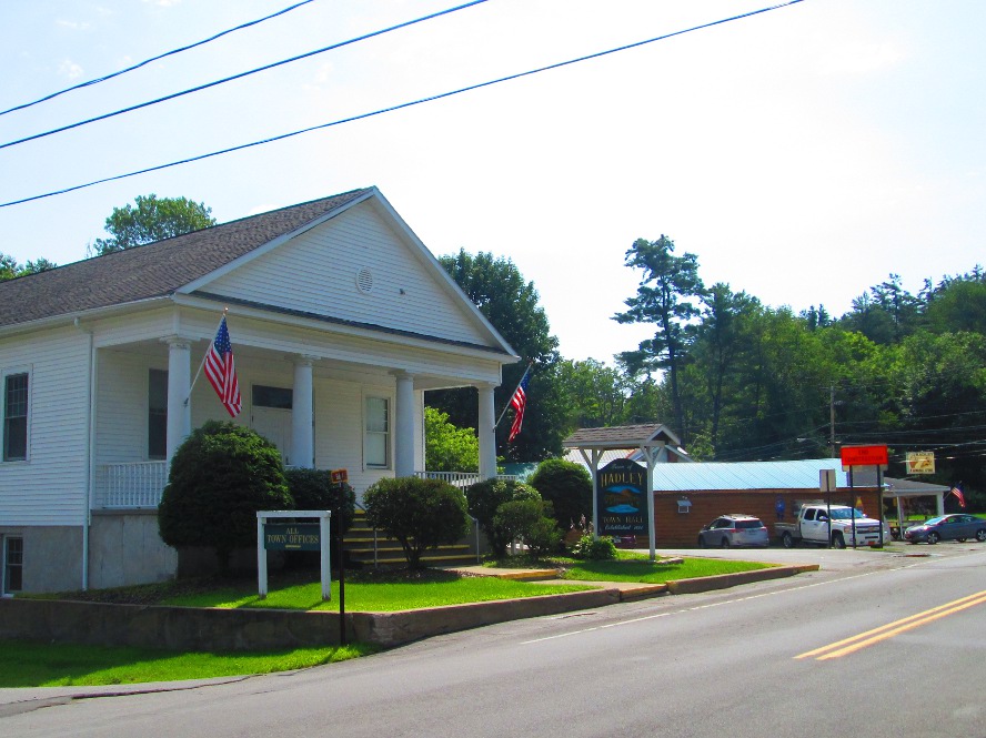
I arrive at the campsite after Corinth before noon, at 11:30 am. It's a pleasant diversion from the very busy road beside it. Lots of greenery here! The trip ends back in Sarratoga Springs 13 miles away. Along the way we see mixed urban and farming areas with many small commuter towns and hamlets like Hadley and Greenfield.
|
|
|
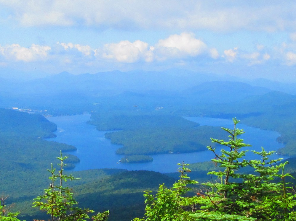
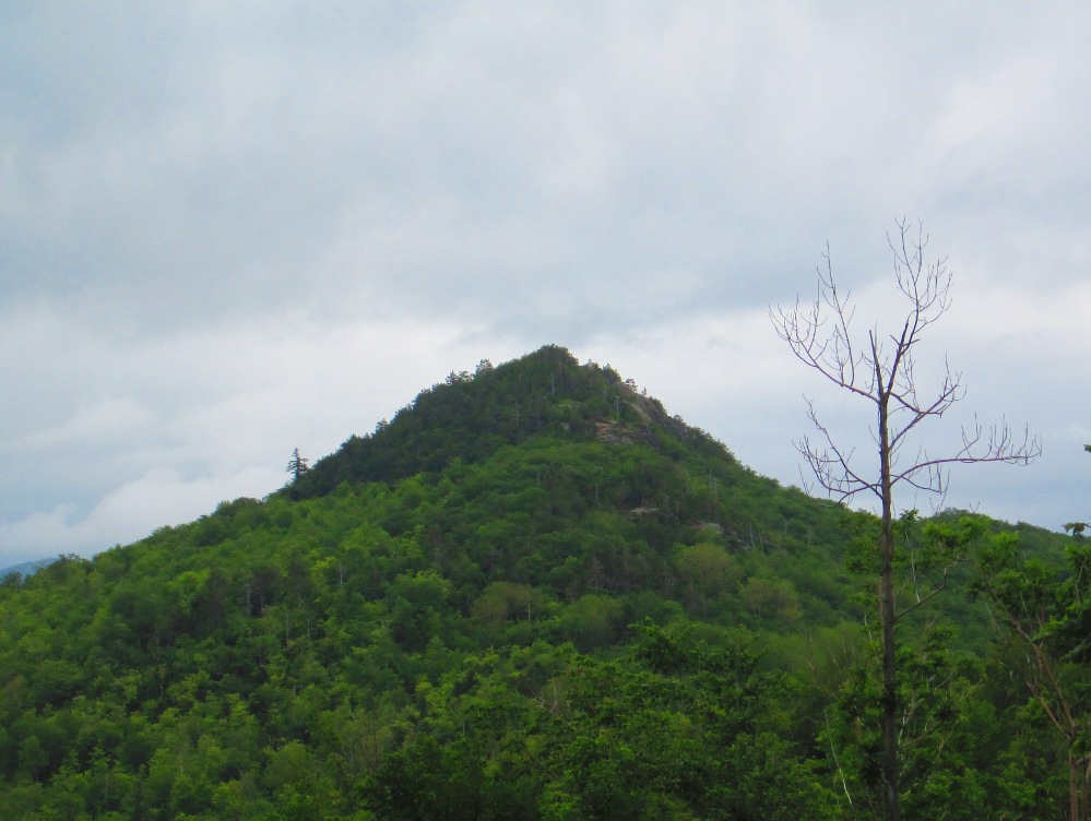
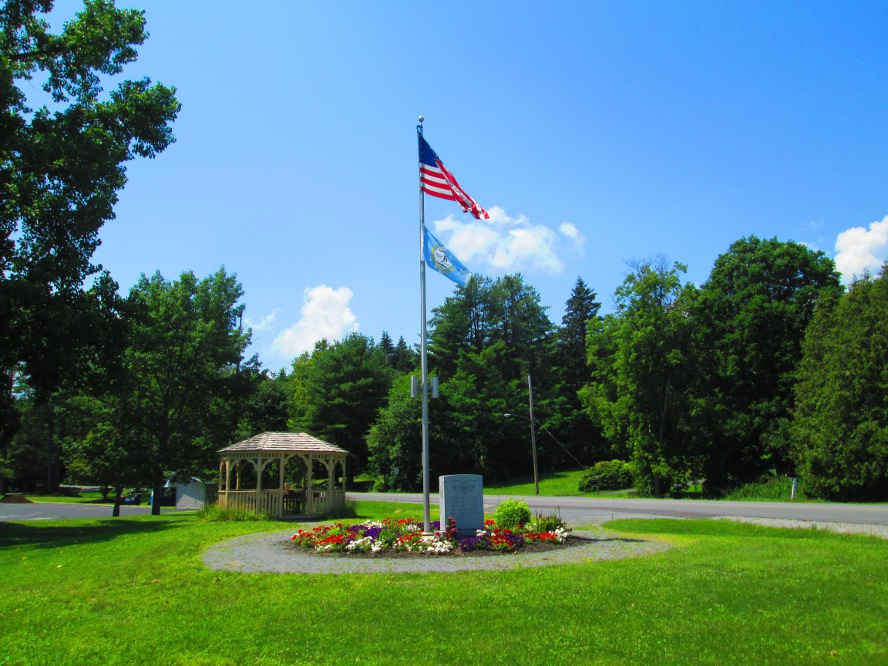
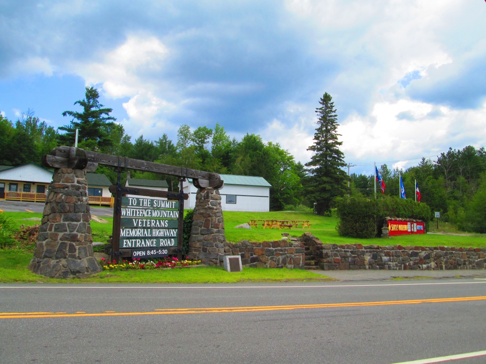
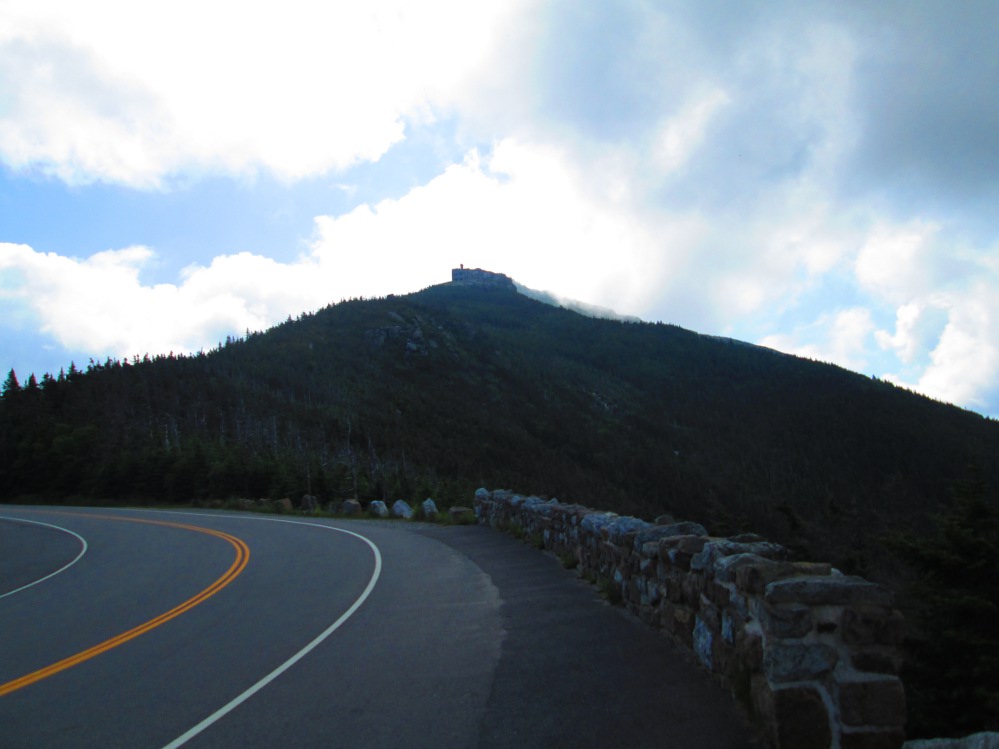
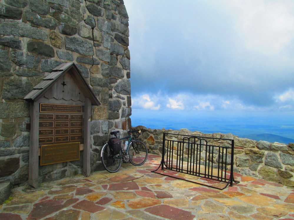
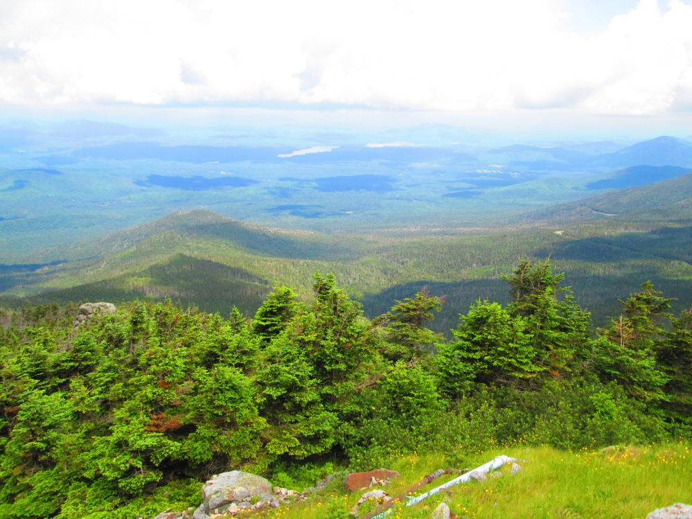
I do a side trip on the way home to see Whiteface Mountain, just north of Lake Placid. I pay the fee of $8 and ride all the way up Veterans Memorial Highway. It's quite the climb - 13 km at average of 8.3% grade with sections of over 25% grade. This is one of the steepest climbs for road bikers in North America. There's a bicycle race up Whiteface every year at end of May.
|
|
|
|
|
|