1.
Poster in ferry terminal
2.
A street in Skagway, Alaska

3.
White Pass railway train beside dirt road to Gold Rush Cemetery

4.
Gold Rush Cemetery
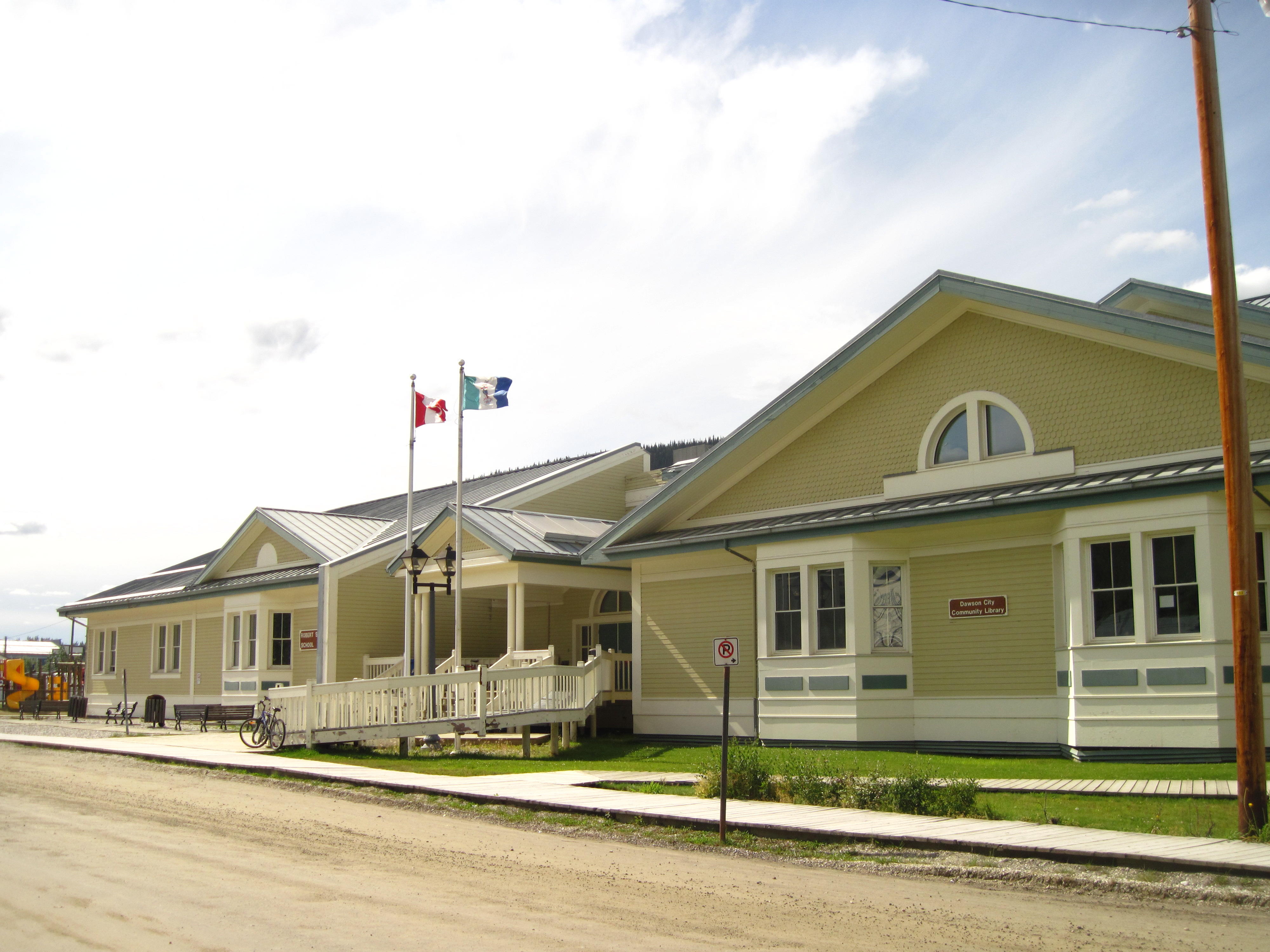
I'm updating the blog again in a pleasant spot – the Dawson City Community Library in Dawson, Yukon. There is a pleasant staff, continual Wi-Fi for looking up facts, and electrical plug-ins so one can type forever. There are also hard-wired personal computers available. The library is in the same building as the local school. Just an amazing place!
Our day on the ferry begins again with maritime weather – cool and rain. I get up early so I can go-ashore at Haines, Alaska. It's pouring rain; I walk around the parking lot a bit. Town is a few miles away so is difficult, if not impossible, to visit on such a short stop. I do see some other interesting small fishing boats near the ferry dock. After Haines, the ferry travels for an hour and then stops for the last time in Skagway.
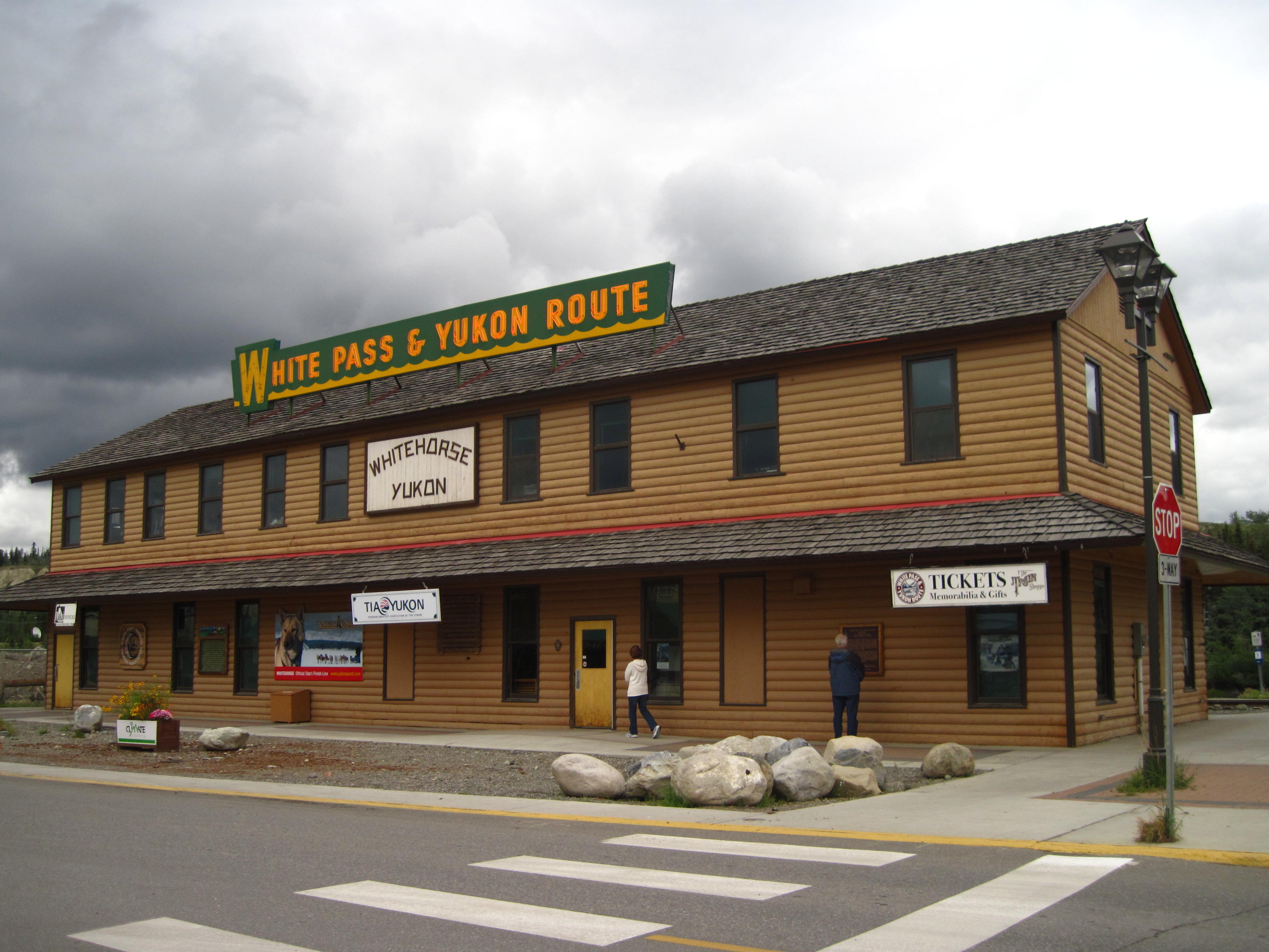
A tour ship is in town when we land in Skagway. Many passengers are in Skagway which is located close to the ferry dock. Some are walking around town. Others are more active doing sports like kayaking and bicycling. Others take the White Pass Railway to the summit of White Pass. I see one train returning to Skagway, and another train when at Canada Customs after the summit of the Pass. It's a steady business, eh? But, all the riders of Tour Arctic do ride up White Pass even though there is alternative transportation – the train – available. The road sure does make it easier than it was in 1898 for the Klondikers seeking to find gold. Many of them used the railroad after it was completed in 1899.
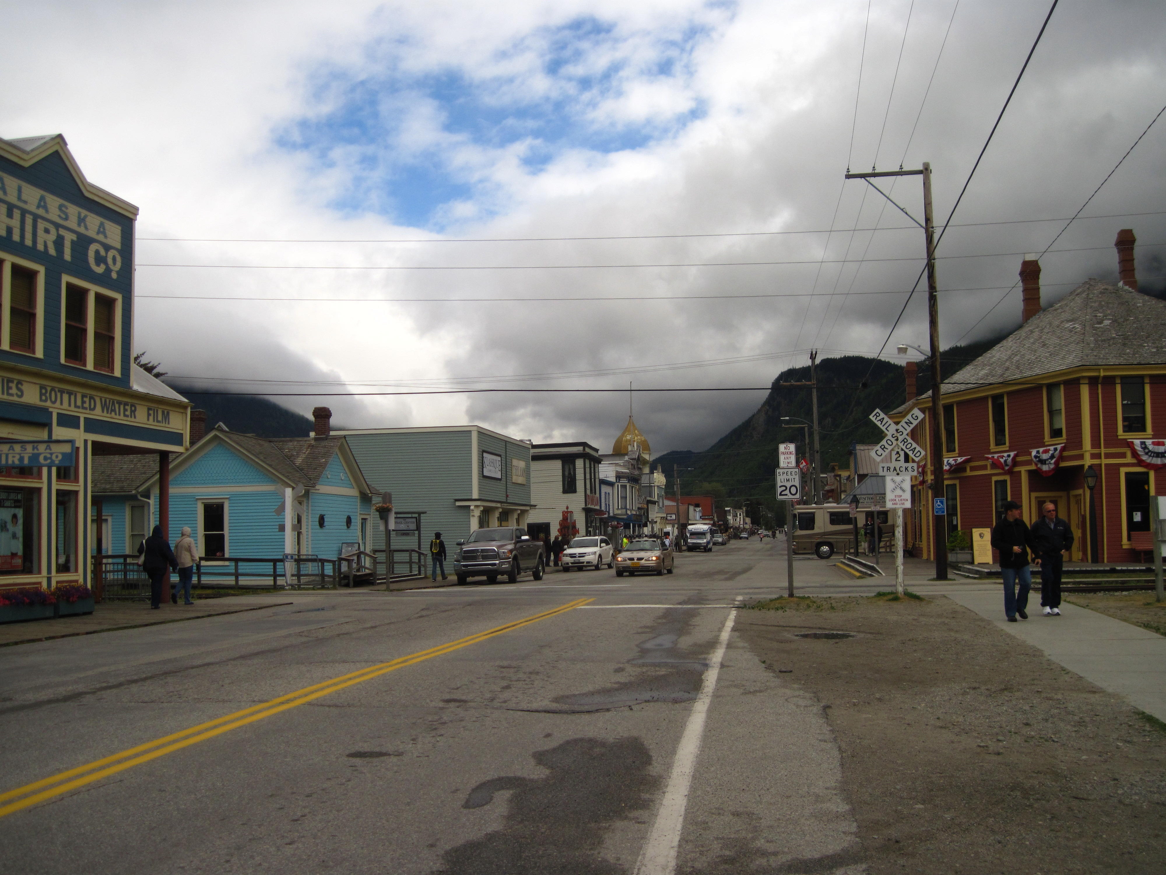
A few streets in Skagway are modelled like they were in 1898, or, so the signs say. Or, is this just another tourist trap? The storefronts are set up like in Klondike Days. I take pictures of a few of these historical artifacts. On the way out of Skagway, I go to a genuine Klondike artifact – The Gold Rush Cemetery – where many notorious individuals are buried.
|
|
|
|
|
|
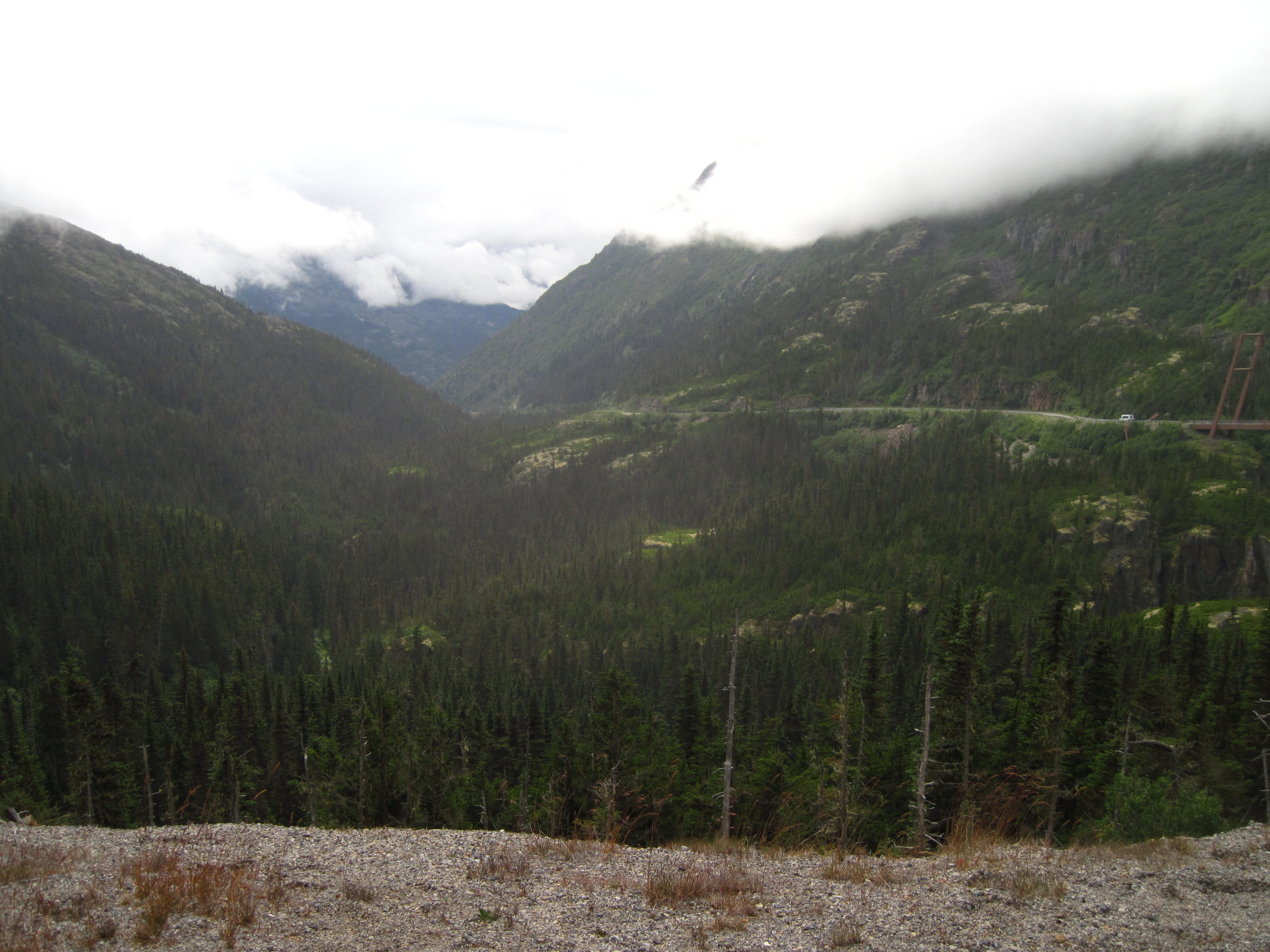
Skagway marks the beginning of our Trail Of '98 adventure. The first big task is climbing White Pass – 1120 metres. In the Klondike gold rush, many miners found the last few miles extremely taxing before the White Pass railway was built. Now, the road rises steadily. I pass many other riders on the way up after being delayed by a flat tire and circling Skagway a couple of times to see all that regular tourists see. The weather is, unfortunately, overcast and raining occasionally. The rain gets steadier as I ride to White Pass, and I am in the clouds when I get there. It's cold and wet at the pass so I stay a couple of minutes – long enough to get my picture taken with the White Pass sign and help a few other Tour Arctic riders take their pictures. Some are wearing many more clothes. I'm in long-sleeved polypropylene top and bike shorts. I put on my rain jacket to descend. I do have a few more clothes in one of my panniers, but my layers of clothing are OK as long as I keep moving.
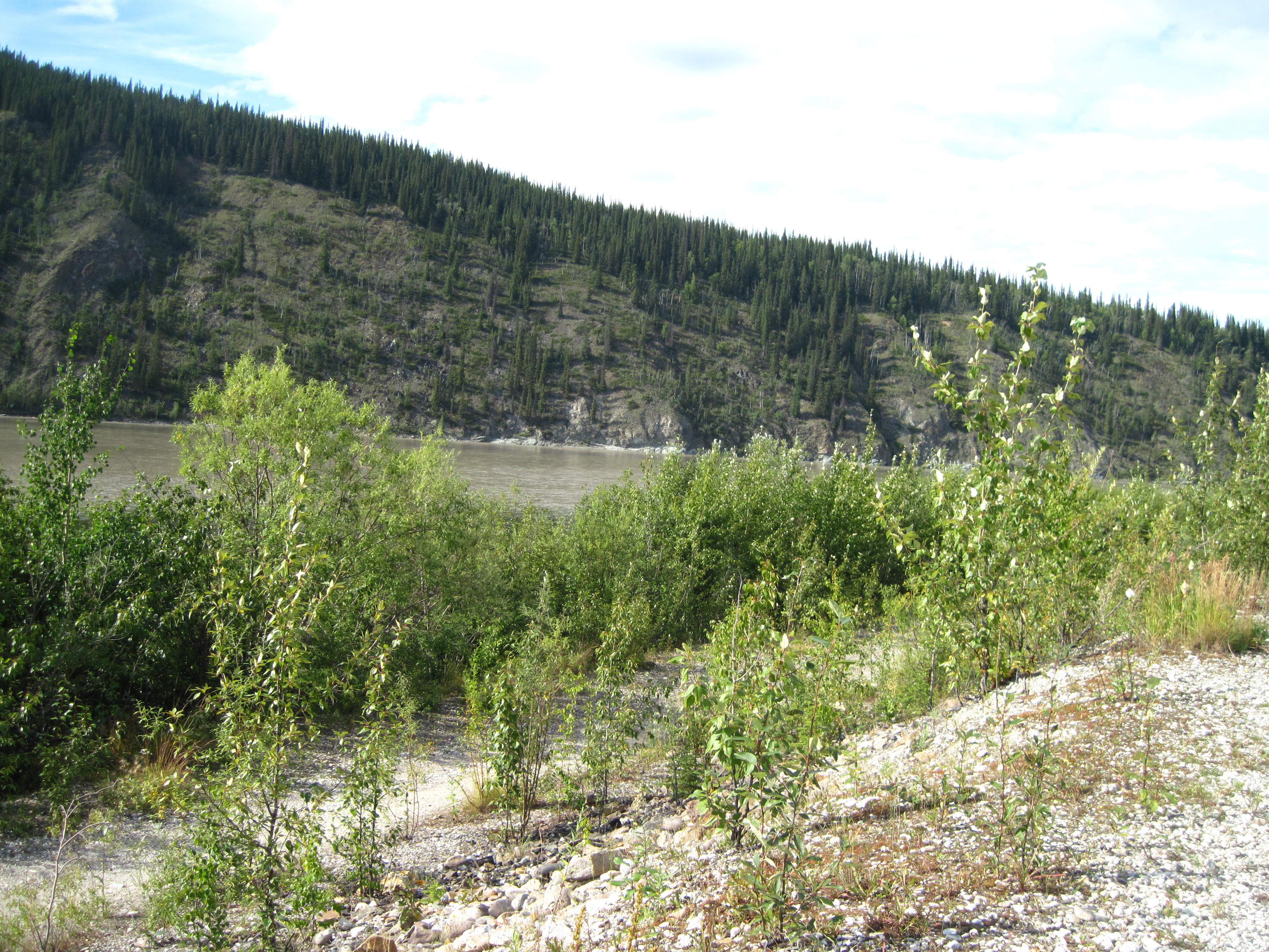
The scenery changes at the summit. There were coastal evergreen trees everywhere on the ride up. All was green. There are more rocks and less trees for a bit at the summit and I see more deciduous trees on descent. The kinds of trees change. There are now more Aspen.
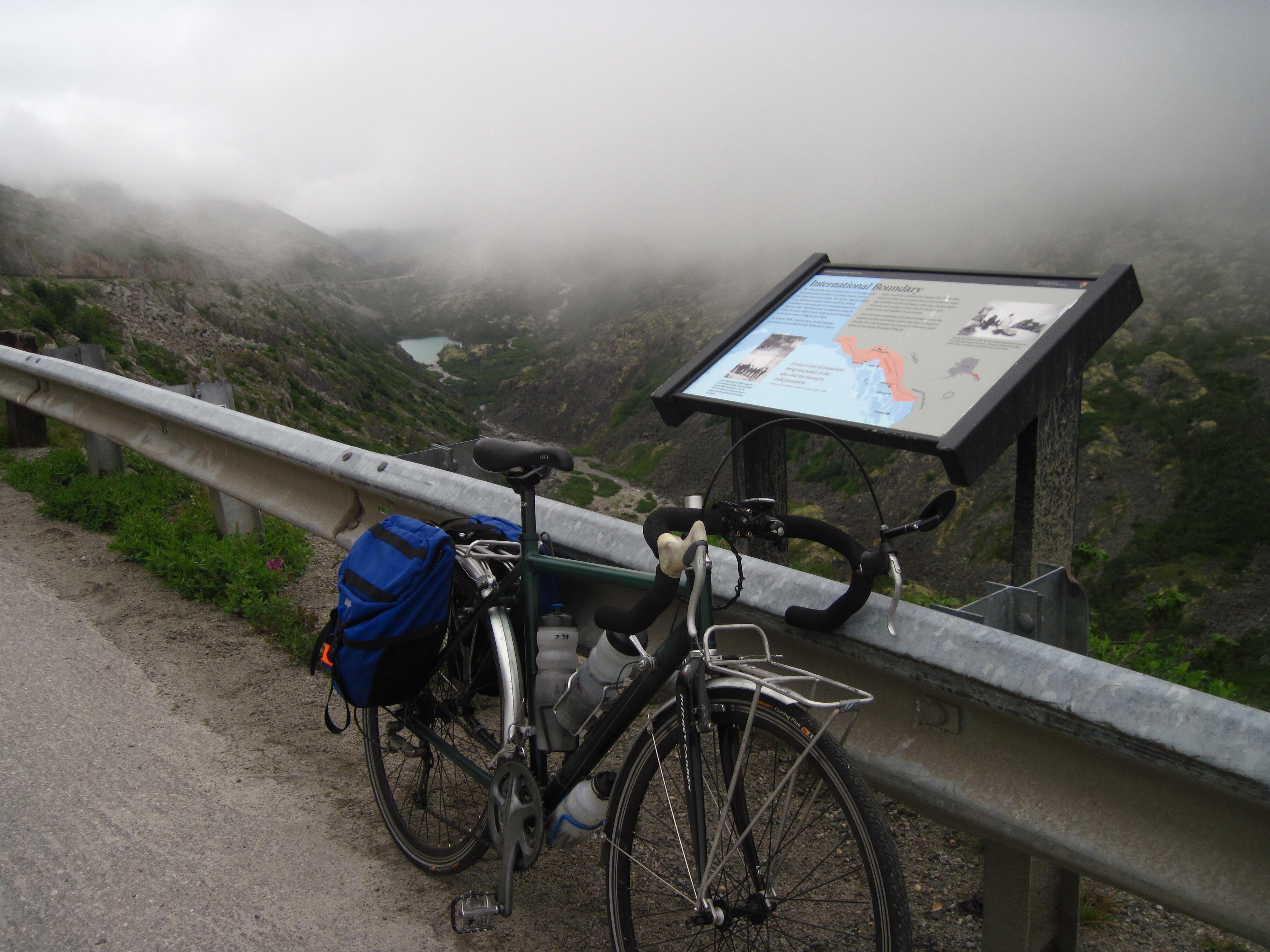
The descent is slow at first, but soon speeds are over 60 kph. After awhile is the Canada Customs check point. All is well and I pass through quickly – the officer likes my NEXUS card. I then seek shelter from the wind on the Canadian side of the check point. I keep warm enough to eat a couple of sandwiches, and soon am alive enough to observe the White Pass railroad cars being readied for their descent – the engine is moved from one end of the train to the other so it's always at the front.
|
|
|
|
|
|
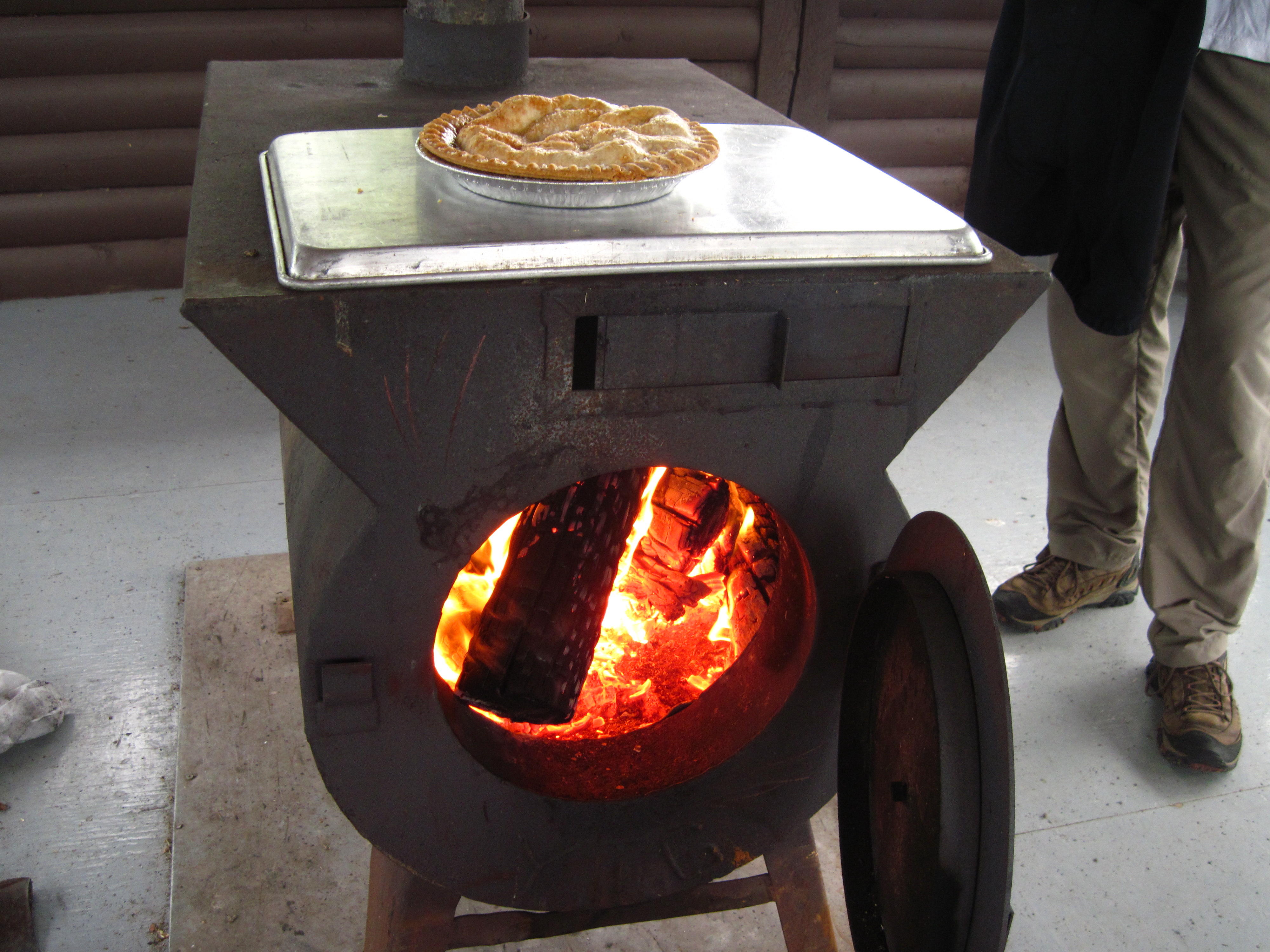
I'm sill cool, but not cold. The rain has stopped. I continue wearing the rain jacket due to the temperature. I do try taking it off, but then I'm too cold. Soon is the historic site of “Log Cabin.” This was a resting spot of many Klondike gold-rush adventurers on their way to Dawson. Many stopped here before walking a day further to Bennett Lake where they built boats for travel on the Yukon River. Actually, the owner of the store and accommodations at Log Cabin probably made much more money than almost all the Klondike miners who had the gold-rush craze. As many Yukoners know today: “There's lots to be made from those people goin' by.” They're now called tourists.
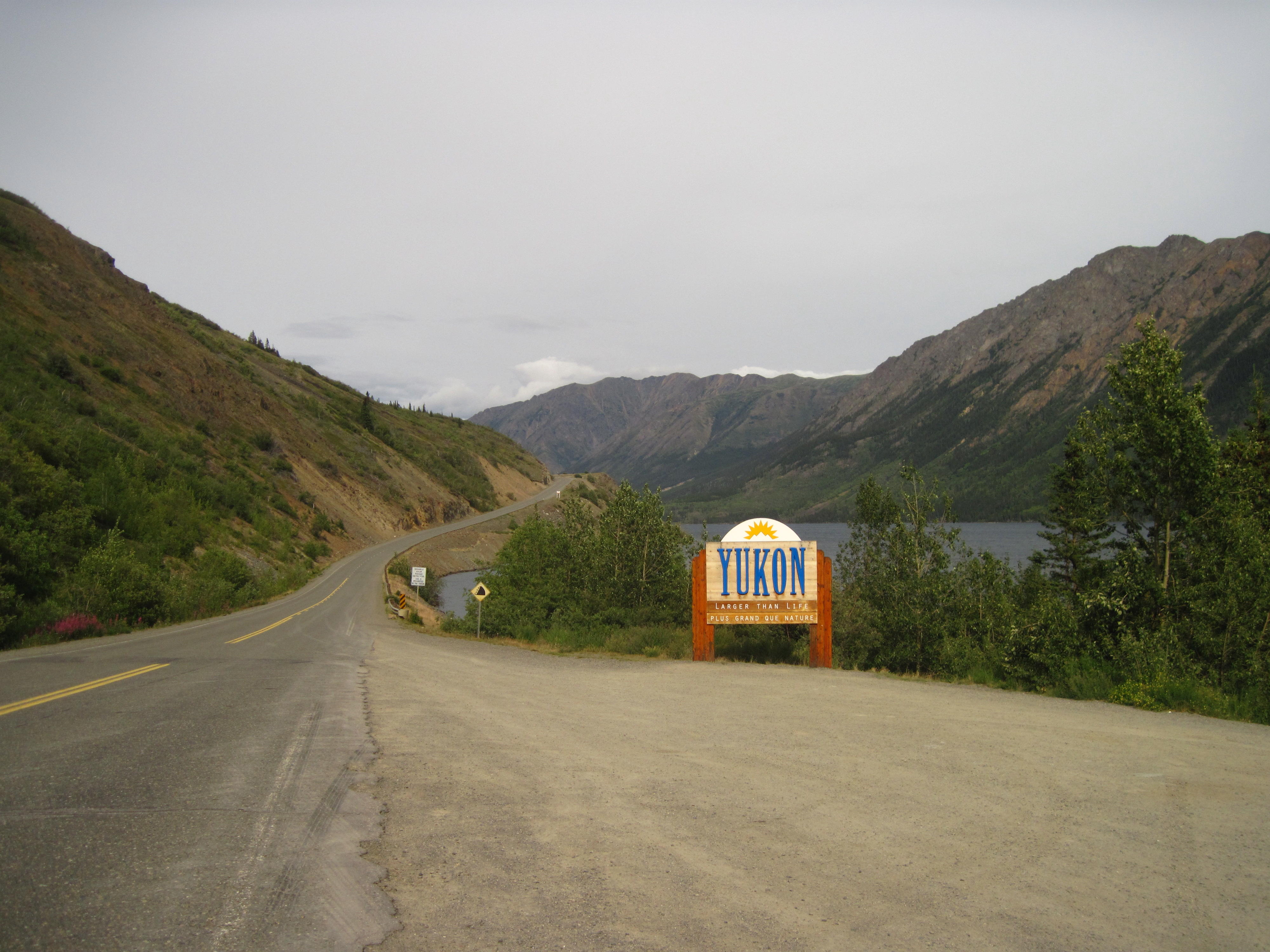
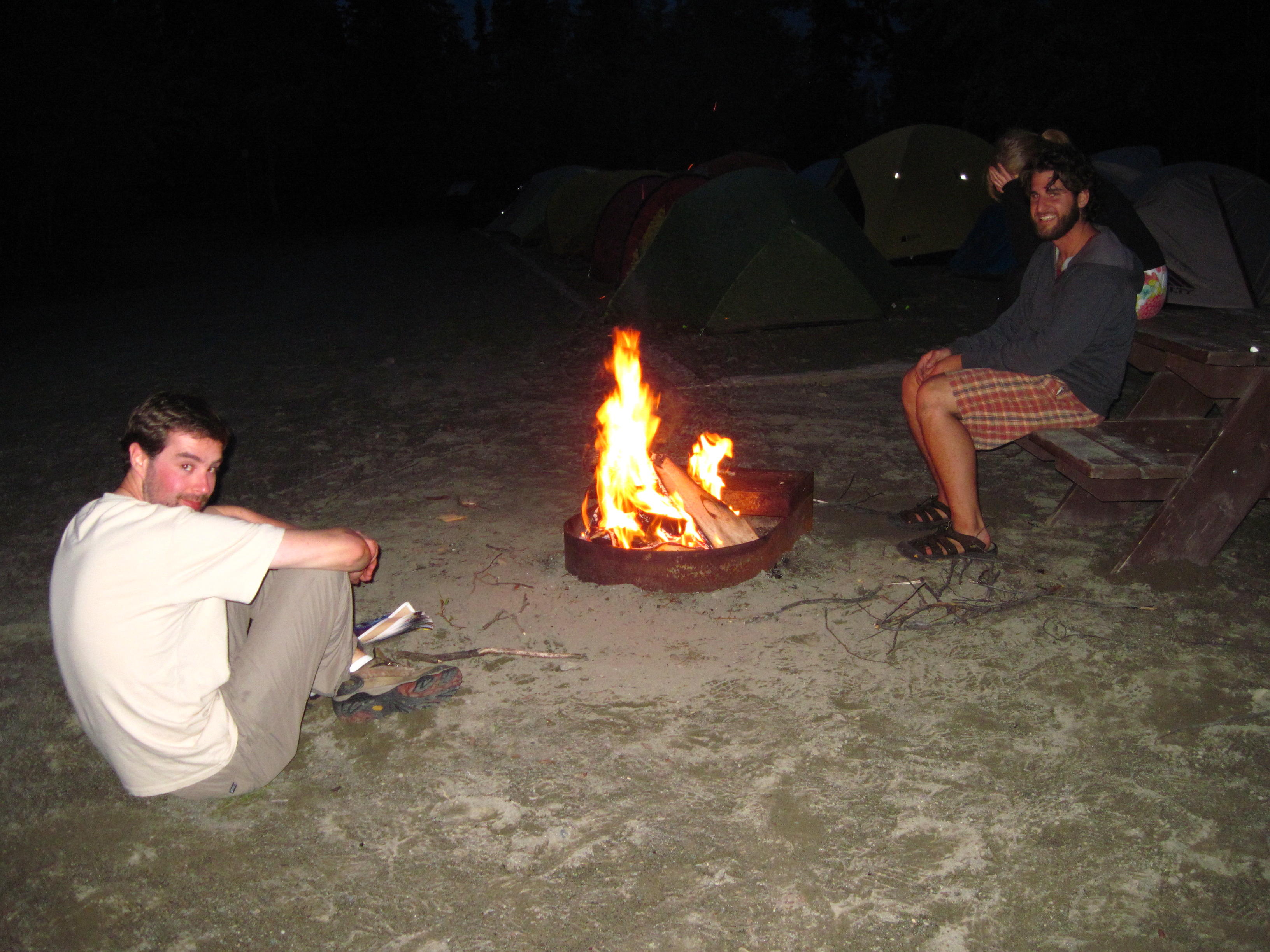
Our stop for the night is in Dustin's lot at Carcross. Dustin owns “Cabin Fever Adventures” - the firm who is providing the crew for the Dempster Highway part of Tour Arctic. Dustin's lot has many trees. Our tents are all over the place. He has a fire pit. Initially, some of our tents are near the fire pit, but are moved so we can have a fire to keep warm. I make a fire with much help from Dave and some help from other campers. The big news is that we're all back in Canada, “Eh?”
|
|
|
|
|
|
It's been many days since I last updated this story. As you'll see, I am very busy at times on this trip of Tour Arctic. The opportunities to update a story are limited on this trip since there's lots to see in the habitations of Whitehorse, Dawson City, and Inuvik, and many other days one only gets to type a few brief notes since the power of the Netbook's batteries needs to be conserved when they can only be refreshed every few days in this sparsely populated land. Internet access is also scarce.
I'm now at home in Ottawa, Canada's capital, recalling this part of the trip with glee. I visited Whitehorse, Dawson, and Inuvik and all points in between. In fact I saw the road between Whitehorse and Inuvik twice, once in either direction, as I drove back in a friend's truck from Inuvik to Whitehorse after bicycling all the way there.
|
|
|
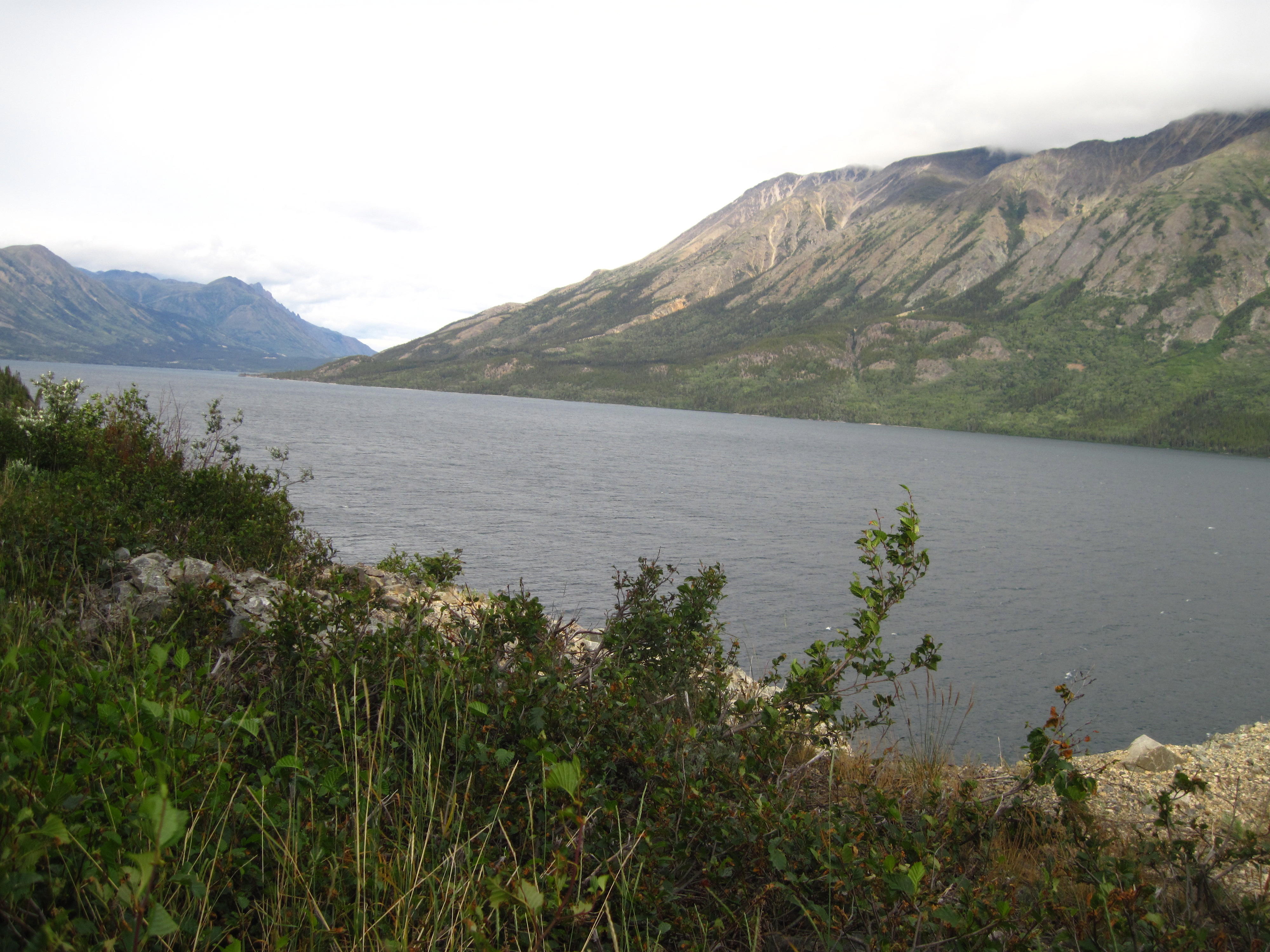
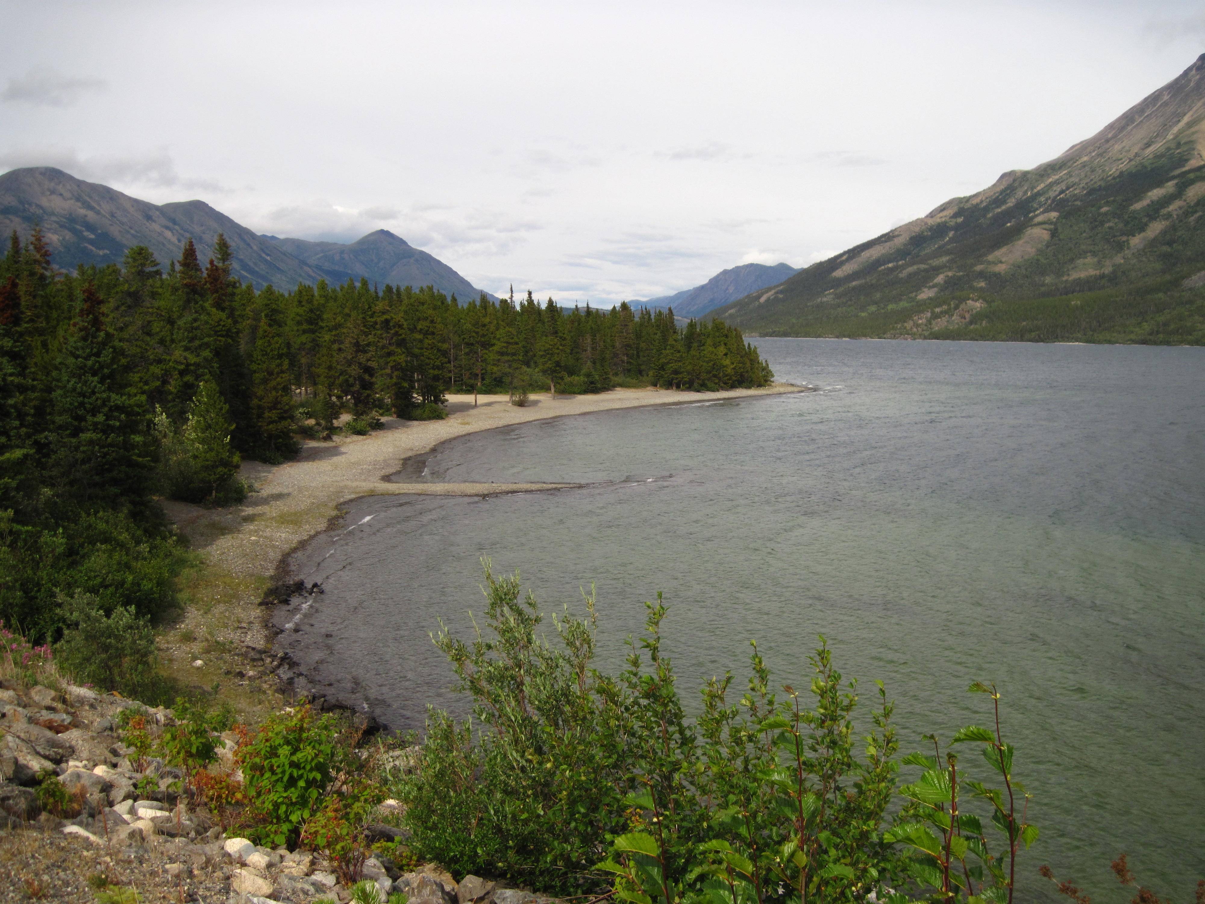
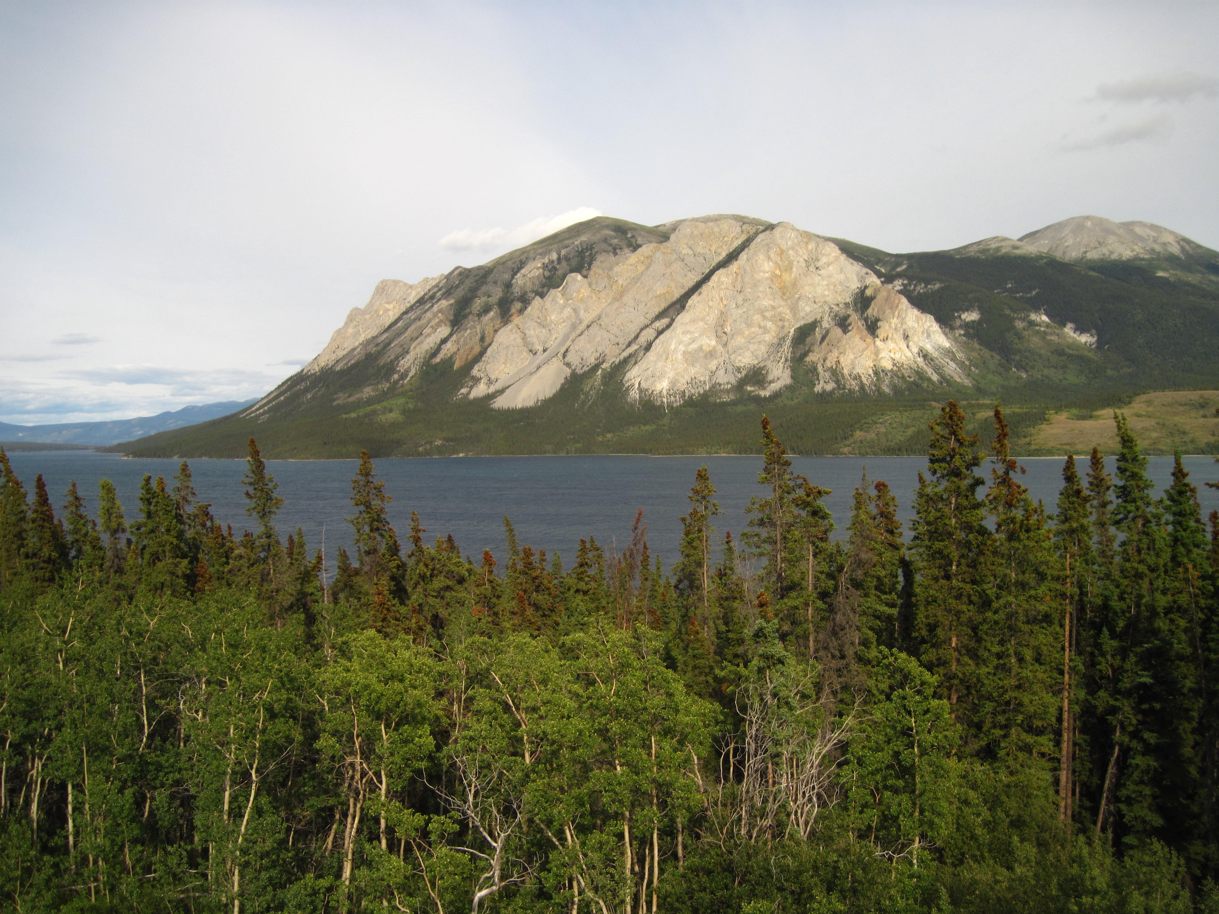
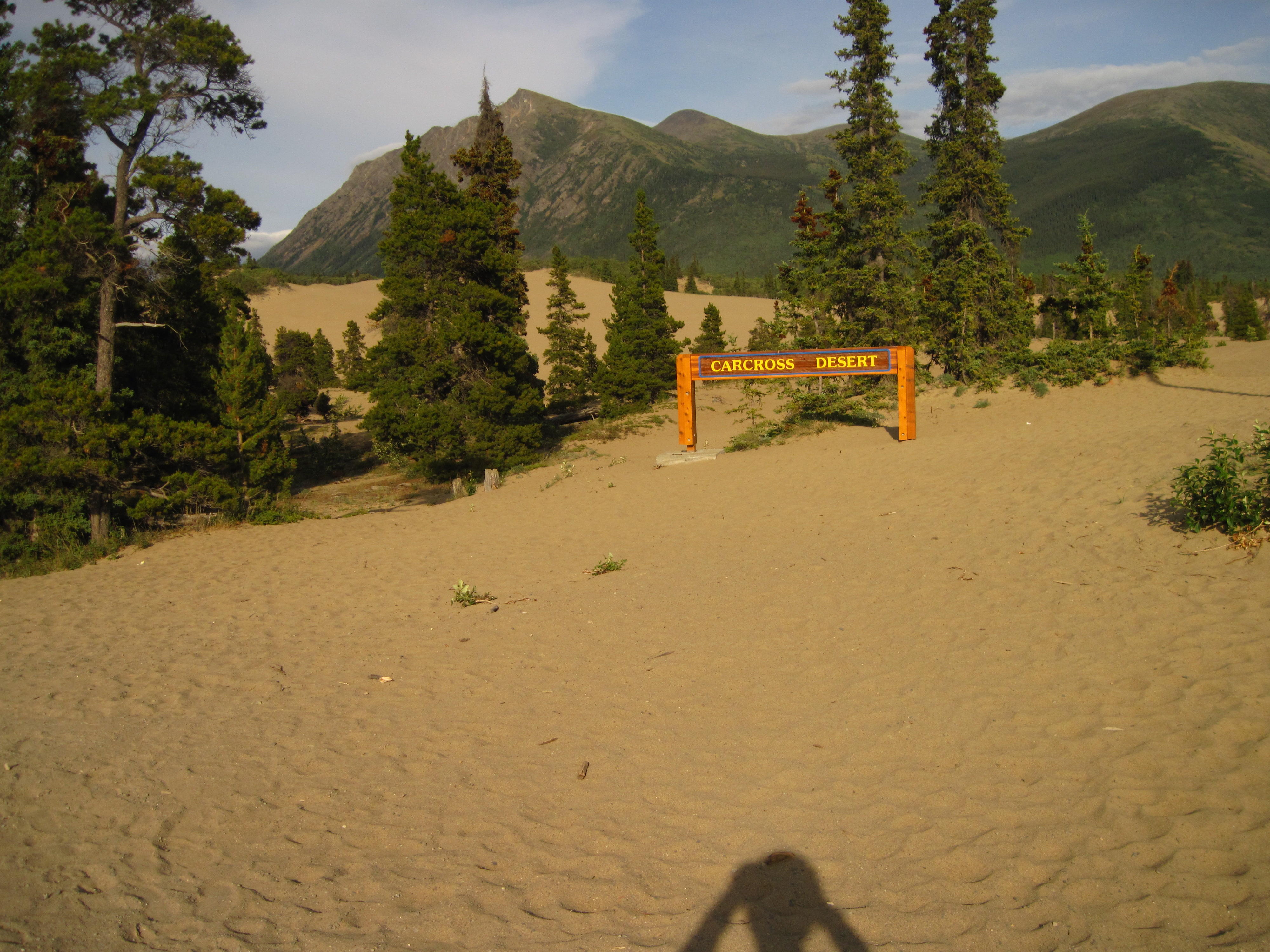
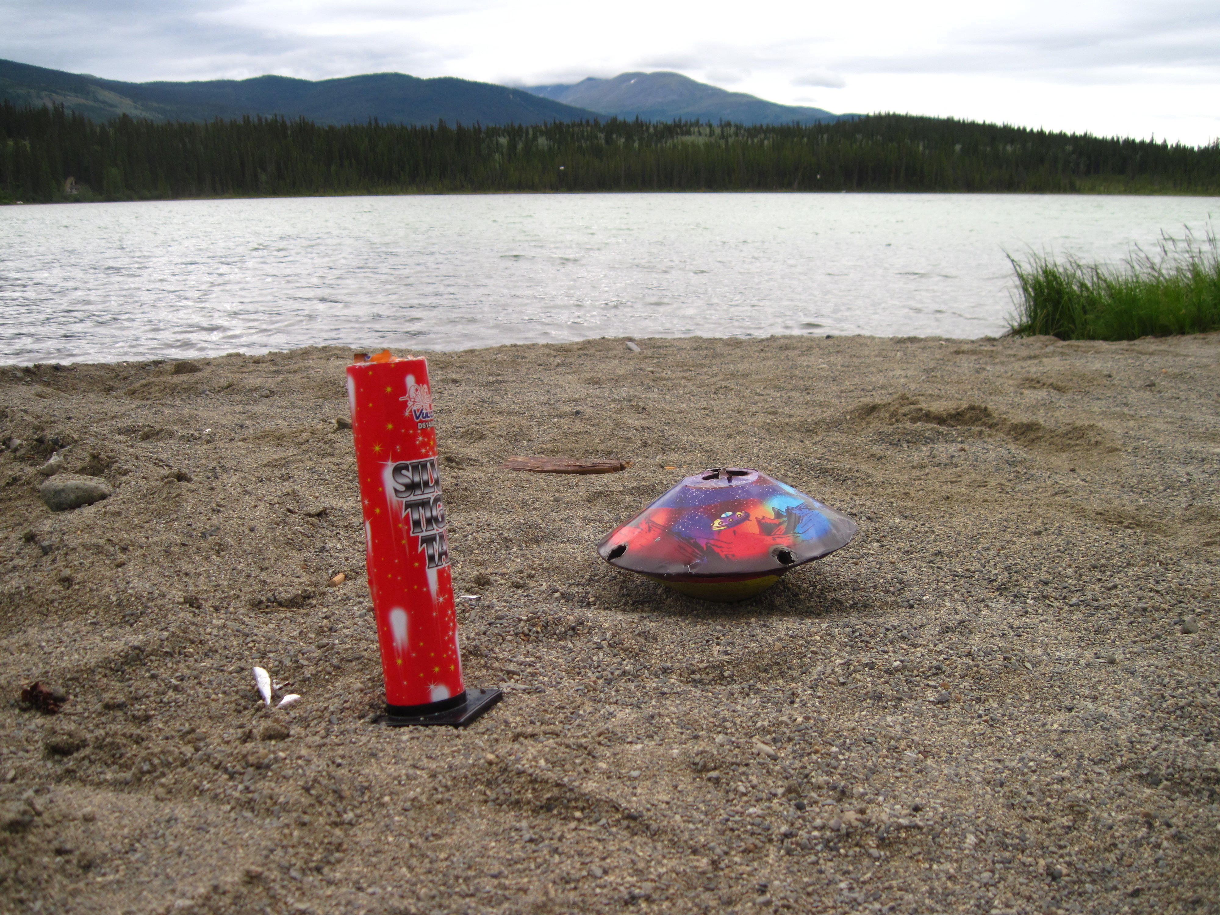
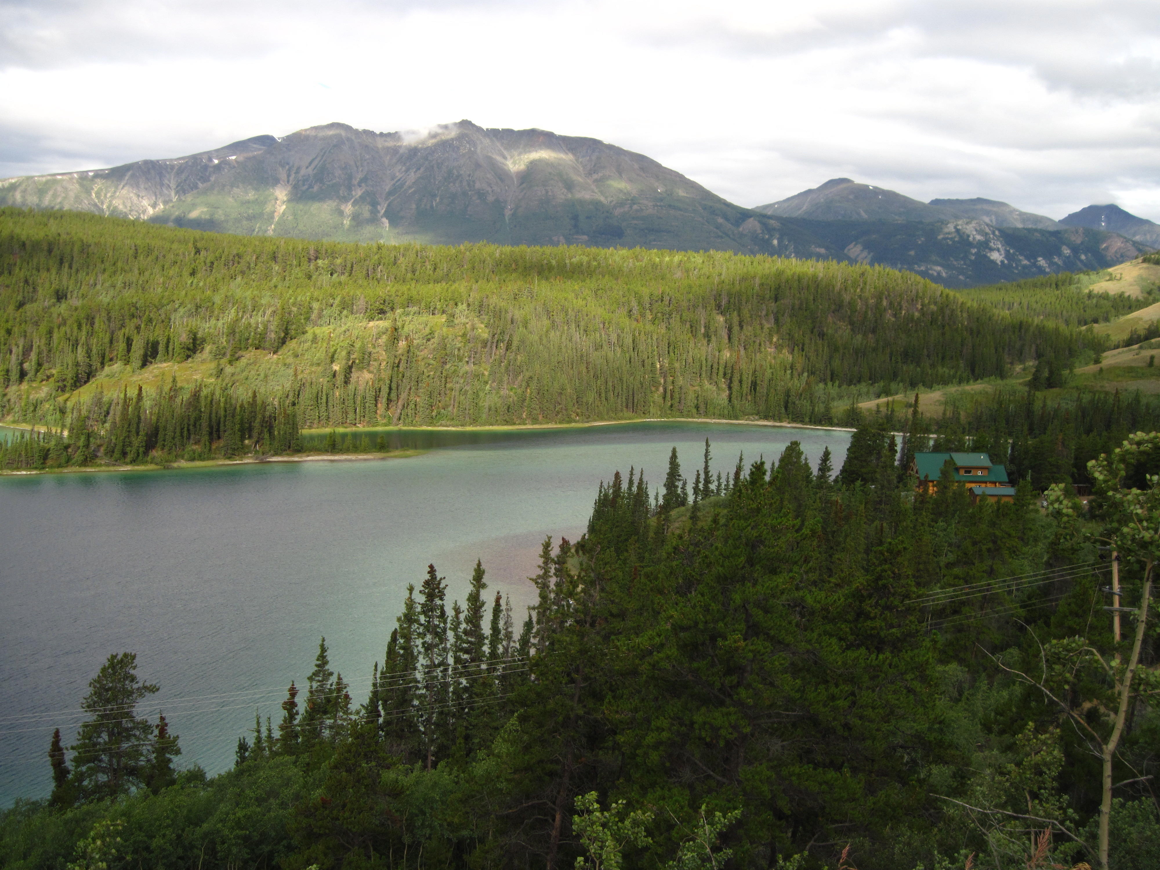
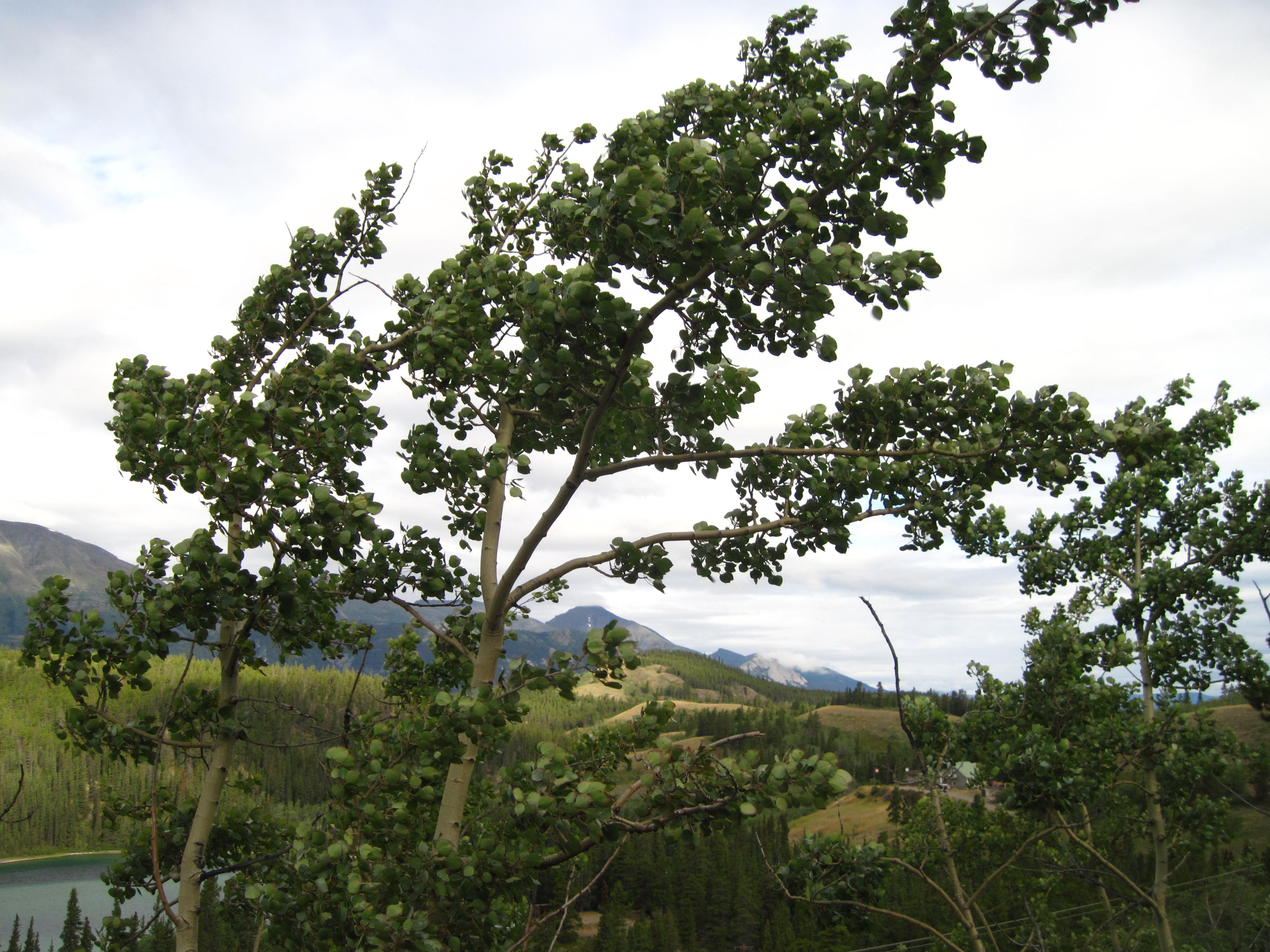
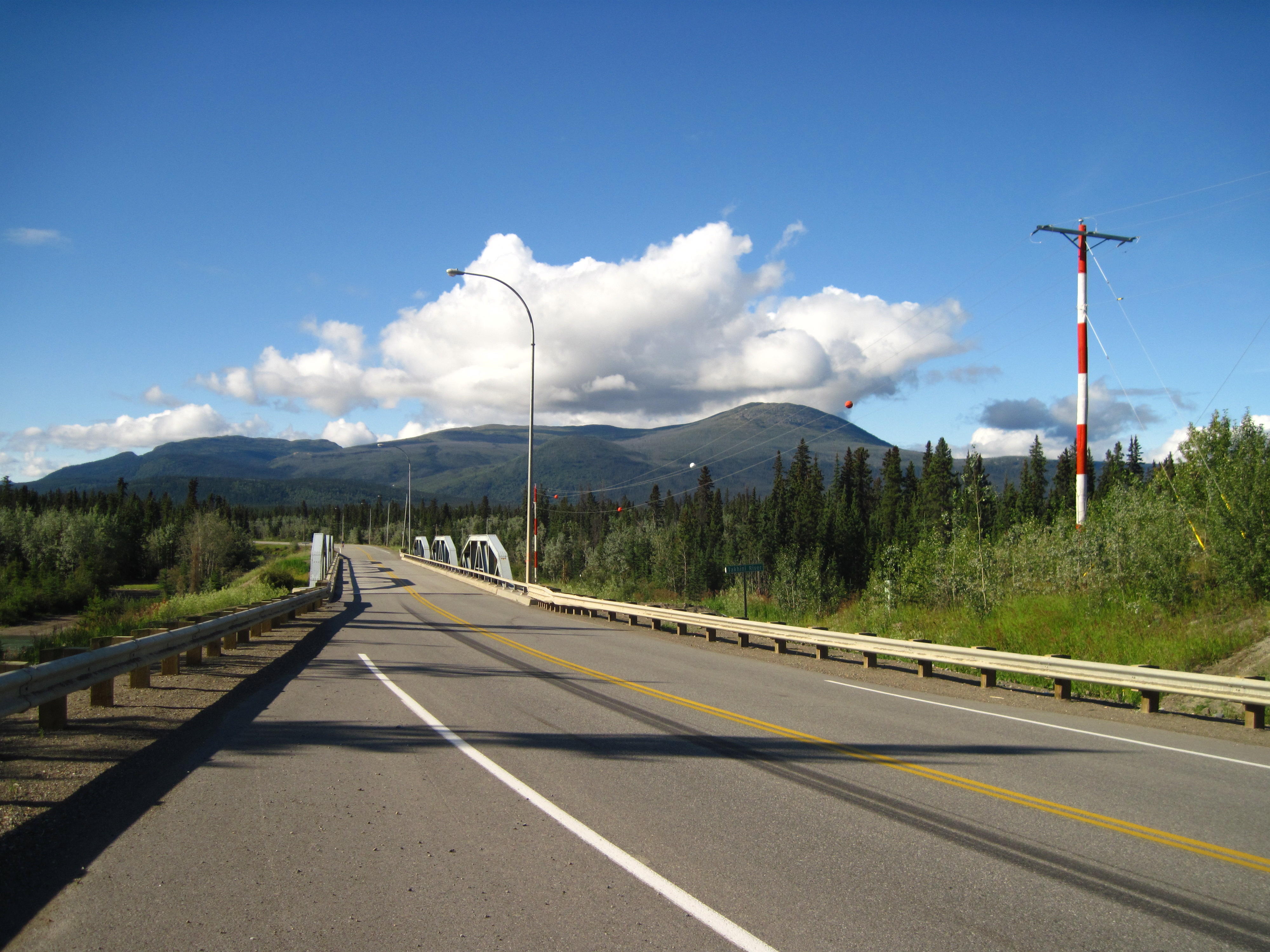
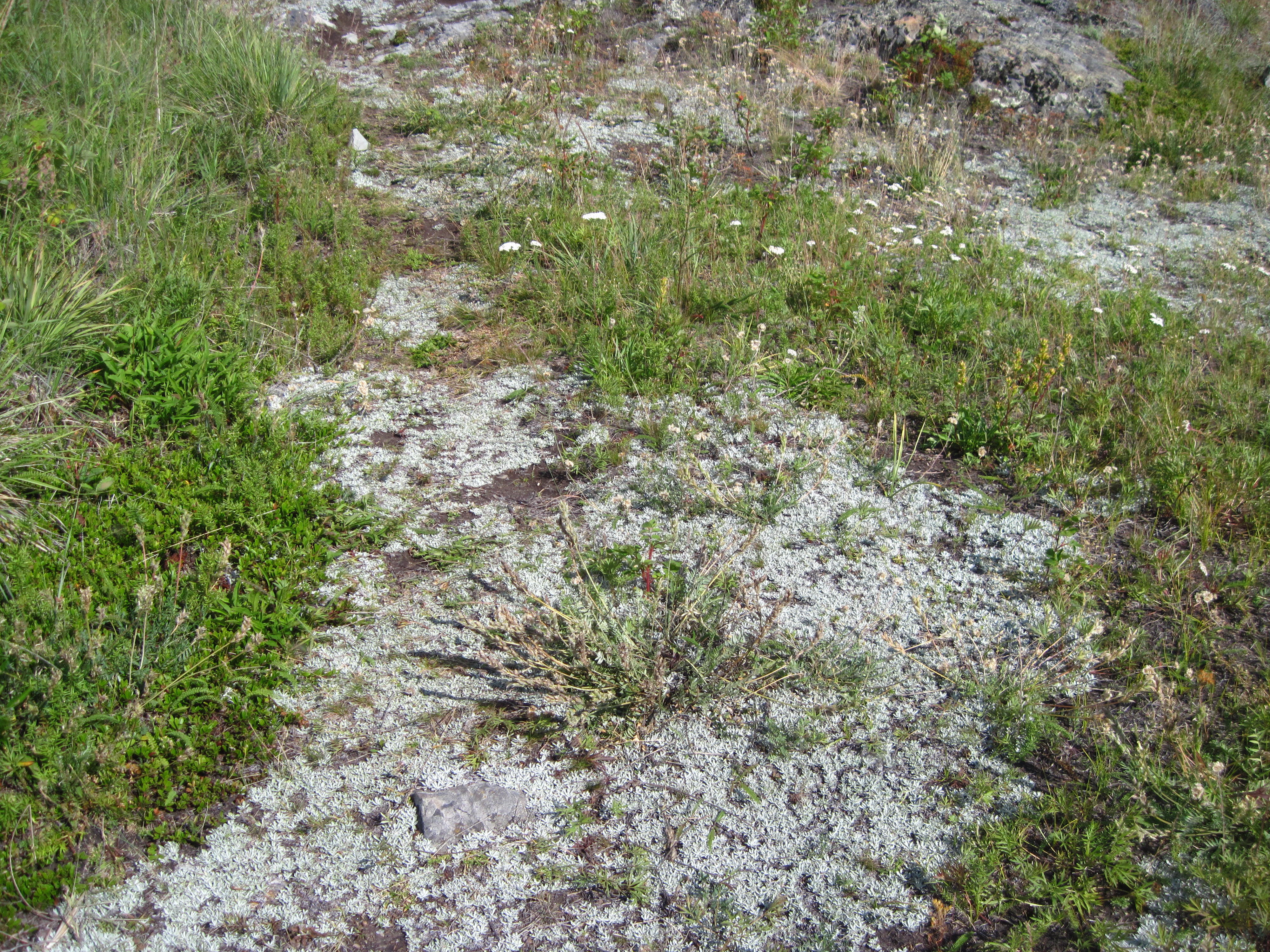
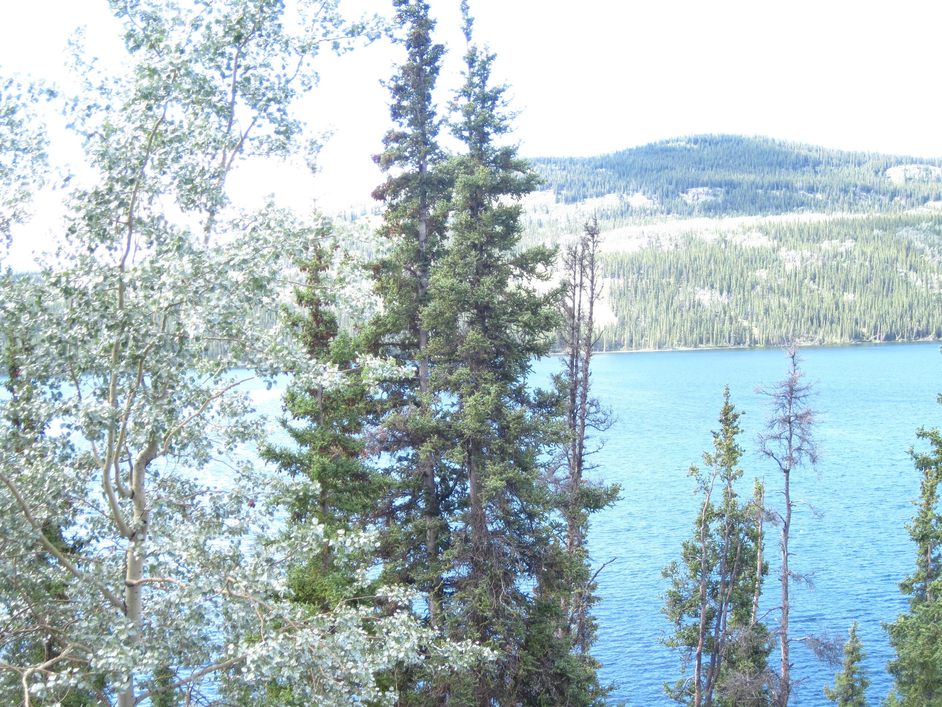
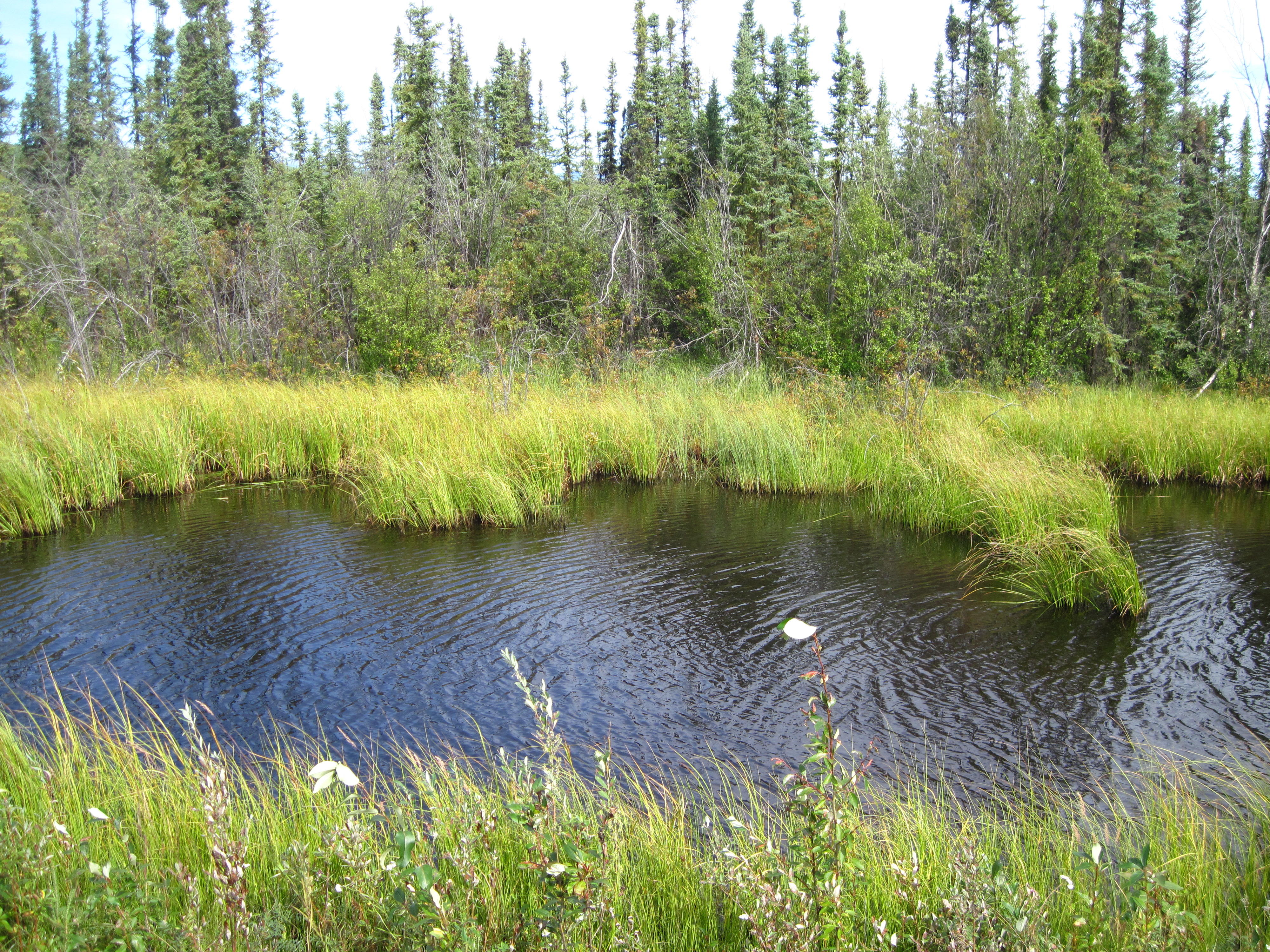
Today's ride begins in Carcross and continues north to the Alaska Highway where it turns left toward Whitehorse. Before the Alaska Highway, I see evidence of extraterrestrial life on one beach of Kookatsoon Lake. What are these aliens up to anyways? This place is sure different than my home. For one thing, there are more trees than people. I take pictures of these and the lakes and mountains beside the highway. The pictures are in the order taken along the highway. Some I can identify. The others I leave up to the reader – I numbered them so readers can easily suggest their locations to the author.
|
|
|
|
|
|
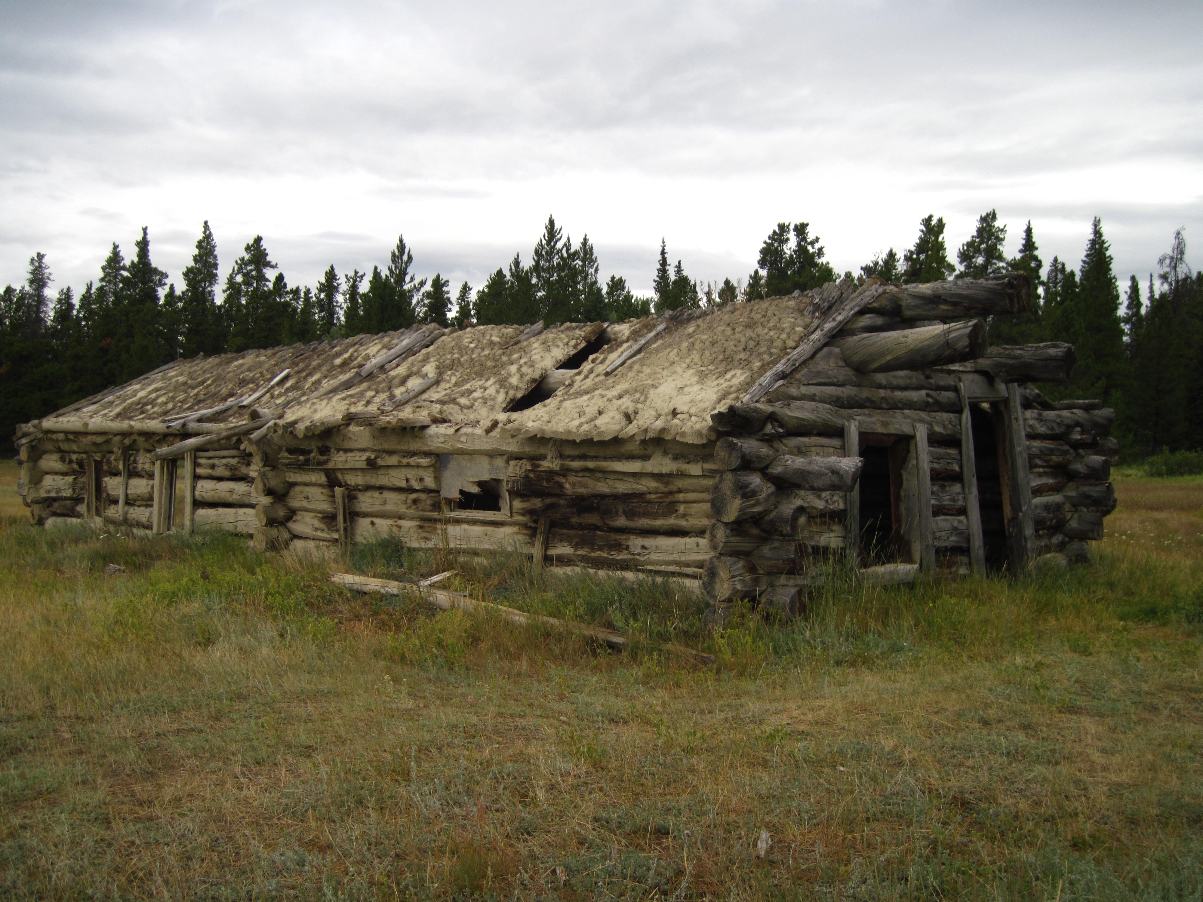
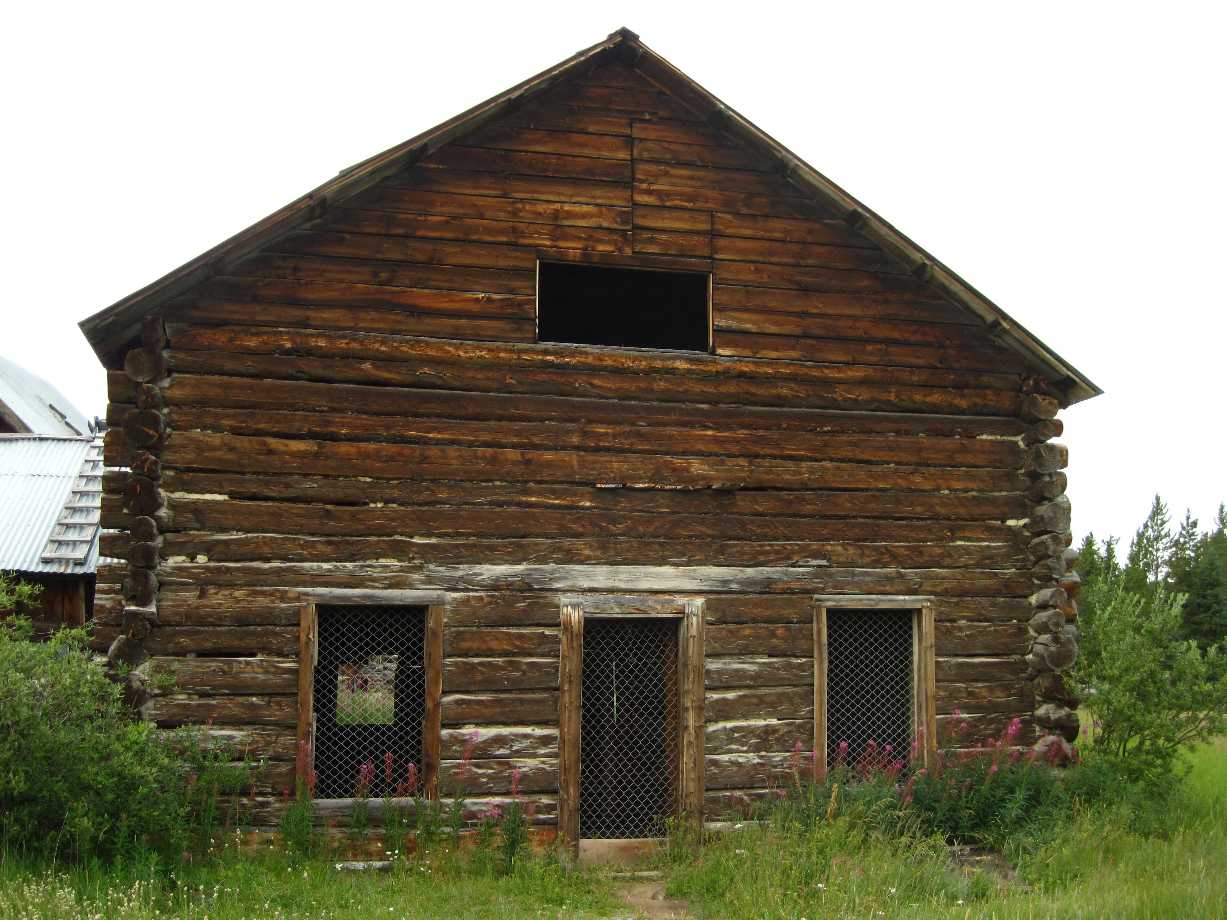
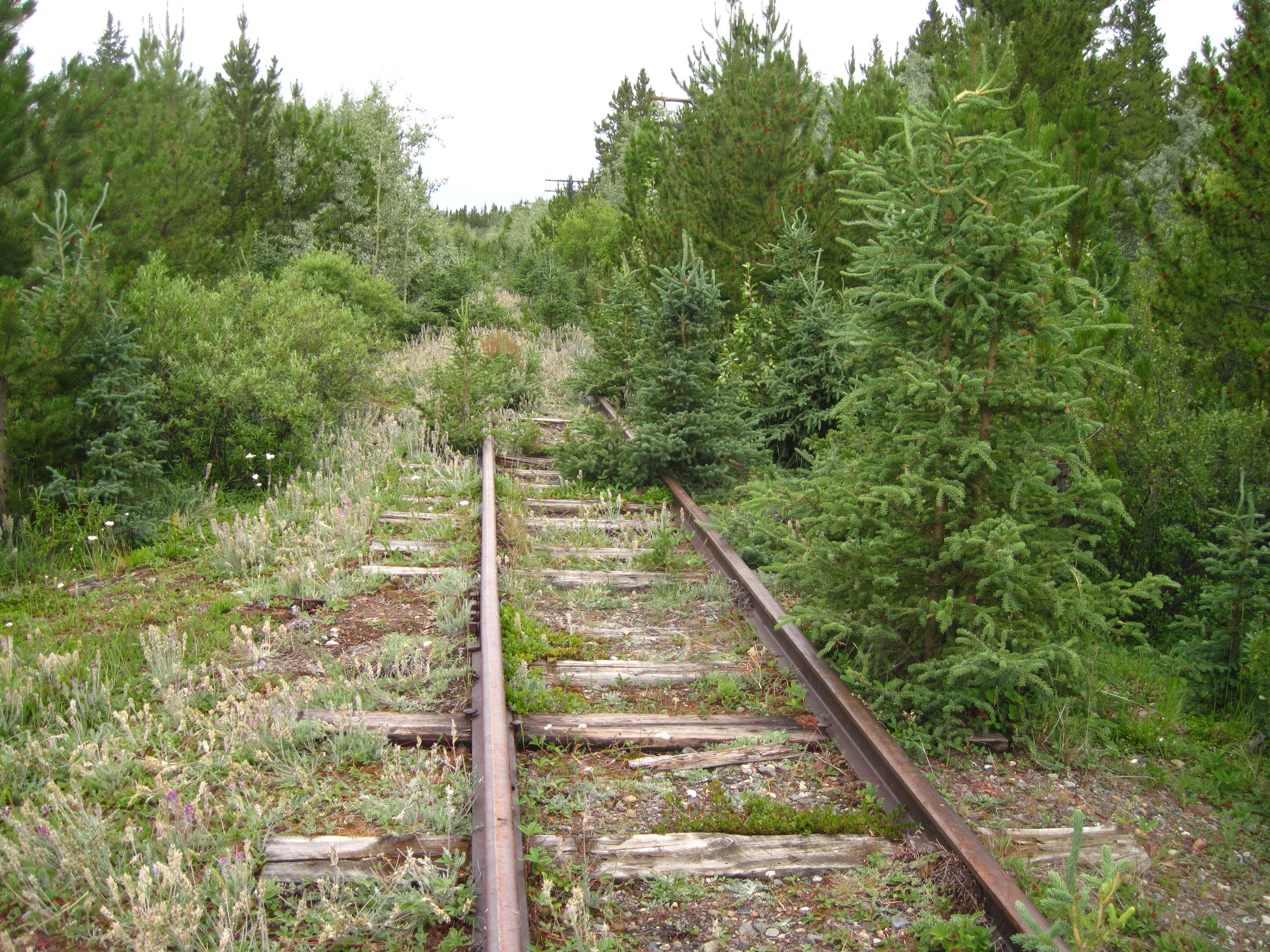
I stop to see the remains of Robinson Roadhouse where there was a mini-gold-rush in 1906. Like the Klondike gold rush this one was much smaller than expected at first. Robinson survived as it was a stop on the White Pass and Yukon Railroad.
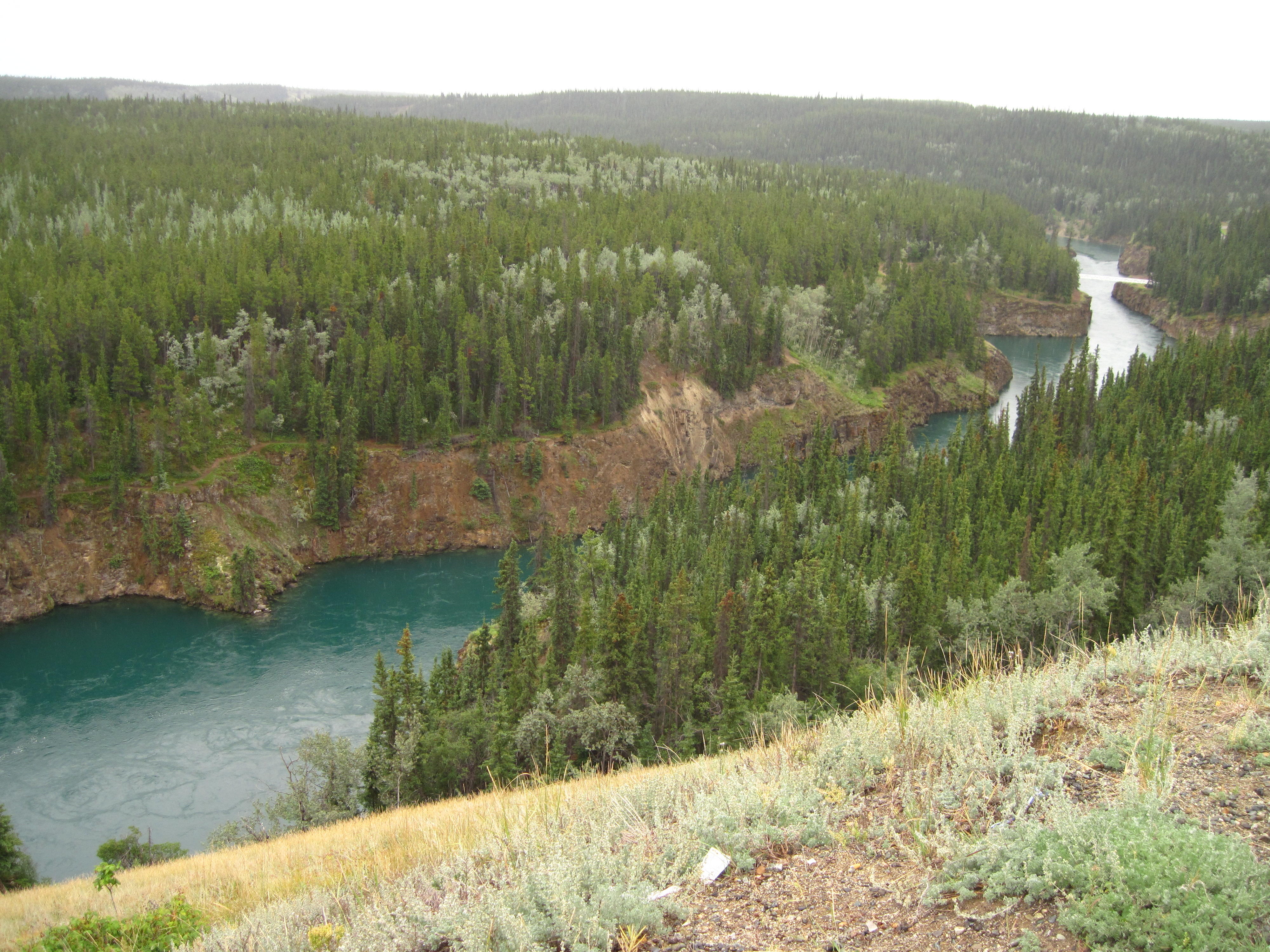
One impediment to the Klondike gold seekers was Miles Canyon just upstream from Whitehorse. There are copper deposits here due to lava flows at one time. I found Miles Canyon to be one of the more beautiful scenic spots on this trip so far! It is a real canyon. I'm truly amazed by the difference in width of the Yukon River at the canyon where it is very narrow and in downtown Whitehorse. There is a small, white suspension bridge across Miles Canyon (the Robert Lowe Bridge) so that people can follow a trail from downtown Whitehorse on either side of the Yukon River and return on the other side.
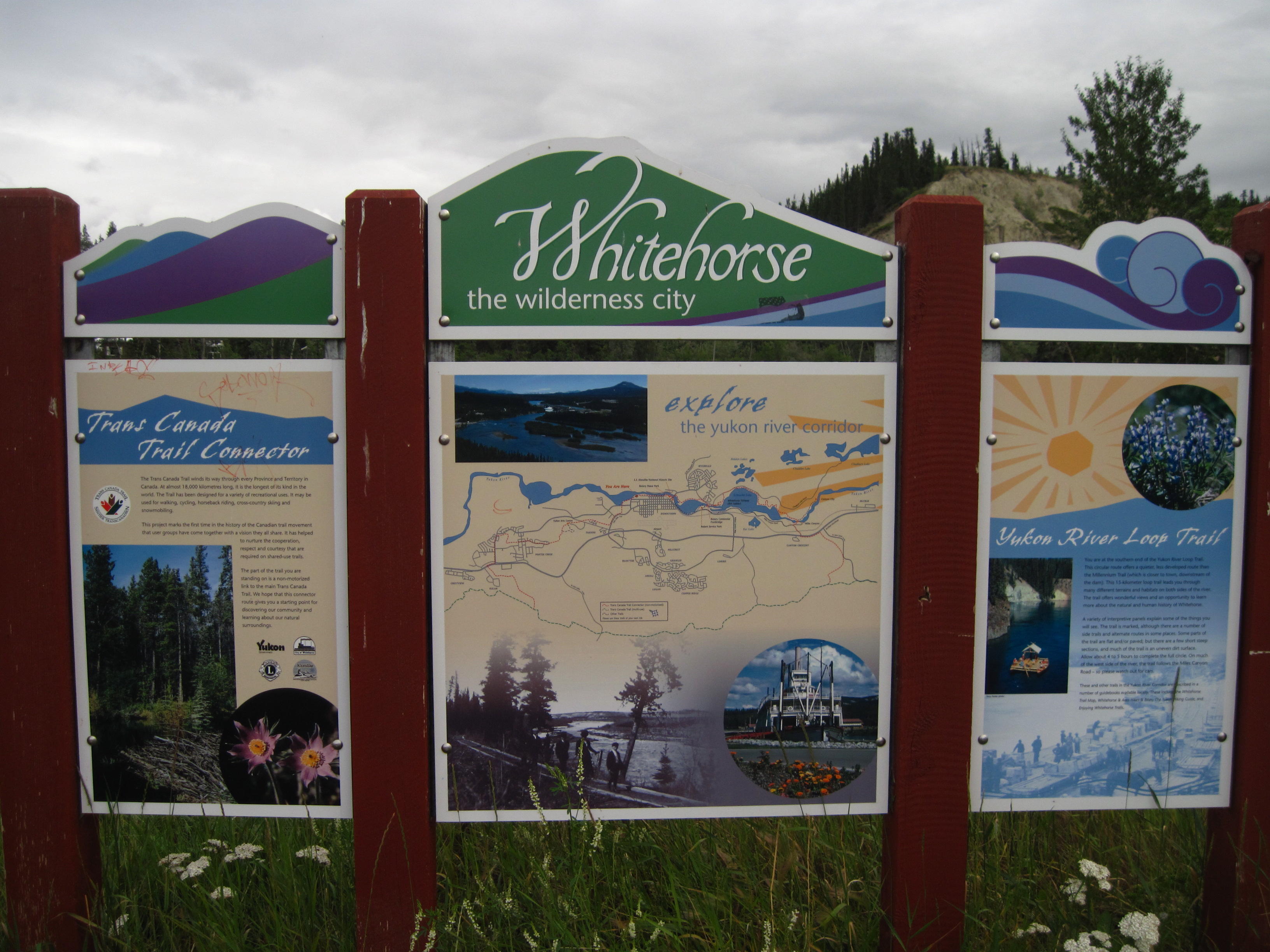
After leaving Miles Canyon I go to Whitehorse on Miles Canyon Road. Now, at first, I do this to avoid the big hill back to the Alaska Highway that I had just come down, but, alas, my hill climbing is tested again today: there are a couple of hills with huge, difficult climbs on Miles Canyon Road. The top of one hill provides good views. Next, the road goes around a reservoir (Schwatka Lake). After going around the reservoir, the Robert Service Campground magically appears. That's where we're staying in Whitehorse so I stop briefly so everyone knows where I am. There is a trail right beside the campground for going into town. I take it and ride around Whitehorse, taking lots of pictures before visiting the library for a free hour of Wi-Fi.
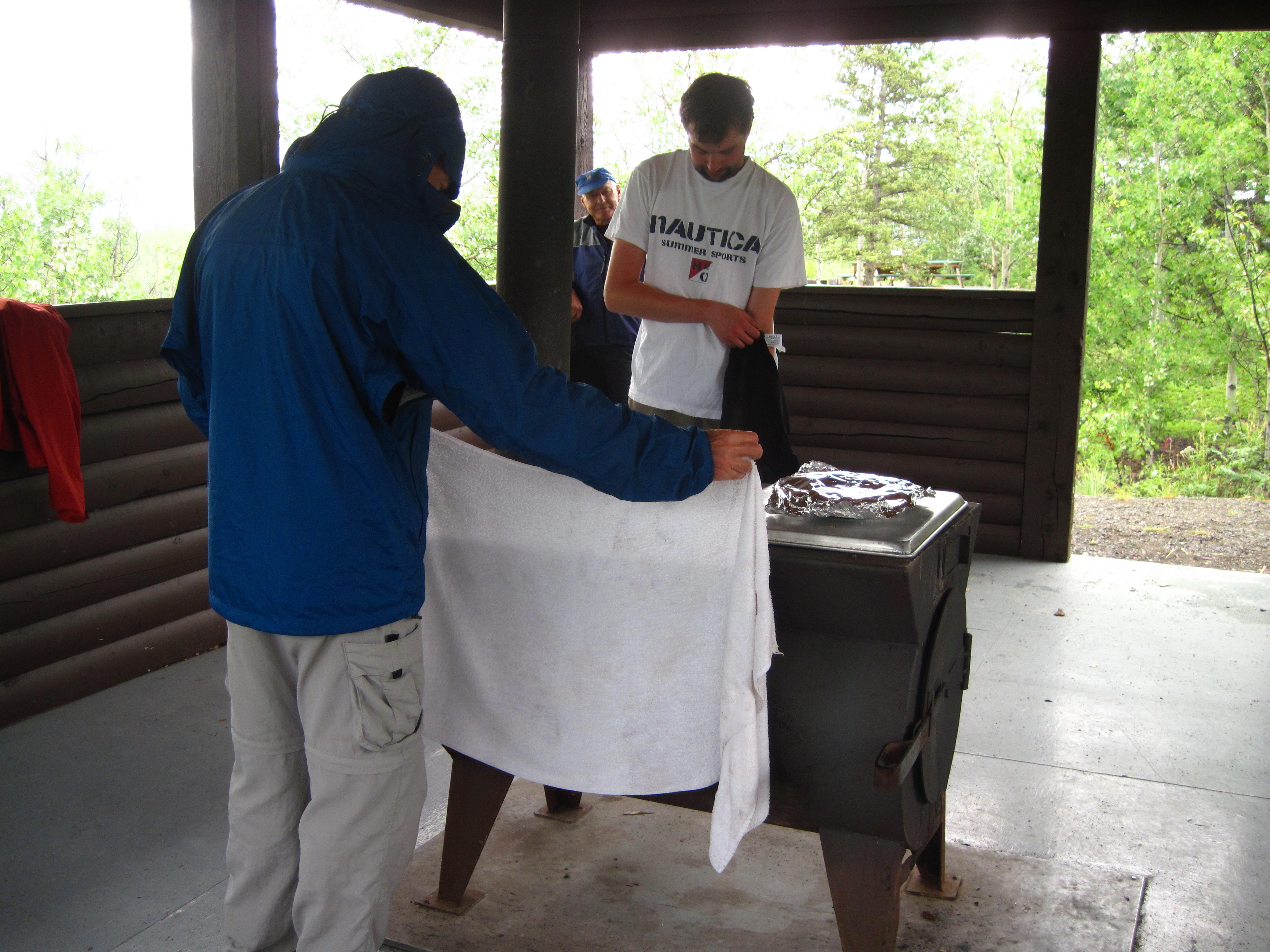
Much later, after supper, I make a fire near our campsite with Kyle's help. We discover that the wood supplied in the campsite is the residual slabs with bark on them that are produced when producing square lumber from logs. This needs to be cut to correct lengths before it can be used. This is difficult, but possible - as you see below we did have a fire. The next day another camper is leaving and gives us some wood that is already cut to length.
|
|
|
Saturday is a rest day in Whitehorse, but I somehow bicycle 45 km. The day starts with a ride to downtown for breakfast at a bakery with four other people from the bike tour. I eat a scone and a muffin and drink some coffee. One person at the breakfast wants a lower gear ratio on her bicycle and I agree to go to the local bicycle shops to help her out. Eventually, at the second shop, Icycle, she settles on getting a smaller, 28-tooth inner ring for her bottom bracket.
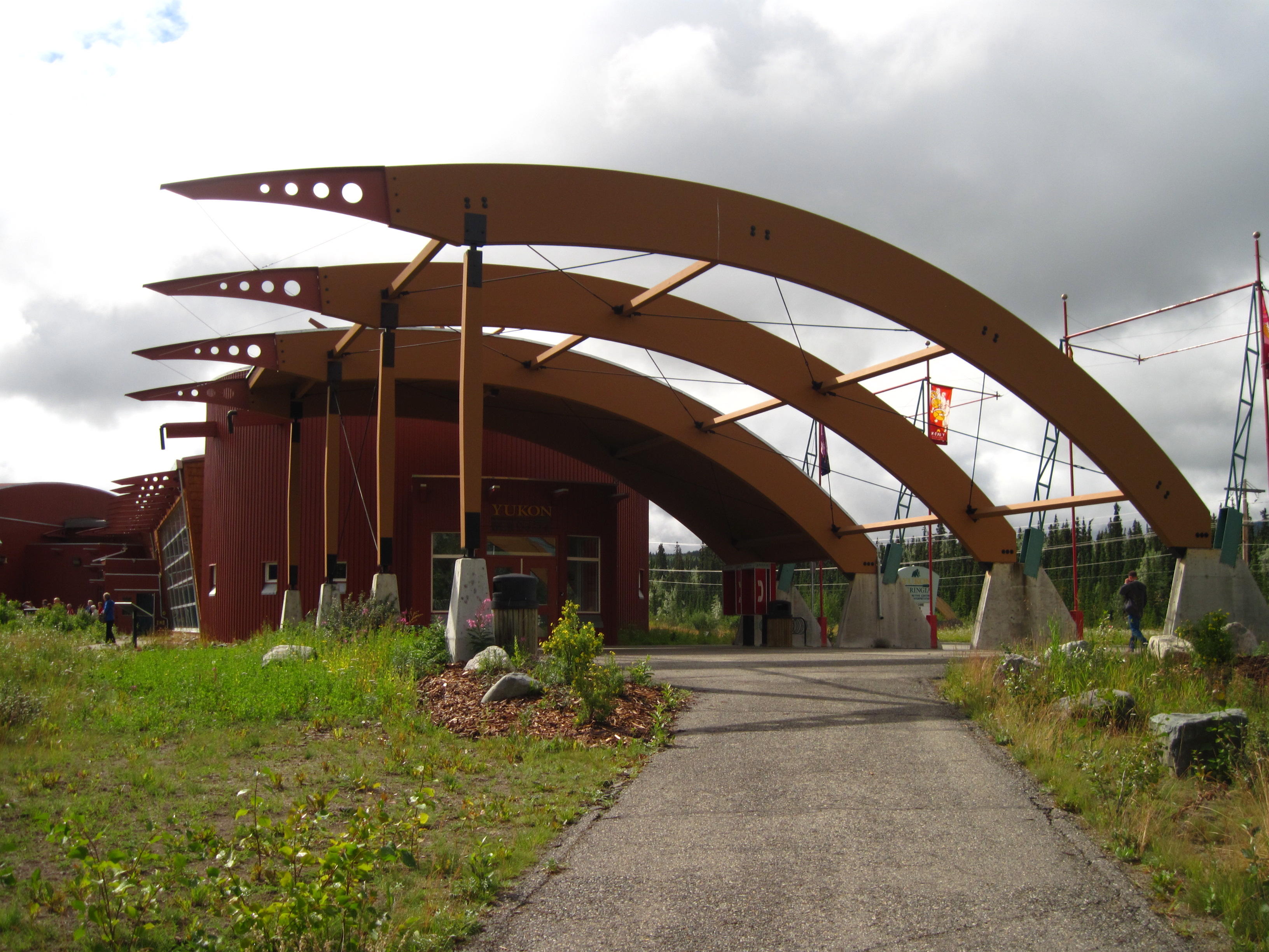
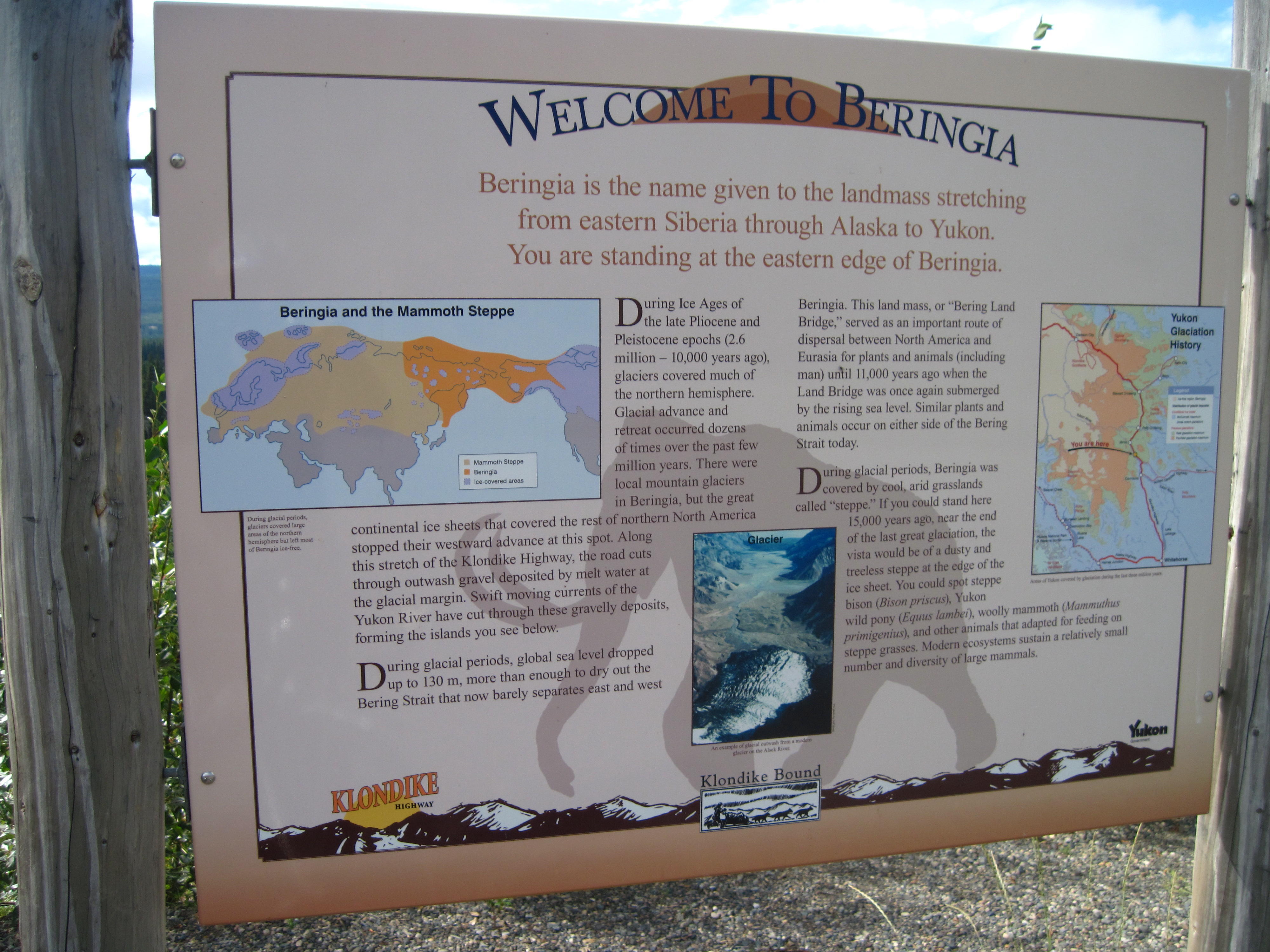
Next, I remember that my clothes are dirty so take a short trip to laundromat which is nearby to determine when it closes. Whew, it closes at 9:30 pm so I can do what I want all day, eh? My first chose is a ride to the Alaska highway bi-pass of Whitehorse to get on the other side of airport and see the Beringia museum as we will be travelling in Beringia. Ugh, will we be seeing super sized mammals like the large beaver out front. I'm reassured that it is a statue of an ancient animal and that the beavers of Beringia are normal sized. Beside the Beringia Museum is the Transportation Museum which has an old air-plane and a yet-to-be renovated paddle wheeler out-front. I decide to skip actually going into these museums since I only have one day in Whitehorse and lots to do.
|
|
|
|
|
|
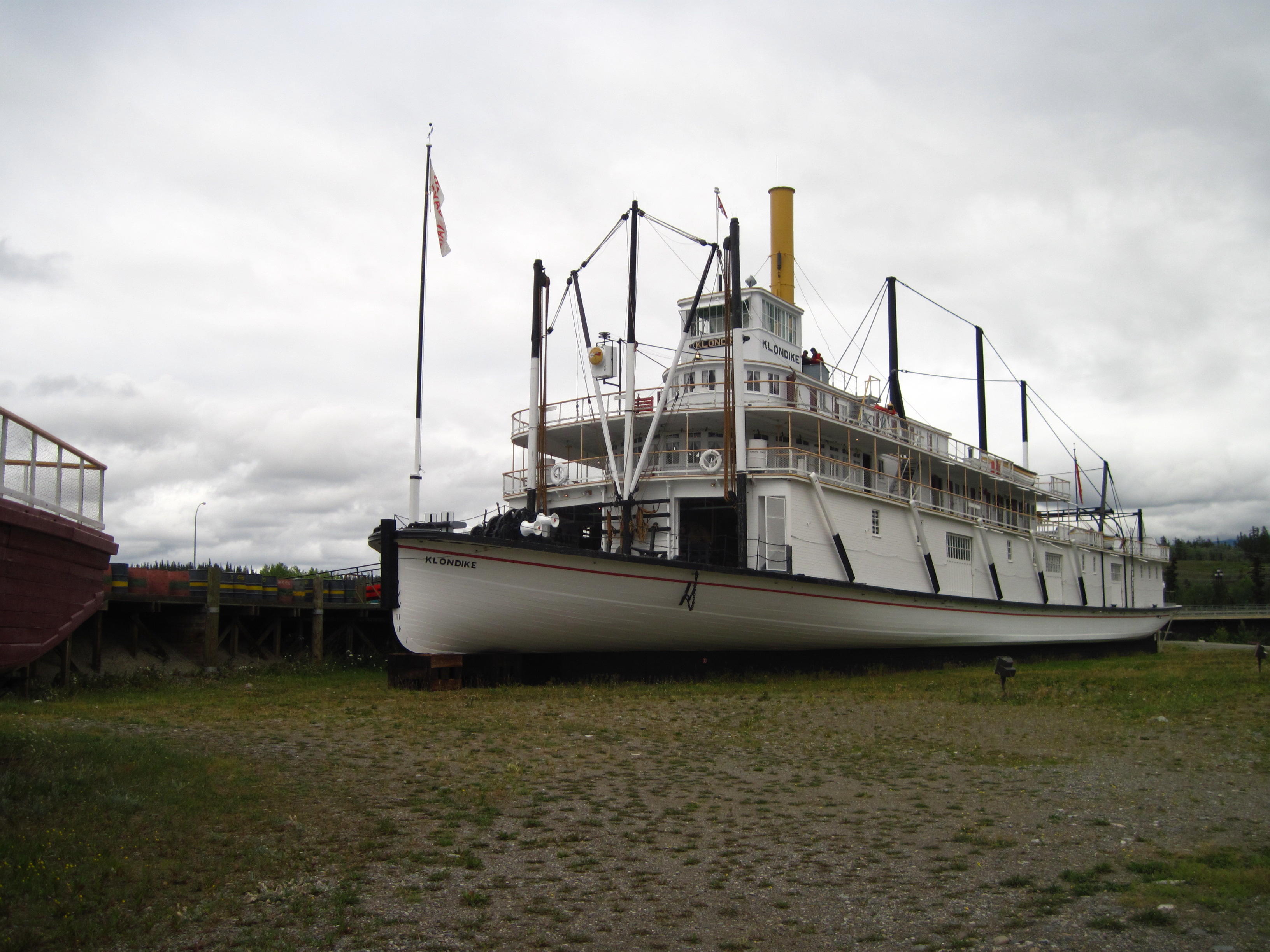
Instead, I visit the Whitehorse Public Library after taking a picture of the S.S.Klondike paddle wheeler from the road side – I took a picture form the bike path yesterday. My objective at the Library is to use a personal computer to upload the first version of this web page about this trip. After waiting a few minutes for my turn to come up, I get most of the web page loaded in my allotted hour, except for a few pictures that are too large for my ISP's software to handle. I'll deal with these when I return to Ottawa.
|
|
|
|
|
|
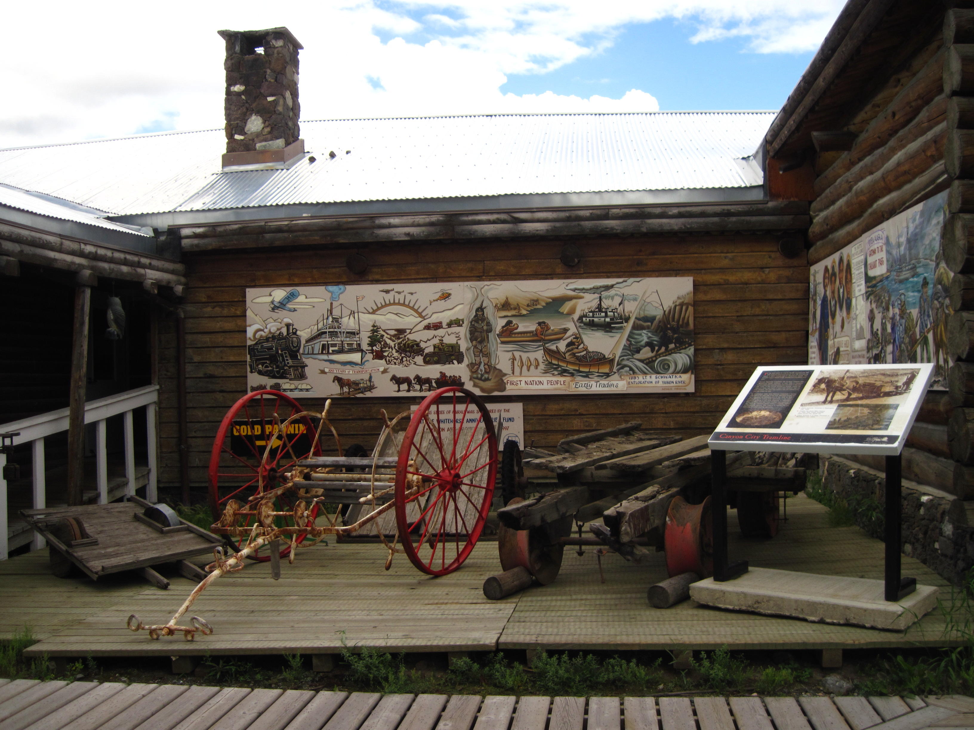
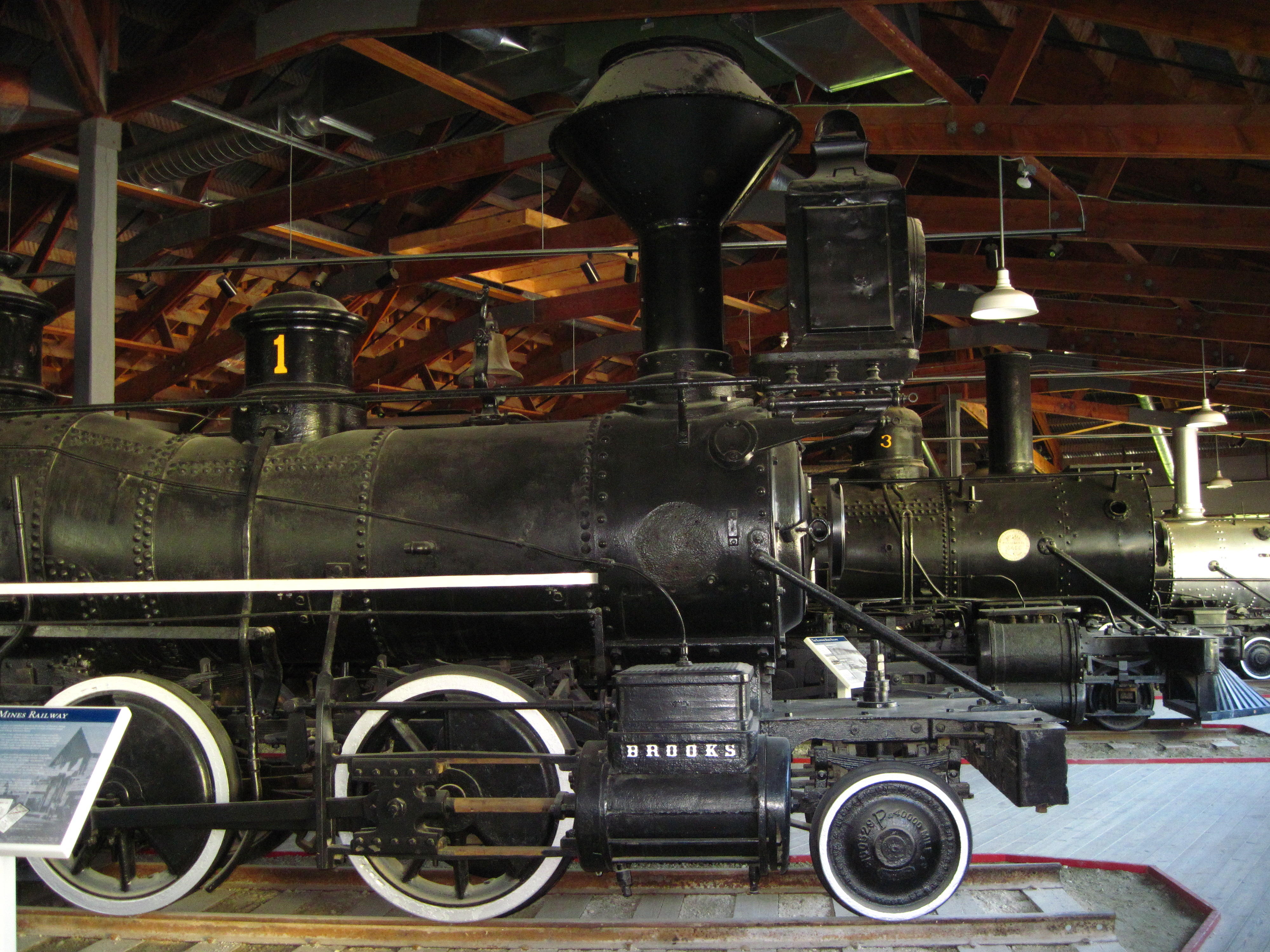
This frees me up to go to the McBride Museum and see a few artifacts of Yukon history. It all starts about 1900. Gee, my grandparents were alive then – but my family tends to marry late in life and have children even later, eh! Whitehorse was established with the Klondike gold rush in 1898. It's population fell to 4,500 in the 1930s and increased in 1942 with the construction of the Alaska Highway. Whitehorse has since thrived in comparison to Dawson City since it is a centre of commerce on the Alaska Highway, and the capital city of the Yukon was switched from Dawson to Whitehorse in 1952. In the McBride Museum, there are exhibits of pseudo gold miners panning, and a huge shed full of locomotives that were used by mining companies to get their mined ore to the next available means of transportation – normally water craft, and, sometimes, the White Pass and Yukon Railroad.
|
|
|
|
|
Ah, the moment has arrived to wash clothes in the local laundromat since probably the next good washers are in Dawson after 4 days of travel. Thar's another rest day in Dawson – for washing clothes, eh?
On the way back to camp, I investigate the trails on the other side of the Yukon River. There is a paved trail that goes all the way to the dam, a fish ladder near the dam, the Rotary Centennial walking bridge that goes all the way across the river. When back at camp, I find another small bridge behind our campground to a small island in the river – Temptation Island. I use this bridge to access the island and walk the nature trail around it.
|
|
|
My exit from Robert Service Campground in the morning is rather sneaky as I use the Rotary Centennial Bridge to take the trail on the other side of the Yukon River which I then follow downstream to Whitehorse where I take the Robert Campbell Bridge back across the River. In the town centre, I stop at The Real Canadian Super Store since I need a bar of soap because mine somehow ended up in my laundry bag and was washed last evening.
|
|
|
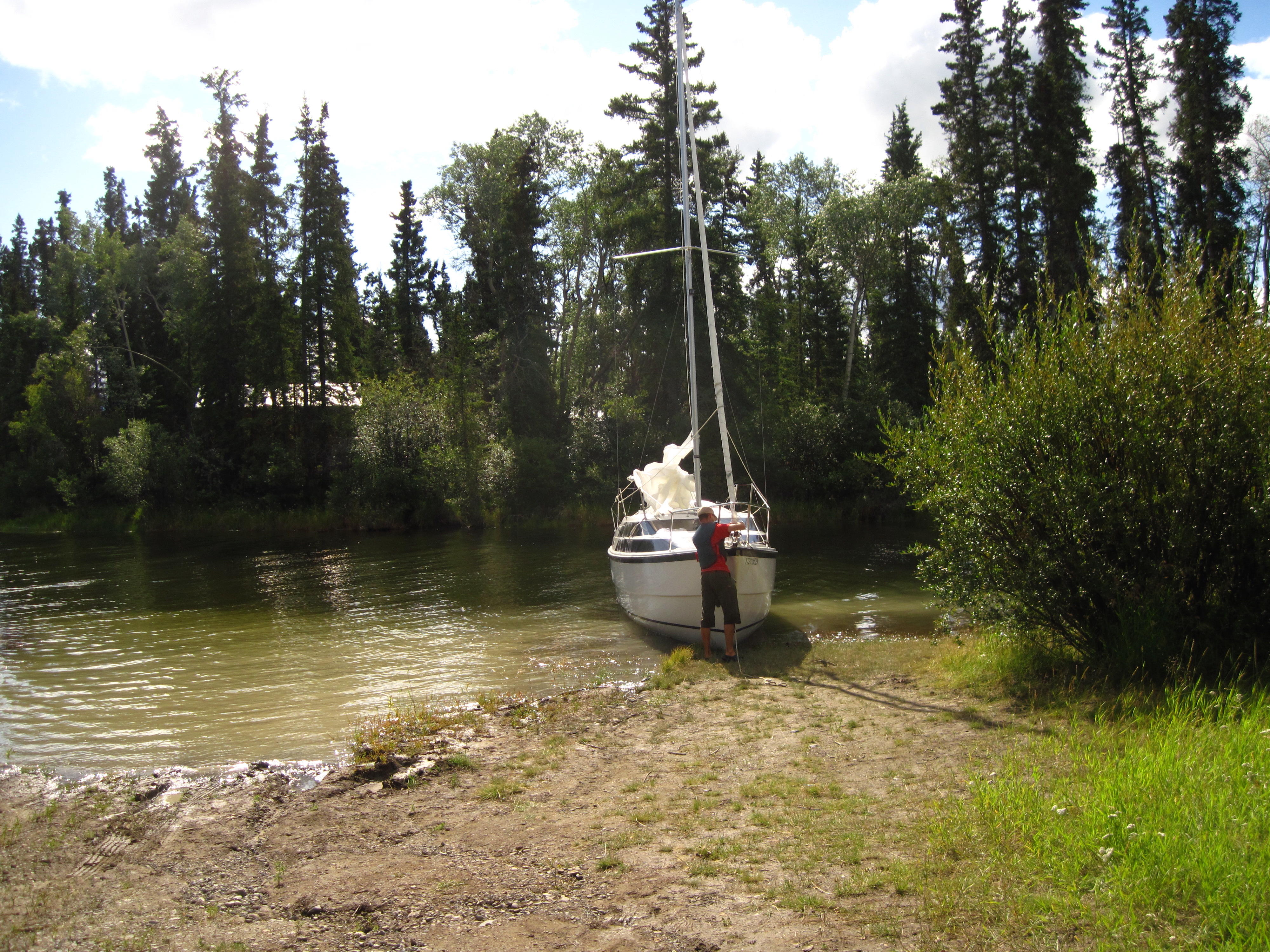
The first side-trip of the day is to Lake Labarge where I see
A man and woman who live nearby year round walking 3 dogs
A man docking a sail boat on a beach. I notice him when he yells out “Please move. I'm beaching this boat.”
I make a few other interesting stops today:
A memorial for the Fox Lake fire of 1998. The effects of the fire becomes more real to me when I visit an interpretive trail at a rest stop. The Fox Lake fire was very large, extending to Lac Labarge in 13 days. It was caused by a campfire.
At Braeburn Lodge where I stop for pop in afternoon and lots of other cyclists are also stopped
An interesting interpretive sign on the “Whitehorse Trough.” The geology at this point is different on either side of the road: only the west side is in Beringia.
|
|
|
|
|
|
I start to notice the condition of roads: many sections are very rough since they are old; others since they are covered with an over-coat of sealant. The road today is also rough due to the long sections of construction.
Today's sleeping spot is at Twin Lakes government campground which is very primitive. I do like having my tent beside a Lake like tonight. However, the truck is a few hundred metres away up a steep hill. I find it awkward having to climb the hill every time I need to visit the truck and retrieve some necessary item. As it is, I like the lake so much that I jump into it to get cleaned. I also exit very quickly as it is very cold.
Two other cyclists tell me that I did have an encounter with bears today. I do not remember this? They say that I interrupted these 2 black bears that were eating at the side of the road, just before camp. I failed to notice the bears and rode right by. The other cyclists were following me. They say that I rode right by the bears, not noticing them; I startled one bear who retreated from the side of the road. One of the other cyclists caused the other bear to retreat when he yelled “Bear.”
The weather changes rapidly when rain descends on us at dinner time and the temperature also falls. The effects of the low temperatures are mellowed when I help Sue use the park's supplied stash of wood to make a fire in the camp stove that is under the shelter where most of us are huddled. Life is much better with the fire.
|
|
|
Alas, we leave camp today in rain that lasts until after noon. It's now raining again, in fact pouring, outside as I write up my diary in the dining room of Minto Resort. The scene outside the window is very pastoral as this camp site is off the main road by about 1 km so there are no truck noises, and our group are the only tourists in this campground this evening.
The weather today was great for riding: the weather got warm and sunny during late morning and afternoon. It was nice weather to ride by and set up tents to dry them out. Like last evening, the weather changes abruptly during supper with pouring rain and continues like this into the night. The rain is over by morning.
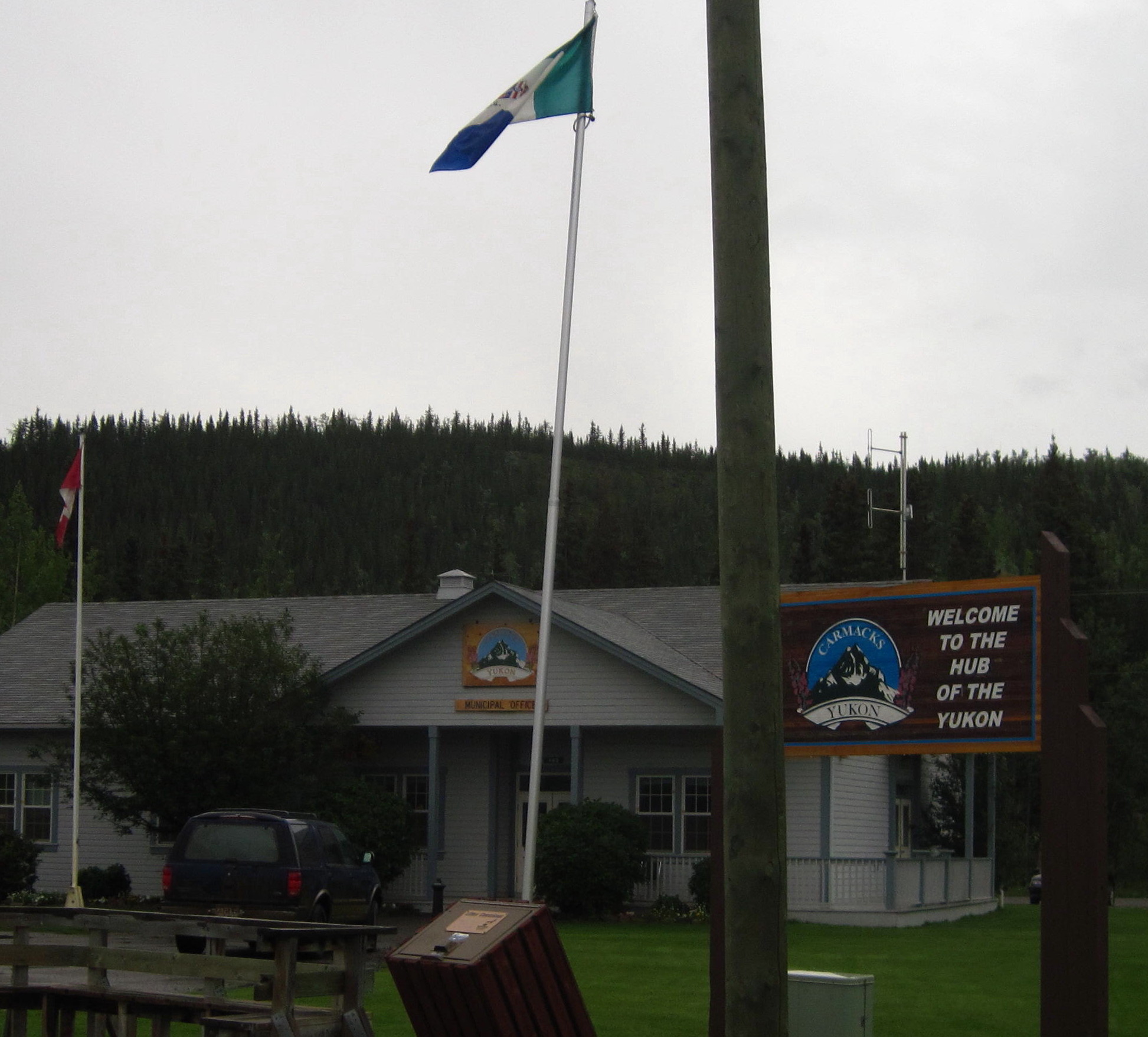
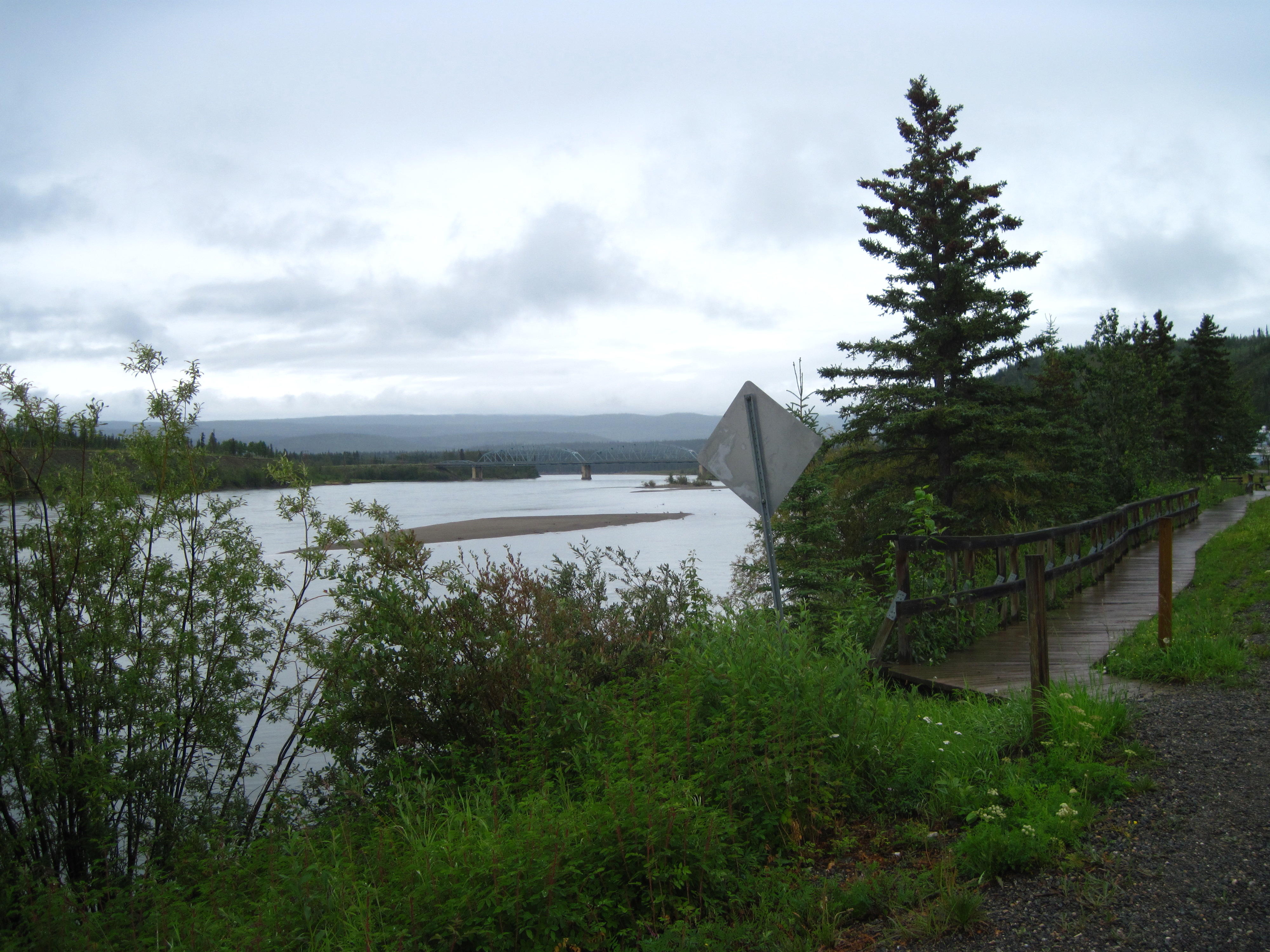
The ride goes through another small town today, Carmacks. This one is fixed up – probably for attracting tourists? The features are:
A new boardwalk along the Yukon River throughout all of town
Some display boards describing the history of the area along the boardwalk
Some work in progress to restore an old road-house: the windows are boarded up and doors of sorts are installed
A town hall
Yesterday I was accused of ignoring bears; today, it's a coyote. Another cyclist was following me up the hills after Carmacks. He says that a coyote was looking at me inquisitively as I took a picture from the top of the hill. I don't remember this coyote?
|
42. Carmacks |
|
|
|
|
|
|
Today is another ride through northern bush with it's tendency to be continuous forest-ditch-road-ditch-forest. The monotony is of the landscape is broken since the vegetation is a bit different from prior days and there are a few scenic lakes, some larger hills or mountains in the background, and rivers with impressive amount of flow.
Today's weather: cold and cool at camp in morning but much warmer within an hour. I left camp all bundled up with cycling longs on the legs and a jacket over a synthetic long-sleeved t-shirt. I almost started to shiver in camp this morning, it was so cold. Within an hour, it's warm enough to ride with short-sleeved t-shirt and bicycle shorts. It's so warm in the afternoon that I sweat a bit due to the heat! The weather cools off in the evening.
My method for always being comfortable and warm with such varied weather is to carry 2 small panniers on the rear rack of my bicycle. One pannier is stuffed with cold weather and rain gear as these parts in the mountains in the north are somewhat unpredictable. Sometimes the weather seems to come from nowhere, like the storm last evening. It was a bright sunny day about 5 pm, and pouring rain by 6 pm, an hour later.
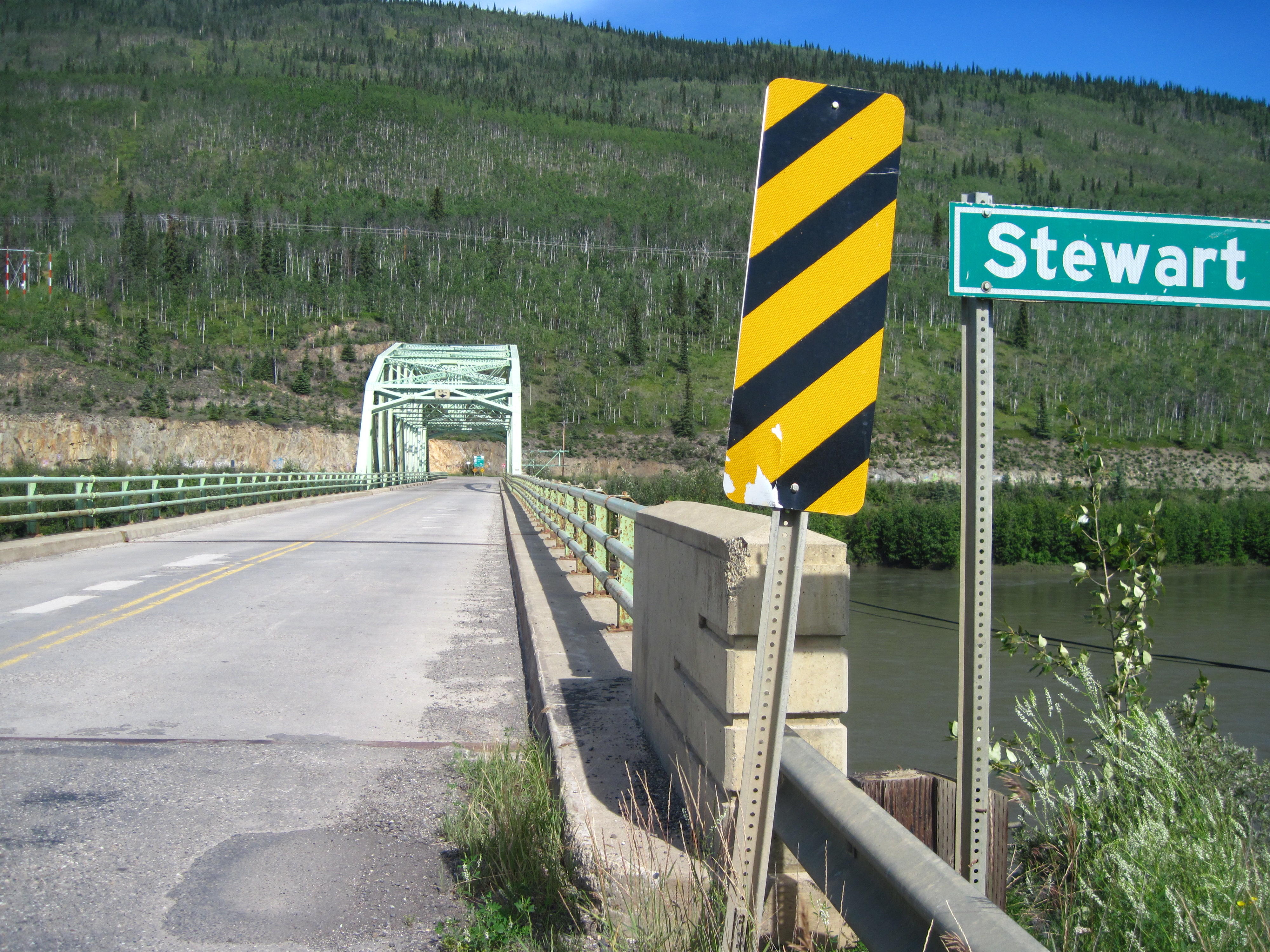
Today's tour goes through two small villages: Pelly Crossing and Stewart Crossing. In Pelly Crossing, I decide to ride around town rather than going into a restaurant for a second breakfast, like many other Tour Arctic cyclists. Pelly Crossing looks like it is surviving, and at least some residents are thriving.
I do encounter a dog in Pelly's Crossing when I decide to do a circle tour of the town: when I am almost finished my tour of the hamlet, I see construction ahead of a house or shack, and there's a large, light brown, skinny dog standing beside the construction. I stop and then walk by with one foot on left bike pedal. The dog approaches me. I stop and yell “hey.” The dog continues to approach me, not wagging it's tail. The dog then wags its tail a bit and smells my hand and leg. It is friendly, after all, at least for these parts of the country.
|
|
|
|
|
|
In Stewart Crossing, I get some pop at a store after reading a few information signs. I enter the store despite the signs warning me in advance that there is an admitted grouch inside. There's a sign apologizing in advance for her moodiness and grouchiness! I still buy some pop. Stewart Crossing appears to be dying as a town: there's one large resort with a “closed” sign at its entrance way, and there does not appear to be much more in this settlement.
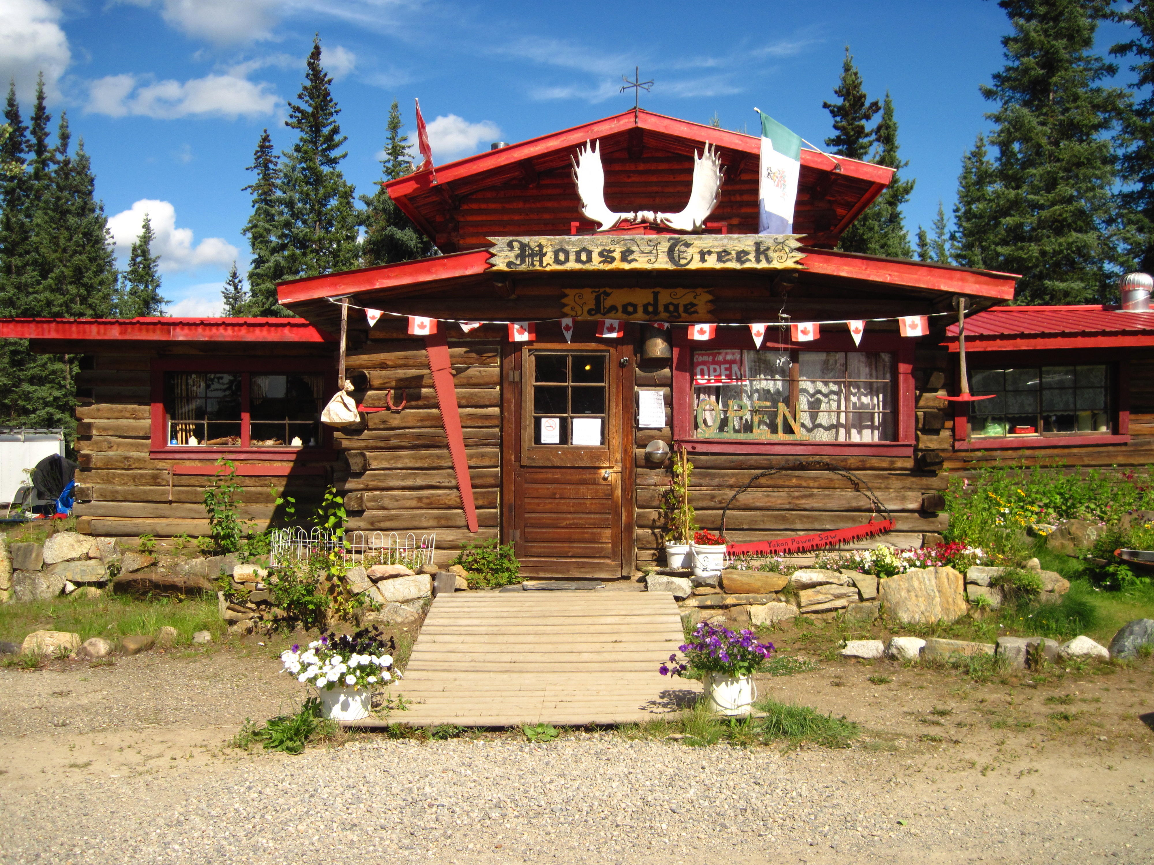
The notes for today's report were written from an enclosed dining area at Moose Creek Lodge where Tour Arctic is staying. Moose Creek is the first campsite on this trip with serious mosquitoes and black flies. We have a fire which controls the bugs a bit, but the enclosed dining area is even a better idea, eh? There's a government campsite near by. I guess we're at Moose Creek Lodge since it has showers and flush toilets; whereas, the government campsite has pit-toilets. Tour Arctic members are camped randomly around the Lodge property which does not appear to have any specific campsites. There is a turkey wandering around. Some cyclists try to scare turkey while others talk to it. The turkey continually squawks when it comes around for a visit. What is it trying to communicate?
|
|
|
|
|
|
Our group of cyclists seems to be taking Tour Arctic quite well, but one can never be certain. The cooking of the current support crew helps. It is still wonderful. Jerry is collecting a tip to give them in Dawson City when they leave our tour. Now, as for the bicycles, one cyclist's bicycle is having lots of problems. First it was a flat tire yesterday due to the working through (wearing out) of rubber on a tire. Today there's a problem with brake adjustment. Is this bike ready for the Dempster Highway? Another cyclist reassures me that the Dempster is in great shape for bicycling: dry and ridable. This cyclist claims to have talked to someone who is working on road improvements, and has been to the Dempster in the last couple of days.
Today is our first encounter with the Dempster Highway. The route goes by it without turning down it. Instead our route goes another 35 km to Dawson City. The location of the Dempster is noted though with many having their first stop at Klondike River Lodge at the junction of Klondike and Dempster highways. I, too, stop for a pop. Some other cyclists are eating much more.
The weather is warm and sunny by the afternoon today, after a cold start in the morning. It's so cold in the morning that the Nutella won't spread. This pattern will continue through most of this trip to Dawson and on the Dempster Highway. The daily weather is also marked by a sharp drop in temperature most days, around six o'clock in the evening. The sun stays out, but the temperature plunges.
|
|
|
|
|
|
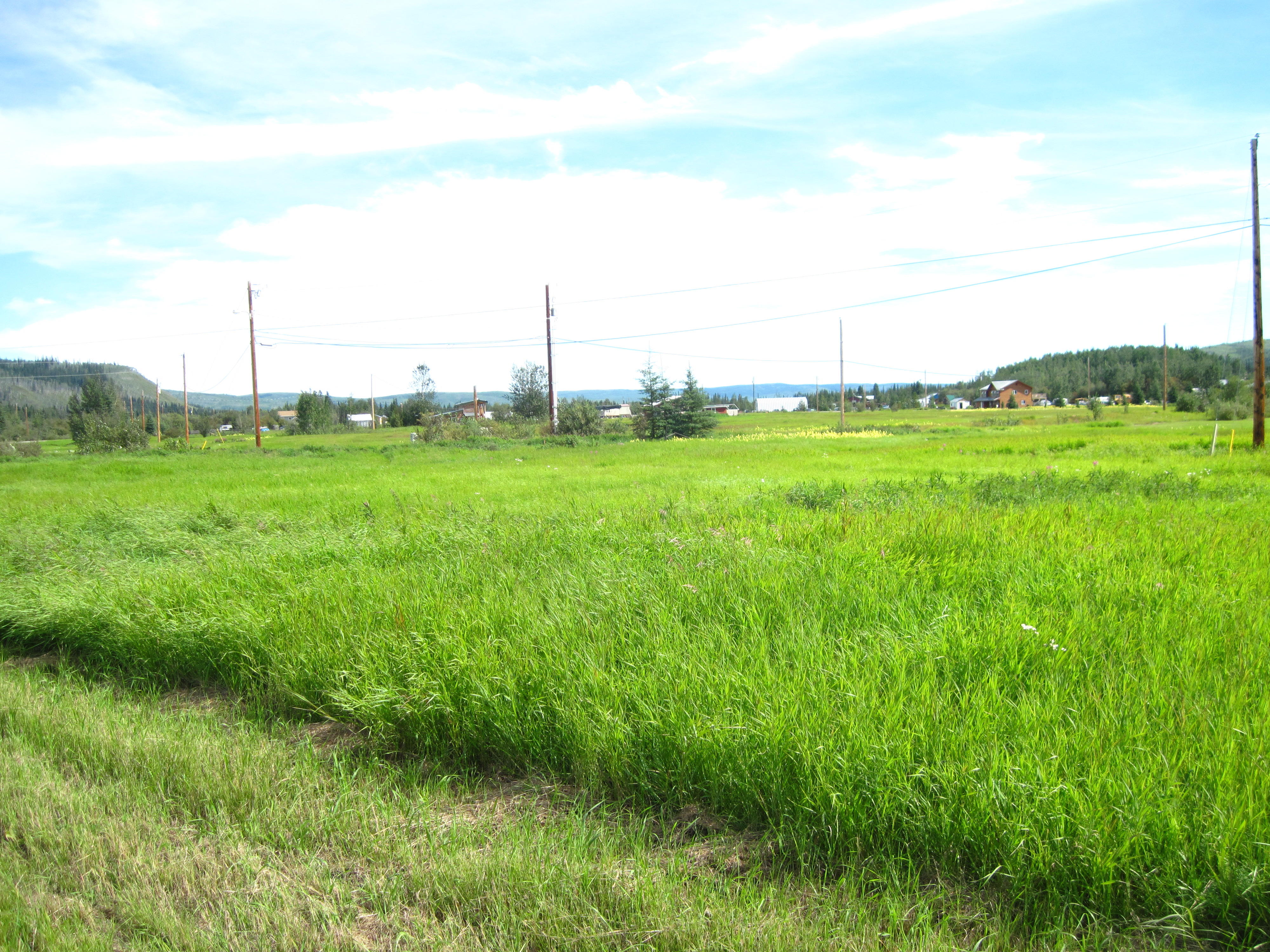
Much of the road is the same type of northern-bush road today with trees-ditch-road-ditch-trees. This pattern is broken by the sudden appearance of lush, open fields about 10 km before Dawson City. In Dawson City I see streetscapes that are either truly historic or manufactured to represent bygone eras. I see the Robert Service Cabin, the Jack London centre, and the Catholic and Anglican churches. Most streets in Dawson City are gravel. After all, it is a rather small city with a population of 3,500 in the summer and 800 in the winter, and an average of 10 students graduating from school each year.
Tour Arctic stays at Gold Rush Campground in Dawson City. It is more an RV camp with gravel lots than a campground. While having supper there, we engage in a conversation with a real gold miner. He is married to person from a first nation so can live on the wild animals that they trap year round. We give this man 2 beer over the course of an hour and he sure talks a lot. We learn that he's not fishing today since someone stole part of his motor this morning. This local person then engages in a long spiel about how he will make more money in one season when gold costs more, at least $2,000 per ounce. Then he'll work or sell his claims at great profit, eh?
This local person then gives Mike, our cook, 2 salmon fish heads that he heats up. This salmon taste like it wants to melt in your mouth. It is very smooth salmon to eat.
|
|
|
|
|
|
|
|
|
Today is a rest day for Tour Arctic. I face a primary problem right off and wash my clothes in the laundromat of Gold Rush Campground where we're staying. At the same time, I eat a mini-breakfast of 1 muffin and 1 orange, both of which I've saved from yesterday.
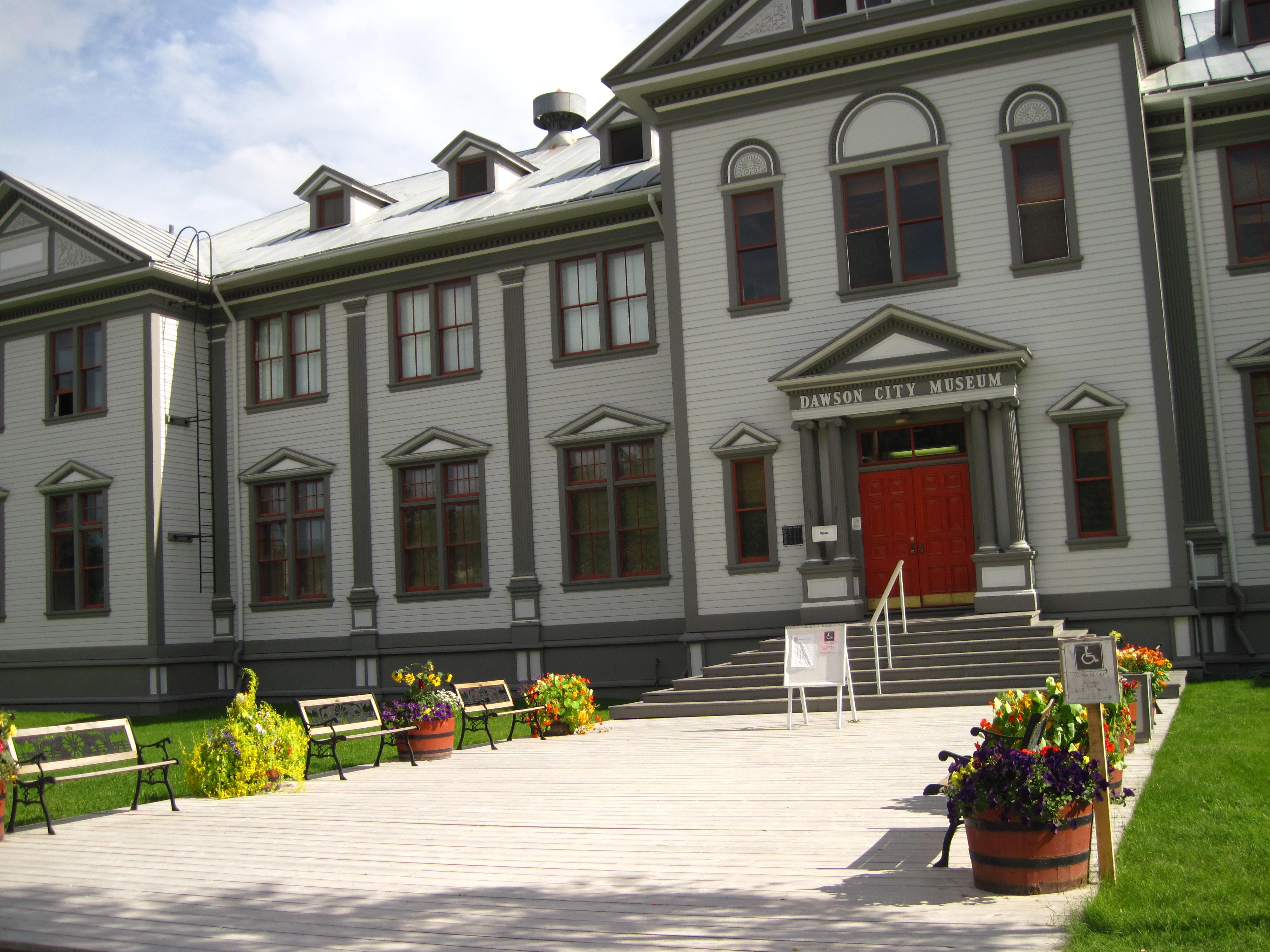
Later in the morning, I walk to Dawson City Museum that is on the same street as Gold Rush Campground, Eighth Avenue. The museum is the old territorial government legislative building from the era when Dawson City was the capital city of the Yukon. This was before 1952 when Whitehorse became the capital city of the Yukon. Now, the old room of the parliamentary assembly in Dawson is sometimes used as a court room. The Dawson City Museum contains many interesting exhibits and reminds one that bicycling was in the news at the same time as the Klondike Gold Rush in 1898. There are many period costumes on display from the era around 1900, and the staff are dressed like the people of that time.
The museum has a regular schedule of live demonstrations each day. I see a gold shaking machine demonstration. This helped miners sort the gold bits from the rest of the dirt and works on the principal that gold is one of the heaviest materials so goes to the bottom when filtered with water.
A bit later, I see a mock trial of a man who threatened to kill someone else. Another tourist volunteers to play a role in the theatrics. This is a case of frontier justice. In the current mock trial the man receives a lighter sentence than the sentence given at the time. He was banned from being within 150 miles of Dawson City.
|
|
|
|
|
|
I wander around Dawson City after seeing the Dawson City Museum. My travels lead to Front Street that runs along the Yukon River. There, I have lunch in Sourdough Joe's Cafe with other Tour Arctic participants
I spend most of the afternoon in a well kept library, the Dawson City Community Library. It is in the same building as the school and can be accessed by students without going outdoors – a great feature in sub-arctic winters. The Library has Wi-Fi Internet access and power bars attached to wall plugs so I can hook up my Netbook. I do that, surf the Internet, and update my diary and this web page about Tour Arctic.
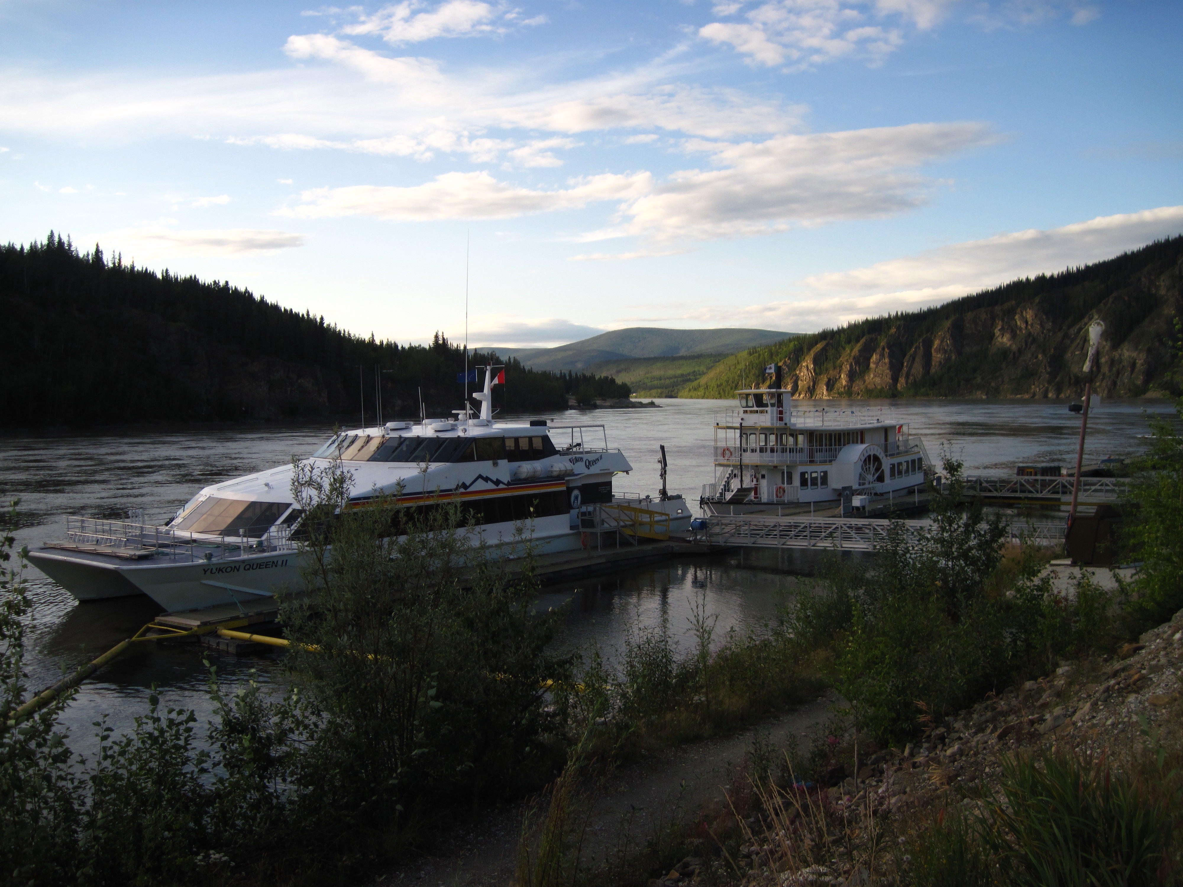
When the library closes, I return to the Gold Rush Campground and learn that most other participants in Tour Arctic are going to Jack London's Bar to eat and drink. I join them. Afterwards, I walk along Dawson's waterfront on the Centennial trail and take this picture of day touring boats.
|
|
|
![]()
Please
send comments to
the author.